|
|
|
Home |
|
Intro |
Gear |
About |
Ski Trips: |
2024 |
23 |
22 |
21 |
20 |
19 |
18 |
17 |
16 |
15 |
14 |
13 |
12 |
11 |
10 |
09 |
08 |
07 |
06 |
05 |
04 |
UBXC |
Apps |
eBook |
|
2008/2009
by: Tim Kelley
|
|
|
|
|
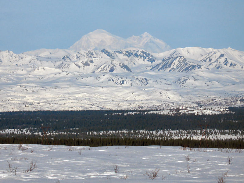
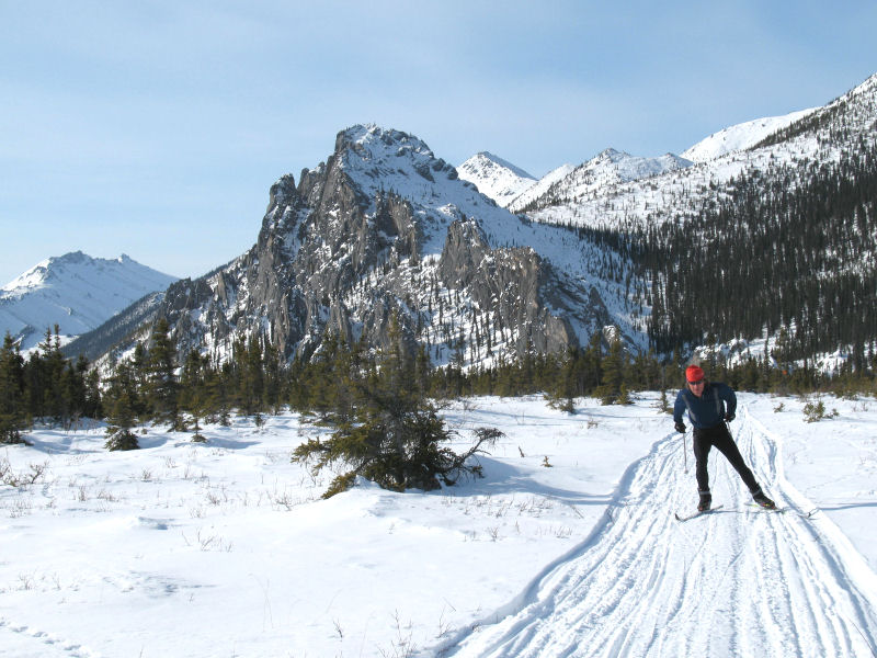
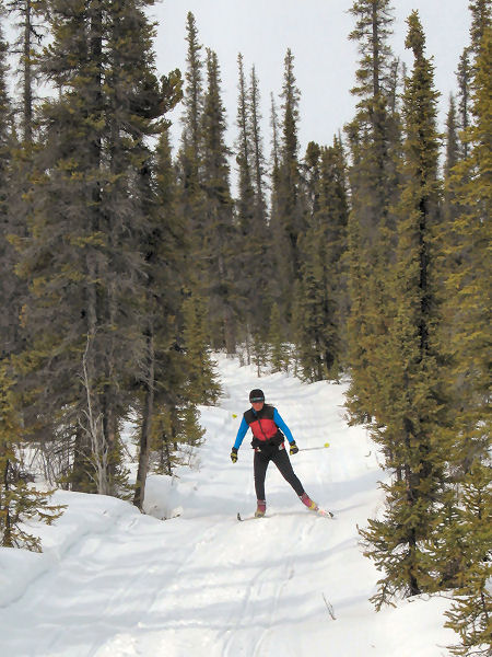
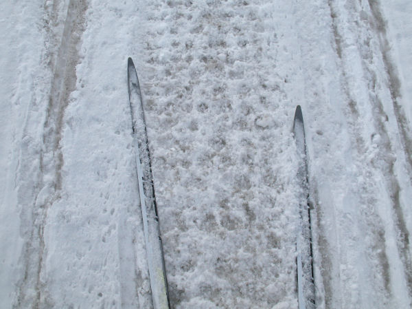
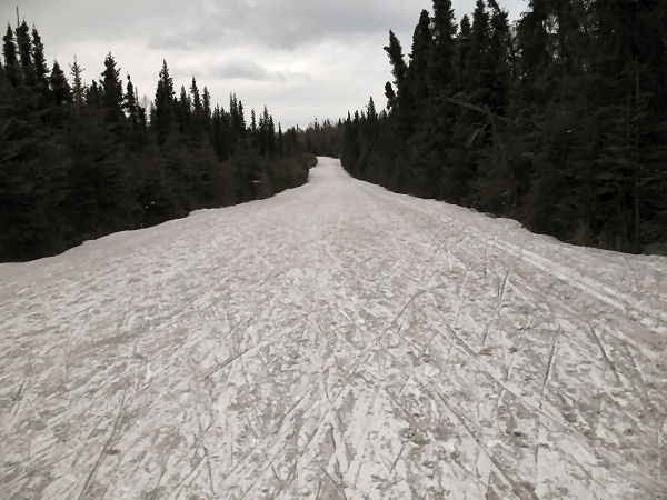
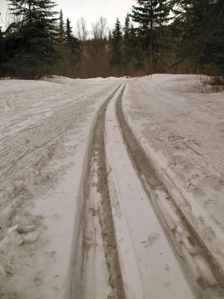
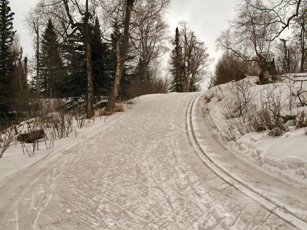
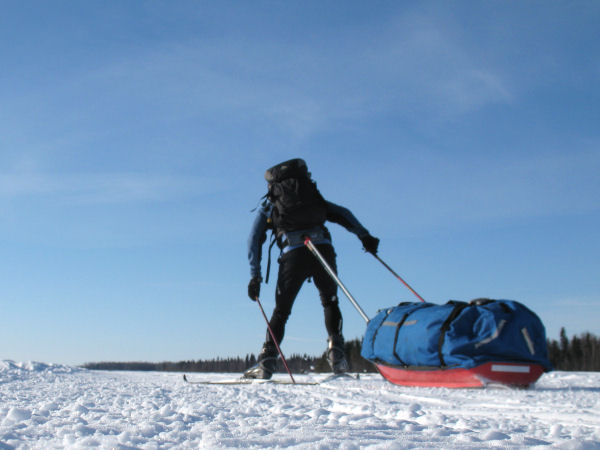
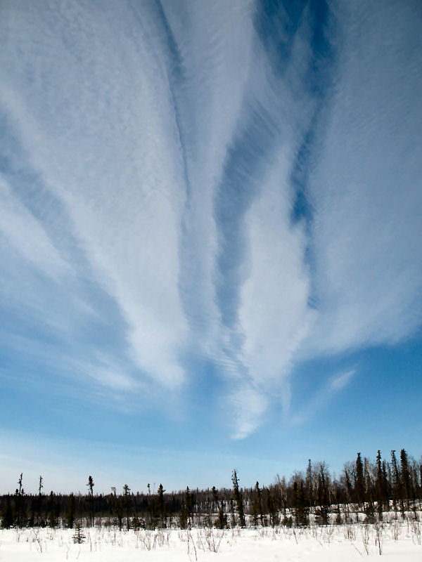
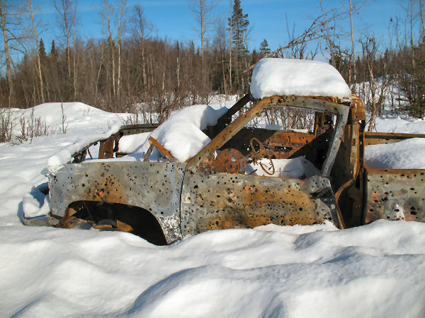
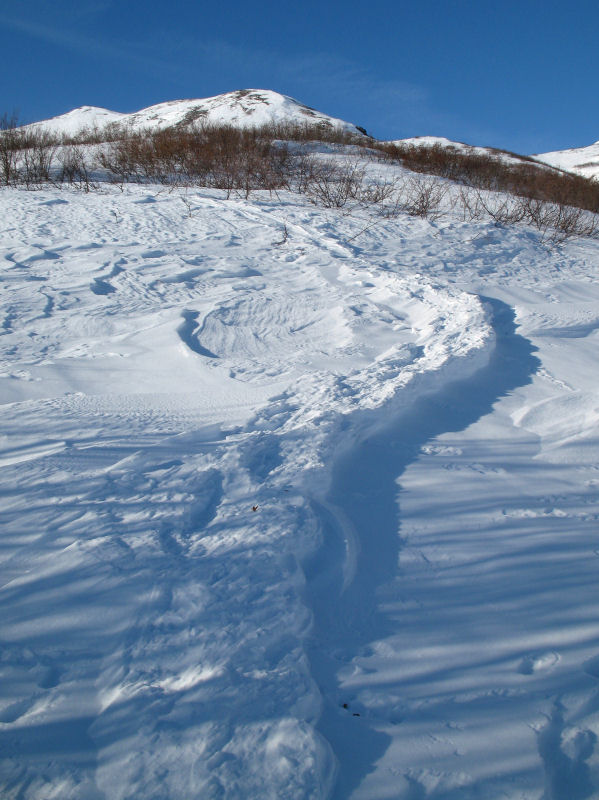
Broad Pass Crust
Skiing |
|
|
|
|
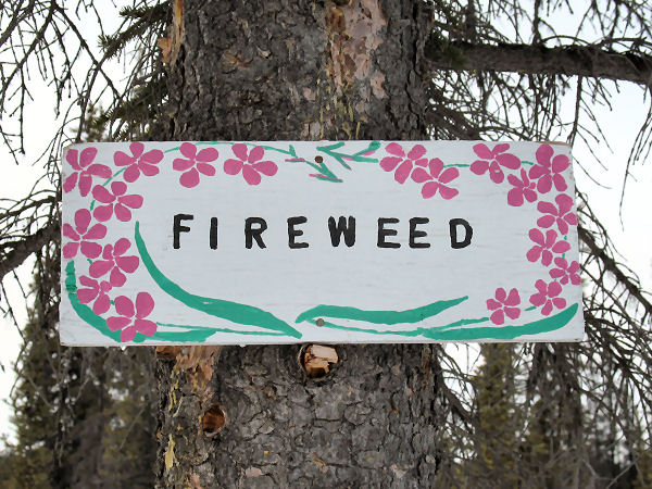
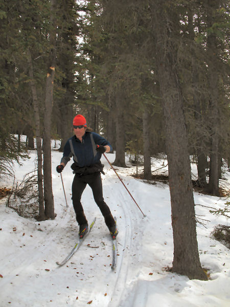
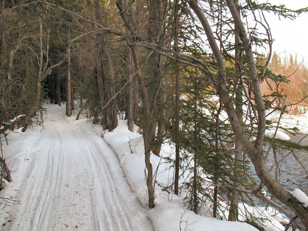
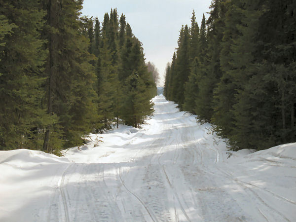
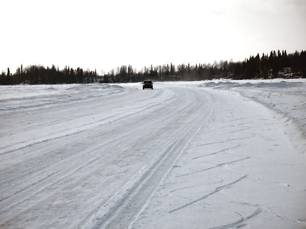
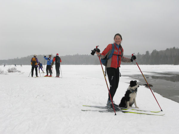
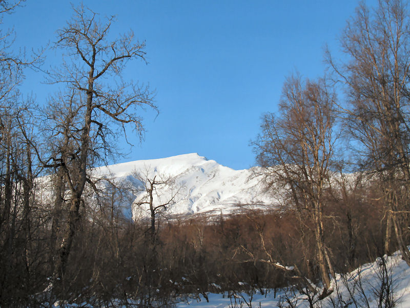
Random Shots |
 |
 |
 |
|
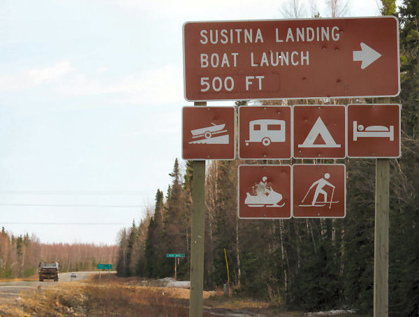
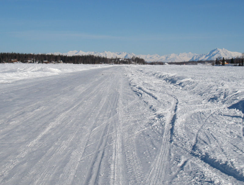
Someone in the Rabbit Creek
Valley in Anchorage is bringing "old school"-sized ski baskets back !! |
Susitna Landing north of
Willow is taking radical actions to become more cross country
skier-friendly. If they catch any snowmobiler disturbing,
harassing or driving too close to a cross country skier ... that
snowmobiler will be SHOT !! I don't know this fact first hand ...
but their new skier-friendly policy seems to be shown on their
sign! ;-)
(Just kidding Ron! So
please don't shoot at me, or other skiers, when we ski by your place at
Susitna Landing!) |
|
|
Reliable Crust
Skiing on Big Lake |
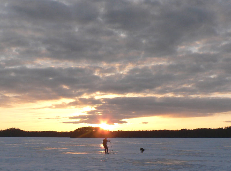
| Big Lake - Late April 2009:
When late April conditions aren't panning out for good crust
skiing around Anchorage (or you want to try someplace different)
... then Big Lake often delivers.
Mid-April is about the time when folks stop driving vehicles on
the lake's ice roads. They stop driving the ice roads not
because the ice is too thin, but because it can get too sloppy
on top of the ice. For two to three weeks after the
driving stops the ice remains good for snowmobiling, 4-wheeling
and ... crust skiing. This was a 25 mile crust skiing loop
similar to the
Nordic skating loop I did in early November 2008. |
 |
 |
 |
 |
 |
|
Corn snow and crust
on top of Big Lake ice. |
Someone that weighs
much more than me was walking out on the ice ... a moose. |
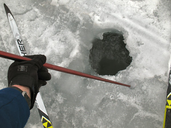
I checked the ice
depth at old ice fishing holes. The ice was still over two
feet thick (distance from my thumb to the pole basket). |
This is the only floating cabin I've seen
on Big Lake.
It's got a walk-around deck with an anchor winch and grill on it.
It's quite the
pad. |
It was a cold winter
... but luckily the Big Lake palm trees survived! |
|
|
|
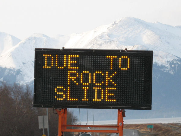
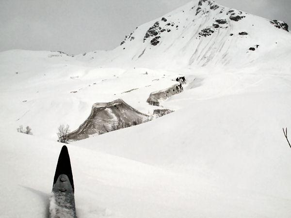
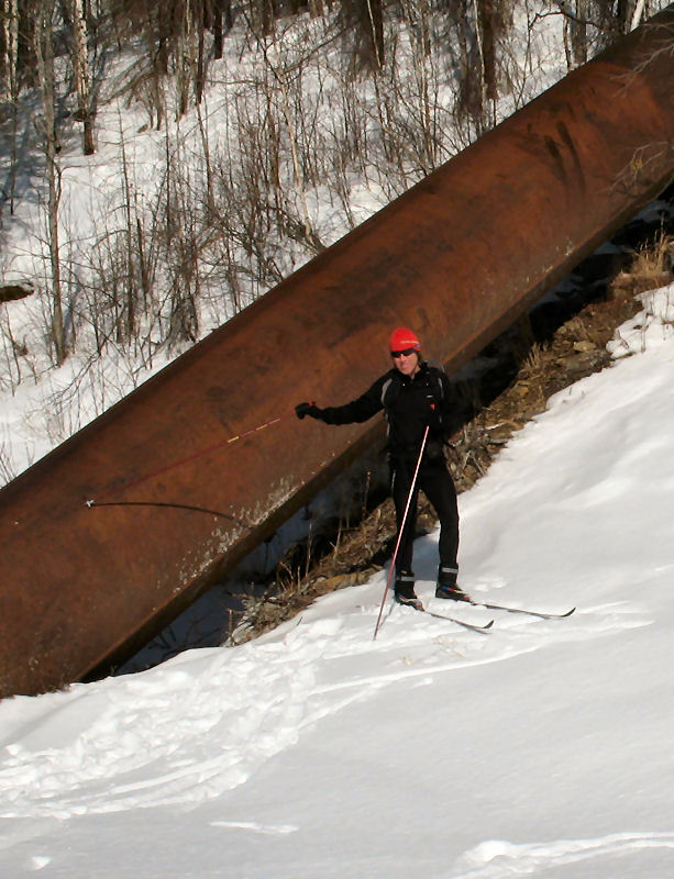
Road to Whittier
Rock Slide - A Crust Skier's View |
| Portage - Late April 2009:
I wanted to check out the rock slide that shut down the road to
Whittier. So what better way to check it out than via
crust skiing. |
 |
|
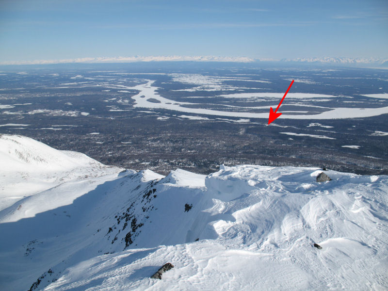
Here's a 360 degree
panoramic shot from Portage Lake. The red arrow shows
where the rock slide is located |
 |
 |
 |
 |
 |
| |
|
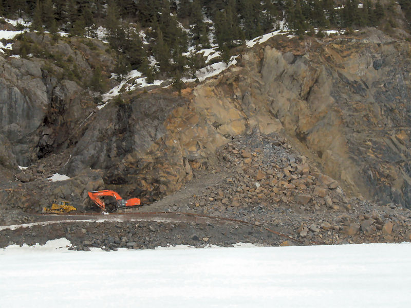
Here's the rock
slide. You can see that the slide pushed the guard rail
towards the lake. The road is officially closed, but
actually - it is open somewhat. I saw pickup trucks driving back
and forth across the front of the rock slide. |
There is a lot more
snow in the Portage Pass area than last year. The crust
skiing was really good when I was there. However, due to cloud cover the
light was pretty flat - which made for slower descents.
A bonus here is that there is very little sign of ash. But
that will likely change as more melting kicks in. |
 |
 |
 |
 |
 |
| |
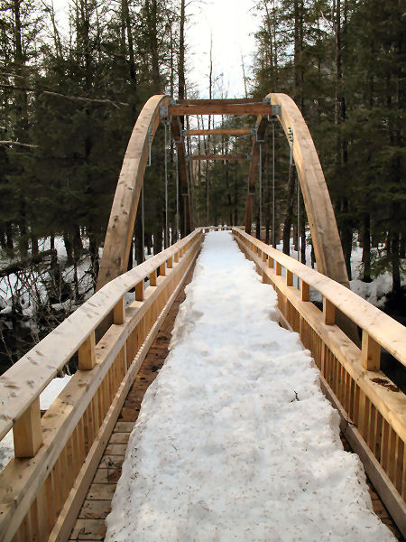
I did a bunch of
skiing to the west of the Byron Glacier access road. There
is some good open forest skating there. And then you can
hook into the "Trail of Blue Ice", which is partially completed
(completion will be this summer?)
There was still 3 feet of snow on top of some of the trail
bridges. And there were some neat looking "hairy"
cottonwoods in the area. |
This sign was by the
lake. If heavy equipment is working at the slide site and
trucks are hauling rocks, like the day I was there, then they
certainly aren't blasting. It's spring ... lots of people
regularly ski on the lake. The state should acknowledge
this and remove this sign when they are not blasting. |
|
|
|
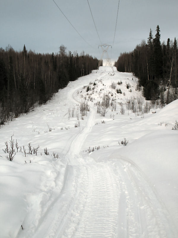
A Crust Skiers'
Shrine Disappears |
| Powerline
Pass Valley - Late April 2009:
"Let's ski up to the weather station and back!" How many
thousands of times over the years have crust skiers at Glenn
Alps said or heard this statement? This old wooden weather
station had the status of a crust skiers' shrine. It was a
goal, a destination, a logical turn-around, a mystery and
... the half-way point of the infamous Spring Skiing World
Championships of the World races (in 2004 and 2006). This was a sacred
icon of crust skiers. So then, why am I using the past
tense? Why am I saying: "was"? Well, I don't know
the answer to that question. All I know is that the old
weather station is gone. This vanishing is a mystery worth
solving. I'll post info here if I find the answers.
Anyone know anything about this? ... |
 |
 |
 |
|
April 2008 |
April 2009 |
It looks like the
old weather station did not get blown away by high winds, but
rather it was removed by cutting the anchor posts. |
|
29-April-09 update, email excerpt:
Hello Tim.
According to the Superintendant of Chugach State Park they did
not remove the cabin. They do believe it was the [NOAA] weather service
that may have removed it.
Sincerely
DNR Public Information Center
01-May-09 update, email
from NOAA Weather Service:
Maybe the
wind finally blew it away, or, the River Forecast Center is
replacing it with a new one. |
|
|
|
|
|
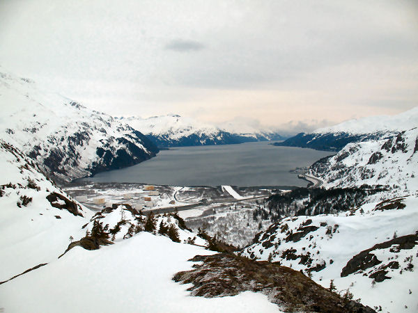
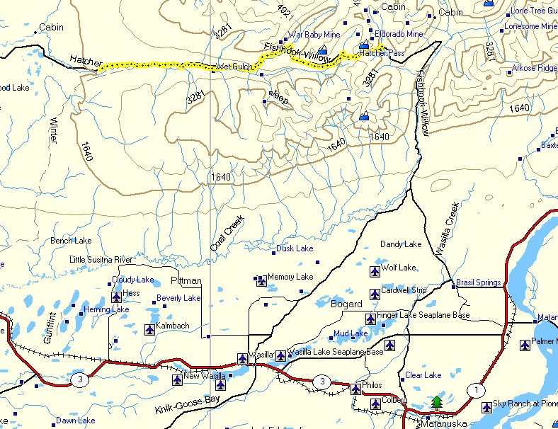
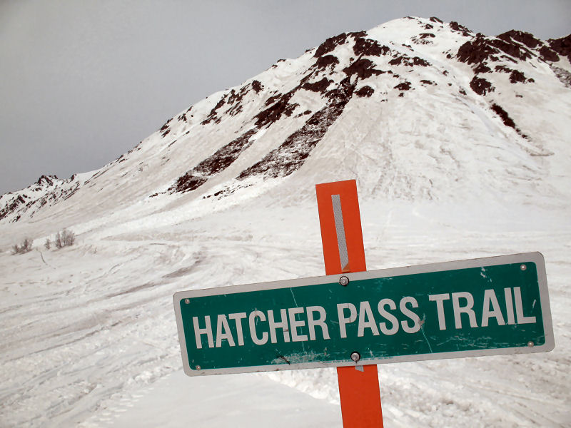
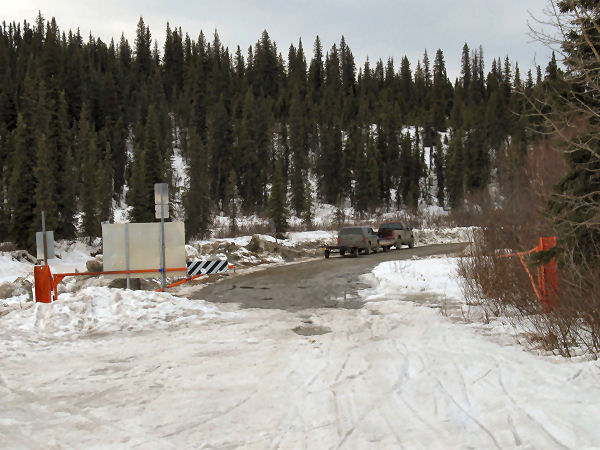
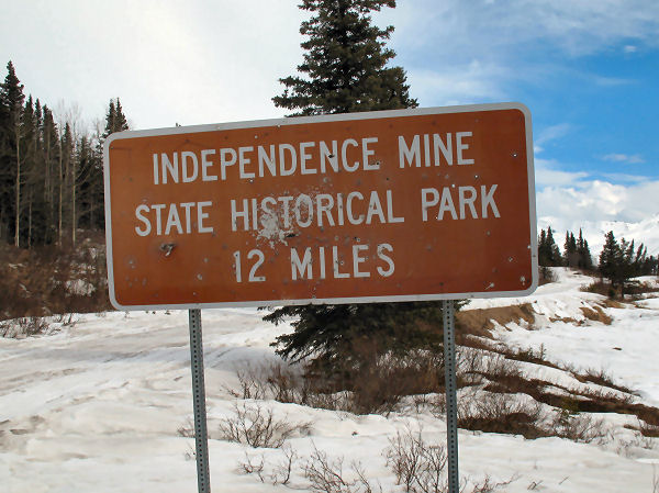
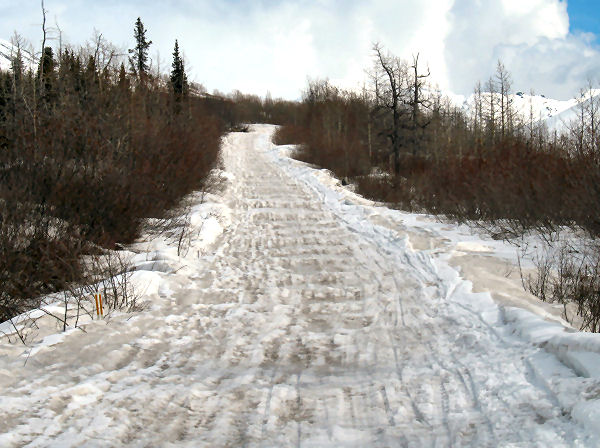
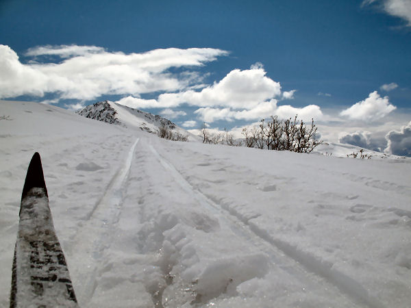
Hatcher Pass
Traverse, Over and Back |
|
|
|
|
Matanuska Aufeis |
| Palmer -
19 April 2009:
Aufeis ... what's that!?
Aufeis is a
sheet of ice that rests on gravel bars of a river. It's
caused by extreme cold temperatures causing ice jams in rivers
that force the flow of water to spread over the river's flood
plain and freeze. Usually you have to go to someplace way
north like the Brooks Range to experience aufeis. But
thanks to the exceptionally cold winter we just had ... there is
aufeis galore on the Matanuska River just east of Palmer.
So if you want to be able to say: "Yeah ... I've skied aufeis!",
then you better make a trip to the Valley and check it out. |
 |
 |
 |
 |
|
This looks like
crust snow, but it's aufeis ... a mostly solid layer of ice
resting on gravel bars. |
Aufeis can make for
some great skate skiing. Notice the ice rescue picks
hanging around my neck (6 dollars at Sportsman's Warehouse).
If you go near open water ... be safe. |
You can access this
aufeis from the Old Glen Highway just east of the Matanuska
River bridge. |
The hike from where
you can park to where the aufeis skiing starts is not too long.
;-) |
 |
|
A panoramic picture
of the Matanuska River flood plain. Aufeis can be seen
from bank to bank, with the Matanuska River cutting through the
middle of it. |
|
|
|
Susitna Valley
Farewell Ski? |
| Trapper Creek -
Mid April 2009:
On Easter Sunday I went for a 28 mile ski on the
Amber Lake Trail. The trail was good skating while it
was frozen. But as the temps warmed and it started to rain
- wet snow mixed with volcanic ash made for painfully slow
skiing. Unless there is an unseasonably cold and clear
spell in the next week or so ... I think this is my last Susitna
Valley ski for the season. Time to head to higher ground. |
 |
 |
 |
 |
|
The Amber Lake Trail
follows some long seismic line cuts. |
Volcanic slush ...
very slow skiing. |
A farewell salute to
the Su Valley trails. It was a fun winter of skiing in the
Su Valley. Can't wait until next winter. |
|
|
|
Backcountry XC
Skiing On YouTube |
|
|
|
|
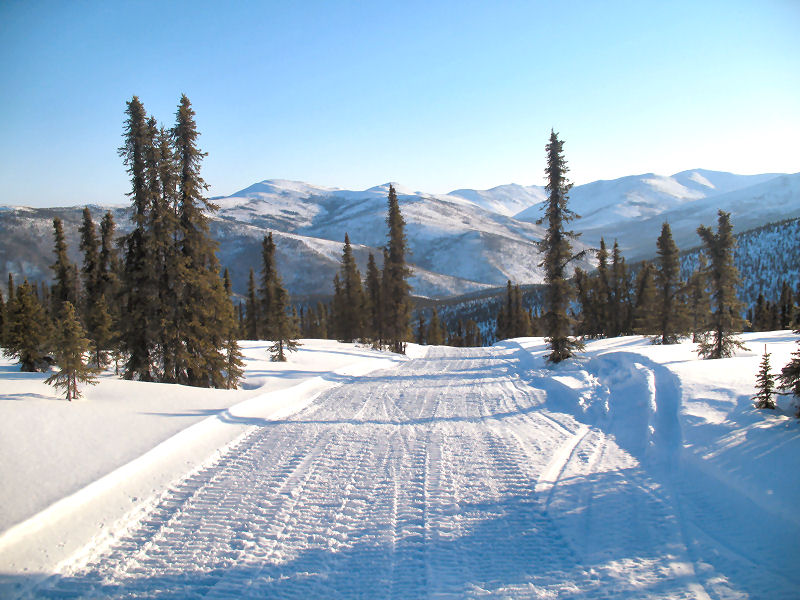
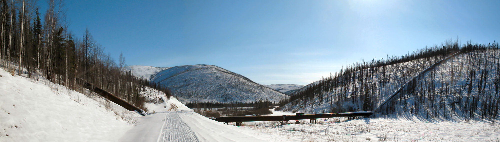
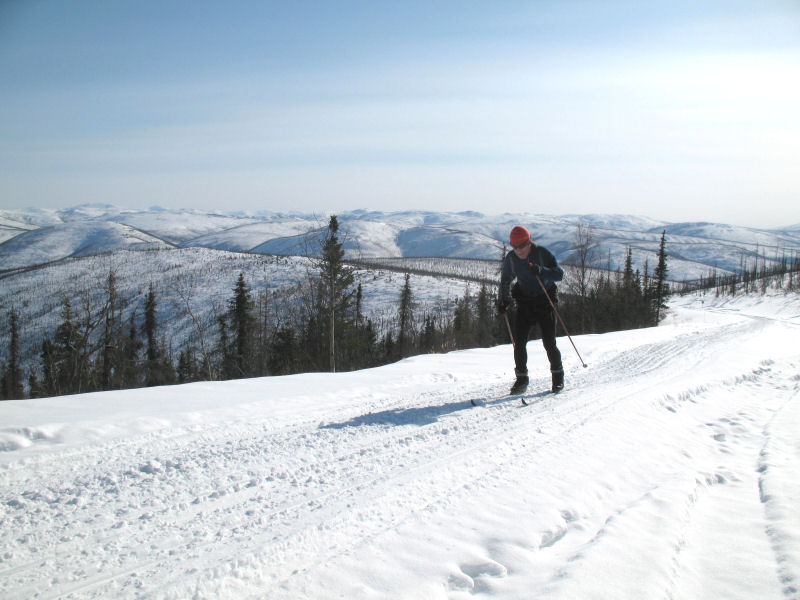
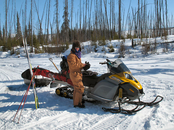
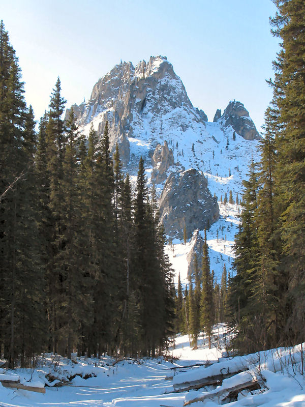
Return to the White
Mountains (after 12 years) |
| White
Mountains - Early April 2009:
One of the favorite places my wife and I liked to take our dog
team of Malamute pals was the
White Mountains National Recreation Area north of Fairbanks.
Our dogs have passed away, but our fondness of the BLM trail and
cabin system of the White Mountains lives on. 12 years
after our last mushing / skiing trip to the White Mountains we
went on a snowmobile-supported skiing trip in these hills.
We took turns skiing while the other drove the snowmobile
pulling a sled with our supplies. The nice thing about
this arrangement is that you can cover a lot of miles during the
day because you can ski fast and free due to not having to huck
a big pack or pull a sled. At nights we stayed in
pay-for-use BLM cabins (though we carried a tent in case our
plans are forced to be changed). This was the first time I
had ever done a snowmobile-supported multi-day ski trip.
And I don't think it will be the last time! It can be a
great way for folks of different skiing speeds to cover a lot of
country together. |
 |
 |
 |
 |
|
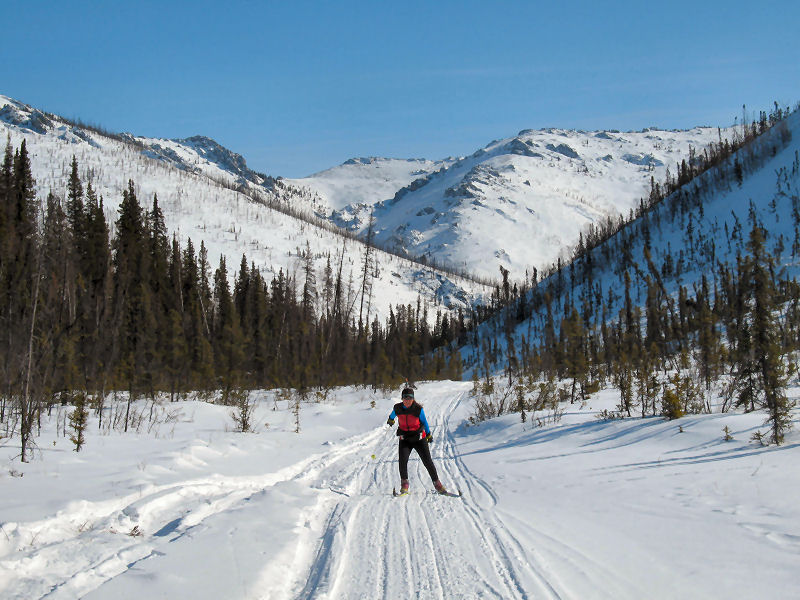
I like to start from
a "backdoor" of the White Mountains (that is - not at the
Wickersham Dome trailhead). It's a lot quieter. Here
I am at Mile 57 on the Steese Highway next to a remnant of the
"Davidson Ditch". |
The Davidson Ditch
was an 83 mile system of ditches and inverse siphons, built in
1925, that supplied water needed by floating gold mining dredges
in Fox, AK. |
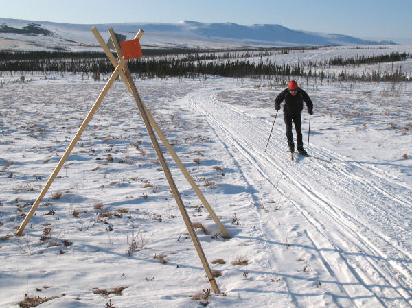
From the Steese
Highway Mile 57 it is almost 4 miles of continual uphill to
the top of the ridge. |
Quite the grunt.
But it is soon forgotten as you cruise the ridgetops with great
views in all directions. |
 |
|
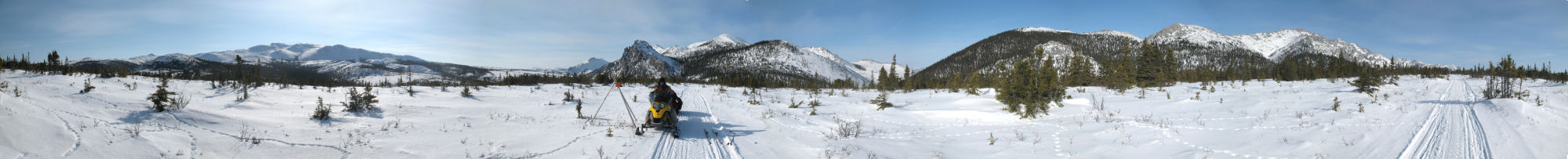
360 degree panoramic
view of the White and Steese Mountains from the top of the US
Creek Road climb. |
 |
 |
 |
 |
 |
|
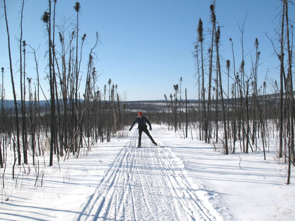
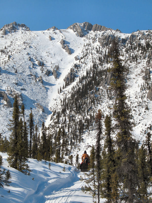
Heading down the Nome Creek drainage. |
One big change that's
easy to notice in the White Mountains since 12 years ago is the
affect of forest fires. Fire has ravaged much of this area
since then. |
 |
 |
 |
 |
 |
|
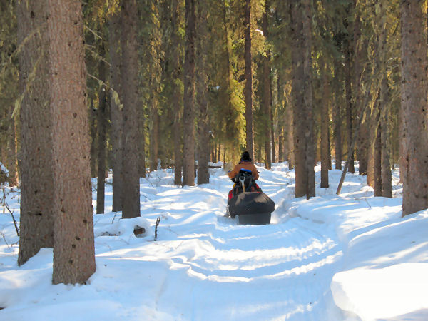
Switch time.
My wife is getting ready to ski, my turn to drive. This is
a 4-stroke snowmachine - fuel efficient, low emissions and ...
quiet! |
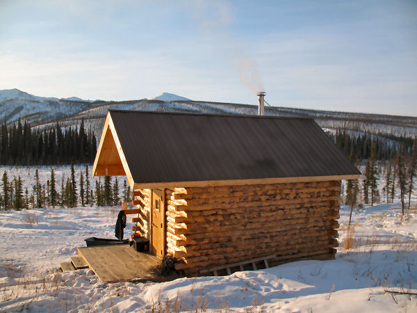
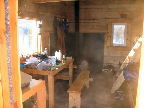
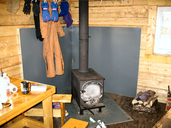
We stayed at BLM
(Bureau of Land Management) cabins. This one was my
favorite - the Wolf Run Cabin. It's practically brand new. It
was built in 2006 to replace another cabin at this same site
that was lost in a forest fire. |
 |
 |
 |
 |
 |
|
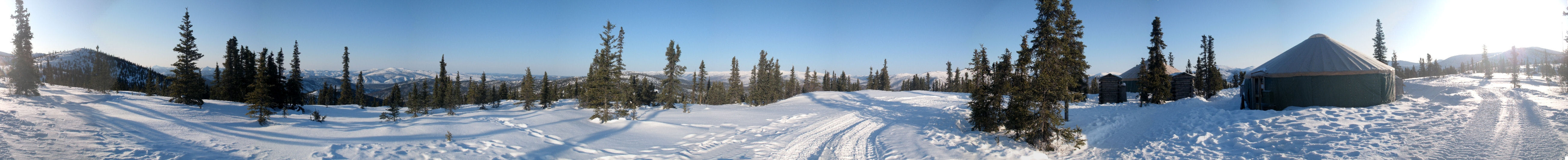
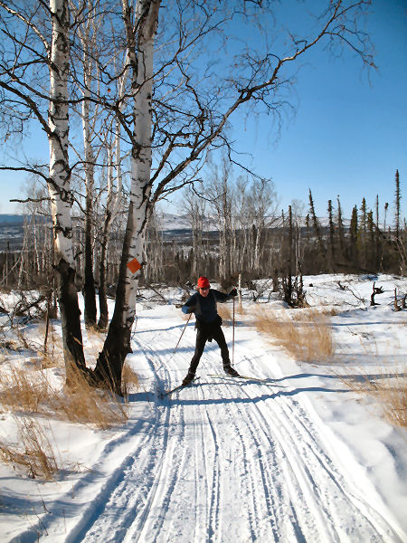
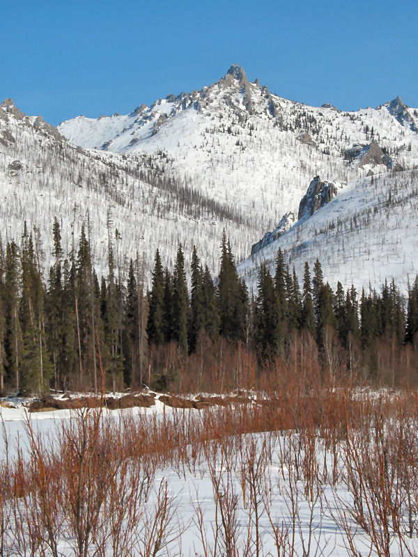
Probably the most
defining area of the White Mountains, and my favorite, is the
Windy Gap and Fossil Creek Valley area. |
 |
|
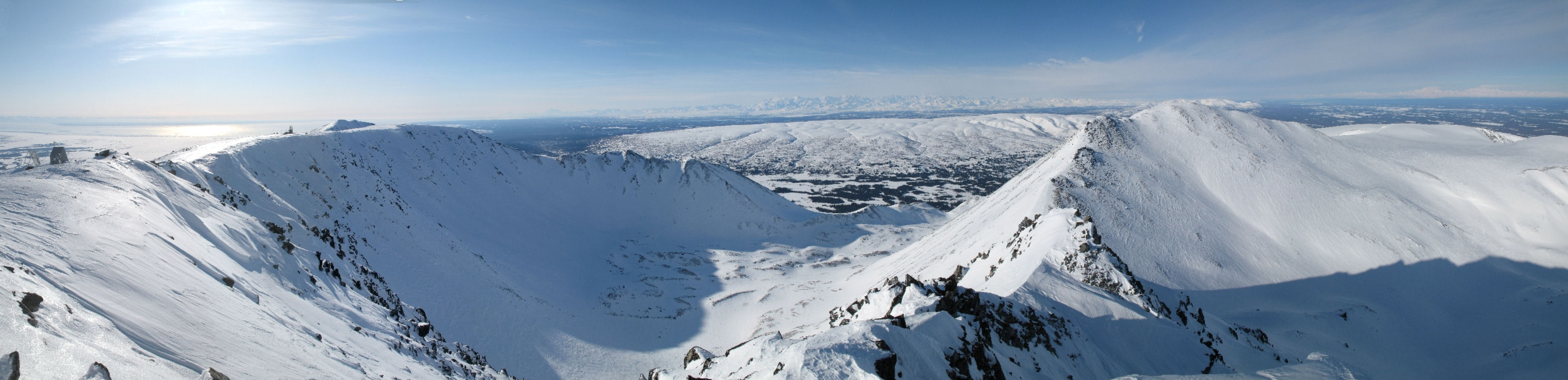
Windy Gap 360 degree
panoramic view. |
 |
 |
 |
 |
 |
|
The Fossil Gap Trail
is also very scenic. |
 |
 |
 |
 |
 |
 |
|
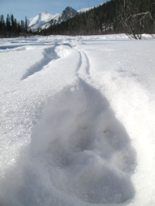
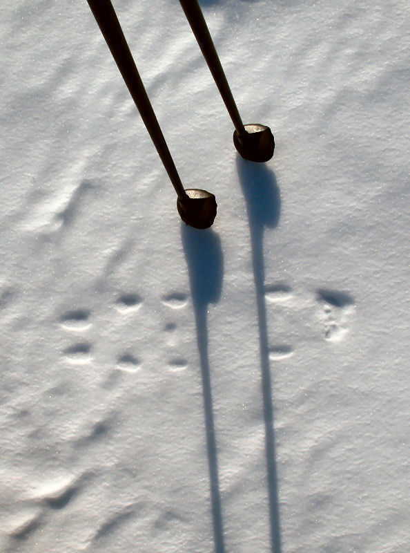
Along Fossil Creek we saw
the aftermath of nature's brutality. A big wolf
pack was in the area. |
Here is a wolf's paw print
where you can see it's claw drag marks in the snow. |
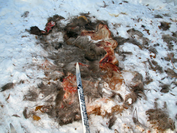
On Fossil Creek there was a
wolf super-highway and an area where the wolf pack had stopped
and congregated. |
Tufts of moose hair on the
trail indicated that a moose had been attacked by the
wolf pack. And the moose had began a futile run
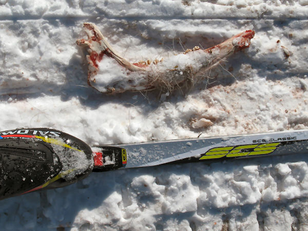
for its life. |
A half mile down the trail
the chase ended where the wolf pack took down the moose
and devoured it. |
Looks like it was a young
moose. Little moose don't have a chance if a big
wolf pack targets them. |
|
| |
|
|
|
|
 |
 |
 |
 |
 |
 |
 |
 |
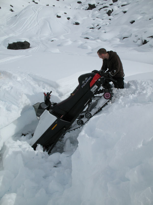
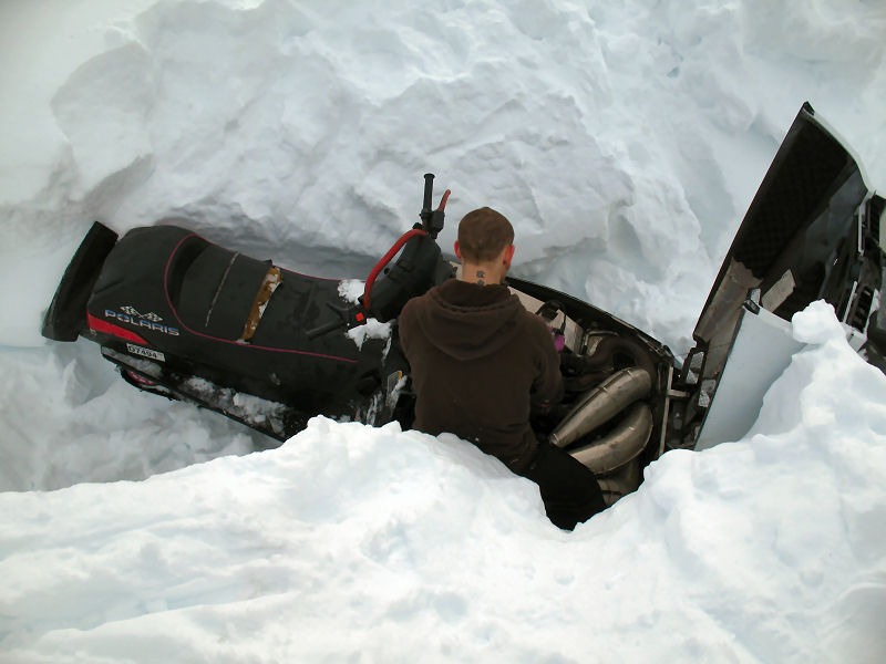
I should make a
disclaimer of sorts concerning snowmobiles. Using a snowmobile for remote
backcountry access can be great. But it can also be
dangerous. A snowmobile adds a new layer of potential
problems you may have to deal with in the middle of nowhere:
engine malfunctions, getting stuck, sliding off overflow
glaciers into the trees, tipping over on side hills, parts
breaking, etc. An ideal situation would be to have two
snowmobiles in your group in case one machine dies. My
wife and I use one snowmachine of course on ski trips, which ups
the risk factor in case of breakdowns. We rely on decades
of snowmobiling experience dealing with just about everything
and anything that can go wrong with these machines. That
helps us to prepare for and deal with 80 to 90 percent of
snowmobiling challenges. But we know there is always the
10 to 20 percent chance of a problem that will be very tough for
us to get out of. So if you want to use a snowmobile for
backcountry access, take the time to learn how to troubleshoot
and fix it and get your skill level up for driving it in
challenging terrain. |
|
This is a grass
tussock that I found lying loose on the trail. |
Tussocks on the side
of the trail can cause my wife to catch a ski tip while skating,
do a face plant ... and then say some very colorful words !!
;-) |
Broken sled hitch.
We were prepared for this mishap so it only took a minute to fix
this problem. |
|
|
|
Fairbanks Ridge
Rambling |
 |
Steese Mountains -
Early April 2009:
Unique and fun spring skiing can often be found skiing the trails on
mountain ridges to the northeast of Fairbanks. The ridges are
often wide-topped and long and you can cruise with "top of the world"
views for long distances. But be willing to pay for ridgetop
access with long climbs, and be prepared for ripping descents on the way
down. Trails in the Chena River State Recreation Area access such
ridges to the north of the Chena Hot Springs Road. The Yukon Quest
trail travels along high ridges from Circle Hot Springs to near Chena
Hot Springs (I've done this trail segment twice). Other neat skis
are the Far Mountain Trail, Haystack Mountain north of Chantanika Lodge and the Charlie Dome cat trail above Chena
Hot Springs, pictured here. |
 |
|
Near the top of Charlie
Dome, looking down at Chena Hot Springs Resort. |
Cat track (for hauling
aurora viewers) near the top of Charlie Dome. Nice glade skiing
descending through the sparse spruce up high on this ridge. |
 |
|
360 degree panoramic view
from the area of Chena Hot Springs Resort's aurora viewing yurts on top
of Charlie Dome. People come here at night, so if you ski here
during the daylight hours you probably won't see anyone. |
|
|
Mendeltna -
A Convenient Skiing Destination |
| Mendeltna -
Early April 2009:
If you are a skier, the location of
Mendeltna Creek
Lodge can work out well for you. If you want to
break-up a drive from Fairbanks to Anchorage via the Richardson
and Glenn Highways, I've found this place is a good place to
stop. The next day you put your skis on outside your door
and get a ski in before traveling to Anchorage. It also
makes for an after-work travel / ski the next day option from
Anchorage or the Valley. Besides the snowmobile-groomed
ski trails here, there is also the Tazlina Lake Trail.
This 8 mile trail leads to a huge lake fed by Chugach Mountain
glaciers. Russ and Mabel Wimmer run the Mendeltna Creek
Lodge. You can stay in their lodge or in rustic cabins
that are inexpensive. And for breakfast - Russ sure makes
a killer Mendeltna Breakfast Sandwich !! |
 |
 |
 |
 |
 |
 |
|
Skiing the Mendeltna
Creek Lodge Ski Trails. |
Skiing down the 8
mile Tazlina Lake Trail (that Russ Wimmer keeps brushed). |
 |
 |
 |
 |
 |
 |
|
The Tazlina Lake Trail
next to Mendeltna Creek. Nice trail. |
The Tazlina Lake
Trail goes past ruins of an old trapper's cabin. If you
notice on the rightmost picture - the cabin was insulated with
moss and saplings were nailed on the logs to keep the moss in
place. Old school! |
Skiing on the
Nelchina River delta. |
 |
|
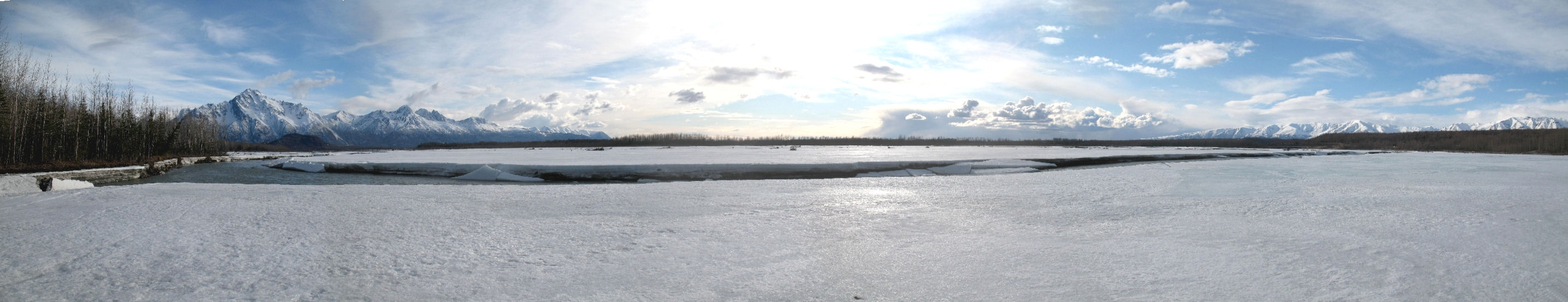
A panoramic view of
Tazlina Lake. This would be a great crust skiing location.
Unfortunately I was here when the lake was covered with
breakable windblown crust that made for poor skiing. But I
will be back ! ... |
|
|
|
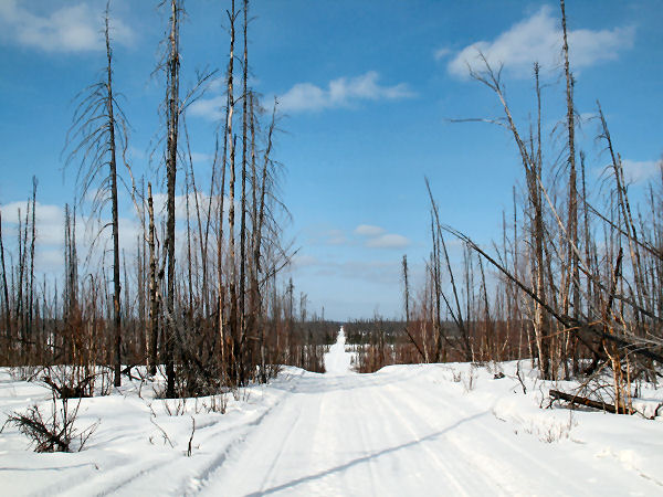
Big Lake Snowmobile
Trail Cruising |
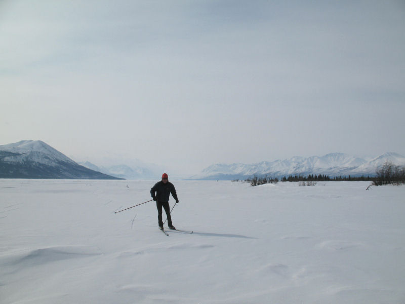
| Big Lake /
Houston - 30 March 2009:
While skiing the Susitna Valley Winter Trail a couple of weeks
ago, a Big Lake Trail System sign reminded me that there were
some trails to the north of Big Lake I had never skied before.
I couldn't have trails I've never skied in the Lower Susitna
Valley hanging over my head ... so I set off to check them out.
I skied from the North Shore Park on Big Lake to Houston, then
took the Little Susitna River and snowmobile trails west and
south to Big Lake. One half inch of new snow had covered
Mount Redoubt ash fall from two days ago, so the skiing was
pretty good. Nice, quiet loop. I did not encounter
any snowmobiles, just a few vehicles on the Big Lake ice road. |
 |
 |
 |
 |
 |
 |
|
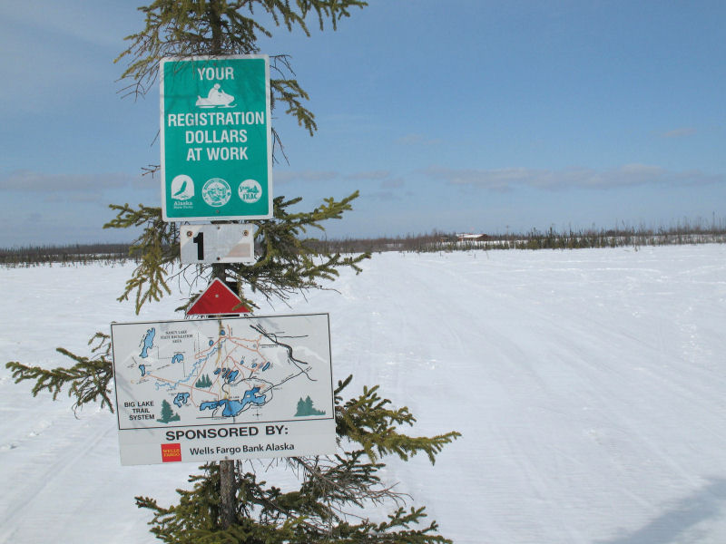
Big Lake trail
system map. |
GPS track: 34 miles. |
Trailhead on north
shore of Big Lake. |
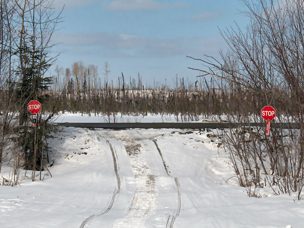
Snowmobile stop
signs. |
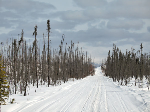
These seismic line
trails traverse the area that was scorched by the 1996 Big Lake
wildfire. |
 |
 |
 |
 |
 |
 |
|
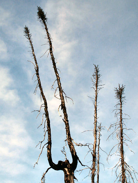
Many fire-killed
black spruce trees can be seen in this area. |
Must be springtime,
trees are starting to Bud! |
Following the
Intertie, where I missed a turn ... |
... and ended up in
a place I REALLY DID NOT want to be! |
Good skiing on the
Little Susitna River. |
Looks like maybe
sport fishermen cut up sweepers so they wouldn't be a problem
come fishing season. Just a guess. |
 |
 |
 |
 |
 |
 |
|
I really liked the
trails to the north of the Little Susitna River, near Nancy
Lakes State Park. |
Skiing all day was
on light snow on top of Mt. Redoubt ash. |
Old trail marker. |
New trail marker. |
Seismic line heading
south to the Iron Dog Trail. |
 |
 |
|
Heading back across
Big Lake on the ice roads. |
While skiing this
loop I looked for the Castle Mountain Fault. This is a
major earthquake zone that comes through this area and
supposedly you can see where it has uplifted on the north side
of the fault. Here is a
web page
about the Castle Mountain Fault by
USGS geologist and fellow cross country skier Peter Haeusller,
and Keith Labay. Judging by Peter's
map of where the fault is, the picture above is where I think I
crossed it. It was where a low east-west ridge dropped
down to a swamp. But I can't say for sure that this is the
fault line. Thanks Peter and Keith for the interesting
information about this unique geological feature in the Susitna
Valley !! |
|
|
|
Canadian Crust
Skiing |
|
|
|
|
Mt. Redoubt's
Vulcan Spew |
|
|
|
|
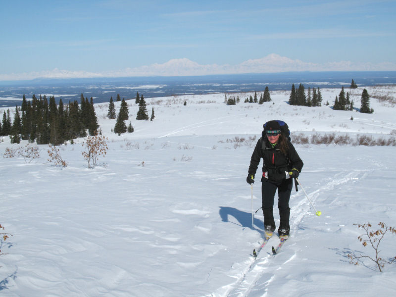
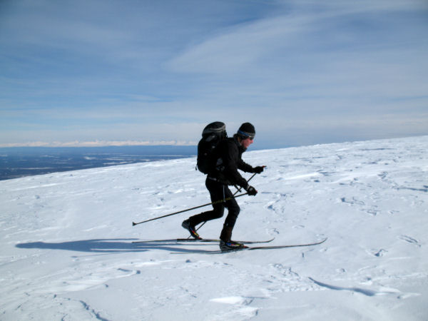
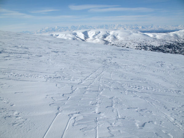
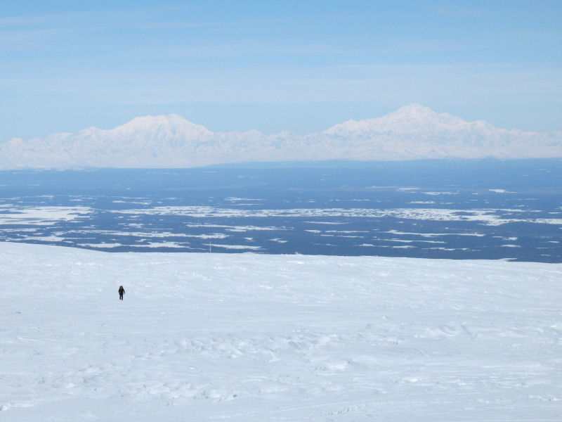
Mount Susitna Yet
Again ... North Ridge |
|
Mount Susitna
- Mid-March 2009: My
wife and I tried to ski up the North Ridge of Mount Susitna
earlier this winter, but deep snow and no trail discouraged us
and we decided to try again later. Going back in March we
found a good trail to tree-line. And then good classic
skiing on windblown snow on up the ridge, with a stiff north
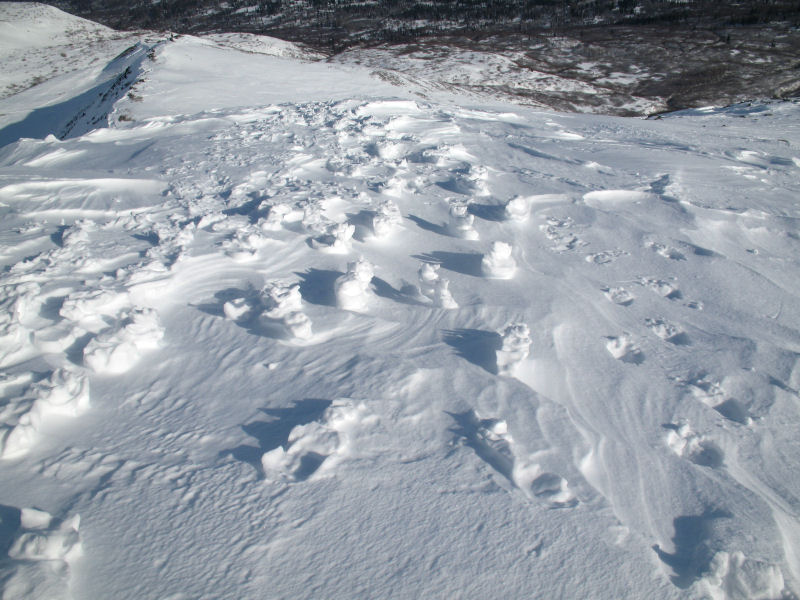
breeze pushing us along. The last step on the ridge had a
wind-hardened crust on it, as did the last rise to the summit.
My wife is smart enough to not climb this stuff in slippery
cross country racing boots, so she let me prove I was less smart
and I scrambled to the North Summit. 5 snowmobiles arrived
while we were on the ridge and they broke up the sastrugi and
made a good trail for coming back down. |
 |
 |
 |
 |
 |
|
Leaving the trees
behind and heading into the great wide open. |
The North Summit of
Mount Susitna comes into view, |
Half-way up the
ridge we found lots of kiting tracks. I believe these
tracks are from the Best pro kitesurfing team, flown out here by
ChaplainAK Air. |
On clear days
Foraker and McKinley watch you as you ski this ridge. |
 |
 |
 |
 |
 |
|
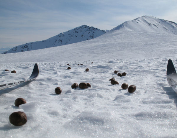
Holy crap!
This amazed me. Moose poop at 3900 feet. The Main
(left) and North summits of Mount Susitna are in the distance.
So basically, this moose in on the top of Mount Susitna in the
winter. Crazy moose ... WHAT are you doing up here!?!?! |
I left my skis at
the base of the summit ridge and kicked steps on up. Here
you can see footsteps in relief from the kite skiers (I assume)
from prior to the last wind storm. |
If you expand this
picture you will see 3 (out of a group of 5) snowmobilers
heading to the final steep step of the ridge. They had to
fight to get up and over this pitch. One guy rolled his
sled trying. But they all eventually made it. Good
going dudes! |
On the North Summit.
This was a "three-peat" of sorts for me. I had been up the
South and Main summits of Mount Susitna earlier this winter.
3 times in one winter ... you might get the idea I like rambling
around Mount Susitna. Yep, I do. |
This snowmobiler
made it over the last step and then went back to encourage the
others to give it a try. He drove up to my skis, took a
picture of them, looked up and saw me descending and took off
before I could talk to him. That's snowmobilers ... always
afraid of big, meanie cross country skiers! |
 |
 |
 |
 |
 |
|
Skating back,
Foraker and McKinley in the distance. |
Nice down-trail of
sugared sastrugi made by the snowmobilers. |
Click on the image
above to see a panoramic photo I took in
2005 of the North Ridge of Mount Susitna. It's long
and gradual, glacially graded climb ... makes for fine xc
skiing. |
This was a
snowmobile-supported ski trip. So I've got to include some
snowmobile shots ... |
 |
|
Mount Susitna North
Summit panoramic - looking east. |
 |
|
Mount Susitna North
Summit panoramic - looking west. |
|
|
|
First Ski of the
SVWT |
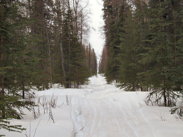
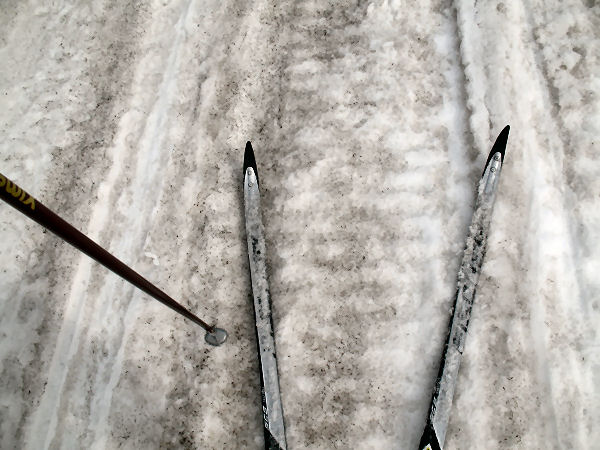
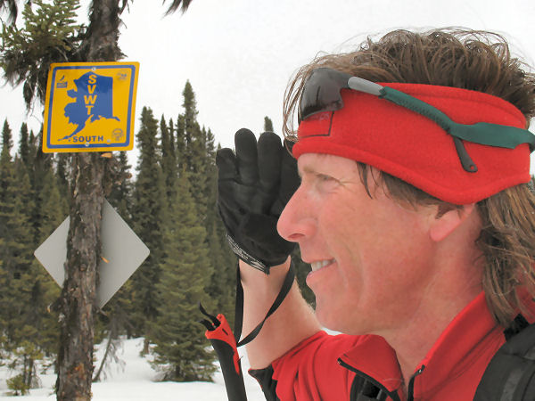
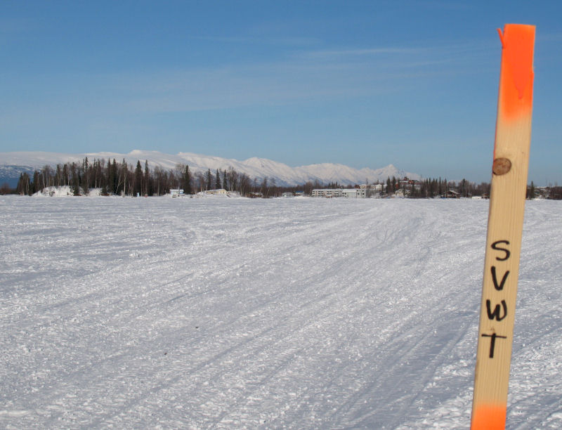
| 18-19 March
2009: The big
deal in the Susitna Valley this winter was the official link-up,
marking, grooming and opening of the Susitna Valley Winter Trail
(SVWT). This 120 mile trail, from Denali State Park at
mile 131 on the Parks Highway to the North Wayside Park on Big
Lake, creates a "backbone" trail for the Susitna Valley.
The official opening of the SVWT was the weekend of March 14-15.
Valley trail clubs scrambled to get the trail marked with brand
spanking new signs and get the entire trail groomed before the
grand opening. The true official opening of the trail was
the moment Governor Palin cut the SWVT ribbon at Susitna
Landing! I waited
until after the party to ski the length of this trail. I
did it as an overnight camp-out trip that took me two days.
Things had sure quieted down. I encountered only 13
snowmobiles and two four wheelers in 120 miles. Beautiful
weather, fantastic trail ... the SVWT is yet another reason to
love the Susitna Valley!!
Here is the State of Alaska Department of
Natural Resources
map of the Susitna Valley Winter Trail (6MB pdf file). |
|
 |
 |
 |
 |
 |
 |
|
Trapper Creek: No sense in driving to WalMart in Wasilla, when
you can snowmobile to WalMike's !! |
The Curry Ridge
Riders' gorgeous Chulitna Bluffs Trail. |
The Curry Ridge
Riders' monster trail drag. |
Mile 7 of the Curry
Ridge Riders' Rabideax Trail. |
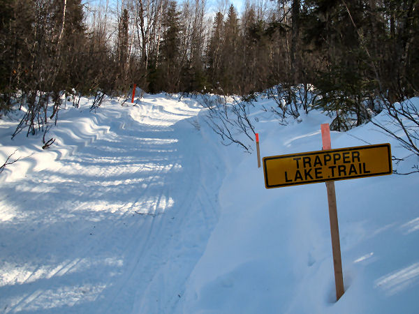
Start of the
Mid-Valley Trail Club's Trapper Lake Trail. |
There are plenty of
views of the Alaska Range on the Trapper Lake Trail. |
|
 |
 |
 |
 |
 |
 |
|
Recent winds had blown out some of the Trapper Lake Trail, but
it was still decent skating. |
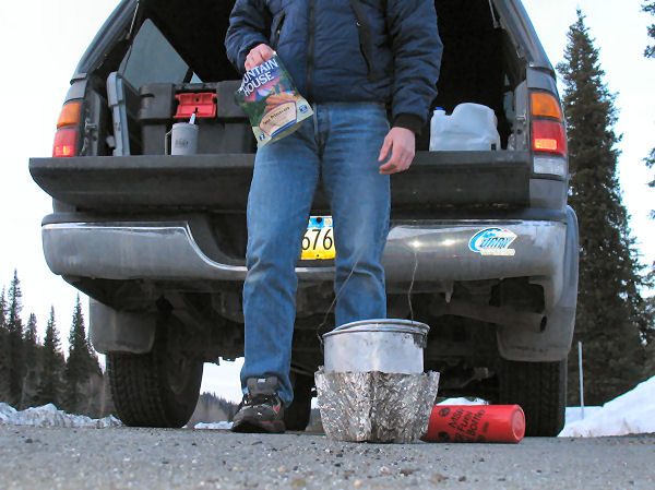
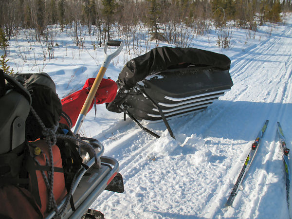
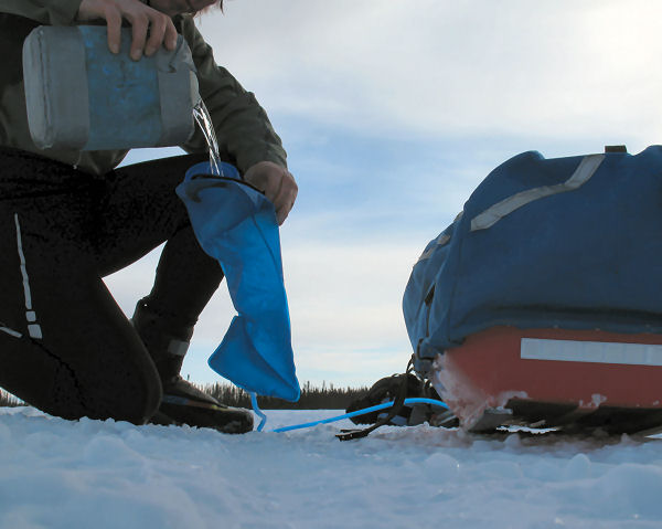
A mid-day refill of
the drinking bladder from an insulated reserve bottle I carry in
the sled. |
Near Trapper Lake
some very freshly groomed trail showed up. |
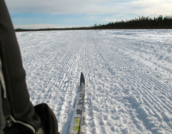
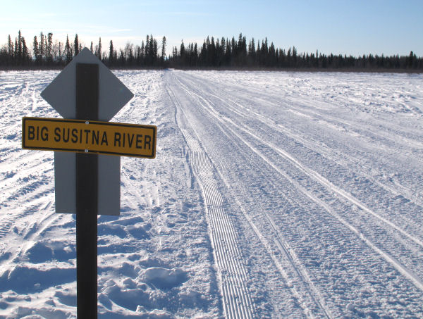
Skiing the Big
Susitna River towards Susitna Landing. |
No question ... I
turn right here! ;-) |
Sunset while skiing
the SVWT to the west of the Delta Islands. |
|
 |
 |
 |
 |
 |
 |
|
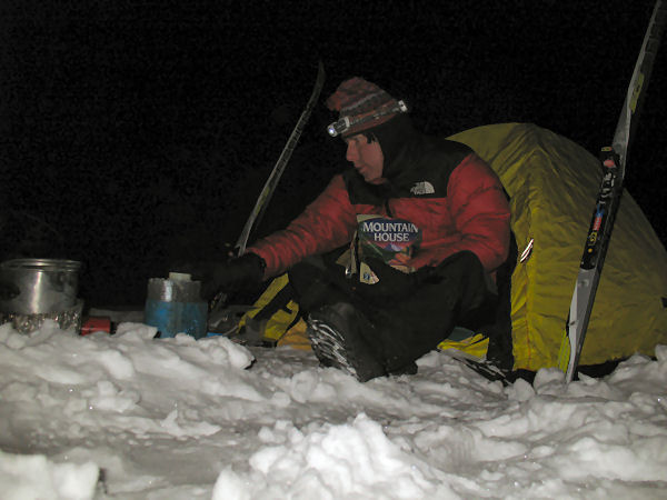
Camp for the night. |
Dawn ... time to get
going. |
Skiing the
Mid-Valley Trail Club route west of the Delta Islands. |
An unopened gift
from my snowmobiler pals. |
The Willow Trail
Committee's nicely buffed Deshka Crossover Trail. |
Cruising the Big
Susitna River towards Deshka Landing. |
|
 |
 |
 |
 |
 |
 |
|
I'm home! Well, not really. But I always feel like
I'm home in Willow because I like it there so much. Here
is a shot of the beautiful Corral Hill Trail and a view from the
trail looking down at the Big Su just below Deshka Landing. |
This shot shows the
impeccable grooming work of Mike, the Willow Trail Committee
Trail Boss. |
|
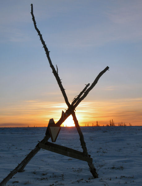
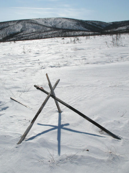
A tripod trail
intersection marker near the southern end of "The Big Swamp". |
The Big Lake Trail
System map (click on this picture to expand it to read-able
size) |
|
 |
 |
 |
 |
 |
|
|
The Iron Dog Trail heading towards Big Lake. |
|
Big Lake ice road. |
Heading to the Big
Lake North Wayside ... the finish. |
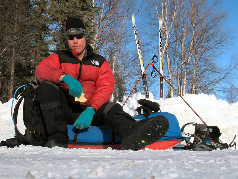
Waiting for my ride,
eating frozen cheese ... and scheming my next ski trip! |
|
|
 |
|
THANK YOU!!!
To the
State
of Alaska Department of Natural Resources and their SnowTRAC
program, the
Matanuska-Susitna Borough, the
Curry Ridge Riders,
the Mid-Valley
Trail Club, the Willow
Trail Committee, the
Big Lake Chamber of
Commerce, Governor Palin
and others for your efforts in creating the Susitna Valley
Winter Trail. You have created an outstanding winter
recreation asset for the Susitna Valley of Alaska. Your
efforts are very much appreciated!! |
|
|
|
Our Pesky Volcanoes |
|
|
|
|
Snowmobilers' Wall
of Shame? |
| Just kidding: There
is no shame in giving or receiving help in the backcountry.
But I am starting to collect pictures of situations I've
encounterd on ski trips where I, a lowly cross country skier,
have helped out snowmobilers in distress. I'm not being
judgmental about this at all. I'm a snowmobiler too, and I
have crashed, rolled, stuck, broken and buried my sled MANY
times! I know that doo-doo can happen ... so I always have
time on ski trips to help out snowmobilers when they are in a
pinch. Yeah that's right snowmobilers ... I know it's hard
to believe. But there are actually a few cross
country skiers out there that are good folks! |
 |
 |
 |
 |
|
I
used my skis to stamp out a 50 foot ramp up out of this creek
bed so this guy could get out. |
These were tough climber dudes. They would have gotten
this sled out without my help. But I helped them anyway. |
And I'll never forget the time I had the privilege of helping
out Alaska's most badass and beautiful snowmobiler woman when
she was in distress!! |
|
|
|
The Tour of Nowhere |
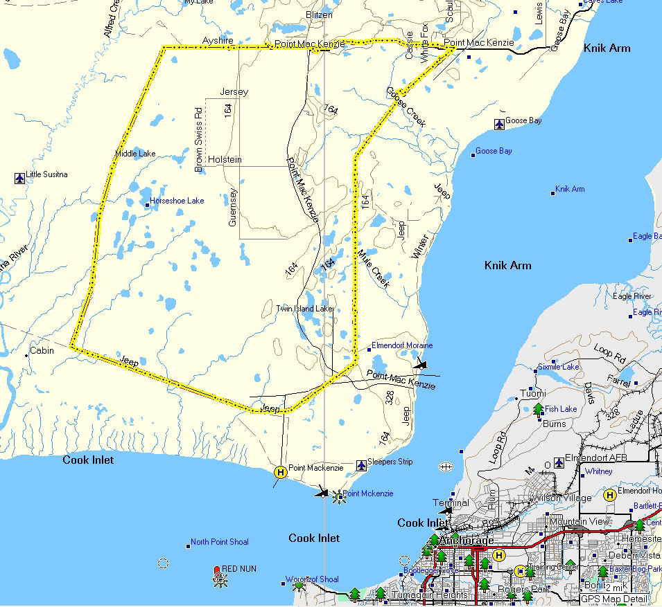
| Point
MacKenzie -
Mid March 2009: The
infamous Knik Arm "Bridge to Nowhere" was to be a link
between "Somewhere", Anchorage, and "Nowhere", Point MacKenzie.
The ski trip documented here turned out to be a fine loop around
the promised land of Nowhere. Starting
at the Point MacKenzie General Store this 39 mile route went out
Ayrshire Road, took a right into the swamps at the Susitna Game
Flats Preserve boundary, headed south on seismic lines to the
electrical transmission line, followed the power line east and
north to Goose Bay and the Pt. Mac road, and then followed the
road west ... back to the store.
It's amazing when you think
about it. The Tour of Somewhere (Anchorage) ski route has
been skied many tens of thousands of times. But less than
ten miles away from that popular ski trail, in the middle of "Nowhere", there is a logical
and neat ski loop that had likely never been skied until
this day. So ... I call this loop - The Tour of
Nowhere! I really like Nowhere. And I hope Nowhere
does not become Somewhere for a very long time. |
 |
 |
 |
 |
 |
 |
|
GPS track: 39 miles. |
Start and finish at
the Pt. Mac. General Store. Same price to park here as
Mat-Su trailhead but better security. Store owners Julie
and Jeff are super nice folks. |
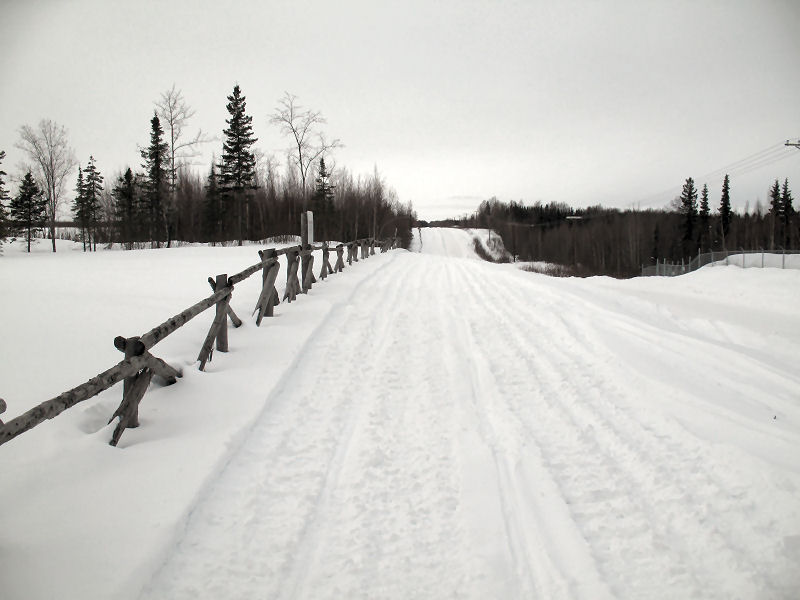
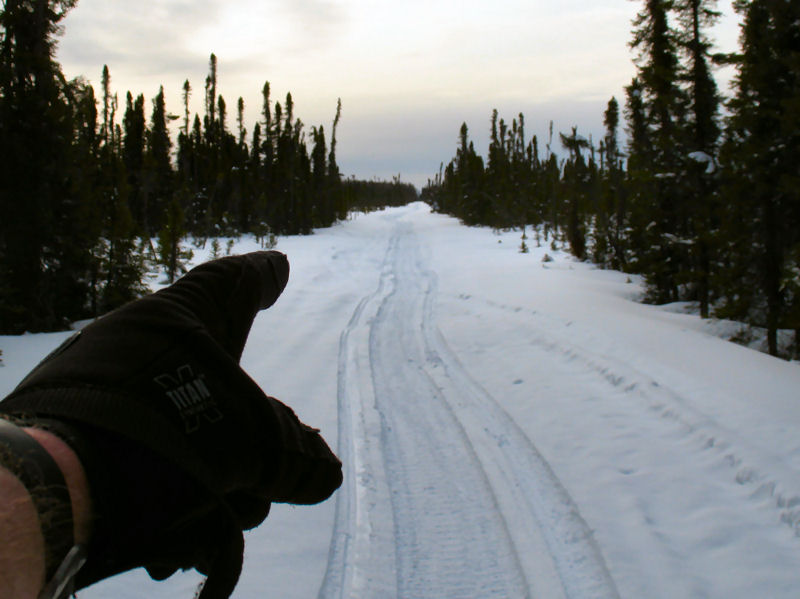
Ayrshire Road.
Following
Nodwell tracks. |
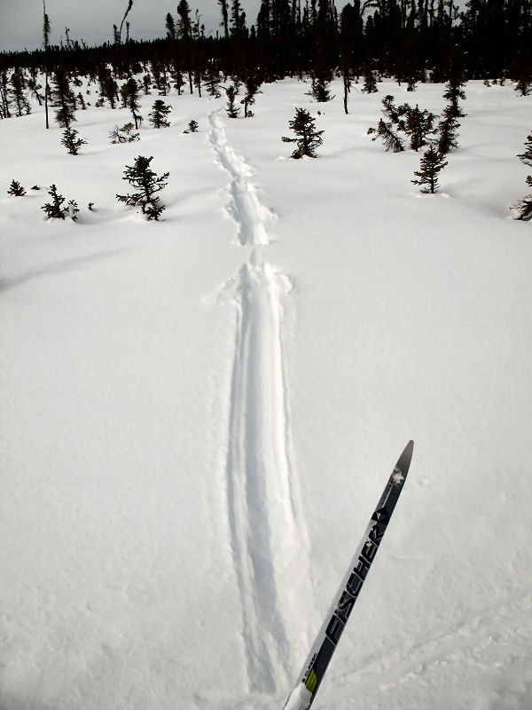
Following seismic
lines south across the swamps on the east side of the Little
Susitna River. |
 |
 |
 |
 |
 |
 |
|
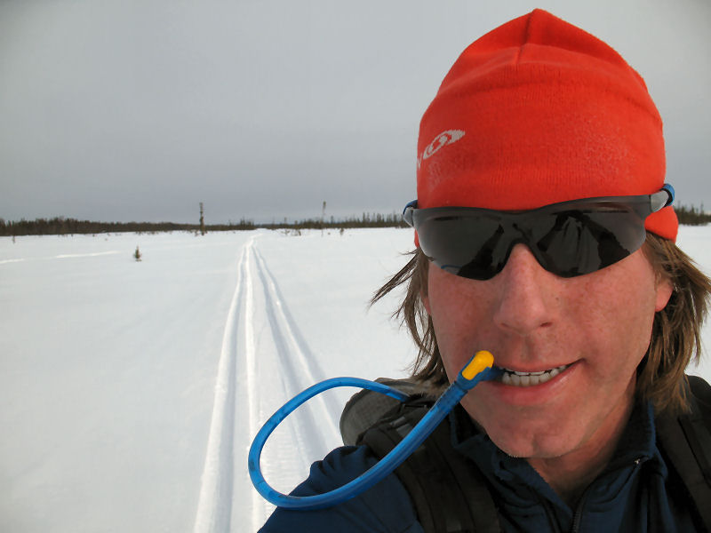
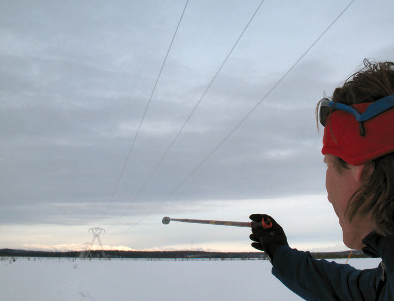
Staying hydrated
while skiing the seismic lines. |
River otter tracks. |
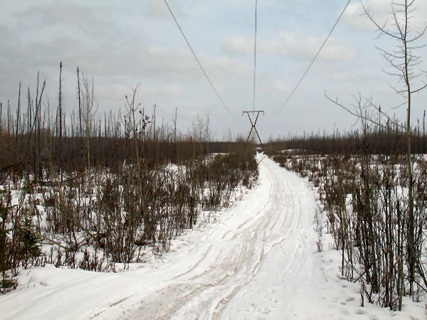
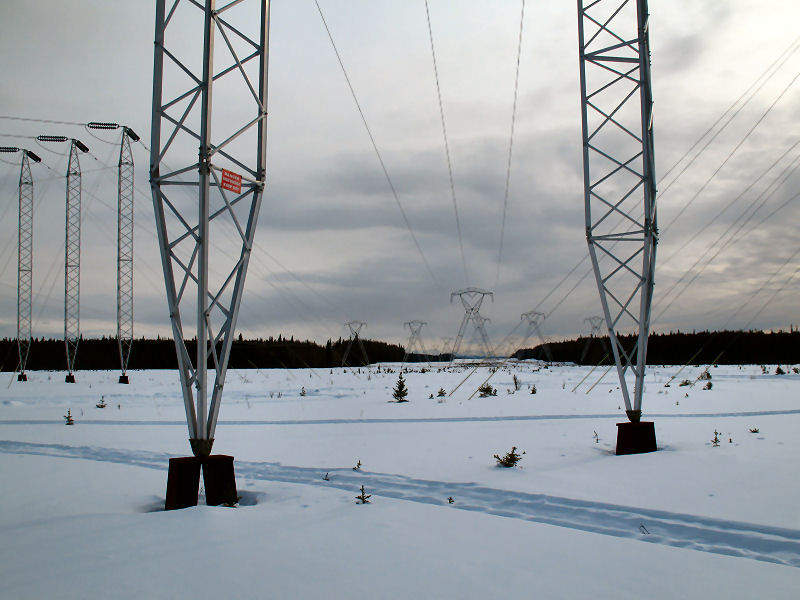
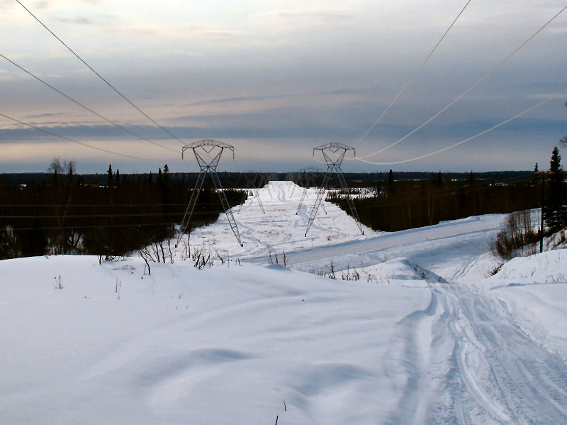
This is where the seismic
line I skied across the swamps hits the power line corridor. |
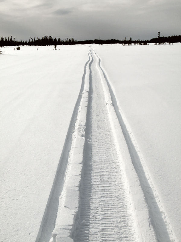
Good skating under
the power line. This loop was about 60 % classic, 40 %
skating. |
A number of creek
crossings break up the power line route. |
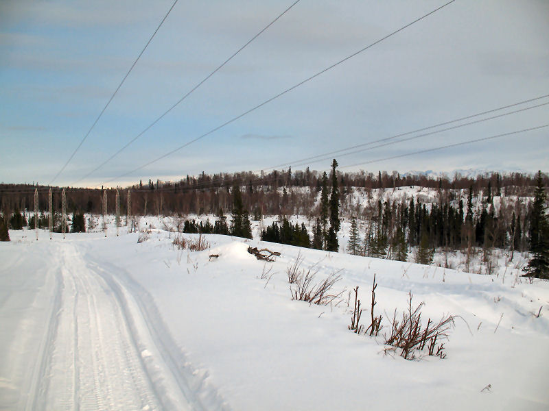
Looking south
towards the substation that sends power below Knik Arm to
Anchorage. |
 |
 |
 |
 |
 |
 |
|
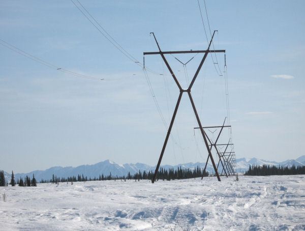
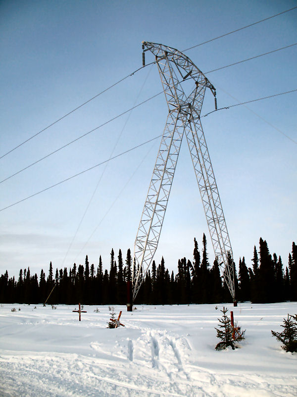
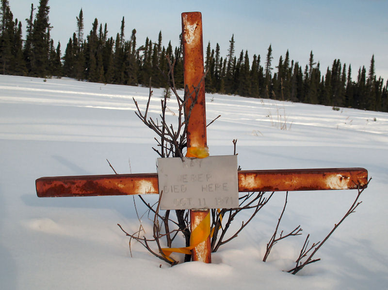
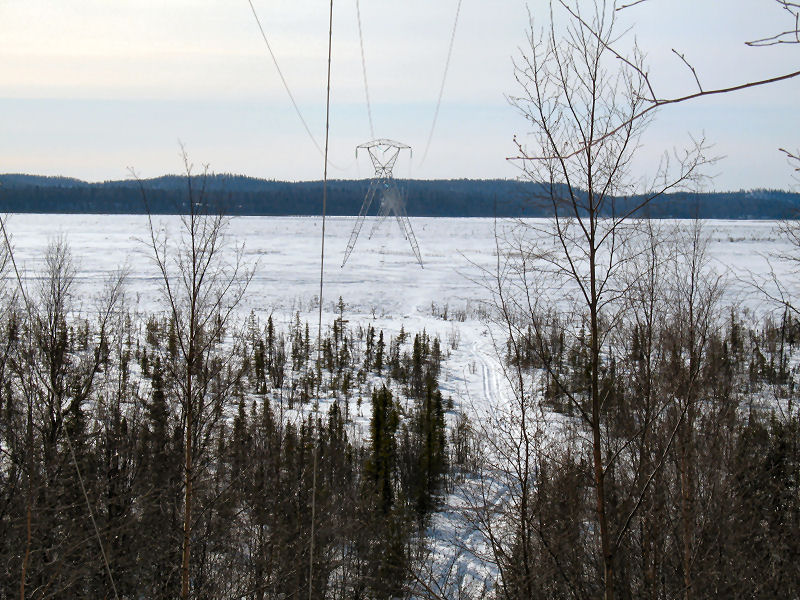
While skiing the
power line I noticed 3 iron crosses (click on picture at left
and you will see them near the bottom). Apparently they
are memorial markers for three men that died in 1971 when their
small plane had a horrific collision with the power lines. |
Looking back
southwest just after crossing the Point MacKenzie Road. |
The terrain on the
east of Pt. MacKenzie is part of the Elmendorf Morraine.
Lots of steep ridges here, left over from the terminus of a large
glacier of the last ice age. |
Power line heading
north towards Goose Bay. This was my favorite section of
the loop, good classic skiing (Special Red was the wax of the
day). |
Crossing Goose Bay. |
| |
 |
 |
 |
 |
| |
Nice trail heading
north of Cameo Drive. |
If I lived here, I
would be home by now. |
The steepest hill on
this loop is less than 1/2 mile from the finish. Welcome
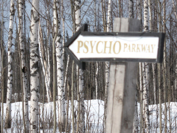
to Holy Sh*t Hill. |
This ski loop went
by the Point MacKenzie Correctional Farm. As I skied by
the farm I had this realization: "Working on farms makes kids
correct!? Wow! I worked on a farm for many years
when I was a kid!! No wonder I'm always correct!!!" |
| |
 |
|
|
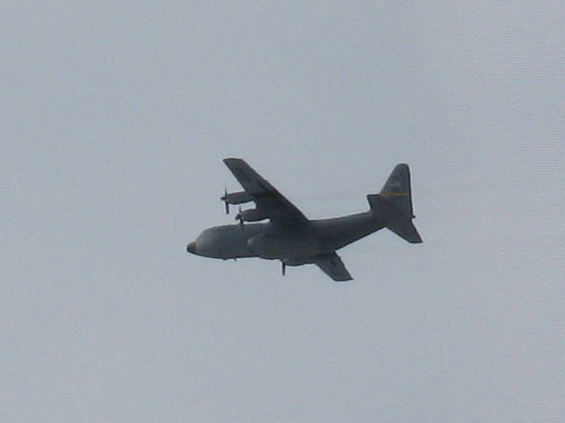
This
is a Hercules C-130. A "Herc". The Alaska
Air National Guard is often flying these very cool beasts over the lower
Susitna River drainage on low altitude training missions.
When you are out skiing you often see them. Some notable
encounters I have with Hercs have been at night while I've been
snowmobiling. The pilots of the Hercs often fly right over
the Gas Line Trail which many folks use. So there have
been a couple of times when I have been cruising along on a
snowmobile and start hearing this ambient low rumbling. I
start to get a bit spooked ... what the heck is that sound!?
Then the lights of the Herc and it's HUGE belly come into view
RIGHT above me! The plane has come from behind and is
flying at what seems like about 50 feet above me! Ahhh!
I went to the air show last
year at the Anchorage airport and toured a C-130 Herc.
There were a couple of Air National Guard pilots there and I asked
them if they have fun scaring the crap out of snowmobilers on
the Gas Line Trail. They started chuckling and giggling.
"You don't hear us coming until we are right on top of you, do
you!!! Ha! Ha!", they said. I laughed too.
It's actually pretty entertaining getting buzzed by these monsters. |
|
|
|
Moose-Whackers ! |
| No! I'm
not out whacking moose.
It's the other way
around. Moose have developed a very effective way of
whacking skiers ... in the face! They do it with a devious
trap they manufacture called a Moose-Whacker. To make this
skier flogging whip they walk down snowmobile trails until they
find a tasty birch or willow sapling. Then they grab up
high on the tree, pull it down until it snaps, munch all the
twigs off and then move on. What they leave behind is an
eye-level whip just waiting to make a swift and painful whack
against a skier's face! Come on moose ... skiers are your
friends! Go pick on some wolves instead! |
 |
 |
 |
|
A classic
Moose-Whacker. Set and ready for an inattentive skier. |
Snowmobilers can go
right under this Moose-Whacker ... |
... but a skier
takes it right in the face!! |
|
|
|
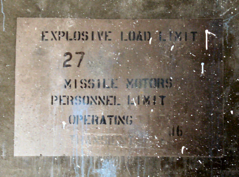
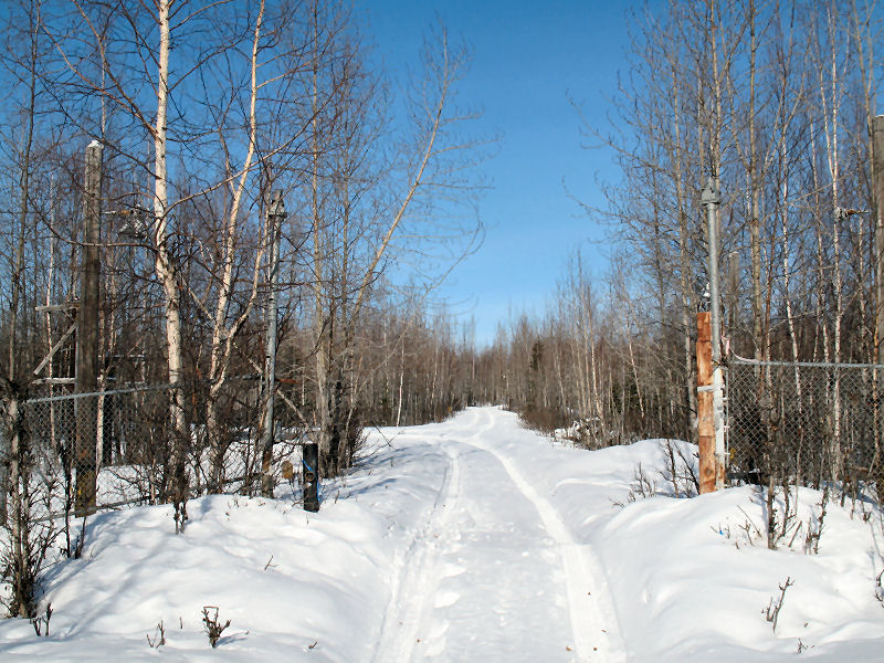
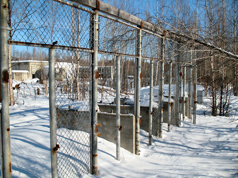
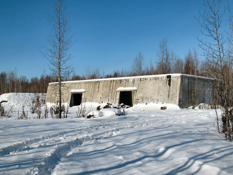
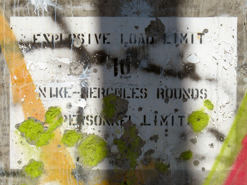
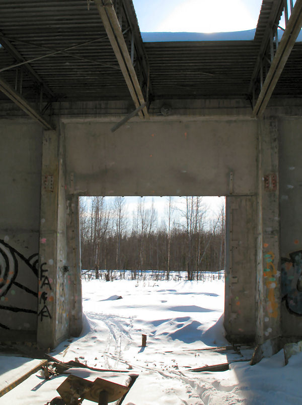
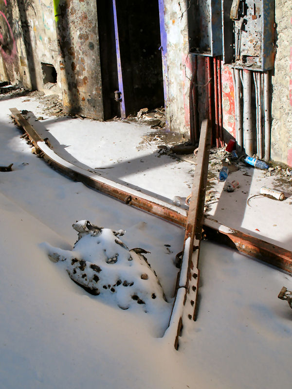
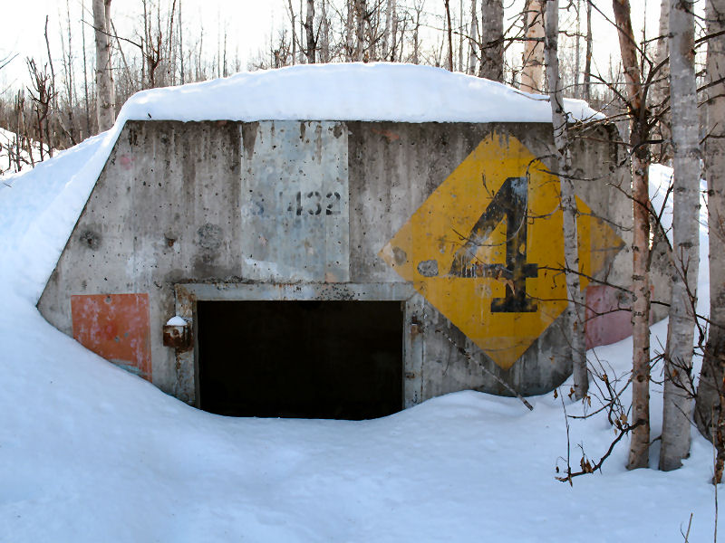
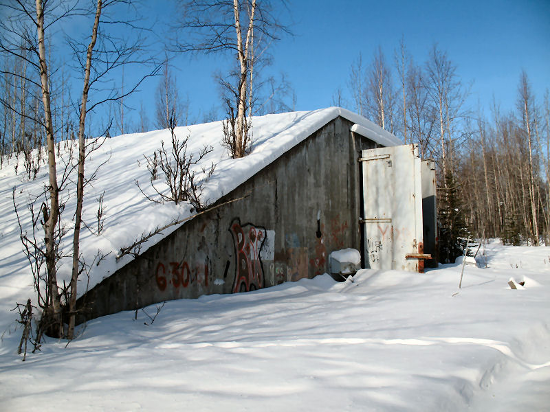
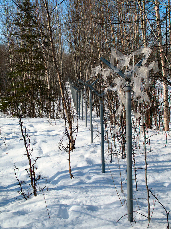
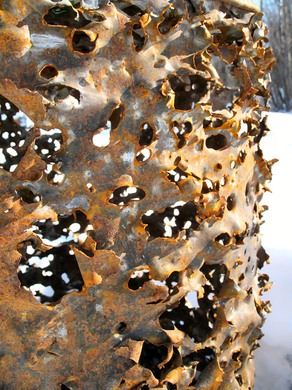
Skiing in a Cold
War Zone |
|
|
|
|
Mount Susitna Again ...
Main Summit |
|
|
|
|
Pierce Creek Cottonwoods
and Dinglishna Bushwhacking |
|
Susitna Valley -
Early March 2009: My
wife and I tried to go up to the Main Summit of Mount Susitna on this
day via the Pierce Creek route. It was too windy to make it to the
summit, so we hiked back out and did a snowshoe-bushwhack traverse over
the length of Dinglishna Hill ... something we had never done before. |
 |
 |
 |
 |
 |
 |
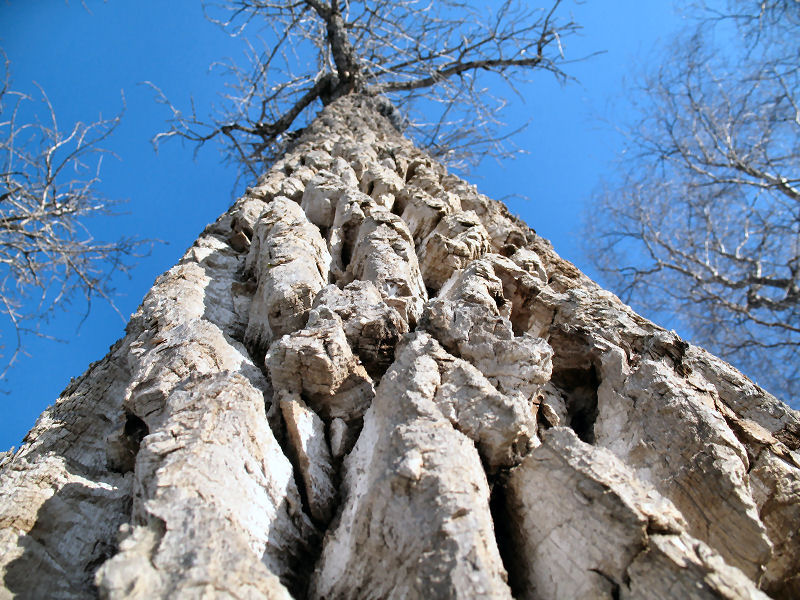
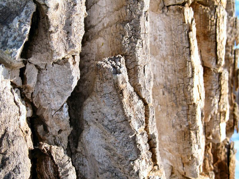
| A
typically beautiful Susitna Valley cottonwood stand in winter. |
|
|
|
|
My new cabin is
about done. I just need to install the door! |
 |
 |
 |
 |
 |
 |
|
Winds bash Mt.
Susitna, viewed from MCA upper camp. |
Dinglishna Hill as
seen from the Main Summit of Mount Susitna. |
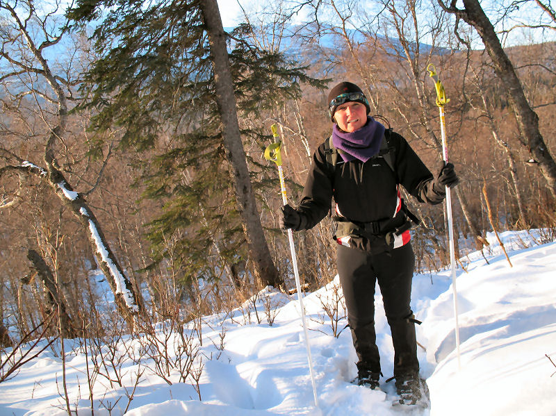
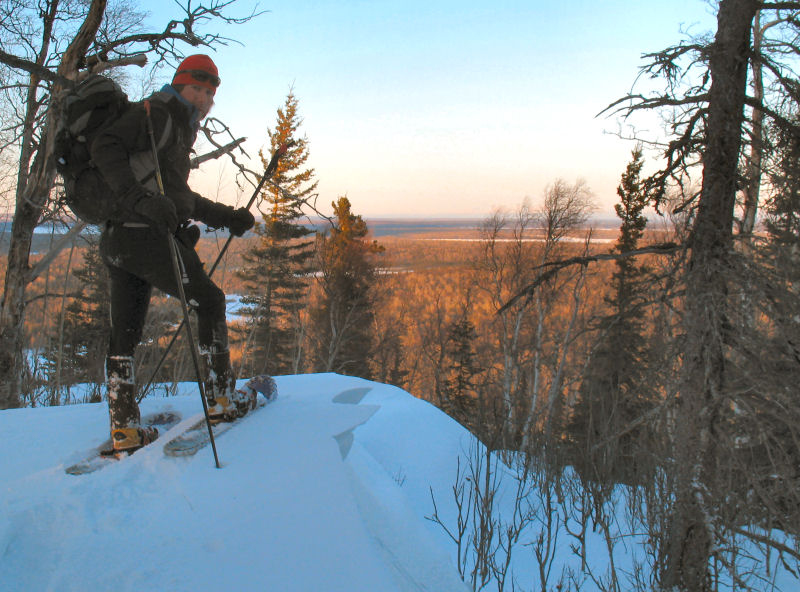
Snowshoeing Dinglishna Hill (or
Casper's Knoll as the locals call it). It was a windy and
cold day as we did a quick bushwhack traverse over this unique
479 foot tall pluton. |
Descending the steep
NE end of Dinglishna, and setting off a small slab slide.
Whoops. |
|
|
|
|
|


.JPG)


