|
Skiing
from Aniak to Bethel on the Kuskokwim River
Skiing Western Alaska's village
trail systems can be, in my opinion, some of the best spring skiing in Alaska. You get to
explore trails to unique places
over frozen surfaces where you could not travel in other seasons, you see and
meet real Alaskans and you often get comfortable skiing temperatures and
trail conditions that allow you to cover a lot of ground. But you
have to prepare for the variables in this game: 1) the weather, 2)
fickle trails, and 3) the weather.
Given these variables, I'm of the mindset to
just pick a starting point for a village trails ski
trip, stuff my sled with as much food as it will hold, and then let
fate determine my ski route. This ski from Aniak to Bethel is an
example of this flexible approach to route planning. It was not
exactly the trip I intended to do. But a snowstorm and
coincidental village travel that opened a trail between two villages
that are not that frequently connected set the stage for this ski trip.
In the end, I got the fulfillment
that I always hope for from a spring skiing trip in Alaska: days
of dawn to dusk hard skiing, every stride being one made on trails I've
never been on, seeing new country and villages and meeting interesting
people along the trail. Basically - spending a few days skiing,
and then walking away with memories and stories that will last me a
lifetime.
The following pictures will give
you and idea of what the ski trip from Aniak to Bethel was like.
You will not see pictures of folks that I met. Why? Respect.
The Native folks that populate the Yukon-Kuskokwim (Y-K) Delta are friendly,
tough people that I admire very much. I realize that when I'm
skiing in the Y-K Delta trails that I am an "oozveetuk g'esuk", a crazy
white guy, to them. Most Y-K residents have never seen people skate-ski
their trails, much less while pulling a sled. To them this
is something only a nutty white guy would do. I understand this.
And I don't want to aggravate their opinions of skiers further by whipping a
camera out and taking pictures of them. That wouldn't help the
situation at all. I look up to Yupik Alaskans (I've been married
to a woman of Yupik descent for 20 years!), and I want to be on the best
of terms with First Alaskans.
|
 |
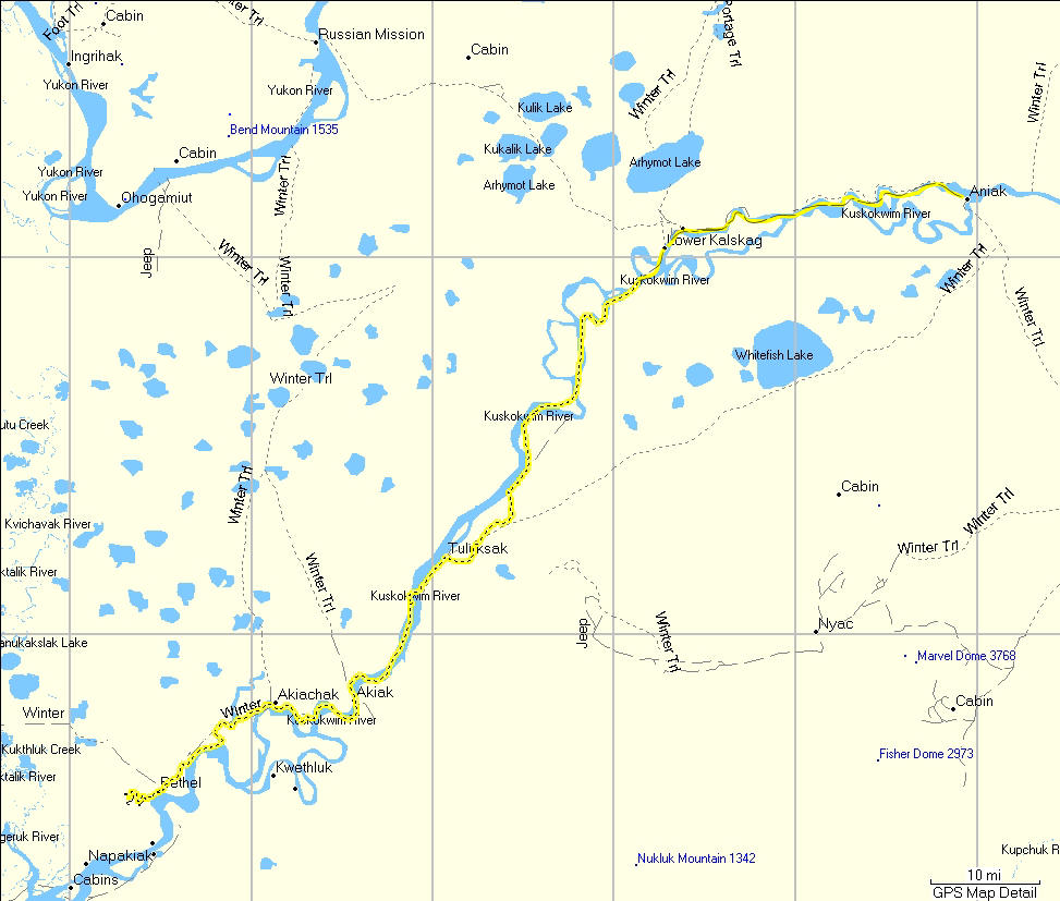
The
map on the left shows the locations of Aniak and Bethel on the Kuskokwim
River in Southwestern, Alaska. The yellow line on the right side
of the map is the nearest highway - 300 miles to the east.
The map on the left is the GPS route
of where I skied, the distance was about 135 miles. |
 |
 |
 |
 |
| To
start this trip I flew 300 miles or so west of Anchorage to the village
of Aniak. The
night before I left Aniak I had takeout pizza from this place - the
Hound House. |
Esther
makes an awesome pizza ... if you're ever in Aniak don't miss out on her
food! |
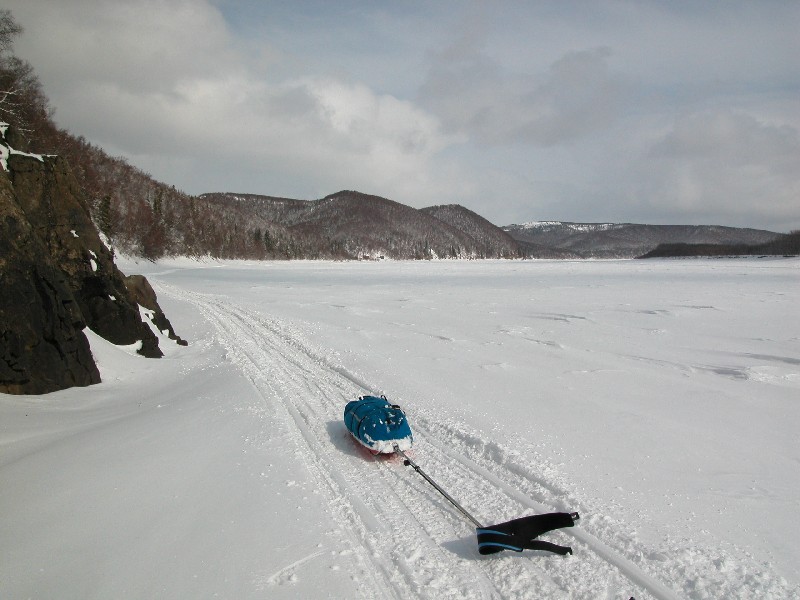
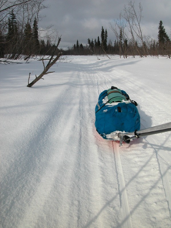
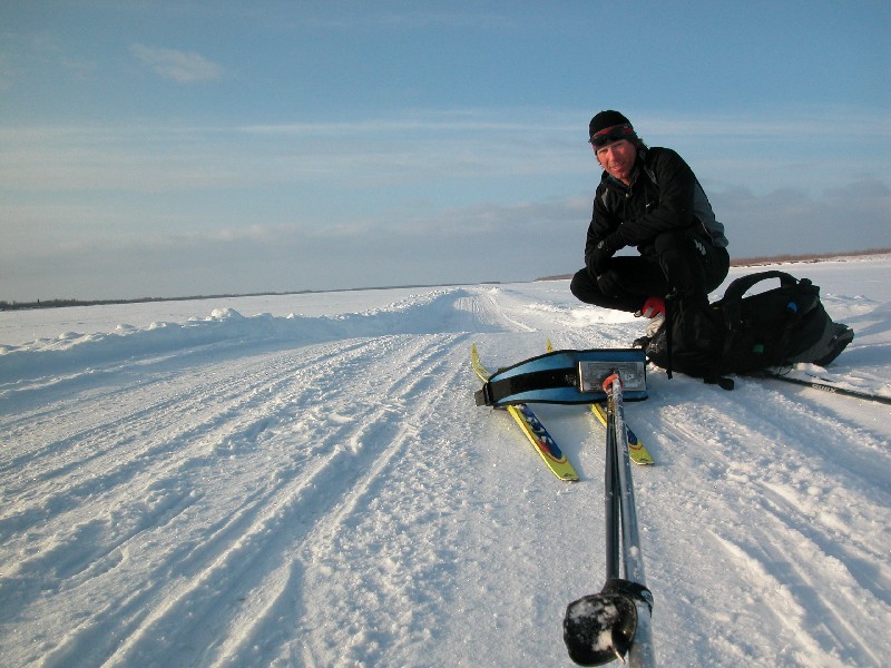
The
trip start ... not exactly what I hoped for. 5 inches of wet
powder. Very slow going. I was pushing hard for the first
four hours and making less than 3 mph. If you've never pulled a
sled through wet snow - you don't know what you are missing!! |
 |
 |
 |
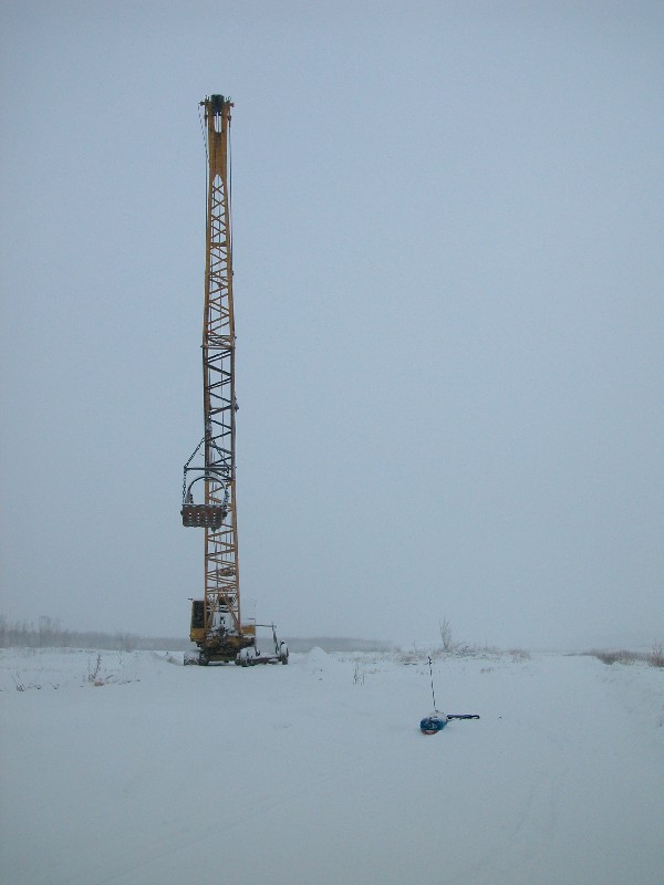
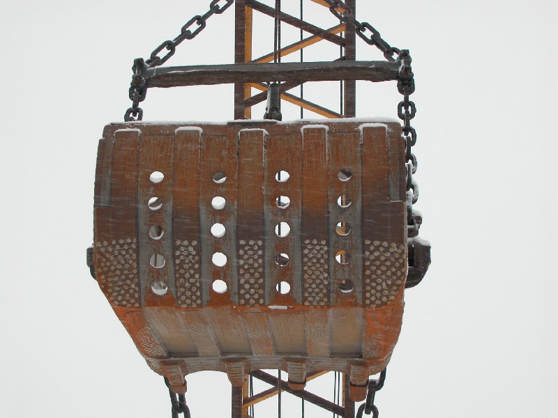
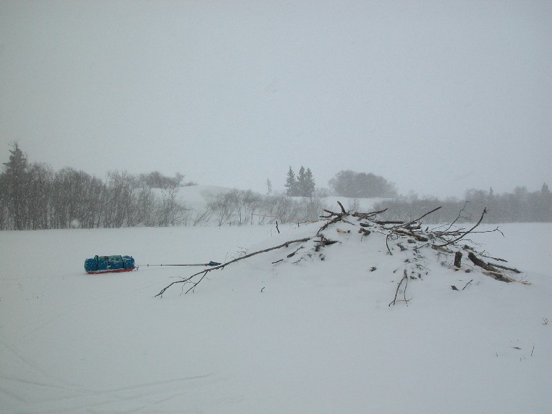
| Back-trails out of Aniak led to the Kuskokwim River and this big dredge on
its banks. |
Heavy
equipment like this dredge is brought up the Kuskokwim River on barges in the
summer. |
Around
noon a group of 4 Native guys on snowmobiles came by with a present - a
trail! Wet, sticky snow - but a little faster going in the snowmobile
tracks. |
 |
 |
 |
| The
day before there was a truck trail plowed on the ice to Kalskag.
But wind and drifting snow made the skiing in the trail pointless. A woman from Kalskag tried to drive through the drifts
anyway to get to Aniak that day ... but got
stuck badly and had to be rescued. |
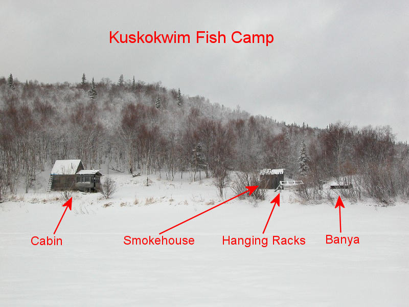
On the
banks of the Kuskokwim near villages you see many fish camps.
These are used during the summer to catch and put-up fish for the year.
This camp above is a typical set-up. It would be fun to help out
at a Native fish camp during fishing season. |
Eventually the storm blew over and the weather turned sunny for a bit.
There was picturesque skiing along rocky cutbanks upriver from Kalskag. |
 |
 |
| This
picture shows the trail on the Kuskokwim River. To the right of my head is
the hill above Kalskag. It will be the last hill I see for almost
100 miles. |
When I got to Kalskag, the village on
the banks in this photo, I was told trails west were not in due to the
recent wind and snow. But ... a basketball team from Tuluksak was
just arriving. That meant a snowmobile trail going 45 miles south over a
lightly traveled section of the Kuskokwim was in. I knew that if I
got to Tuluksak I'd then be into the Bethel area trail system, and could ski
to Bethel. I decided to get hammering towards Tuluksak while the trail was in. |
| |
 |
|
| |
I
skied until nightfall and then set up a camp in the willows. It's
not wise to camp on the river. It's windier on the river and a
snowmobiler could hit you in the night. Around 11:00 PM that night
I heard a bunch of snowmobilers - the team was heading back to Tuluksak.
I figured I'd better get an early start to ensure finding the trail. |
|
 |
 |
 |
| Dawn
on the Kusko. A plastic vodka bottle adorns a trail marker.
Another reason you don't camp on the river and near the trail. |
At
night it snowed some and the wind came up. The trail was drifting
over a bit but was easy to follow. The weight of the sled and the cold
snow, around 10 F, kept me classic skiing. |
Villagers traveling by snowmobiles often drop stuff. I found a box
of DVD's, basically in the middle of nowhere. Cristina Applegate
... I get the feeling she wouldn't be too at home in Kusko country! |
 |
 |
 |
| Around
noon a group of white guys came by on sno-gos and gave me a good trail.
I could start skating. I'm glad I chose classic skis. They
were good for striding, ice road double-poling and skating on soft snow. |
All
day it alternated between clear and calm spells followed by fiesty
wind-driven snow sqalls. |
You'd
have good skating for a while. Then a snow squall would fill the
trail and you'd be striding until a sno-go came by to mix the new snow
in with the old. |
 |
 |
 |
| About
11 miles north of Tuluksak the route moved off the river onto a maze of
inland sloughs with nice trails. |
I got
to Tuluksak but didn't stop as a pack of village dogs ran me out!
Actually the dogs were pretty nice little guys, just super excited by
the novelty of a skier pulling a sled - a sled that smelled of FOOD !! |
A gift
awaited me at Tuluksak - a truck trail that goes all the way to Bethel.
That is - if I wanted to follow it. This section of the trail was
super fast - but it sure wasn't all like this stretch. |
 |
|
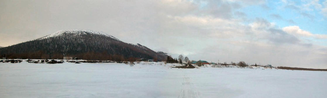
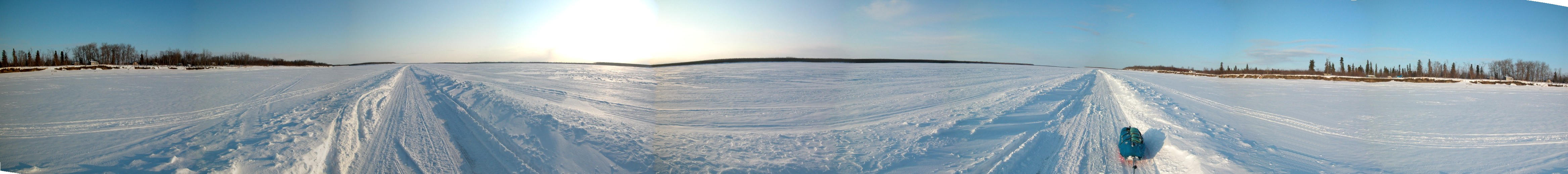
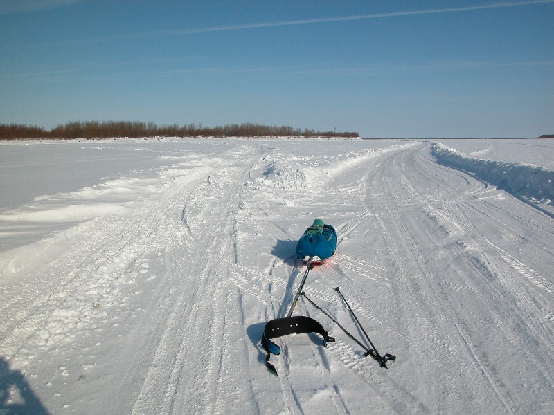
This panoramic was taken a few miles
south of Tuluksak. It's not the greatest picture - but it shows
the scale of the Kuskokwim River here ... huge. |
| |
 |
|
| |
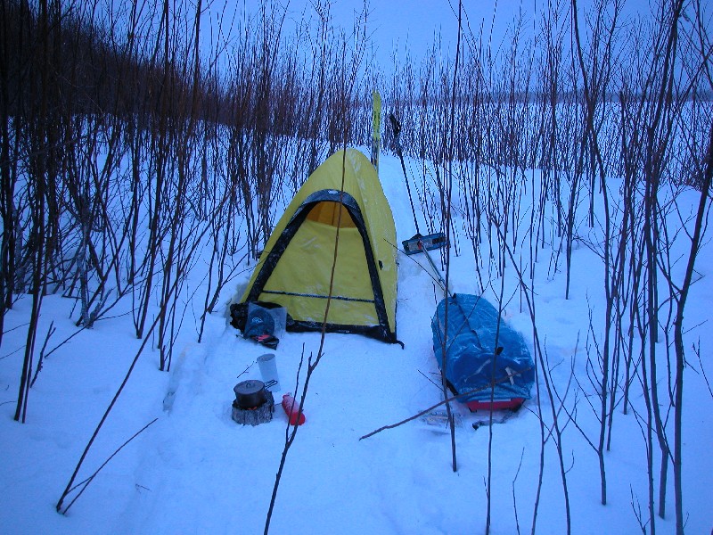
At
sundown I stamped out a tent site in the willows. It was a long
day of fighting snow squalls and pushing to reach Tuluksak. Now I
could relax and enjoy the ride into Bethel. |
|
 |
 |
 |
| At
sun-up I was back on the truck trail. It was fun, and very fast,
double-poling "down the road". |
The
fork in the road: left goes to Akiak (on the bank in the willows), right
goes 18 miles to Tuluksak. |
I
jokingly referred to the truck trail as the "white man's trail".
"White man trail is boosheet! Give me Native trail!" And off I
turned onto the first portage trail, this one to Akiachak. |
 |
 |
 |
| If
you expand this picture you will see sets of poles marking pairs of
holes for underwater nets to catch whitefish, lush and pike. I
asked how they get the rope down one hole, under the ice and up the
other hole. It's a Native secret, that I am sworn to secrecy not
to tell anyone about. |
This
is the water supply hole for folks with no running water in Akiachak.
Not everyone in America has water from a faucet and flush toilets. The village is in the background. |
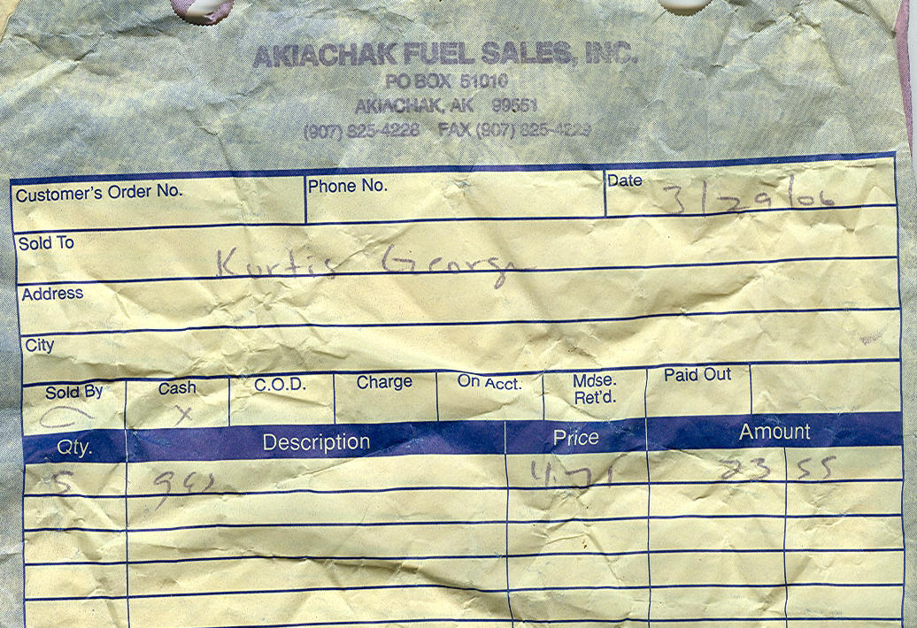
I
found this receipt on the trail. The price of gas in Akiachak:
$4.71 per gallon ($2.10 in Anchorage). And that's before the 5% village tax. Ouch !! |
 |
 |
 |
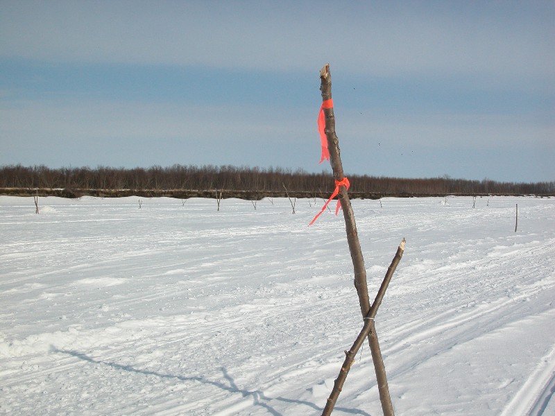
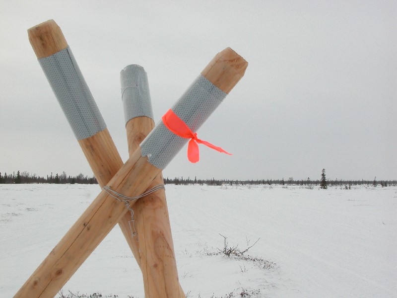
| Nice
tripods mark the main portage trails between channels of the Kuskowim
River. No doubt these trail markers have saved many people from
getting lost in this barren country. |
An
interesting note: my father-in-law who has been an Alaskan bush pilot
for 60+ years says that because of global warming there are much more
trees and brush in this area than there used to be. |
Waterfront in Bethel. I'm not sure what this flag was for, maybe a
'guess the time the river breaks up' contest like the Nenana Ice
Classic? Anyway - it was cool to see the Alaska-Dipper flying
proudly in Bethel. |
 |
 |
|
This is a panoramic of Bethel on the
west banks of the mighty Kuskokwim River. You can see the ice road
in the middle of the river. I skied through Bethel
and off towards the airport. This was the toughest navigation of
the trip. Not knowing the layout of Bethel I skied through a
lot of subdivisions bumbling my way along until I caught sight of the
airport. |
Gas
and diesel prices in Bethel ($2.10 in Anchorage). In the summer you can't drive much of
anywhere here - no roads lead out of town. But you can go many
places in a boat. In winter it is: trucks on ice roads,
snowmobiles, 4-wheelers, dogsleds. Even skis! |
 |
|
 |
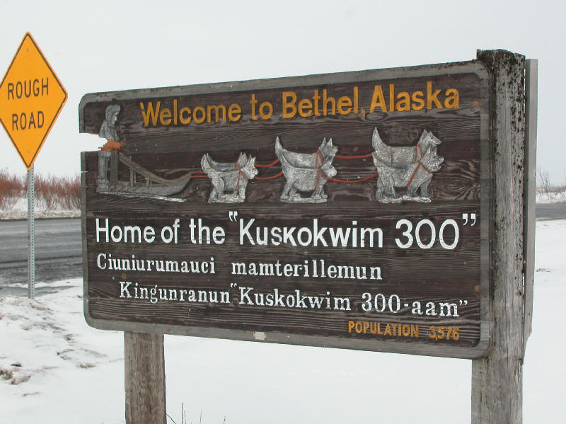
| The
end of the "rough road"? The Kuskokwim 300 (mile) Sled Dog Race goes from
Bethel to Aniak and back. The course changes a bit year to year
depending on conditions. I skied this year's course, though 1/2
the distance of the sled dog race. |
|
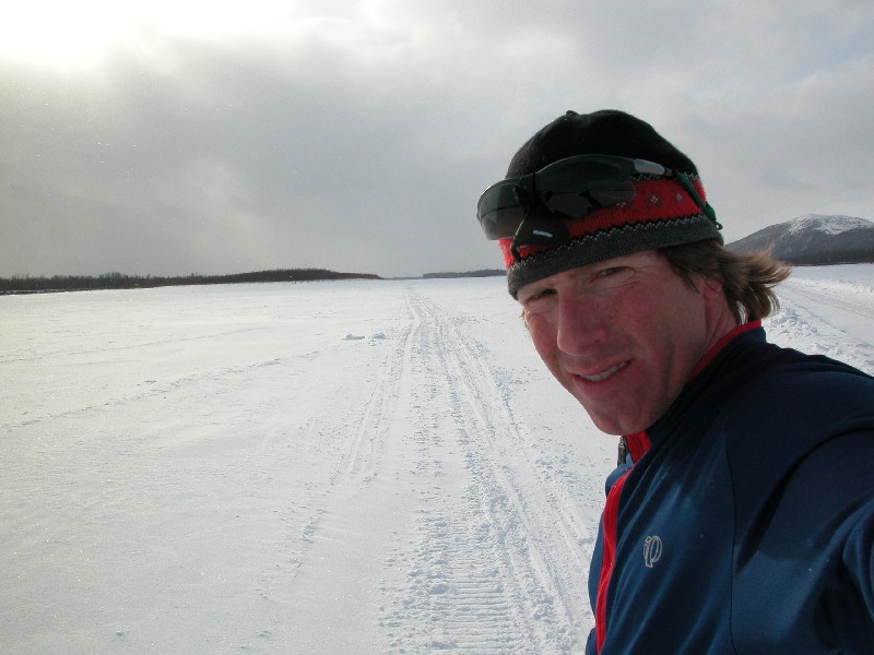
A
tourist shot? You bet. But hey ... at least I earned it!
Many folks I met asked me:
Where are you from? "Camiungusit?" More probably saw me and wondered.
I'm from Anchorage. But a part of my heart now lives in the Y-K Delta. Quyana !! |
| |
|
|
|
Back to 2006 Skiing Photos |
Photos and web page by Tim
Kelley |
|