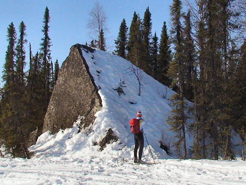
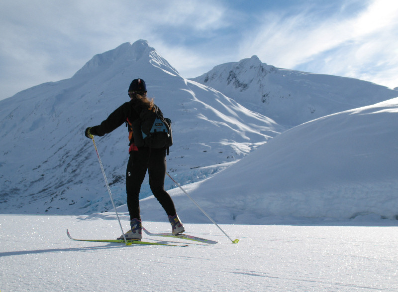
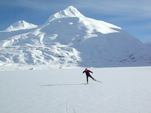
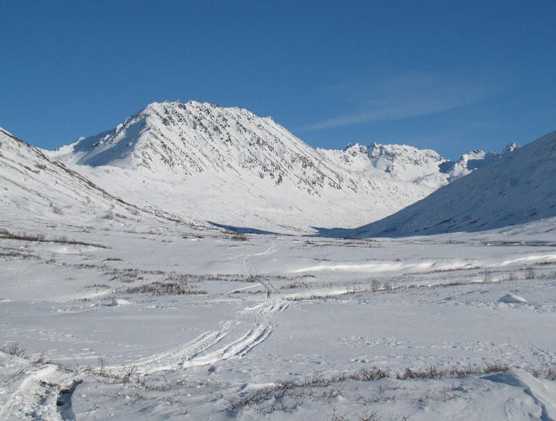
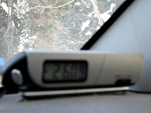
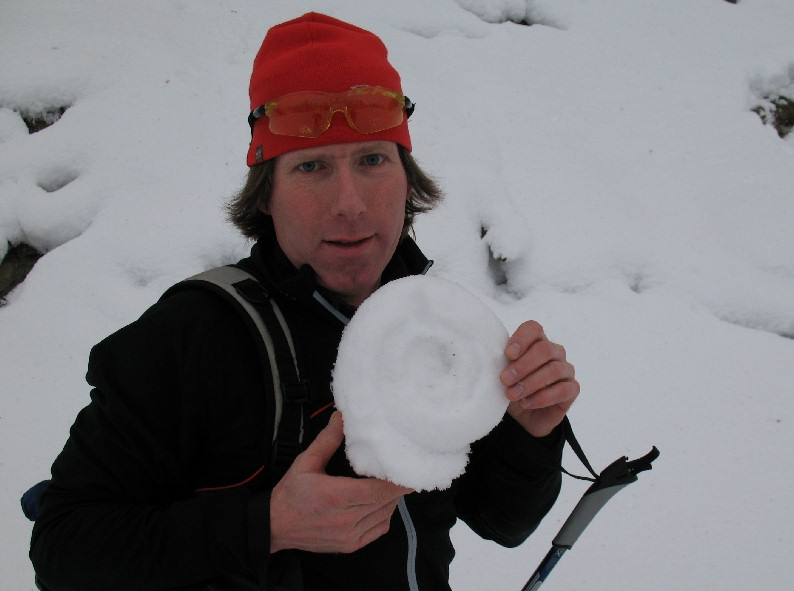
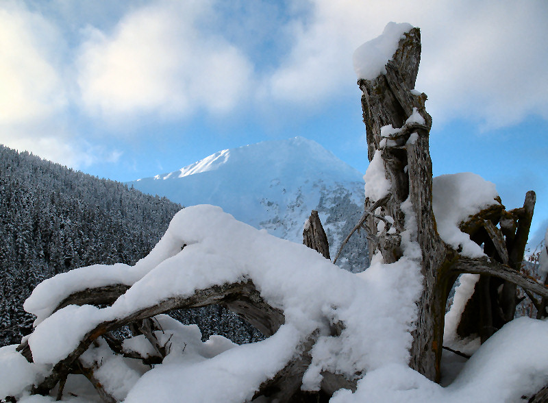
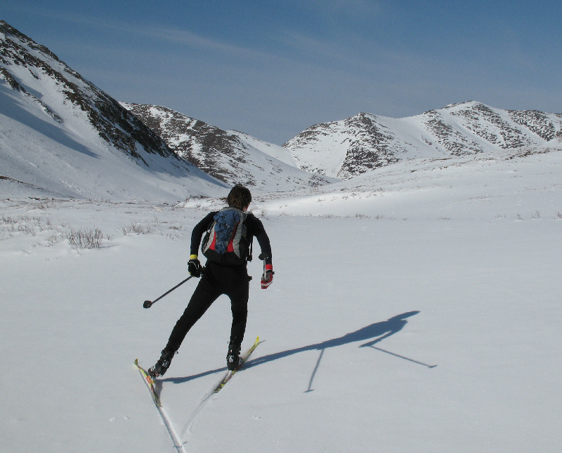
Trapper Creek -
March 2008:
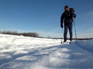
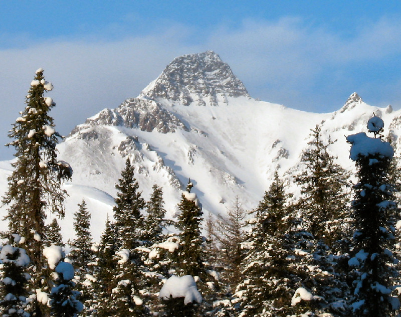
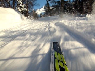
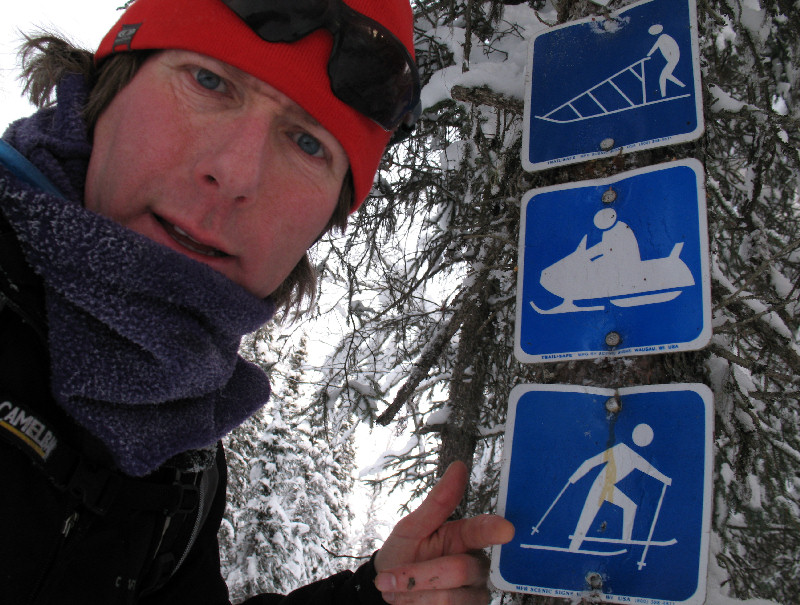
When the Curry Ridge Riders snowmobile club posted on their web site
that they had just finished the north end of their new 46 mile (74 km)
groomed snowmobile loop, it didn't take us long to get to Trapper Creek
and ski it. Wow! This has got to be the coolest groomed loop
I've ever skied in Alaska. Benji Uffenbeck, Cory Smith, Tim Miller
and I were treated to a cloudless day with never-ending, close-up views
of the Alaska Range - all while skiing on a freshly groomed trail. Thanks to the Curry Ridge
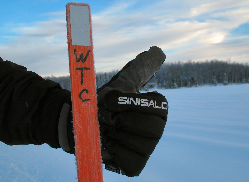
Riders (and all the other trails groups in the Susitna Valley: WTC,
LSDA, MSDA, etc.) ... you make the Valley a great place for ALL winter
recreation groups. Note to xc skiers - if you use any of these these cool
Susitna Valley groomed trails, please consider donating to the non-profit groups that make them
happen.
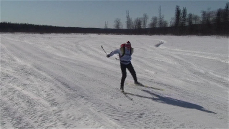
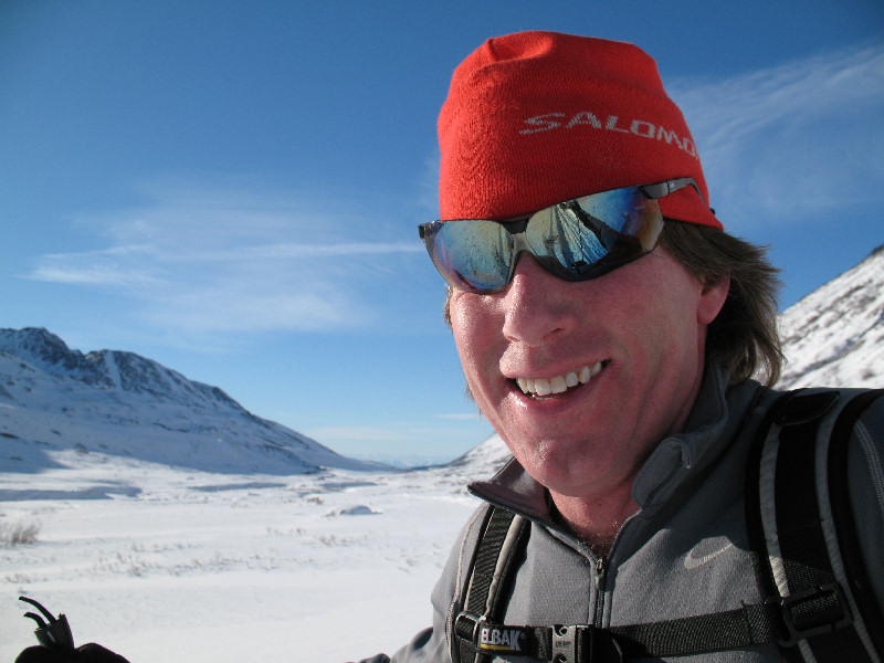
The team is back together!
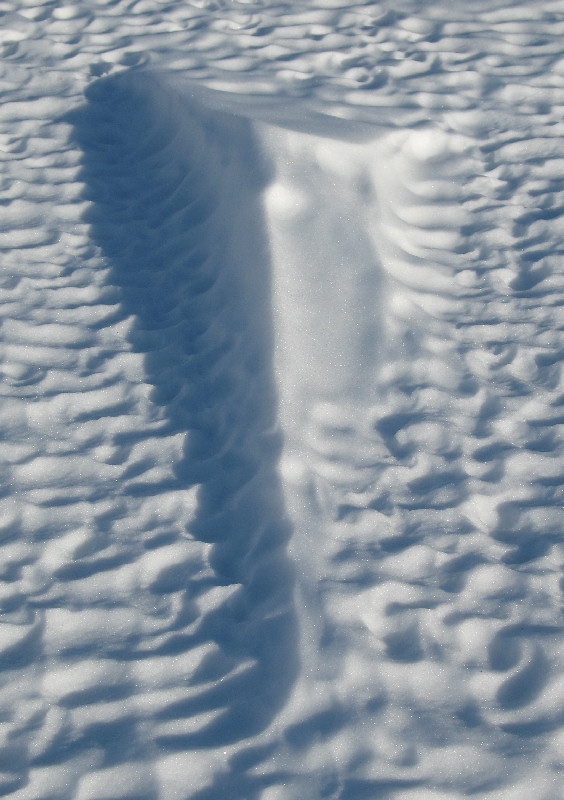
Skiing across the Tokositna flood plain
A large glacial erratic on
the East-West Express Trail
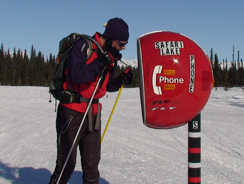
Safari Lake Trail ...and you
thought snowmobile trails were bumpy!
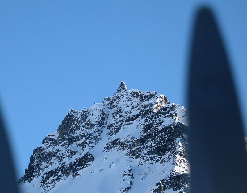
Never ending views of the
Big One
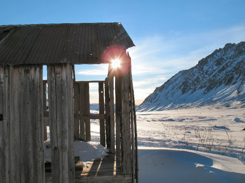
Chulitna Bluff Trail
The Safari Lake phone is
great for making free long distance calls ... to yourself.
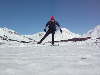
Nudinli Ridge -
March 2008:
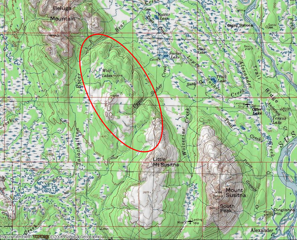
Nudinli is Dena'ina Athabascan for "Ridge That Extends Across".
According to "Shem Pete's Alaska" this is the name of the ridge that
extends from Little Mount Susitna to Beluga Mountain. This ridge
helps form the western boundary of the Susitna River Drainage. It's a
long, sparsely treed ridge ... that makes for some great skiing.
On page 113 of "Shem Pete's Alaska" Shem states this Dena'ina history
about Nudinli:
"Some young people stayed all winter
up on Susitna Mountain and Beluga Mountain and ... Nudinli. They
got all the meat they wanted and just stayed there all winter. ...
They'd stay until March and then come back to their women with furs and
porcupine meat on sleds."
Ah yes, the good ole days when
all it took to impress women ... was a sled full of porcupine meat !!
Actually, joking aside, it was no doubt a huge amount of work and an
epic struggle to get a
sled full of porcupine meat in those days. In late March I did a snowmobile
supported ski trip to Nudinli Ridge. I ski toured 30 miles to get
up onto this ridge and to get to Wolf Lakes and back.
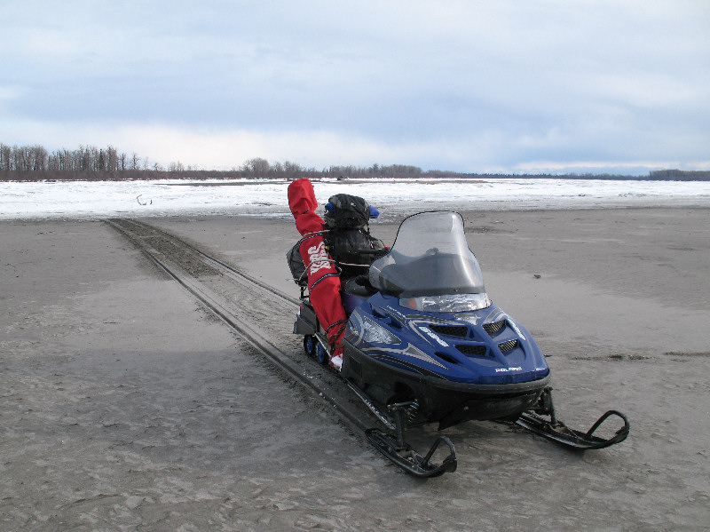
The Lower Susitna River
froze up incredibly rough this year. By March it was smoothed out
a bit. But in December the pressure ridges in the ice were huge.
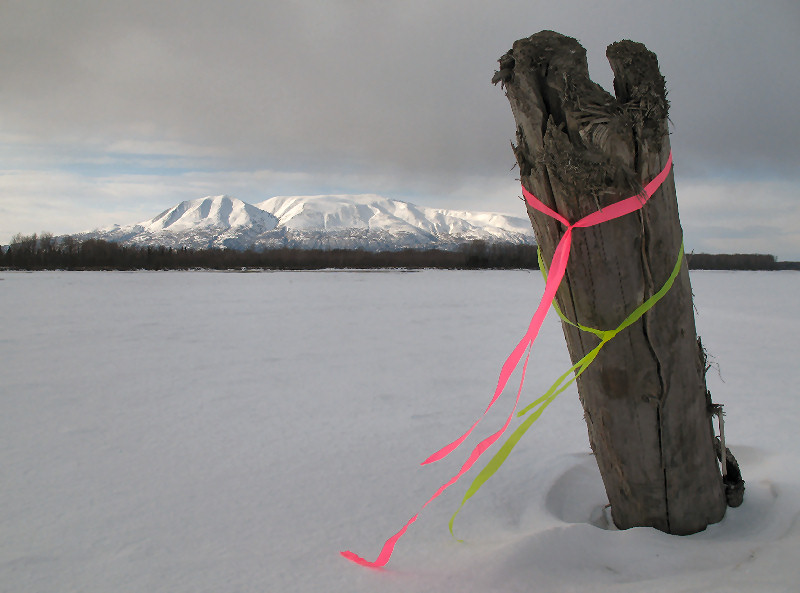
The Dena'ina name for the
Susitna River is "Susitnu", which means 'Sand River'. It's a good
place for "sandmobiling".
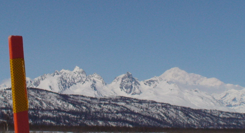
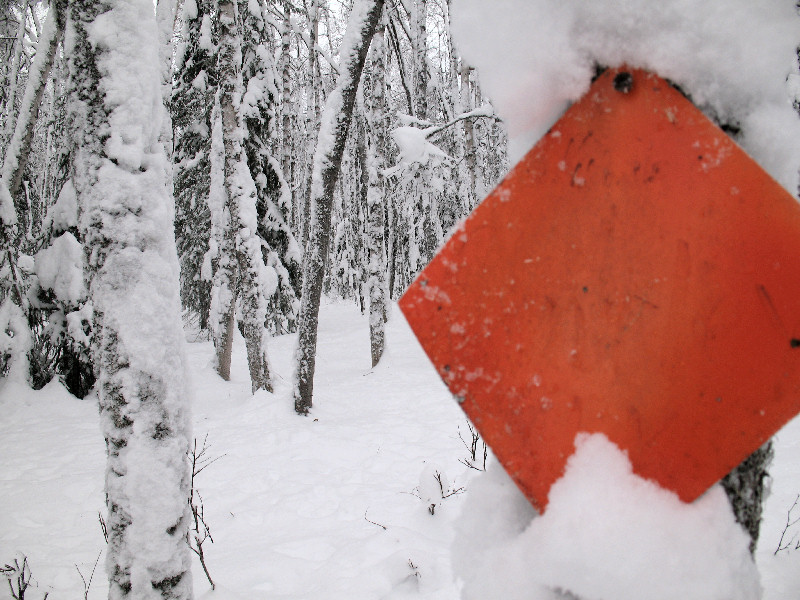
Trail marker and Mount
Susitna
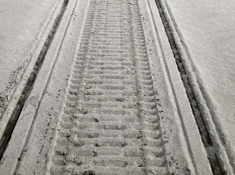
In two months these tracks
will be 10 feet under water and there will be hooligan (smelt), salmon
and seals swimming over them.
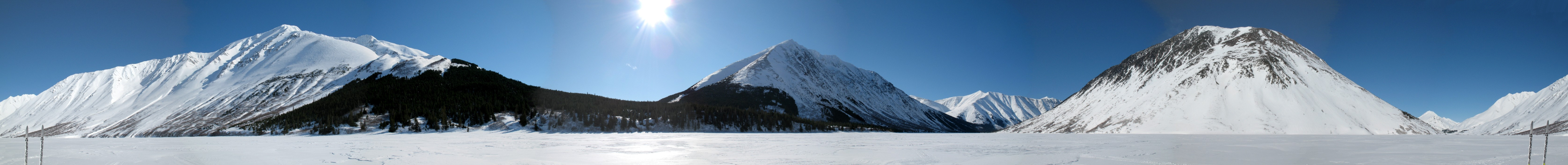
360 degree panoramic shot
from the center of Nudinli Ridge. Lots of open land here, and
great views. In the left center you can see Mount Susitna (Dghelisha
- 'Little Mountain') and Little Mount Susitna (Henq'edishla - 'The
Little Upland One') looking south. On the right is Beluga Mountain
(Hnidi - 'The Upriver One'), Mt. Foraker and Mt. McKinley (Dghelay Ka'a
- 'Big Mountain'). Source: Page 113 "Shem Pete's Alaska".
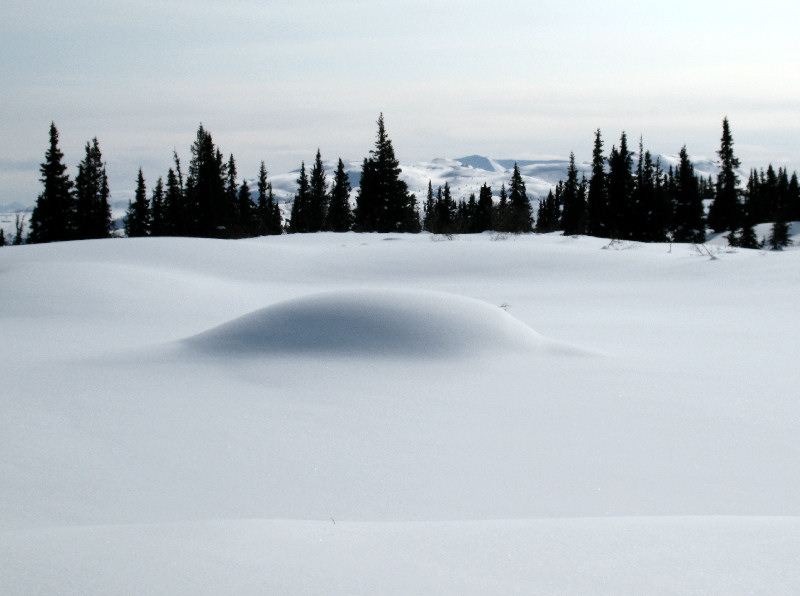
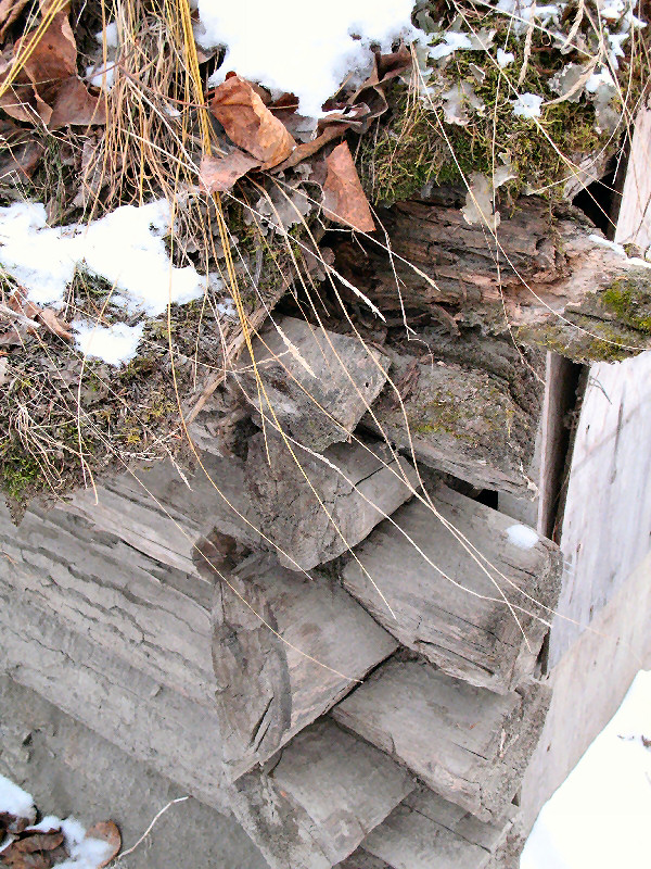
Beaver house smothered with
snow
Tracks from a wolverine
bounding
Here you can see classic
wolverine tracks, and then he or she switches to bounding gear.
Foraker and McKinley.
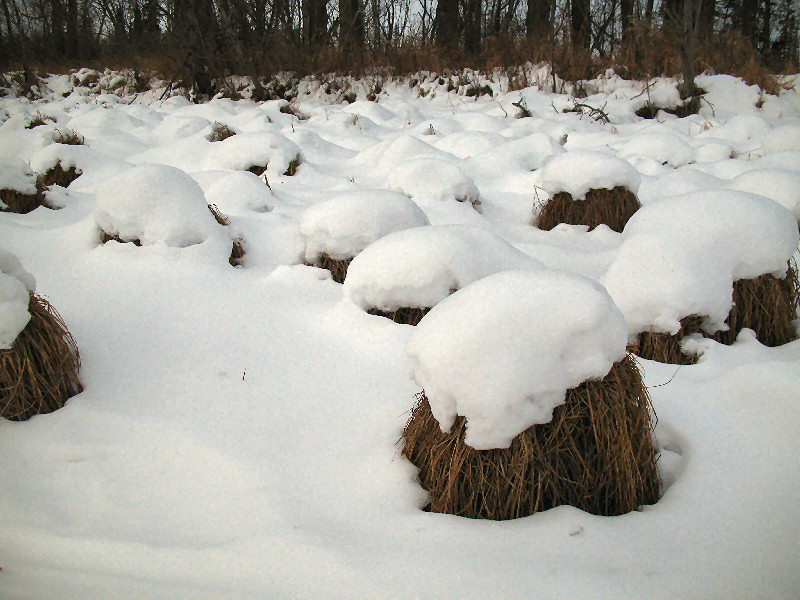
Great views from this ridge
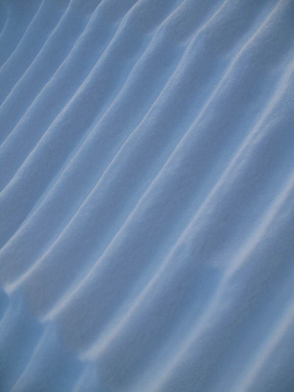
Artsy shots that show snow
conditions. With full-on crust skiing season approaching it's
enjoyable to get in some good last 'extra blue' striding ski trips
Sorry the map has no
route detail. I accidentally deleted my GPS route and I can't
remember how I got there. ;-)
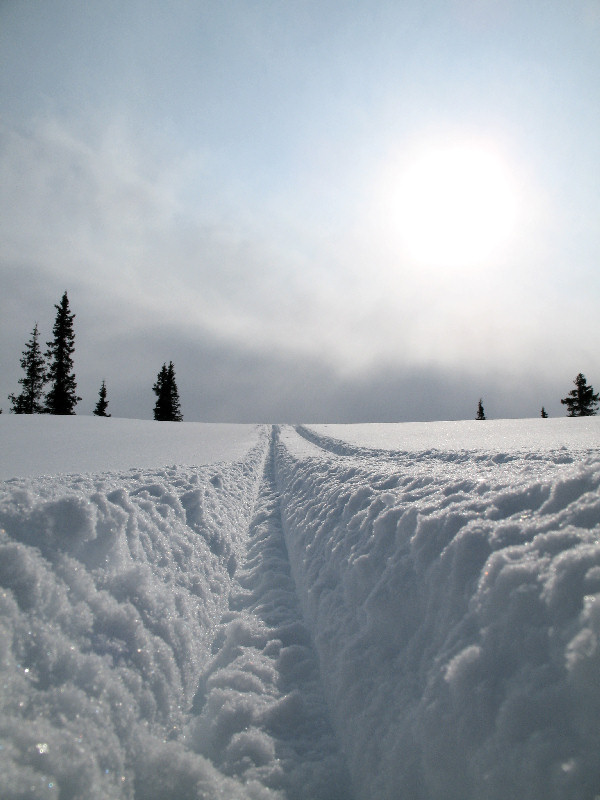
All Crust Skiing
Into the Past
Chedatna Lakes -
March 2008:
A side project of mine for a few years has been to find the location
where Alexander Creek homesteader Otto Thiele took a picture in 1941
(see below) that is the signature image of the Alexander Creek Inc.
Native group. Based on lining up ridge and gully angles, I think I
found the spot during a recent crust ski in the Chedatna Lakes area. It makes sense logically too
that this is the spot - it would be on the
route Otto would follow back to his home at mouth of Alexander Creek.
I plan on going back when the snow cover and light are similar to the
original shot to retake this picture using snowshoes.
Otto Thiele's 1941 picture
of Mount Susitna
Skiing to remote old Dena'ina
haunts like this spot and Nudinli (see above) ... is fun stuff
My 2008 picture
from at, or close to, the same spot
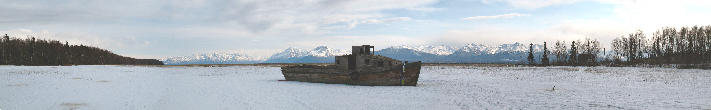
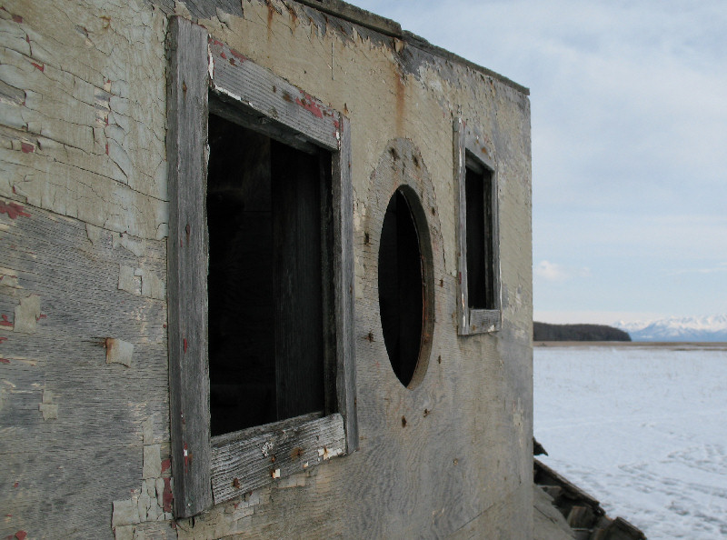
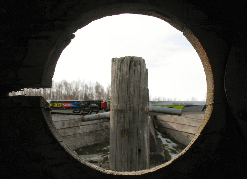
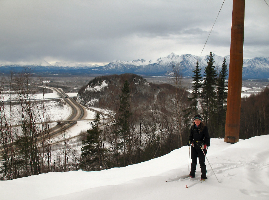
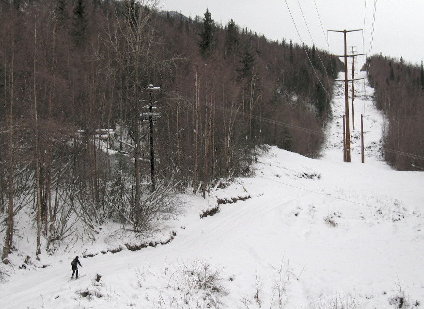
Knik -
March 2008:
Back in 1984, due to low snow along the normal Knik-Goose Bay Road
route, the Iditarod re-started at Settler's Bay and traveled
along the Knik Arm coast to Knik before going inland. Recently I
was crust skiing this stretch of trail I had never been on and stopped
to take some shots of this old fishing boat that I have looked at from
the road for many years ... but had never visited.
From Allen Thomas:
"That boat belonged to the Redingtons. Mrs Redington told me that it
was used as the mail boat at Hope before the earthquake. I think she
said it was made there too. The Redingtons bought it and used it to
commercial fish. The earthquake set it where you took the pictures."
Thanks Allen !!
All cCrescent Crust
Crescent Lake -
March 2008:
This was my first time to Crescent Lake. "What!... Dude,
everyone's been there!" Yeah I know ... that's why I haven't been
there before in the summer. Sure glad I waited for this day to go.
It's a psycho steep and narrow sno-go trench up and down the Carter Lake
Trail. But once above the tree line it was mostly primo crust
cruising to the far end of the lake and back. Saw and talked to a
few snowmobilers that were enjoying this perfect weather day. No
skiers sighted, but I did see some old tracks from skiers that had been
kite skiing up here.
360 degree panoramic shot
from the middle of Crescent Lake
The start of the Carter Lake
Tail is a steep sno-go trench. Then you break out in the open ...
here.
Horses - no. Bikes - no. Skis - OF COURSE !!
Yep ... it's crust.
Crescent Lake Forest Service
Cabin on the NW end of the lake
In the middle of the lake,
looking north
Why does coasT Pizza have a
capital "T" as the last letter? Answer: It was a "Tacos" place in
its previous life. *
* Girdwood's coasT Pizza is where
Turnagain Hardcore snowmobilers and Turnagain Hardcrust skiers eat elbow
to elbow. To be a Turnagain Hardcore snowmobiler you have to take
your sled and do a back flip off a cornice. To be a Turnagain Hardcrust skier you
just have to blow off work or school ... and go crust skiing !!
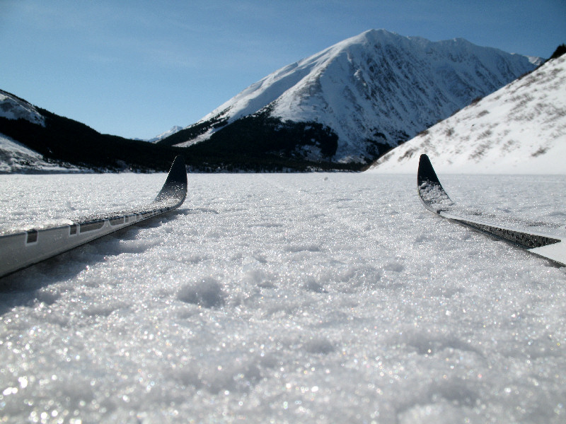
All iFrom Castle to
Cabin And Back
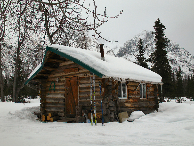
Permenente Trail -
March 2008:
I had never skied the Permenente Trail along the Kings River, though I
had mountain biked it as access for climbing trips before. 15
years ago I had talked to a hunter that was driving a 4-wheeler on this
trail. He mentioned a cabin and an airstrip further up the Kings
River drainage. So I figured I'd go and see if I could find the
cabin on skis. I also remembered a funny incident on this trail
about 12 years ago. Wiley Bland and I were mountain biking here,
again on a climbing trip, and we startled a hunter. We startled
this guy so bad he slipped, dropped his rifle and started sliding and
tumbling down the bank next to the road. The hunter was un-hurt
from the fall ... but very embarrassed!
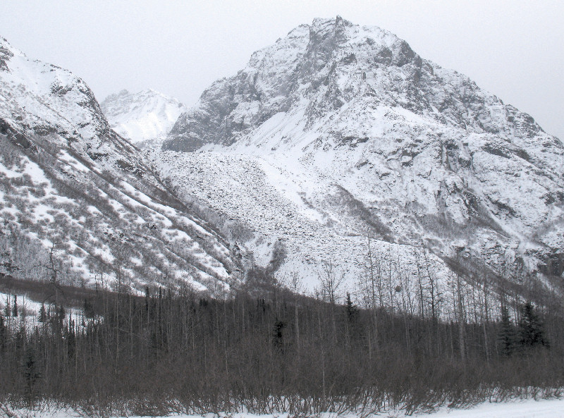
Ramparts of Castle Mountain
Kings River Cabin
Studded "Ice Bug" shoes came
in handy getting up and down the icy parts at the start of the trail
Skiing towards the
unmistakable Castle Mountain
During the warm spell a week
before a small landslide covered a section of the trail about 7 miles in
This rock glacier is very
distinctive. The ice is completely covered with rocks
Looking south from the
airstrip near the Kings River cabin
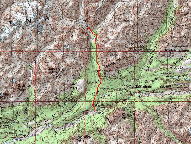
Map of route - 2 miles of
hiking / running, 22 miles of skiing
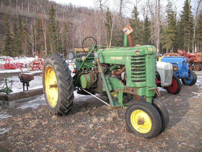
The Pinnacle Mountain Lodge
has quite the display of antique tractors. This is a John Deere A.
When I was a kid I spent a lot of quality time on a tractor like this.
Wait! This IS the
tractor I drove as a kid! See - it says it's "TIM'S" !!!!
All iAll is Well in
Caswell
Caswell Lakes -
March 2008:
I'd never been to Caswell Lakes east of the Sheep Creek Lodge. And
I've never skied the Amundsen Trail from this area up to the Talkeetna Mountains. It
took a while to figure out where the trail started and where to park, but I ended up on the trail I
wanted to ski. It was a long 12 1/2 mile gradual uphill to tree-line on the mountains
via a narrow and bumpy snowmobile trail.
I ran out of time at tree-line, so I skied back to make it a 25 mile cruise.
Talkeetna Mountains in the
distance
Icy granular snow at 40
degrees F
Fire in sky! Bad!
It burn skin! Wish I back in Anchorage, where always rain
and sun no shine! ... Not !
The trail was mostly wooded,
so there was a lot of shade. And lots of moss on the trees.
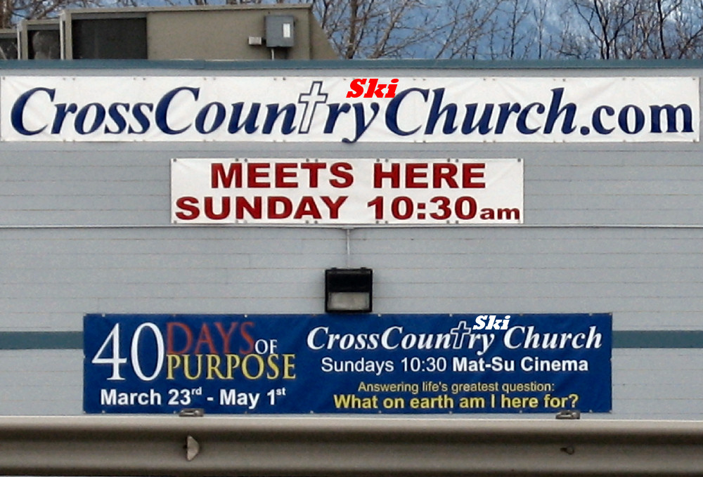
The Mat-Su Valley sure has a
lot of churches. I imagine this one is where they worship the
pagan gods of snow and winter - CrossCountrySkiChurch !!!
A Cool Side Trip to
a Micro-Alaska
Wishbone Hill, Sutton -
March 2008:
While ski-exploring trails in the Talkeetna Mountains north of Sutton I
reminded myself that I had never been to the lakes up on Wishbone Hill.
This hill is a strange geological spot in my opinion. A lumpy
wishbone shaped ridge in the middle of the Matanuska Valley - it has
cliffs on one side, old coal mines loaded with petrified wood on the
other, trails all over it and mountains towering around it. I took the
time to take a side trip and ski up to these lakes on a day no snowmobiles
or 4 wheelers were around. The lakes were a picturesque micro-spot
of Alaskan coolness. Quiet, scenic, nestled between ridges of wind
challenged trees, wolf tracks everywhere ... it's hard to believe you are only 3 miles
from a major highway when you are there.
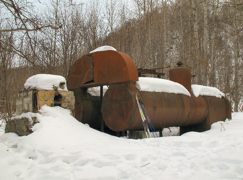
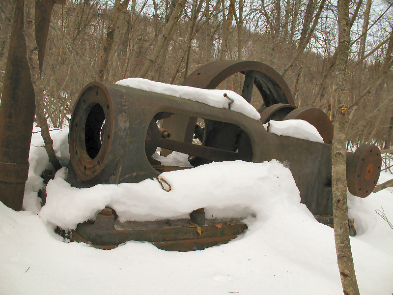
Buffalo (Coal) Mine boiler
and steam engine
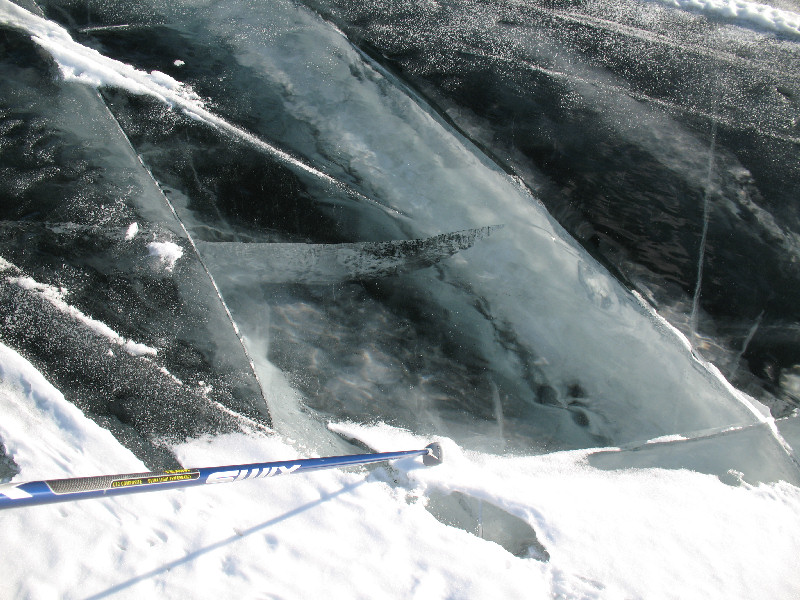
Wishbone Lake, black ice 4
feet thick
Upper Wishbone Lake
They call it "crust"
Wind sculpted sastrugi
getting "crustified"
LOTS of wolf tracks
Lots of wolf poop on the
lake, filled with moose hair
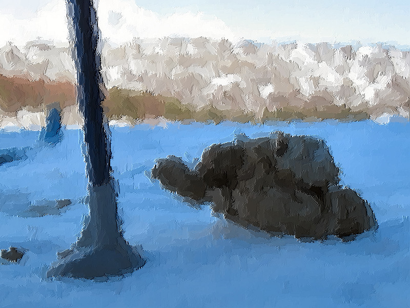
When I got home I did this
oil painting. I call it: "Pole and Poop". I'm selling it for
$10,000. Interested?
* ;-)
* OK ... so this "oil
painting" was made by one mouse click in Adobe Photoshop. So how
about $5000? $1000? $10? A Rockstar energy drink?!?!?
Ah, come on!! ;-)
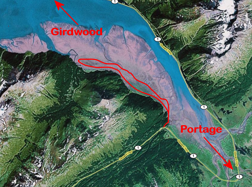
A Short Window of
Portage Crust
Portage Lake - February 2008:
In late February Portage Lake had some good crust skiing for a week or
so between storms.
A Lucky Dogsled
Purches
Purches Creek /
Dogsled Pass / Craigie Creek / Fishook-Willow Road Loop - February 2008:
The key ingredient to pulling off this 33 mile Talkeetna Mountain loop
on racing skis was ... luck. Maybe a day or two before I skied
this loop a group of four snowmobilers went up Purches Creek and made a
trail that I used to the max. Without this trail I would have been
wallowing in deep powder, and likely would have bailed out on this ski
loop attempt. So thanks to those unknown trail breakers!
This was a "combi
ski". I used combi boots and classic skis and did about a 50/50
split of striding and skating. As you can tell from the pictures
... what a day! The sweet spot of winter has arrived!
Summit of Dogsled Pass,
pointing towards Craigie Creek drainage that leads to the unplowed
Fishhook - Willow road.
A cable crossing a few miles
up Purches Creek
After a while the trail went
to the north side and paralleled Purches
Creek
Sure glad I didn't bring
skate skis. It's hard to skate in a 15 inch wide paddletrack
snowmobile
trench
Looking up Purches Creek.
Dogsled Pass is in back of the shadowed ridge, to the right (there was
some steep going to get to the pass)
Looking back down the
valley. Why the smile? Maybe
because it's a nice day and I'm skiing somewhere I'VE NEVER SKIED BEFORE
Looking back down the Purches
Creek drainage
The head of the valley was
in the shadows. Chilly.
A typical rugged Talkeetna
Mountains peak
From Dogsled Pass it's quick
to get to Gold Cord and Independence Mines (in the summer). Just
go over this pass, called Highgrade Pass.
This is an old penstock.
Water once came from a pond, through a flume, dumped into this tower and
turned a pelton wheel which powered a stamp mill that pulverized rock
with gold ore in it. This info courtesy of Fred Trimble!!!
Remains of an old mining
building, War Baby Ridge in the distance.
Tucking into the sunset on
the groomed (for snowmobiling) Fishhook - Willow Road. Fast going on granular corn
snow.
Following Russell
Dow's Ski Tracks to Palmer
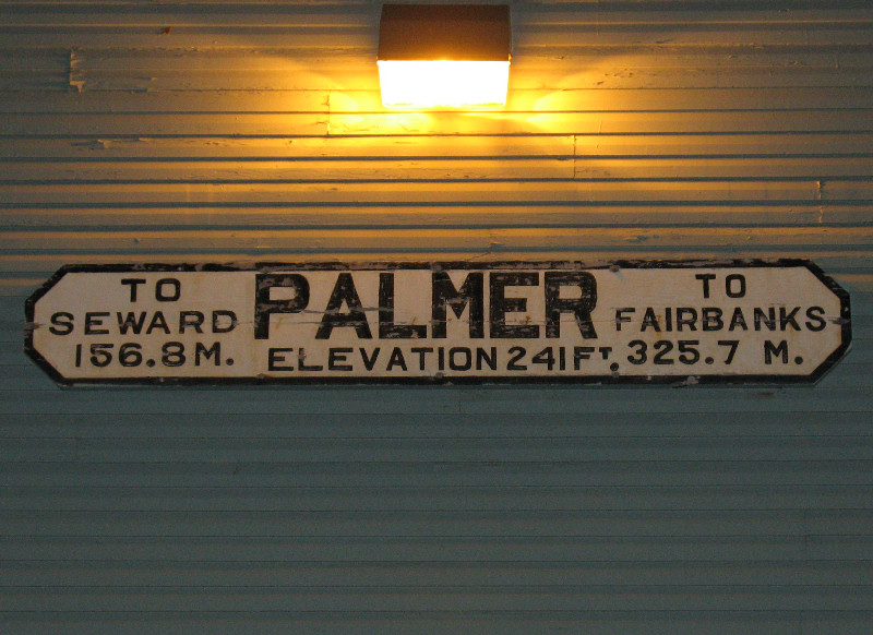
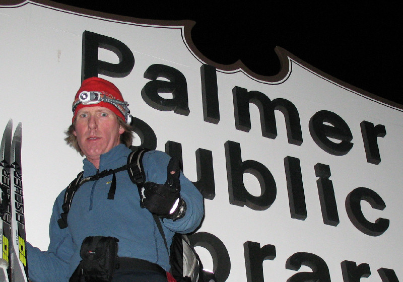
Independence Mine to
Palmer - February 2008:
From my work on the Alaska Lost Ski Areas Project web site (www.alsap.org),
I came across references of Independence Mine workers skiing from this
mine at Hatcher Pass to Palmer in the late 1930's. The likely ring
leader of these skiing miners was Russell Dow. Russell was a New
Englander that skied at Dartmouth College before coming to Alaska in the
late 30's to drive bulldozers for a living at the Independence Mine.
He also skied a lot, taught miners to ski and went on to teach WWII
troops at Fort Richardson how to ski.
Legend has it that
after a week's work at the mine, Russell would ski to Palmer to visit
his girlfriend who worked at the laundromat. Then he would
catch a truck ride back to the Fishhook Inn, and a cat ride to the mine.
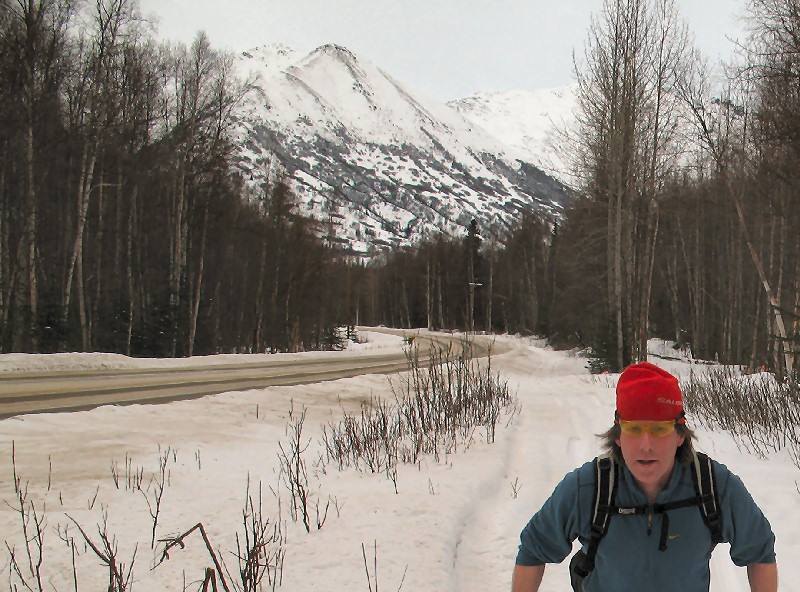
Russell likely skied the Fishhook Willow Road all the way to Palmer.
I wanted to re-create this ski, but do it by connecting trails instead
of skiing beside a road the whole way. It took some field
research, but I finally learned the lay of the trails and pulled this
ski trip off. Thanks for the inspiration Russell !!
Benzie Ola "Rusty" Dow and
Russell W. Dow (1940)
[Photo Credit: Russell W.
Dow collection, UAA Consortium Library Archives]
Russell likely never
imagined this: fresh corduroy xc skate tracks being set at the mine he
once lived and worked at.
"The Mile 16 Run is
unsuitable for sledding" ...
... looks like sledders
can't read.
A 1939 picture of an old cat at
the the former Fishhook Inn (one at the bottom of the Mile 16 Run).
Russell is in the center of the 3 men.
From the bottom of the Mile
16 Run I double poled on the side of the road to the Little Su River.
I figured this section would suck. I was right.
Out of the mountains and
heading to the Mat-Su Moose Range trails.
I skied past the Hatcher
Pass "House of
ROCK" !!
I'm a big fan now of the
trails on the Sutton side of the Moose Range. They are cut on the tops of
moraines ... very cool.
The Sutton side Moose Range
trails are likely old mining roads. Here green moss drapes the
banks of the trails.
Here is the descent
down into the canyon to get to the Moose Creek Campground.
Crossing the Glen Highway at
Moose Creek.
Near the confluence of Moose
Creek and the Matanuska River are old pilings from the abandoned Sutton
railroad.
The Matanuska River Trail
follows the old Sutton railroad bed. I had to break trail most of
the way, but it wasn't bad.
There are many places on the
Matanuska River Trail where active talus slopes from bluff erosion bury
the railroad bed.
The railroad bed of the
Matanuska River Trail on the right, the river on the left, Palmer in the
distance.
Signs of life one mile from
Palmer ... ski tracks! Could they be Russell's?!?!
Russell beat me skiing from
Hatcher Pass to Palmer ... by almost 70 years.
Here's to you Russell !
Finding a Golden
Heart at 30 Below Zero
Willow, Delta Islands
of the Big Susitna River - February 2008:
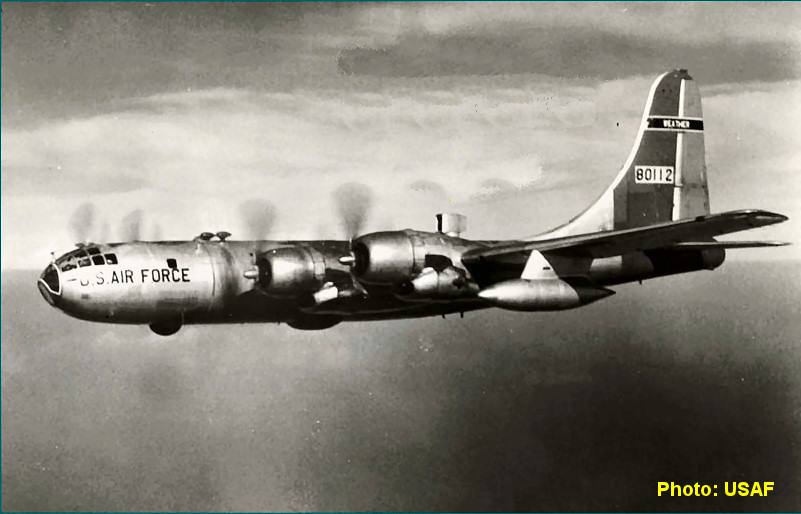
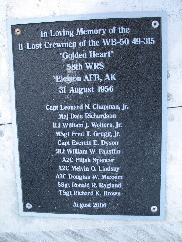
The "Golden Heart" was a cold War radiation monitoring aircraft, a WB-50D, that crashed in August 1956 in
the Delta Islands of the Big Susitna River, west of Willow. The
cause of this crash that killed all 11 crewmen on board was never
determined.
This summer the
Anchorage Daily News ran an
article about Doug Wolters, the son of one of the crew members, and
his quest to find this crash site on its 50th anniversary. While
reading this interesting article I figured that it would be a good
challenge to figure out a way to ski to this remote location.
Myron Wright helped Doug Wolters locate the remains of the WB-50 this
last summer. Myron also helped me find this obscure and unique
site of history and tragedy. Thank you very much Myron!
Minus 26 F in Willow,
colder down on the river
Wreckage in the Delta
Islands, looking west
1st Lt. William Wolters
Wreckage looking south
Placard and photo on tail
section in background
Bird Creek Below
Zero
Bird Creek - February 2008:
I've been to Bird Pass via skate skiing on spring crust (a long time
ago). But I had never skied there in cold winter conditions.
I still haven't. I got close, but I didn't make it. Still, I
had a good day out in sub-zero F temps. On the way back I pulled
the camera out and played with some winter-low-sun-back-lighted shots,
until my fingers got cold (see below). Thanks to the folks that
camped out at the trail crossing over Bird Creek for breaking a nice
trail !!
Canadian Rockies? Alberta?
Nope. It's "The Beak" (4730') on the ridge north of Bird Ridge
Overlook.
Snowmobile trails for the first half
of the trip. Single track ski touring trail the rest of the way.
More Palmer Moose
Range Trail Exploring
Palmer - January 2008:
I've been exploring trails north of Palmer as part of a grand scheme to
link a bunch of them together for a longer point to point ski trip.
This time around I found more dead-end trails ... but some very
interesting
dead ends. As this is a moose range - selected areas are clear cut
to allow better moose forage to grow. The logging trails made by
these operations often follow the tops of glacial moraines and make for
some cool skiing.
Trails on tops of moraines,
fun skiing.
Clear cut for moose forage.
Nice 0 degree F. classic skiing on
powdery sno-go trails.
I hope that if I am reincarnated -
that I
don't come back as a sign in Alaska.
Views from a Cross
Country Ski's Rear View Mirror
PLAY VIDEO
Retracing the
Eklutna Project Run Route ... on Skis
Eklutna - January 2008:
In the 1980's there used to be a neat running race called the Eklutna
Project Run. It started at the now abandoned restaurant in Eklutna
and finished at the Eklutna Power Plant. The cool thing about the
run was that it followed a little known power line access road that
clings to the edge of the Western Chugach Mountains. Since running
this route in the 80's I had wanted to ski this 8+ mile route.
With temps in the 40's, lots of climbing and a lot of breaking trail
through heavy, wet snow in order - I knew this ski was going to be a
tough slog. So what better time to invite my tough as nails wife
to go with me.
Note: Some of this
route is on Eklutna Inc. land. So contact them before going, at:
www.eklutnainc.com.
Glenn Highway bridge over the Knik
River is in the distance.
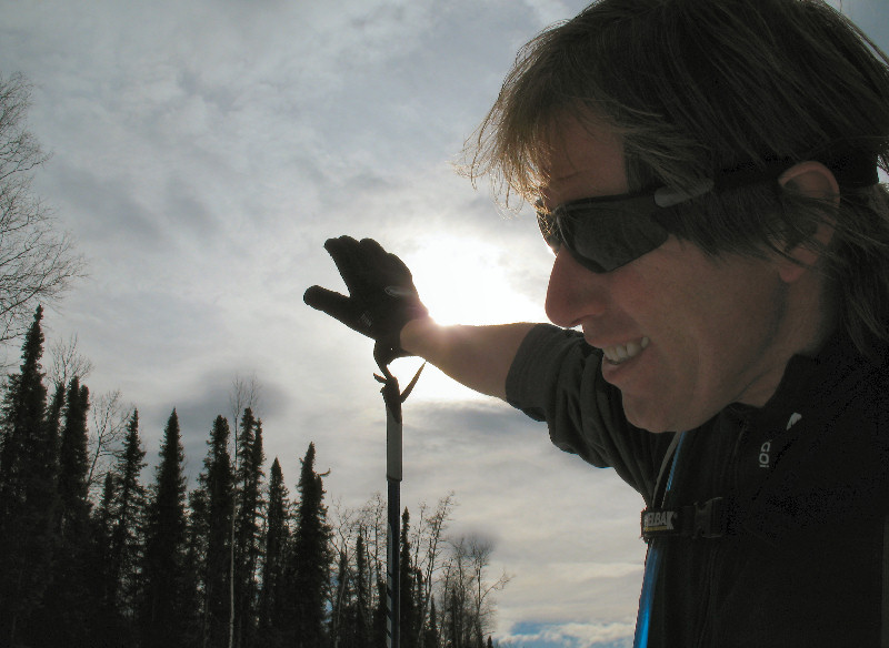
About half the ski
was on old snowmobile tracks, the other half was make-your-own-trail in
very sticky snow (see the picture of the snow covered pole on the right
for "proof-of-stickiness"). The route is about 1/2 under the power
line and the other half off in the woods on roads that skirt gullies and
steep sections.
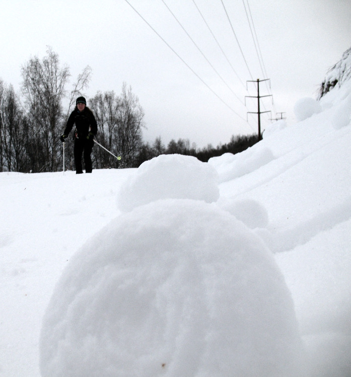
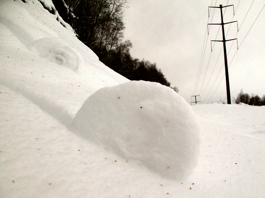
Near the end of the
ski we ran into an area with a lot of snow rollers. This is a
fairly rare weather snow phenomenon that can be caused by wind or
gravity. Here snow build-up on branches got heavy from warm
weather, the snow dropped from the branches onto a steep slope and the
glob of snow began rolling to make a snow roller. I added a new
item on my "done-that" list today ... I can now claim to have eaten a
snow roller!!
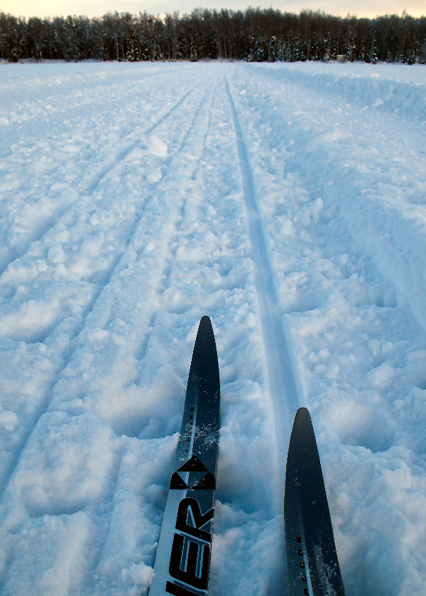
Classic Skiing on
Willow's Classy Trails
Willow - January 2008:
January is usually a good time to take your classic skis to Willow and
do some ski exploration of the WTC (Willow Trail Committee) trail
system. I'm always raving about these groomed multi-use trails,
it's my favorite groomed trail system in Southcentral Alaska.
These trails make me wish I lived in Willow in the winter. Here
are some shots from a 50 km ski on WTC Western Gateway trails I had
never been on before.
I always give a thumps up to the
Willow Trail Commitee.
Racing skis used to fit in dogsled
runner tracks. But no more. Dogsled runners have gotten
really skinny this century.
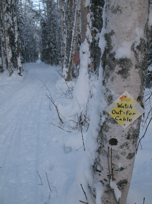
Robert Frost said: "Good fences make
good neighbors". I wonder if he envisioned fences made out of 3/8"
steel cable to catch snowmobile skis.
The whole Willow area was plastered with fresh snow. Nice.
This trail sign was
disturbing. Not only is the skier on the bottom of
the food chain ... but take a close look!! The damn snowmobiler peed on the skier!!!
A good
sign. Skiers are moving up the food chain.
OK!
Skiers are finally on the top of the Mat-Su Trails food chain!
Some WTC trails are as
straight as ... a ski pole.
Skiing
away ...
... off
into the sunset.
Subzero Day at
Elevation Zero
Turnagain Grass Flats - January 2008:
This is an area, between Ingram and Seattle Creeks, that my wife and I
have hiked to quite a few times in the past. But we had never
skied here before. It's a private nook of Turnagain Arm that is
often overlooked. However, good skiing conditions here can be
rare. When the frequent warm and powerful Turnagain Arm winds hit,
this place is often scoured of snow.
There is also the tide
factor. Though unique and
quiet this area has a horrific past.
It was here that the legendary death occurred of a woman who got stuck
in the mud while trying to free a four-wheeler. Rescuers couldn't
free her and the incoming tide submerged and drowned her. So check
the tides before going here. Only go when there are low high tides
and the tide is going out.
Backwoods Palmer
Trail Exploring
North of Palmer - January 2008:
Want to ski for many hours and (happily) have no clue where you are?! Then
the Matanuska Valley Moose Range area between the Hatcher Pass Road and
Wishbone Hill above Sutton is a place you should check out. This
mostly un-mapped maze of multi-use trails is popular with local residents.
But folks from Anchorage should bring a GPS so you can "bread crumb"
your way back to your car. If you are lucky you can link up trails
to get from Hatcher Pass Road to Buffalo Mine Road and back.
Decent snow coverage in the woods.
But in the open ... very slim on snow.
Very multi-use trails - tracks of: 4
wheelers, snowmobiles, dog teams, mountain bikes, moose and ... skis.
You first.
Skied for hours on cool trails, with
no clue of where I was going. Quite the maze of trails here!
When skiing ... it's worth looking UP
now and then.
Warning: As the sun sets, freaky looking skiers come out to haunt these trails!
Backwoods Wasilla
Trail Exploring
East of Houston, North of Wasilla -
January 2008:
Trails that I haven't skied before in the Su Valley ... that's the
perfect draw to get me up into the Valley to ski them. These trails were east of the Herning Trail, that heads north of Houston. Then trails led to
Bench Lake and on to the Schrock-Pittman area.
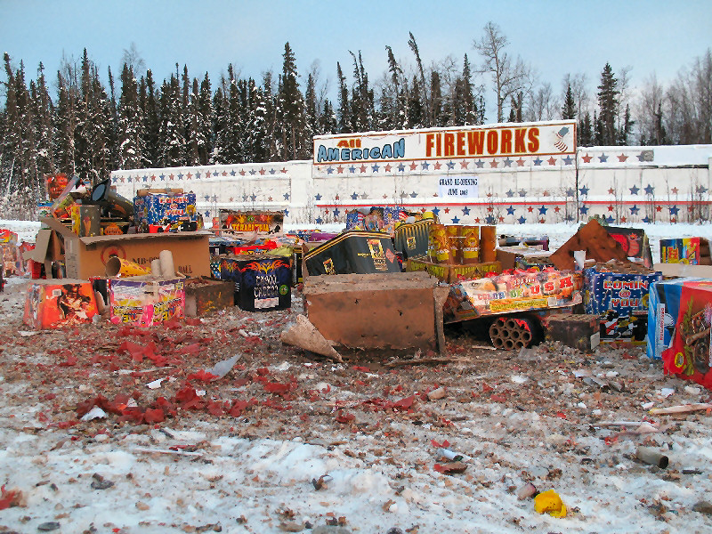
New Year's Eve in Houston: "Hey boss,
what we gonna do with all the fireworks we didn't sell !!??"
Heading up the Herning Trail before
turning off to Bench Lake. I sure like the trails in this area.
I give no trespassing signs in
backwoods Wasilla a LOT of respect!
Sick kitty in the woods. Sick kitty no purr.
Wasillita!
Wasillita! Where are you !!!
Wasilla - January 2008:
For years when passing through Wasilla for ski trips I would stop and
hang out with my girl in the Valley ... Wasillita. But holy
crap!!! I fear something really, really bad has happened to
Wasillita! It looks like she was abducted! Only a boot
remains from the struggle with her kidnappers. Wasillita ... where ever you are I
hope you are okay! I miss you girl !!! (sob, sob)
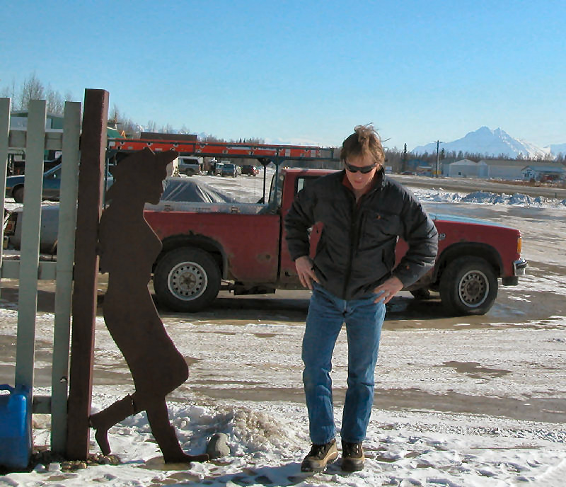
Me hanging with Wasillita in
2006
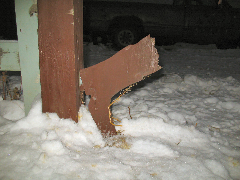
2008: Now only her boot remains
Bell Island Cabin
Sleuthing
Skiing was good considering how
little snow there was.
And skiing was bad considering how
little snow there was.
Here I'm skiing on an old snowmobile track
... seriously.
While skiing by a beaver house a
beaver offered to take my picture (see above). The beaver also
offered me a glass of water, but I passed. I fell for that trick
last time!!
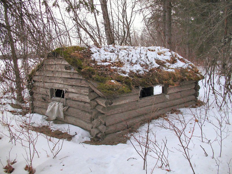
Bell Island,
Lower Susitna River Drainage - December 2007:
I got word of an old beaver trapper's cabin made in the early 50's on
Bell Island in the Big Susitna River. I was a little miffed
that I did not know about this cabin, as this part of the Su Valley is
my haunting ground. So I decided to go on a ski and find the
cabin. This cabin was flooded and half filled with silt during the
1964 earthquake. In 1973 Carl Thomas found this cabin while moose
hunting. He shoveled the silt out, put in new floorboards, window,
stove and door, built bunks and used it for a hunting cabin until 1977.
Here is the old trappers cabin on
Bell Island. It's a simple shelter with a sod roof.
Beaver trappers are gone, but the
beavers still remain.
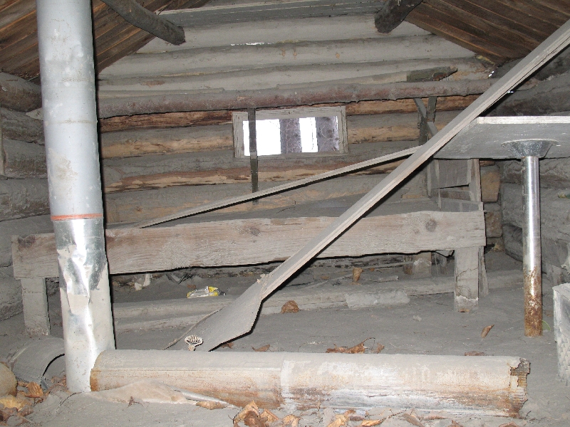
Silt inside the cabin indicates this
structure has been flooded by the Susitna River a bunch of times.
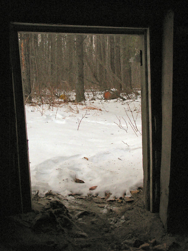
Looking out at the present from the past.
The cabin entrance.
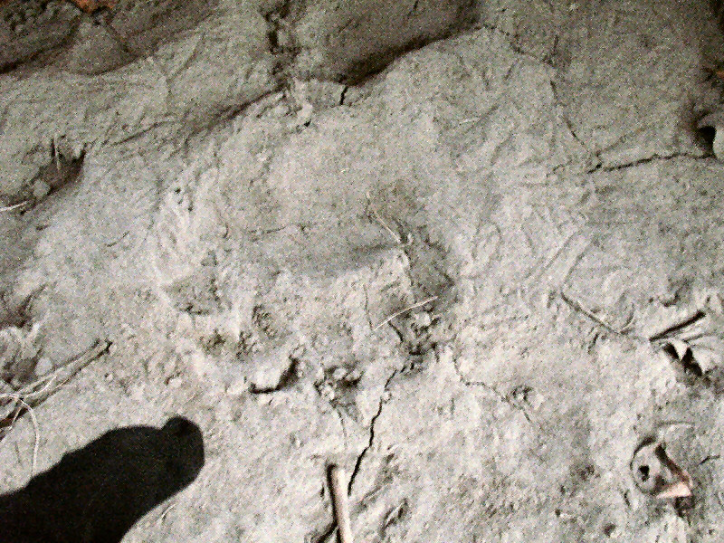
Frozen bear tracks on the silt
covered floor show that this cabin is still in use occasionally.
The cabin has a moss and sod roof.
And the log joints were all hand hewn with an axe.
Resourcefulness. When the can
of beans was emptied - the can would be used to patch a drafty hole in
the cabin.
The outhose. Looks
like a brown bear may have once been searching for goodies.
Niggerheads. Yep - it's a bad
word, but that's what older locals call tussocks. When these tussocks
cause snowmobiles to tip over, locals use this 'n' word strung together
with lots of swear words. And that's kinda entertaining to hear!
Figure Eight Lake,
Skiing in the Lower Su Valley ... Finally!
MacKenzie Farms to
Figure Eight Lake and back - December 2007:
Finally ... ski-able snow in the Lower Susitna Drainage. Too many
folks travel to Flathorn Lake. So I like to head south to Figure
Eight Lake instead. Quiet day. Only met two snowmobiles the whole
trip.
Enstar gasline right-of-way trail
Old seismic line trail to Figure Eight Lake. Straight and flat for
miles.
Skis and poles, on Figure Eight Lake,
point to Mt. Susitna
Nancy Lakes Snow
Searching
Nancy Lakes, Willow -
December 2007:
I knew there wasn't much snow in the Susitna Valley. But I
couldn't stay away. It was below zero F. and there wasn't much
snow ... but it was good to be back in the Su Valley. Because of
low snow - snowmobiles were not yet allowed into the Nancy Lake State
Park. So entire lakes were trackless ... except for those my skis
would make. Pretty cool.
"Trail" to Red Shirt Lake
December 1st Crust
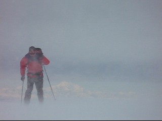
Western Chugach Mountains,
Ship Pass - December 2007:
There was decent early season crust snow skiing here, courtesy of wind
driven wet snow from a storm a couple of weeks prior. After skiing
in this valley for most of the last 6 weeks, I actually wished I was
skiing some place else. But so far no snow in the lowlands, like
in the Lower Susitna Valley.
White in Ship Pass. Brown in
Anchorage (off in the distance).
Wind driven rocks trapped by sastrugi.
Blast
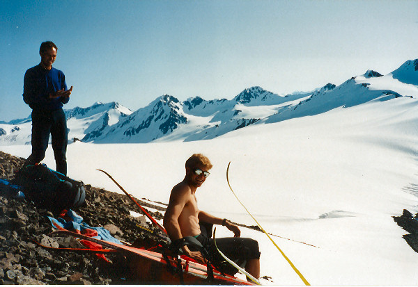
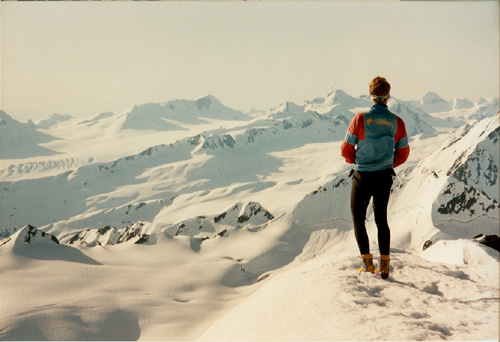
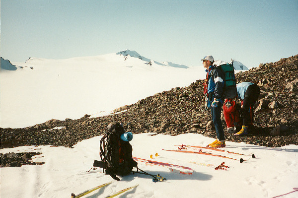
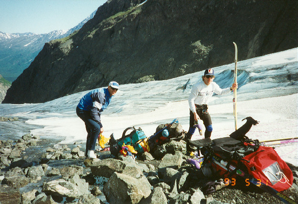
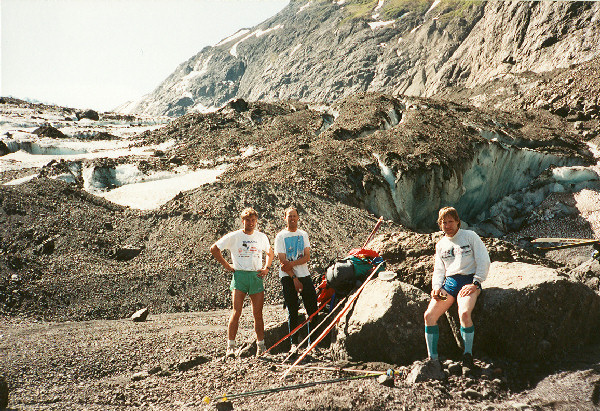
from the Past: Skate Skiing the Eklutna Traverse in 1993
Snacking up at
the 7-11. No loose dogs in Girdwood in 1993!
Changing to skis
after hike up to Eagle Glacier.
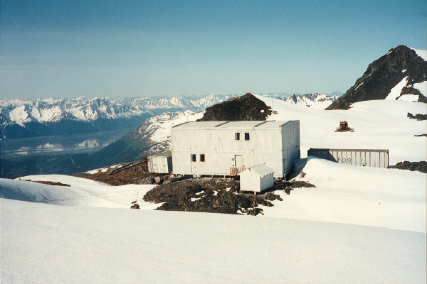
Eagle Glacier
Training Center.
Heading up the
Whiteout Glacier, Eagle Glacier in distance.
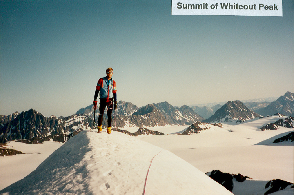
Nearing the
summit of Whiteout Peak.
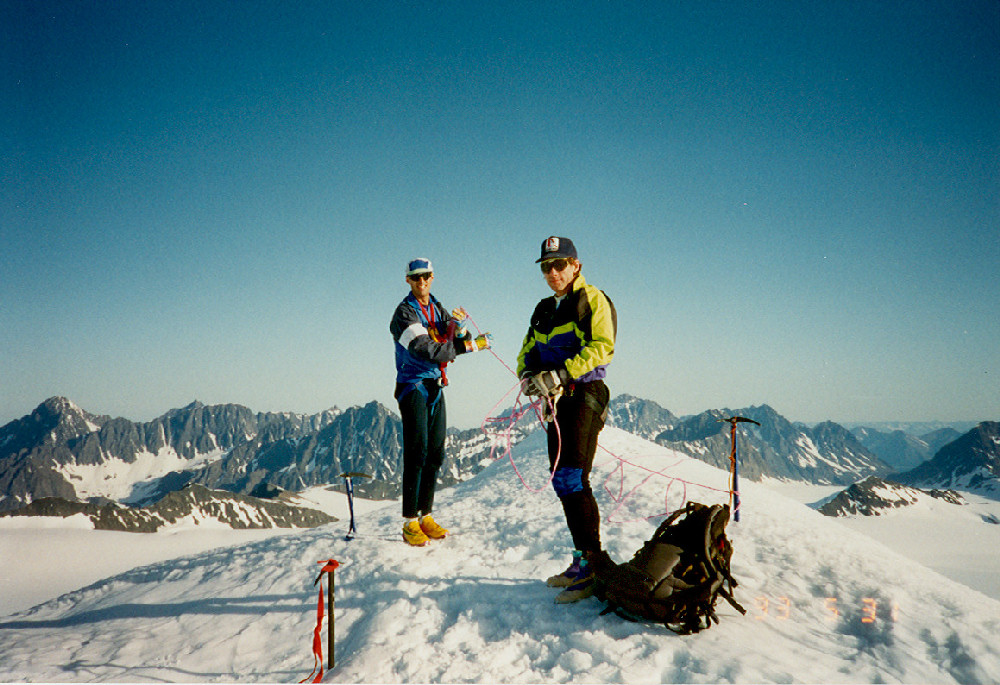
Whiteout Peak summit shots (Tim Miller left, Bill Spencer & Tim
Kelley center, Tim Miller right)
Tucking on ski
run down from Whiteout Peak.
Whiteout Pass
Eklutna Glacier,
switching from skis to running shoes.
Terminus of the
Eklutna Glacier, getting ready to hike out.
Another
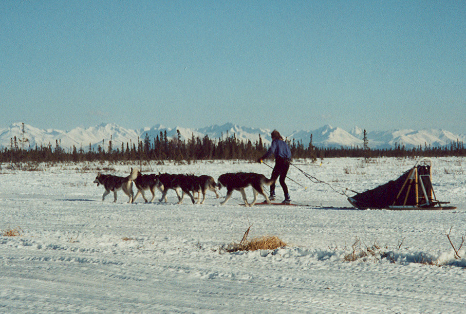
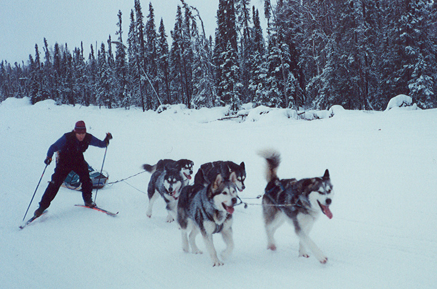
Blast from the Past: Crust Mushing
Crust snow allows easy
exploration of Alaska by many means, including dog sledding.
The fringe sport of ski-mushing, where a skier hooks into
harness and becomes "one of the team" with his dog pals,
also works
well on crust snow.
Dog
teams love crust snow mushing because they can head off in any
direction they want.
Ski
mushing - where a skier harnesses into a dogsled and becomes one
with the dog team. Here you see a team of five Malamutes
and one Skiamute.
Humans are basically too stupid to be good sled dogs. But
some humans love being part of a dog team. So sled dogs
are kind enough to coach
these lowly human types along and tolerate them.
Mushing, ski mushing or skiing on
spring crust snow is nothing new in Alaska - as can be seen by
the above picture taken April 2nd, 1909 at Johnson Pass.
Actually Russians were likely crust skiing on the Kenai
Peninsula over 100 years before this picture was taken.
The picture above is from
ViLDA ...
one of Alaska's
coolest web sites.
2007/2008 Random Camera
Clicks
There's usually a story behind
strange tracks you see in the snow
Urban skate skiers often demand
impeccably groomed "corduroy" to skate on. But why go to all the
trouble making it? Heck, you can find it growing right next your
house!!
Tips that could help make
you a better
Alaskan crust skier ...
Train hard
Hang with tough Alaskans
Stretch
Eat right
Sleep like a dog
Protect your balls (if you got 'em)
Worship outer-fringe Alaskans
Worship outer-fringe Alaskans
Worship bad-ass Alaskan girls
Prepare to take care of yourself
Prepare for bad weather
Cultivate a crust skier's attitude
Search for new places to ski
Ski your butt off
Ski your butt off
... And ski your butt off.
Goodbye Mat Maid
The last
couple of years I have joked around about Rockstar being the drink of
choice for early morning crust skiers. But this year there is no
joking. A new beverage pushes Rockstar aside. I'm suggesting a 2008 crust skier beverage "in memoriam". Recently Alaska lost a
homegrown nectar that was likely the most flavorful substance on earth -
Matanuska Maid Egg Nog. After 70 years, Alaska's only dairy,
Matanuska Maid, went out of business. So that means no more Mat
Maid Egg Nog for future holiday seasons. Damn! No Mat Maid
egg nog in December is like no crust snow in April !! At a
personal wake for Mat Maid Egg Nog I chugged the quart container to the
right. 360 calories per cup ... so that was a 1440 calorie chug.
Beeelch. Mat Maid ... we'll sure miss you !!!