|
|
|
|
Home |
|
Intro |
Gear |
About |
Trips: |
2026 |
25 |
24 |
23 |
22 |
21 |
20 |
19 |
18 |
17 |
16 |
15 |
14 |
13 |
12 |
11 |
10 |
09 |
08 |
07 |
06 |
05 |
04 |
UBXC |
Apps |
eBook |
|
2022/2023
by: Tim Kelley
|
|
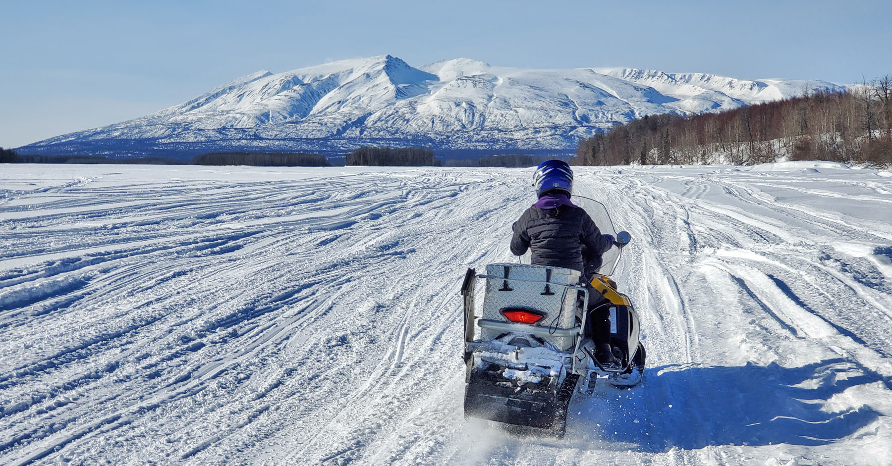
| Mid April 2023:
Crust Skiing Road Trip |
|
There were a
few places I had skied before on the Kenai Penninsula that I
figured would be good crust skiing. But I had never crust
skied at these places before. So that was a good reason
for a road trip to Cooper Landing, Ninilchik and Homer. I
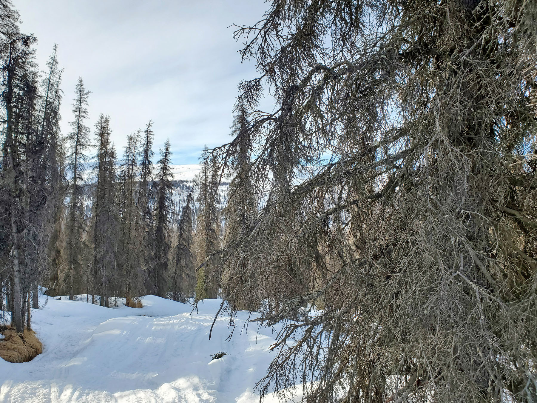
found good crust skiing at the Mystery Creek Road, the Caribou
Hills and off of Homer's East End Road.
Update:
Road trip continued to Willow (see below). |
|
|
|
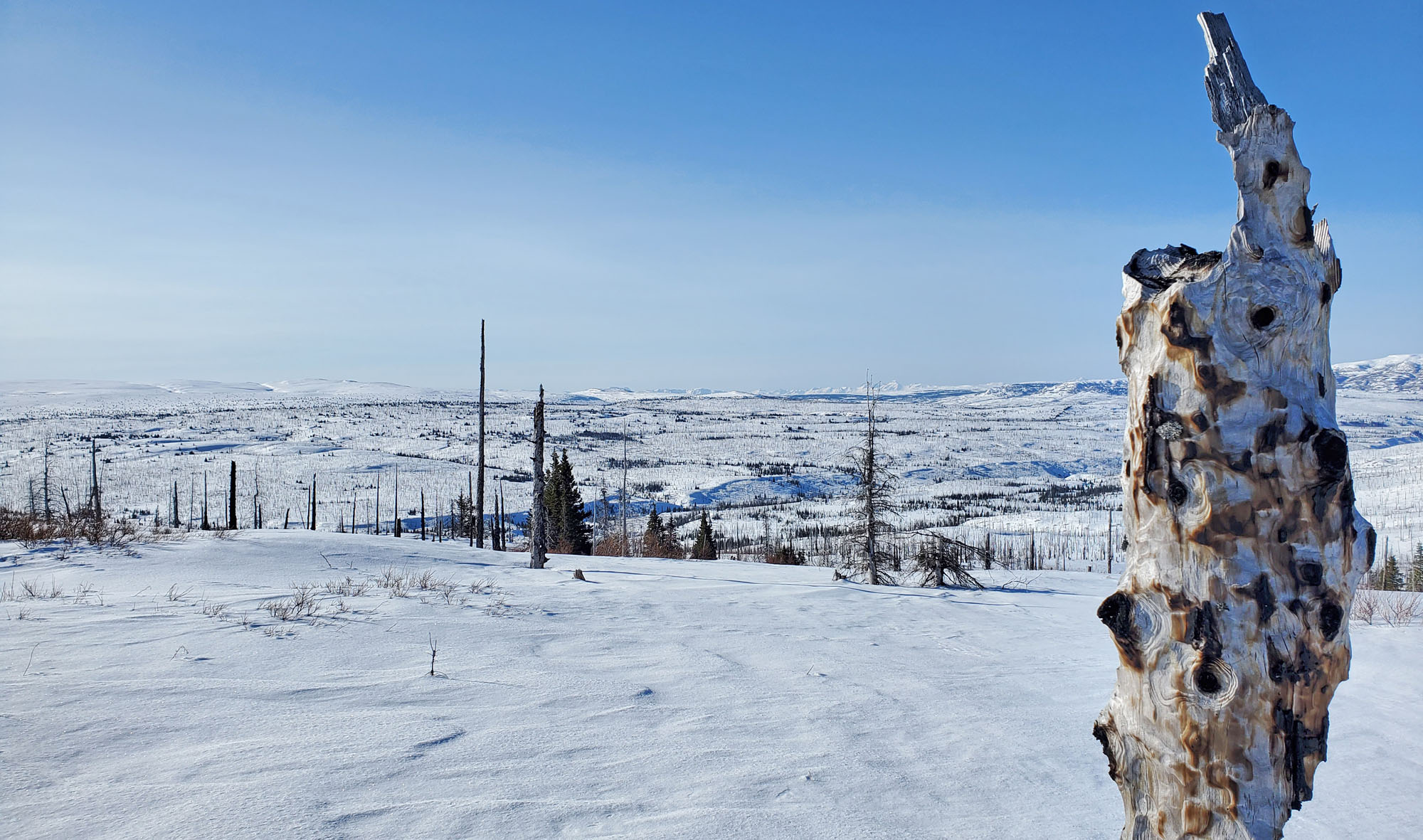
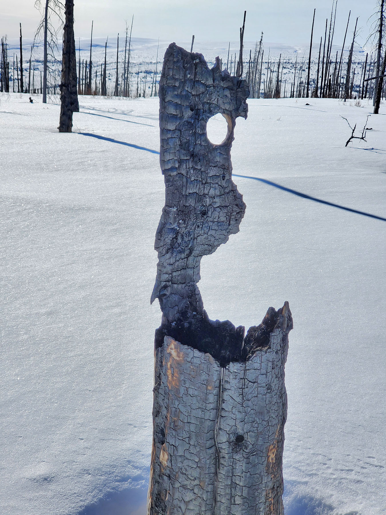
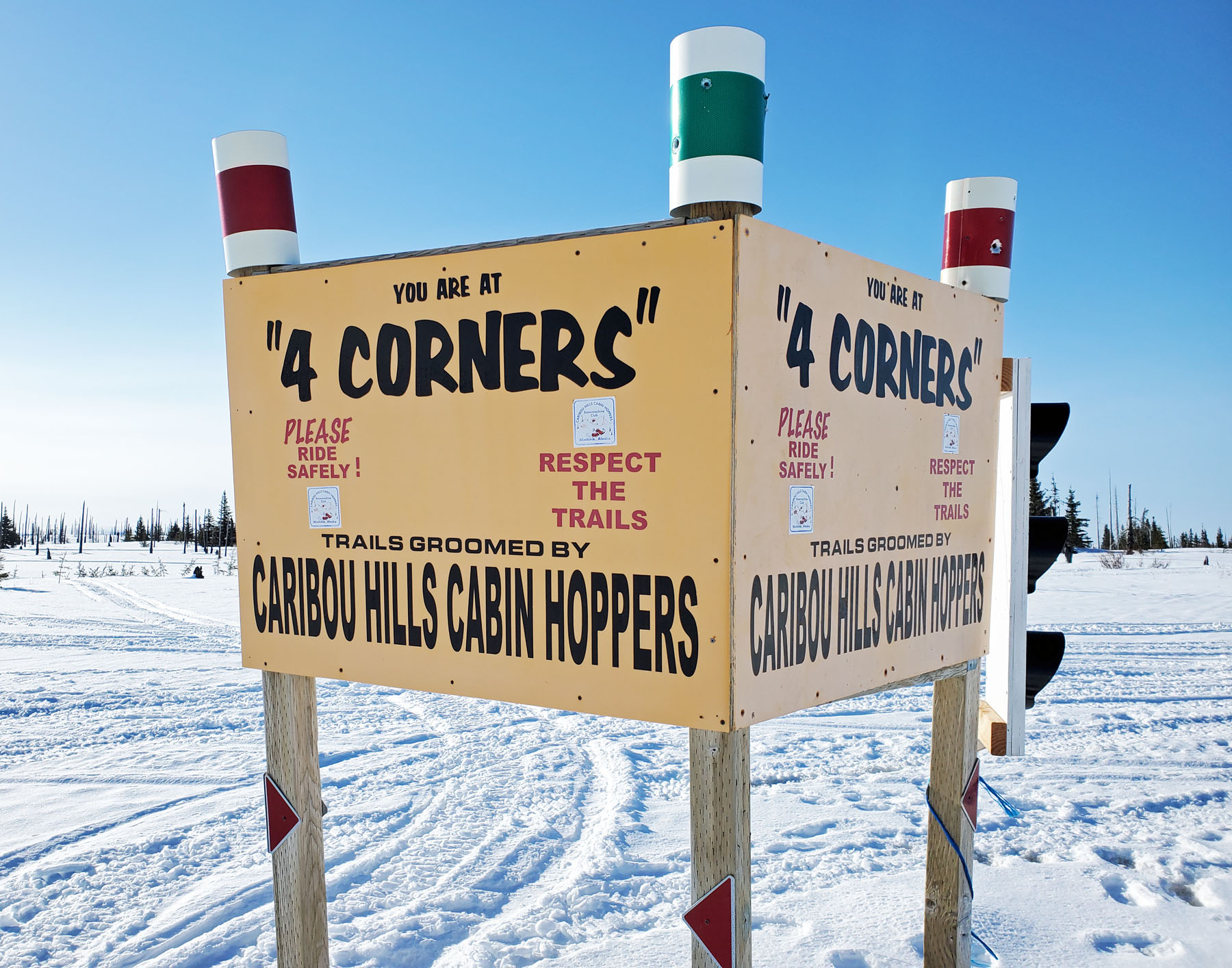
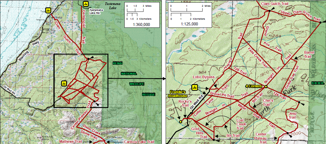
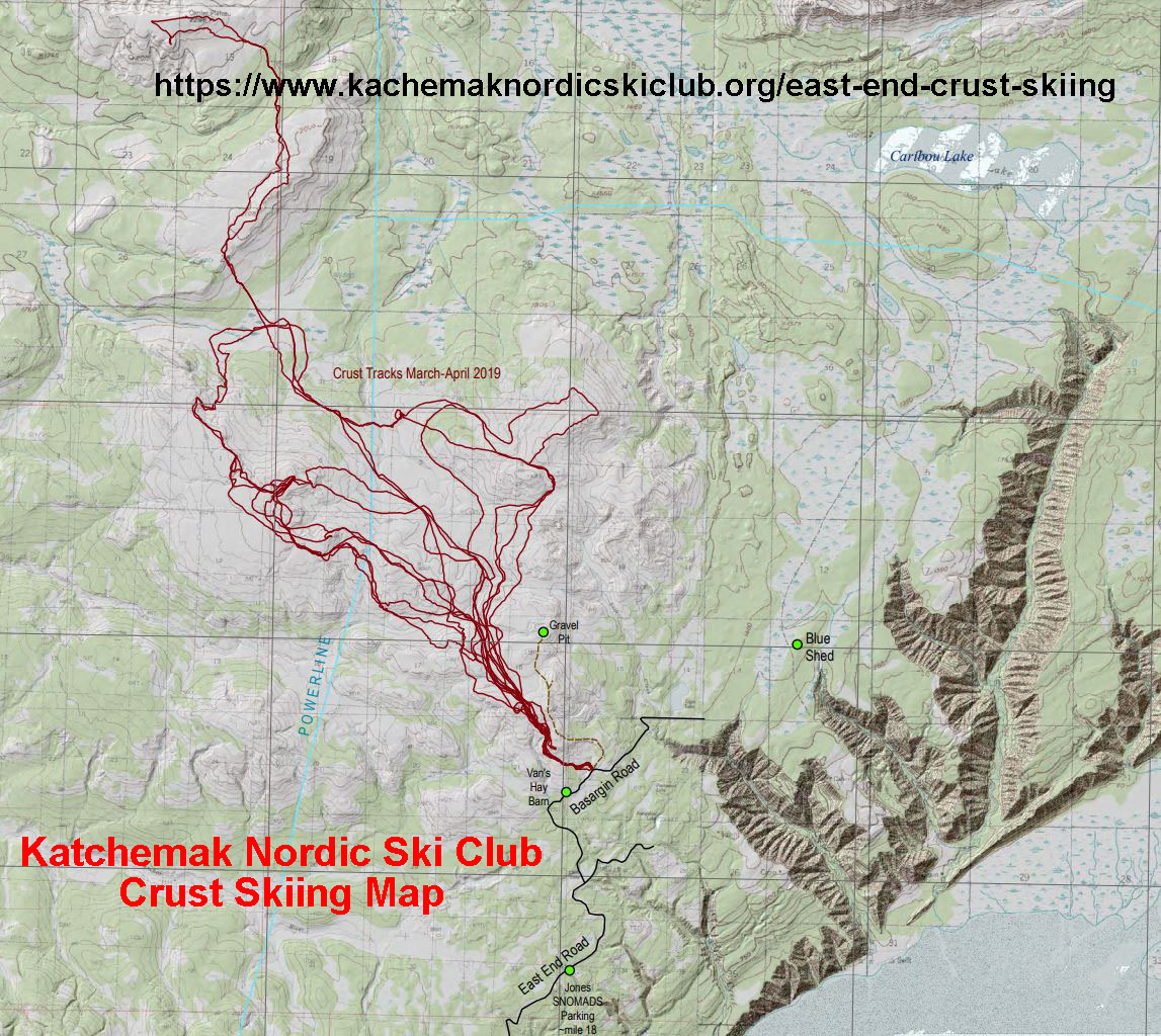
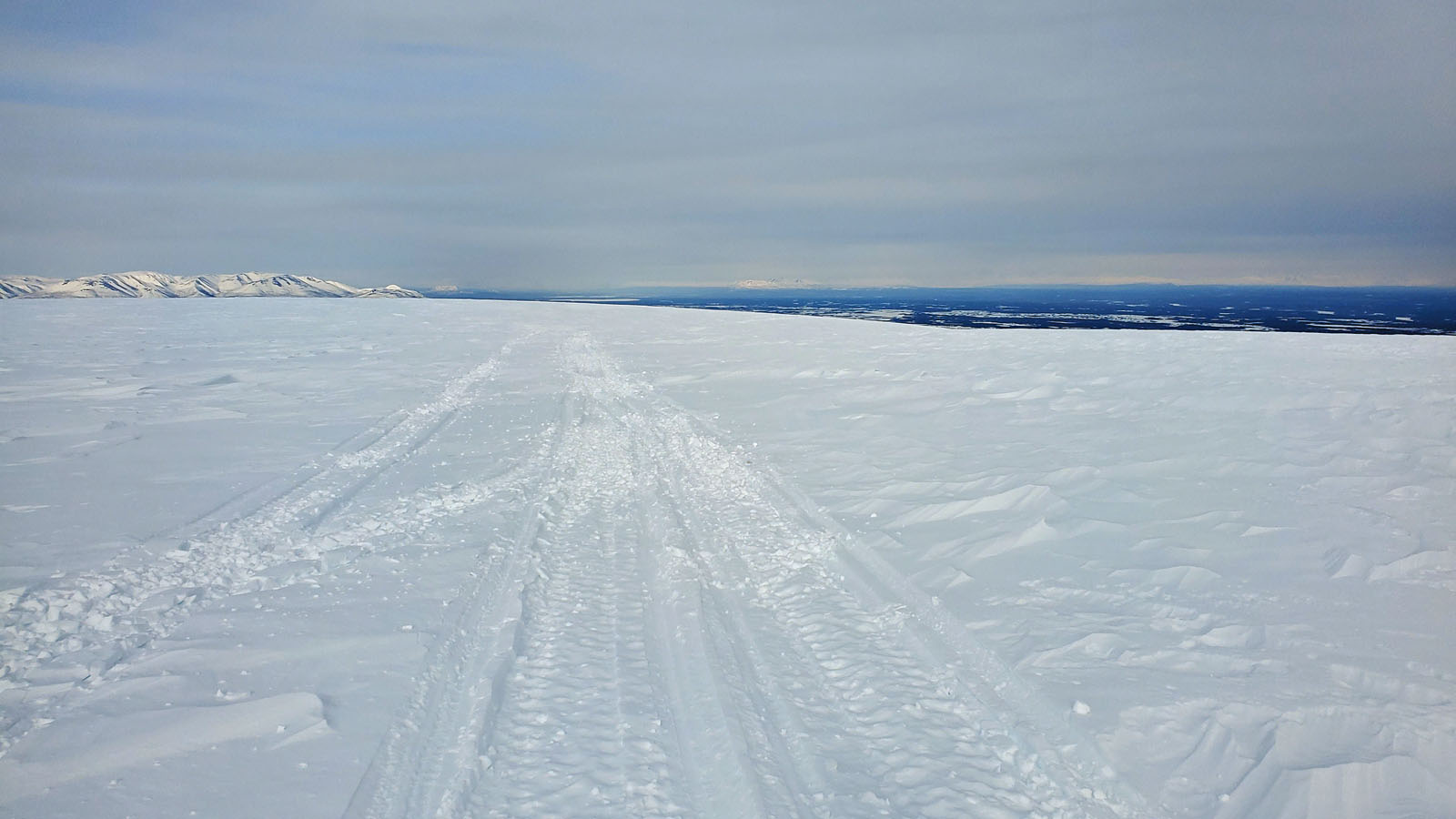
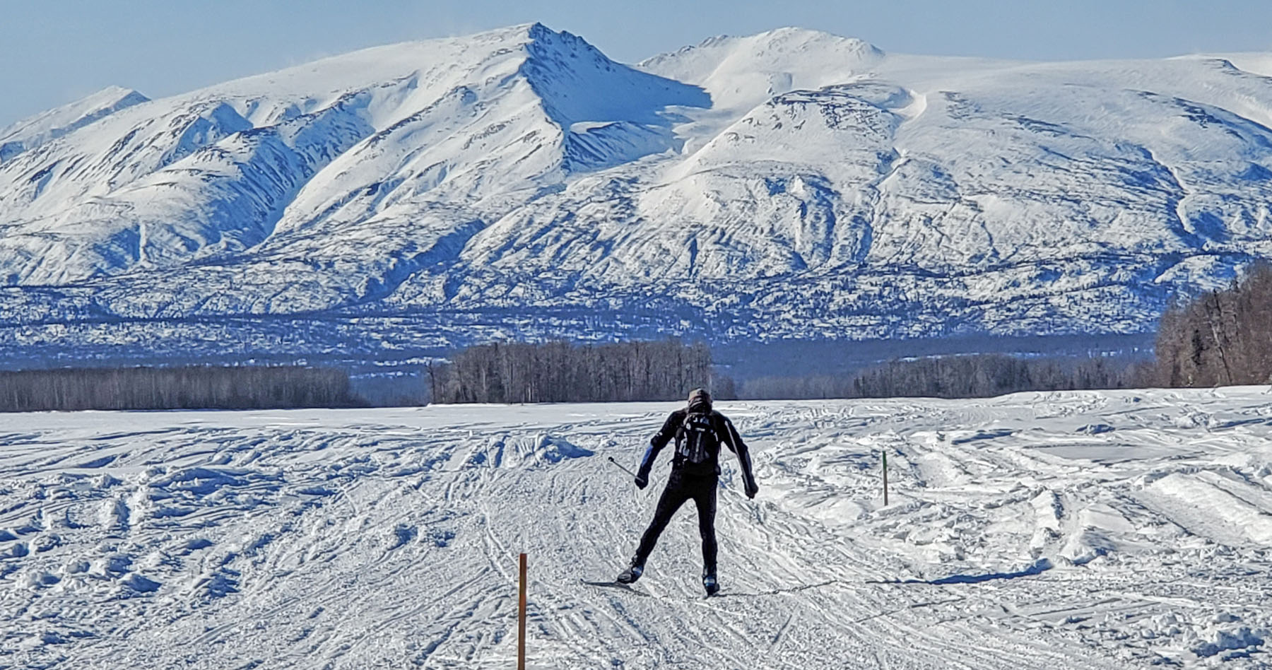
Caribou
Hills, Ninilchik: I
had skied the Tustumena 200 course before in this area (2004 and
2011).
But I had never crust skied in this part of the Caribou Hills.
I started from the large Caribou Hills Cabin Hoppers (snowmobile
club) parking lot that is 18 miles or so in on the Oil Well Road
from Ninilchik. I used the Gravel Pit Trail as a reference
and crust skied up to the '4 Corners' marker. There the
crust skiing terrain gets great. Expansive rolling ridges
to the north, east and south that are sparely treed due to the
2007 Caribou Hills Fire that consumed 87 square miles, and
burned 88 cabins, in this area. Lots of groomed snowmobile
trails here that you can use for references. |
|
|
|
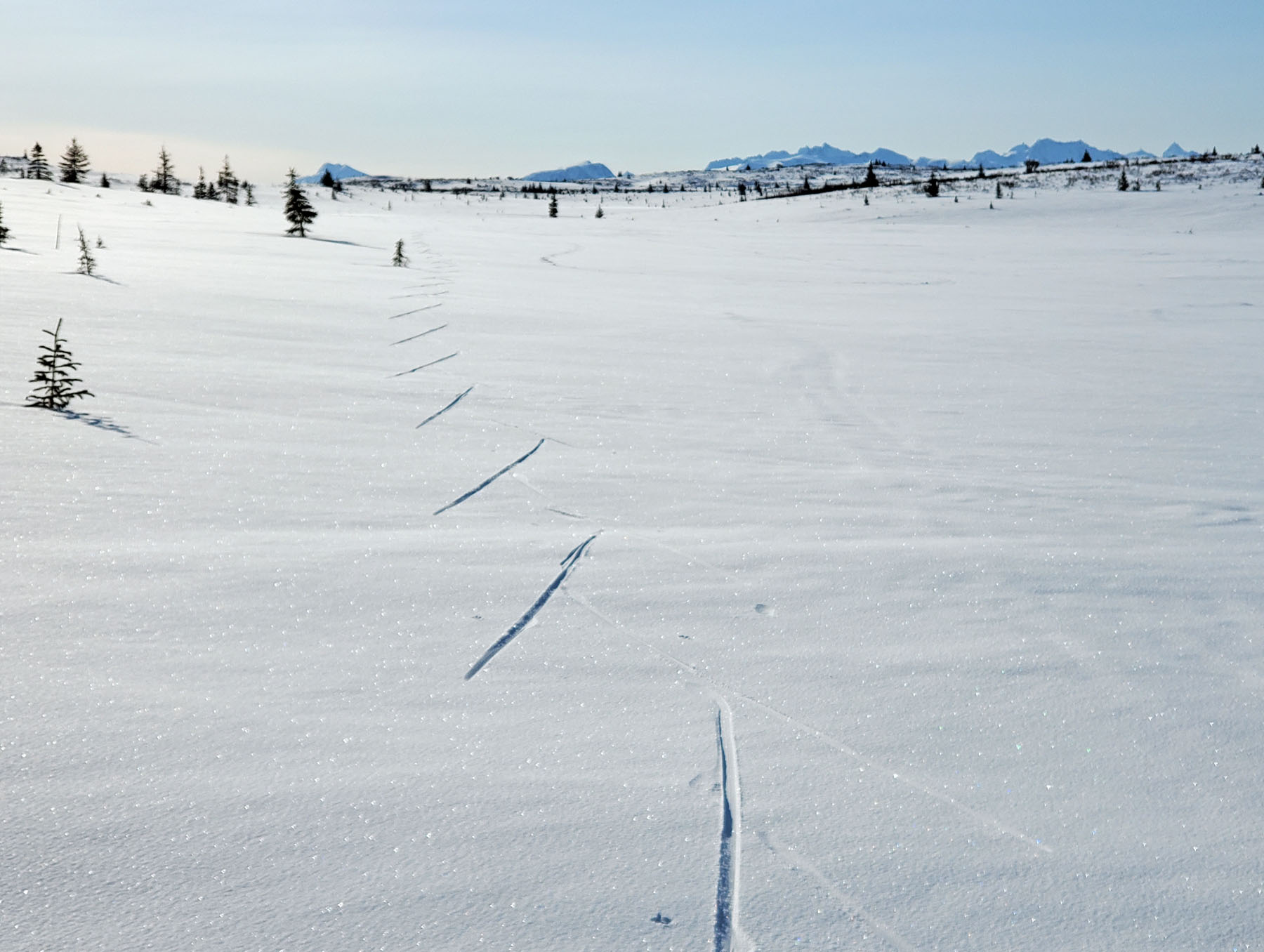
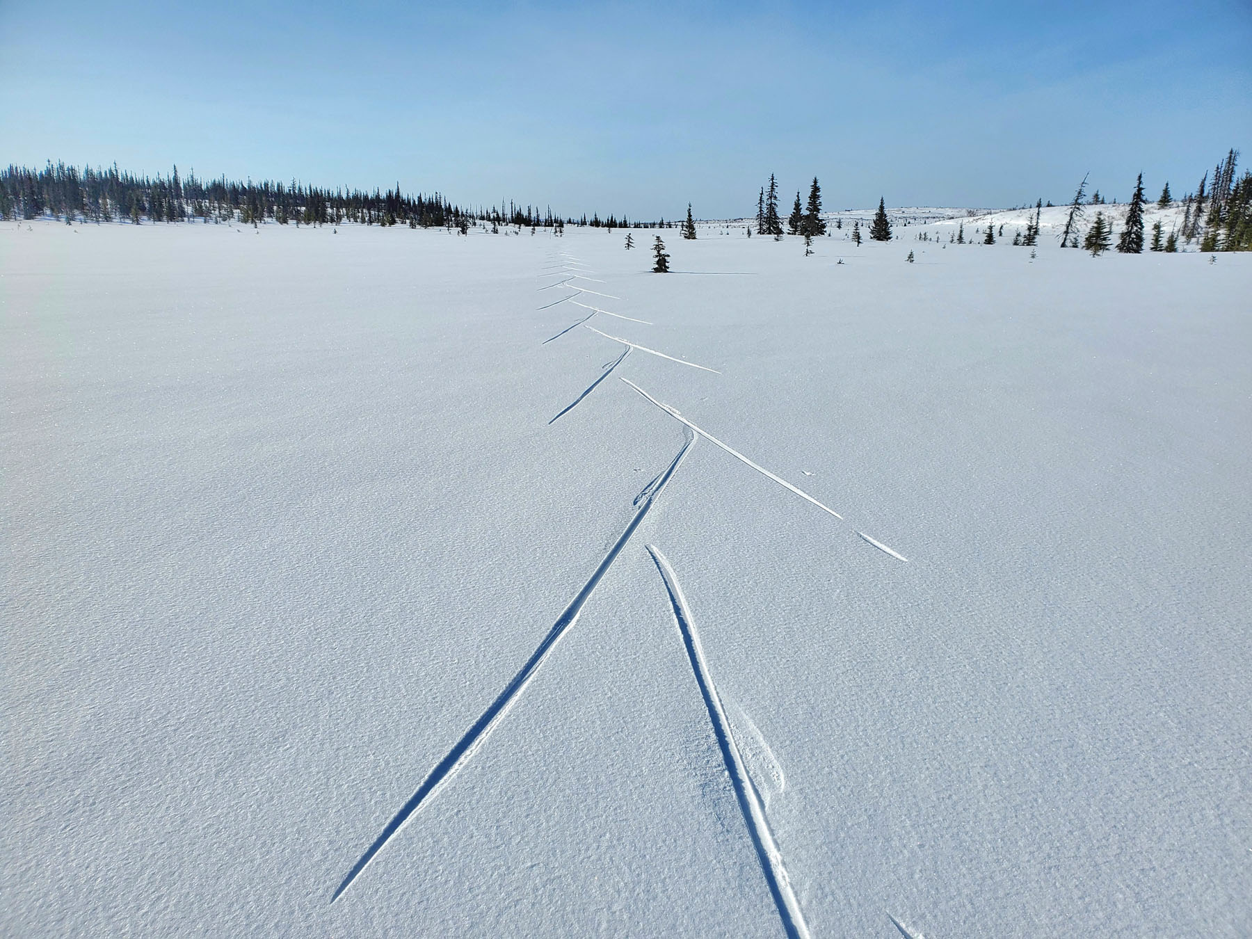
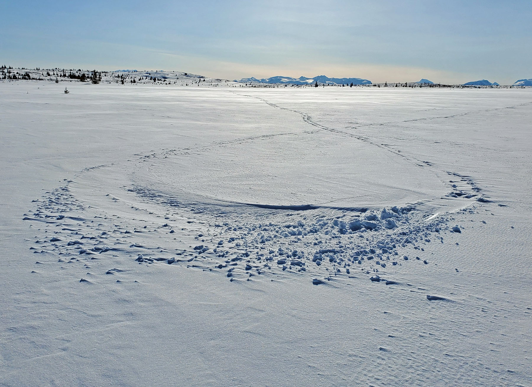
Basargin
Road, Homer: Homer is
known for great crust skiing. Due to the proximity to the
ocean, the snow here usually has a high moisture content.
And that is conducive to great crust skiing conditions when the
freeze/thaw cycles arrive in the spring. The rolling
ridges and swamps between the East End Road and Caribou Lake
make for an impressive crust skiing venue. And the
jaw-dropping views from here of the mountains and glaciers on
the other side of Kachemak Bay make crust skiing here like nowhere else. |
|
|
|
Mystery Creek
Road, Cooper Landing:
At milepost 63 of the Sterling Highway, this road lies within
the Kenai National Wildlife Refuge. It is open by permit
for driving in the late summer/early fall. Otherwise it is
lightly to moderately traveled by snowmobiles, ATVs and by
human-power modes (no permit needed to ski). This was an
out and back ski. You can go as far or not as far as you
want. In the past, during non-crust winter conditions, I
have gone to the end of Mystery Creek Road to access Burnt
Island, the Big Indian KNWR rental cabin and the Chickaloon
Flats. This time I skied to the intersection with the gas
line and back. Good crust skiing conditions. And you
can now see more of the surrounding country due to the massive
Swan Lake Fire of 2019. |

 |
|
|
|
And also ...
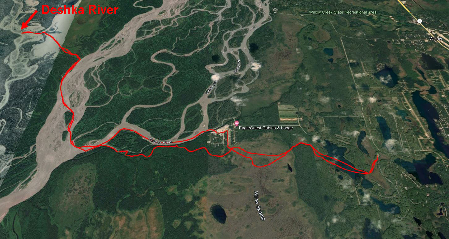
Willow: I have skied
in Willow many times. But I can't ever remember crust
skiing in Willow before. So that was a good reason to
continue the road trip and head to Willow to crust ski to the
Deshka River and back. I had been in Willow (at Deshka
Landing) a week ago for what was my latest ever trip to or from
our cabin (4/14). At that time 12 to 16 inches of new snow
had just fallen. And it had been colder than normal.
So I knew this year would allow late snow travel on the Susitna
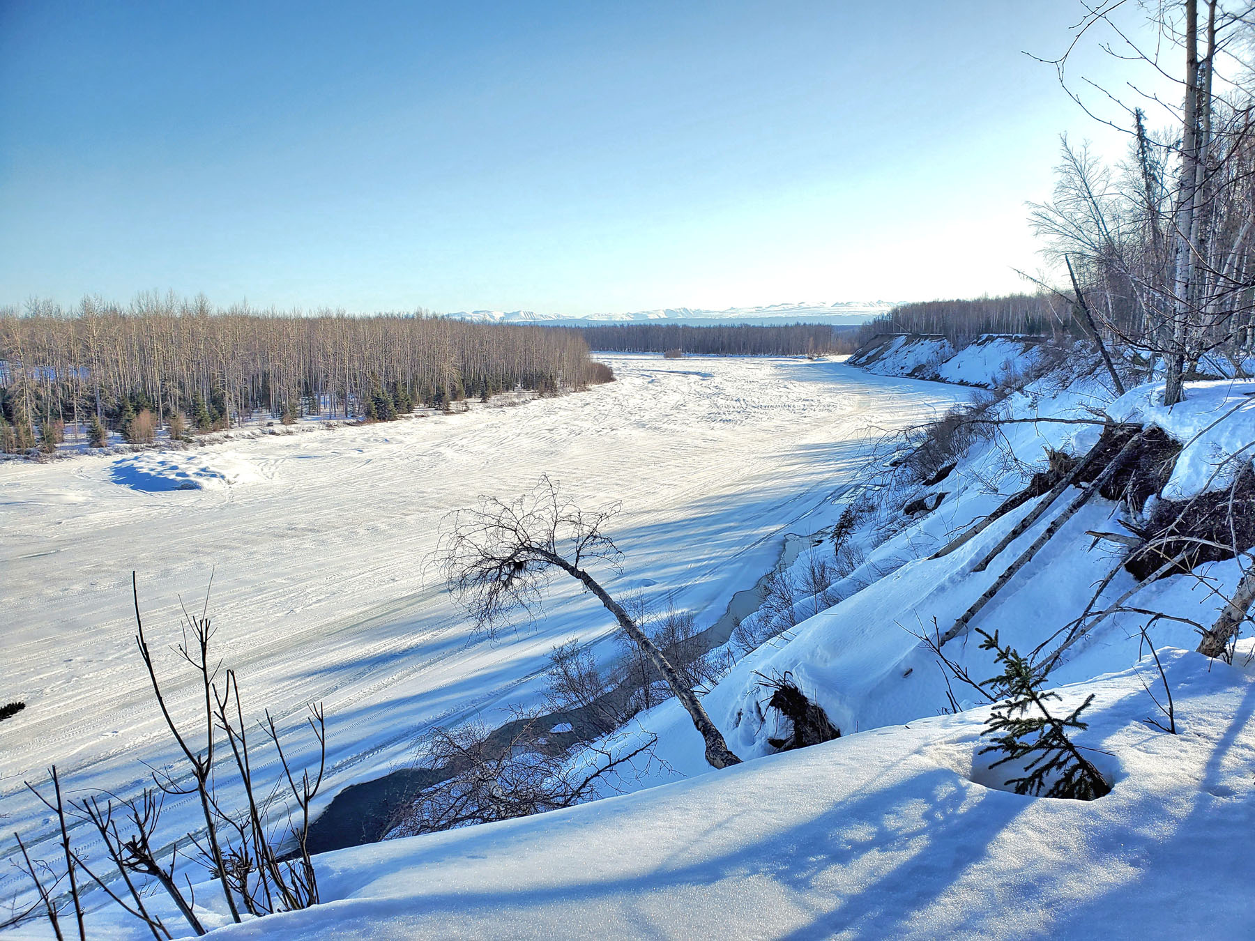
River. Beautiful day crust skiing the Big Susitna River.
Silent. Didn't see another person. This was my
latest-ever river ski in the Lower Susitna drainage (4/21/23). |
 |
 |
 |
 |
|
Looking
upriver towards Deshka Landing. |
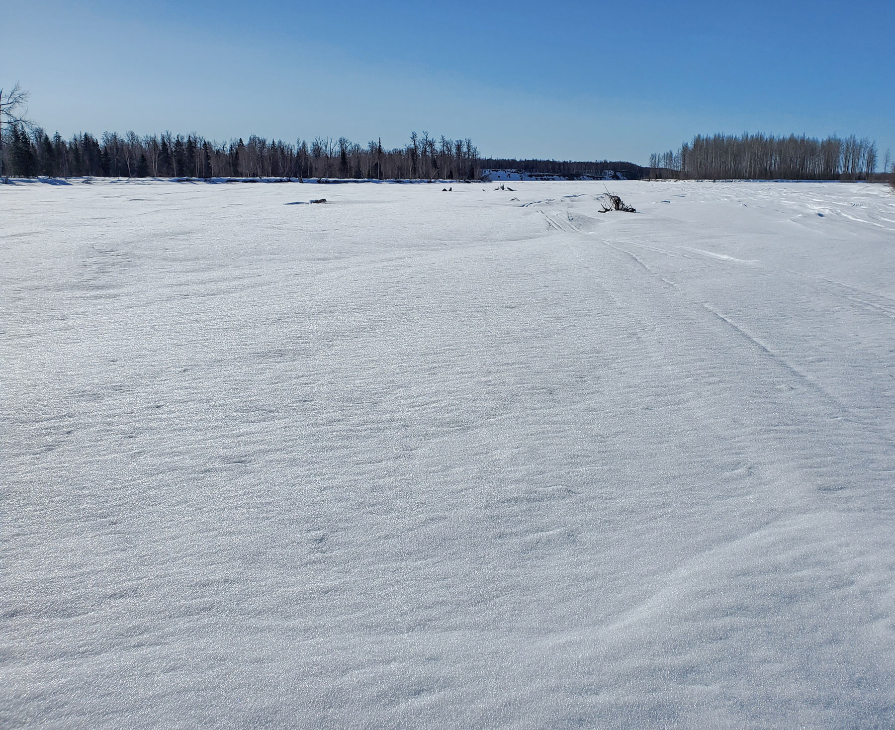
Great crust
skiing conditions on the Big Su. |
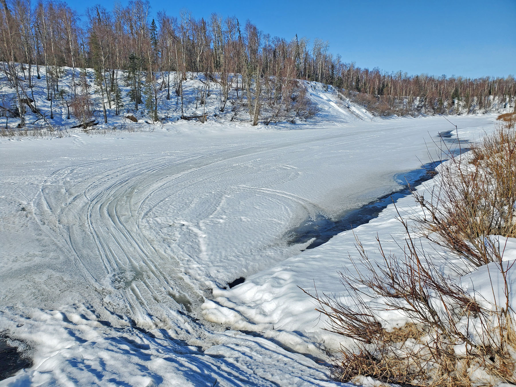
Near the Deshka River. |
 |
 |
 |
|
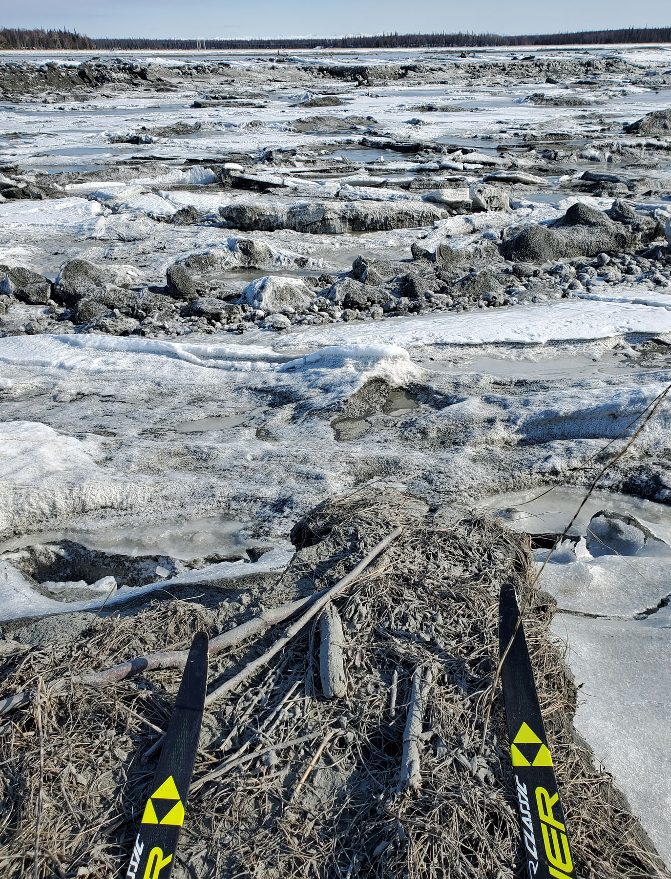
Deshka River |
GPS track:
22 miles. |
Flowing
water eating the trail at Deshka Landing. Sketchy.
Time to take crust skiing to higher elevations. |
|
|
|
|
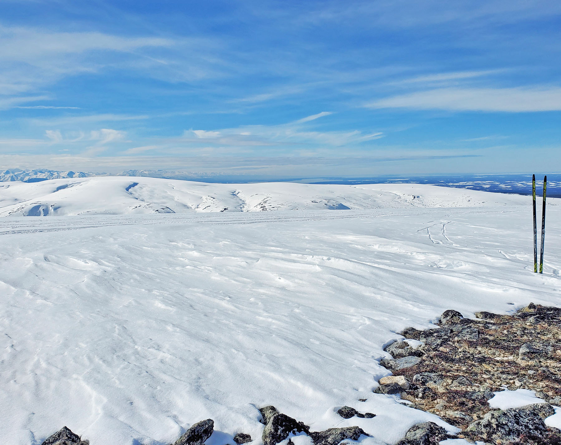
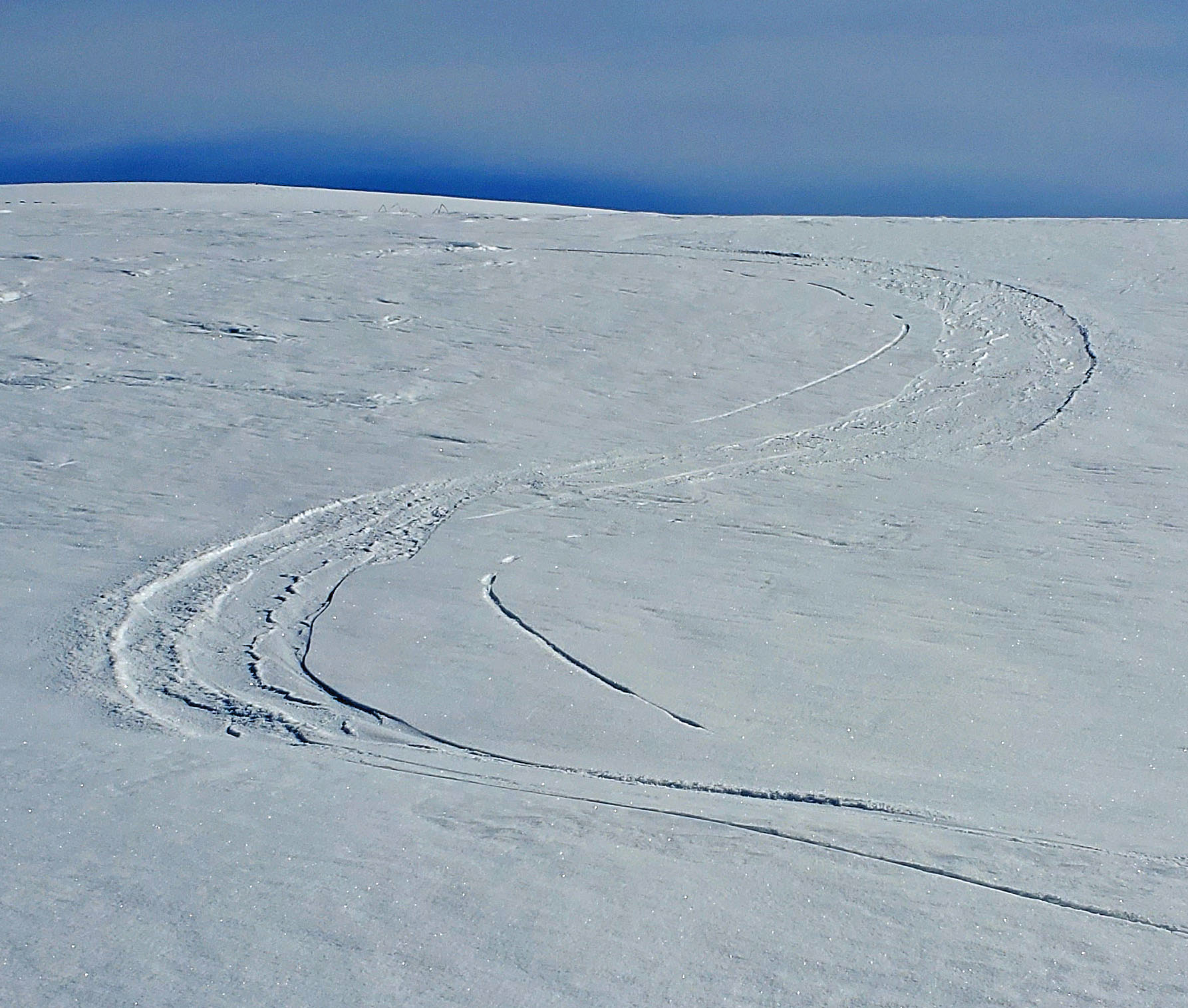
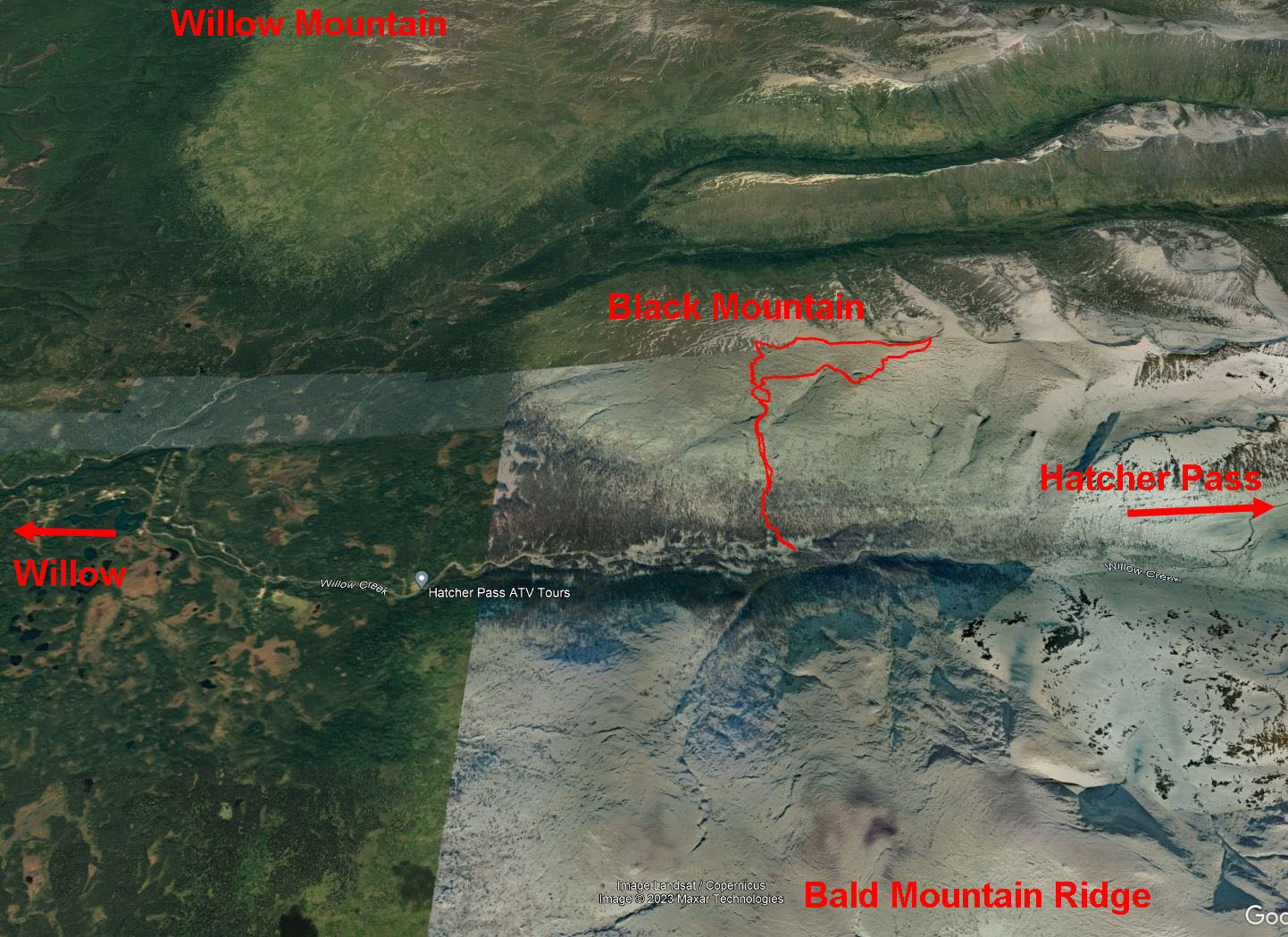
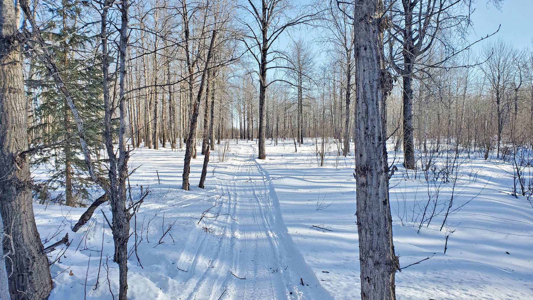
More Willow
... Black Mountain: To
the east of Willow there are three broad ridges: Willow
Mountain, Black Mountain and Bald Mountain Ridge. These
are expansive, safe and fun crust skiing venues that are rarely
visited. I have skied Willow Mountain in the past.
And I have skied Bald Mountain Ridge a bunch of times. But
I had never skied Black Mountain. So, that was a good
reason to go and ski it.
The trail up
to tree line is a steep and narrow snowmobile trail that is
better off hiked than skied in some places. Above treeline
it is wide open area of gradual slopes. There is a lot of
climbing to get to the high point. But the ride down is
worth the climb. |
 |
 |
 |
 |
|
A glimpse of
Black Mountain from the Willow Fishhook Road. |
The
snowmobile trail heading up goes through lots of dead
spruce. This valley is 'scary' ... a severe fire
hazard (in the summer). |
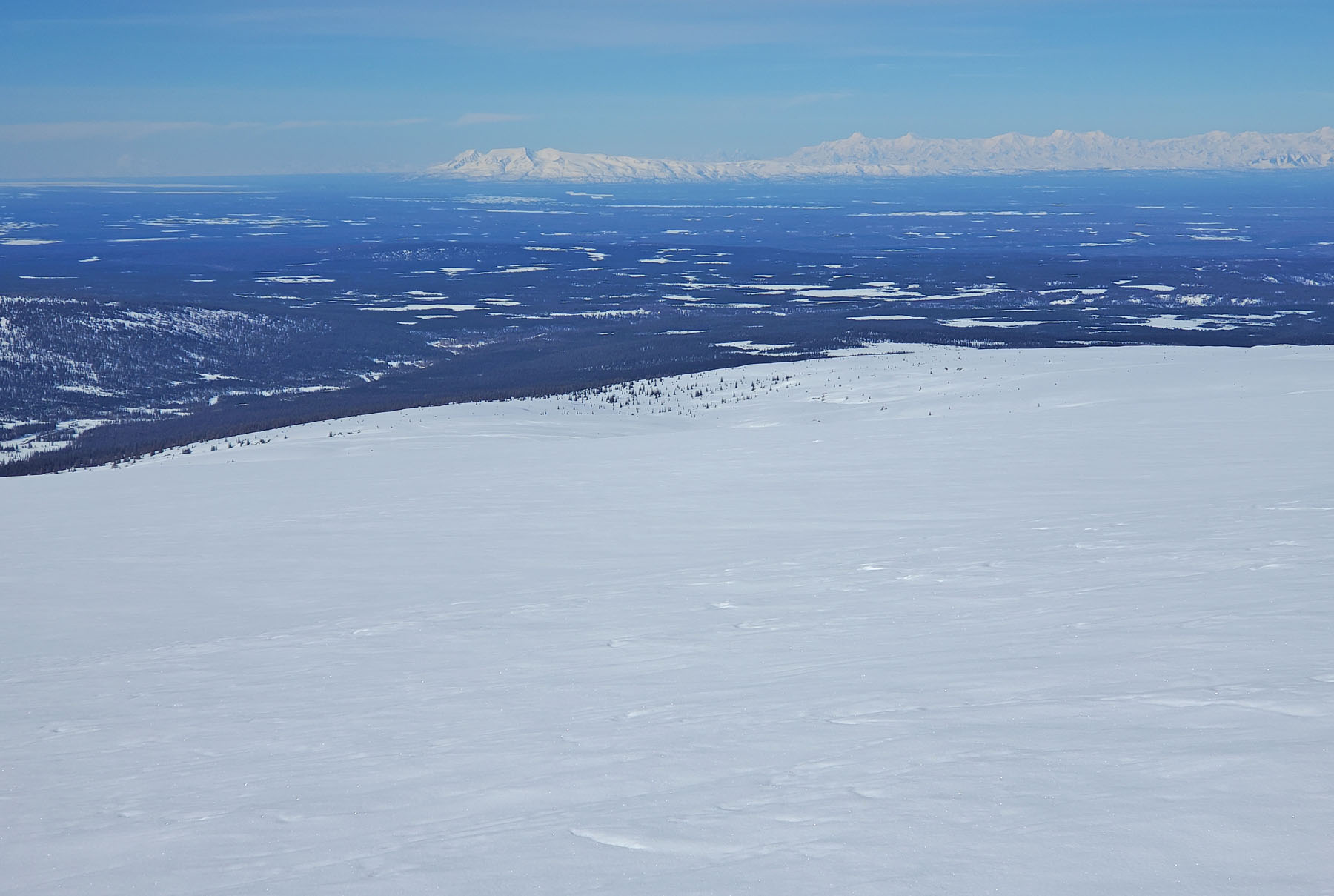
Looking
north towards Willow Mountain, and the Alaska Range. |
Looking
south at Bald Mountain Ridge. |
 |
 |
 |
 |
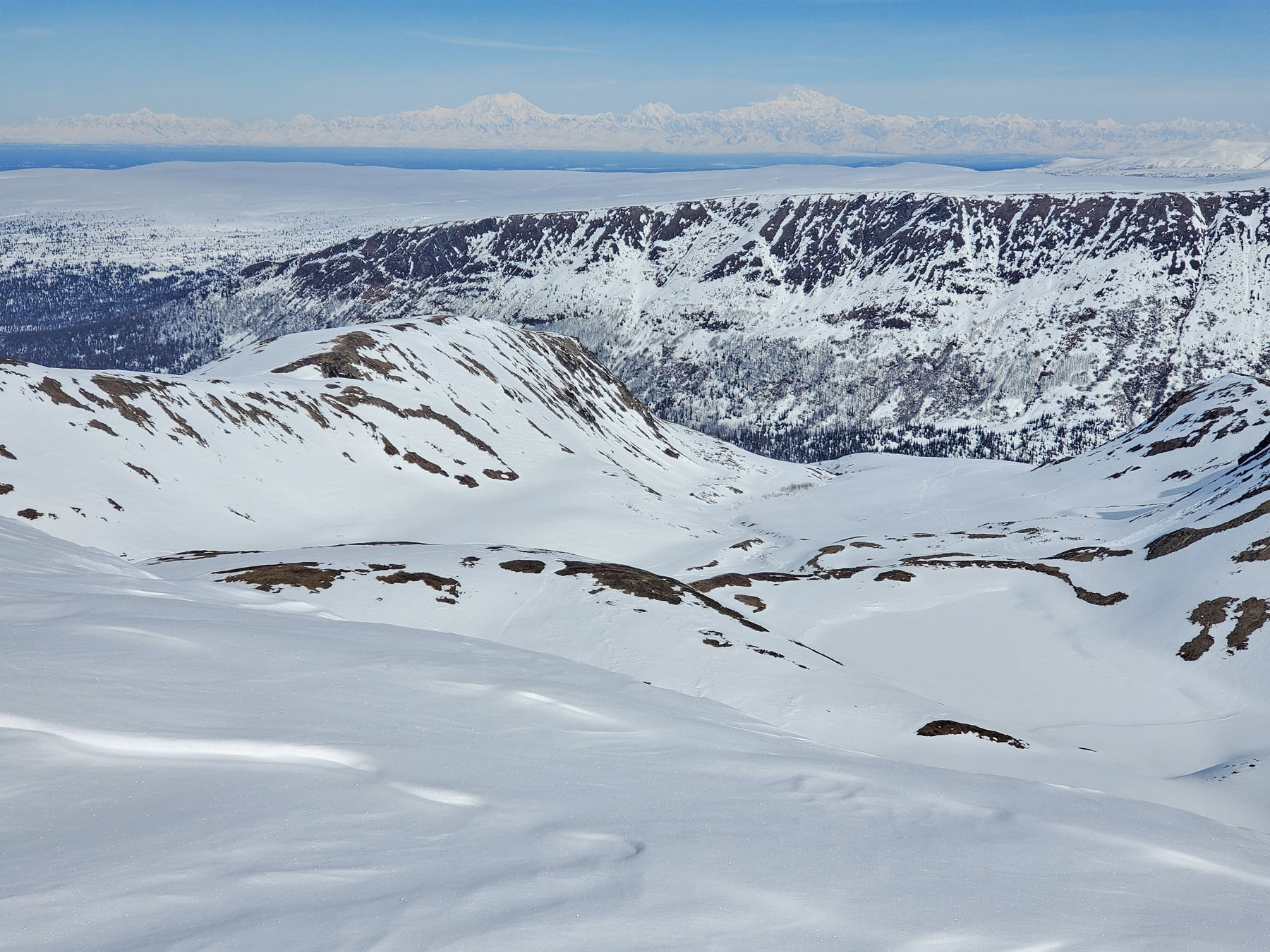
|
Looking down
at Box Lake. |
Looking west
down Black Mountain Ridge, Mount Susitna and the
Tordrillo Mountains in the distance. |
Dust on
crust. Nice for turns on skate skis. |
A view of
the ski terrain. Fun and safe. |
 |
 |
|
GPS track:
11 miles. 2300' of climbing. |
Area map. |
|
|
|
|
| Spring 2023:
Mouth To Mouth Crust Skiing |
|
| Late March 2023:
Kashwitna River |
|
| Mid-March 2023:
West Su Wanderings |
 |
|
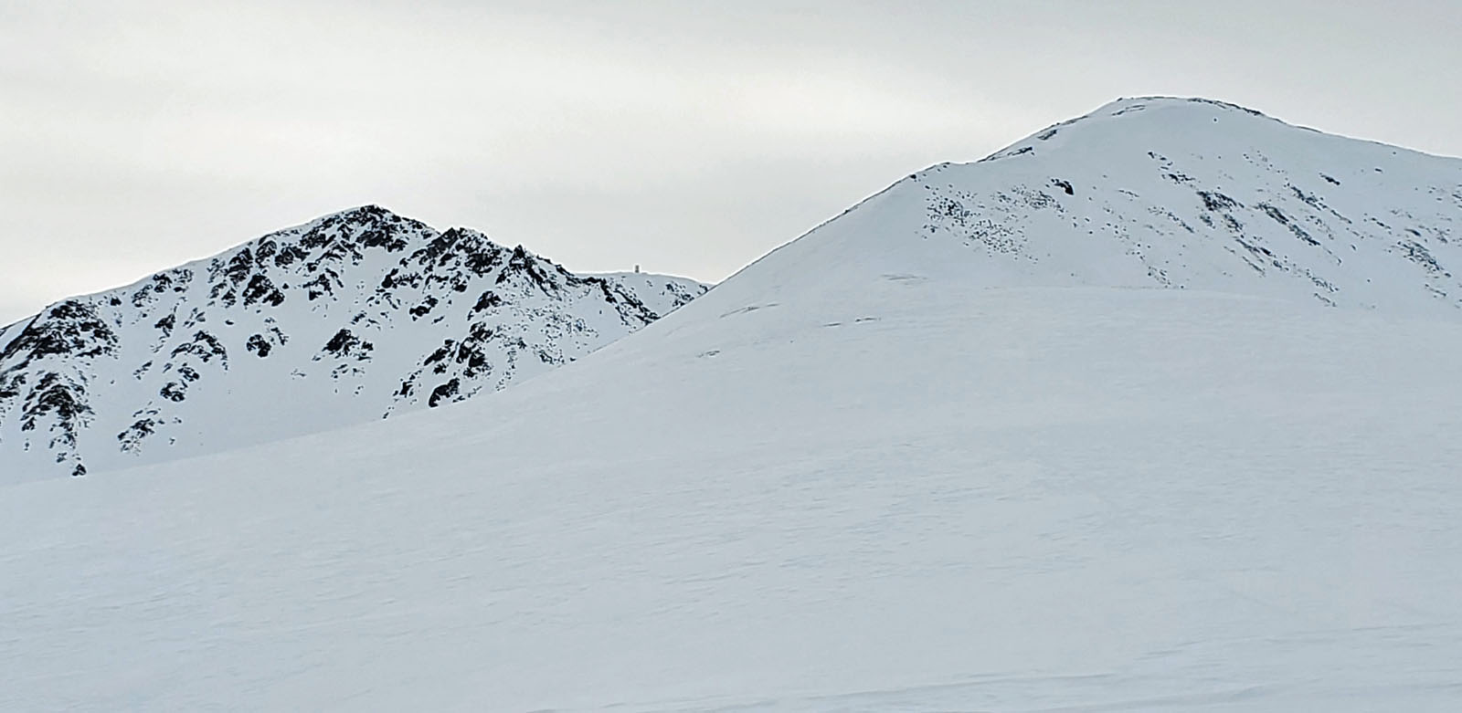
A new
route up Mount Susitna: Once upon a time there was
a reliable, relatively easy and well-traveled snowmobile trail up the north
ridge of Mount Susitna. Lodges at Alexander Creek helped
keep the Mount Susitna trail open for their winter clients. But then king salmon fishing was
shut down on Alexander Creek (a long time ago). This
caused all of the lodges at Alexander Creek to go out of
business. And that spelled the end of the north ridge
trail.
No fish. No clients.
No lodges. No
Mount Susitna north ridge trail.
The old trail
is now long gone. But I figured, there must be hard core
sledders that still go up Mount Susitna. I asked around, but
no one knew for sure if there was any trail. So ... it was time to
do some investigating and find
out for myself.
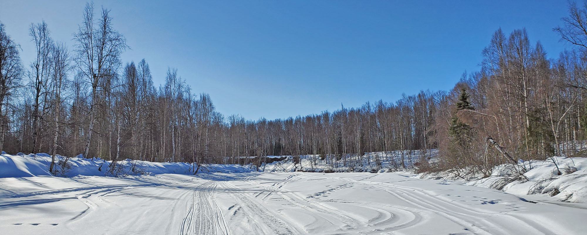
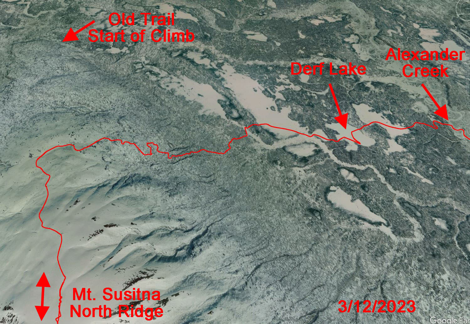
I headed via snowmobile from our cabin up to Derf Lake. There I found a
well established trail from the previous day, heading towards
the mountain. I followed it, hoping it was a route up the
mountain. Past a large swamp, the trail started climbing
... a good sign that this was the elusive trail I was searching
for. I could tell from the trail that the folks
that made it were savvy riders that knew how to get up through
this country. I saw signs of their chainsaw and shovel
work to break the trail. I had to bring my snowmobiling A game because
I was riding a utility sled that probably weighs 300 lbs more
than the trail breakers' mountain sleds. Sliding my beast off this
trail into deep powder up here, by myself, would be a nightmare.
After many
challenging turns, dips, tricky angled climbs and much alder
mowing,
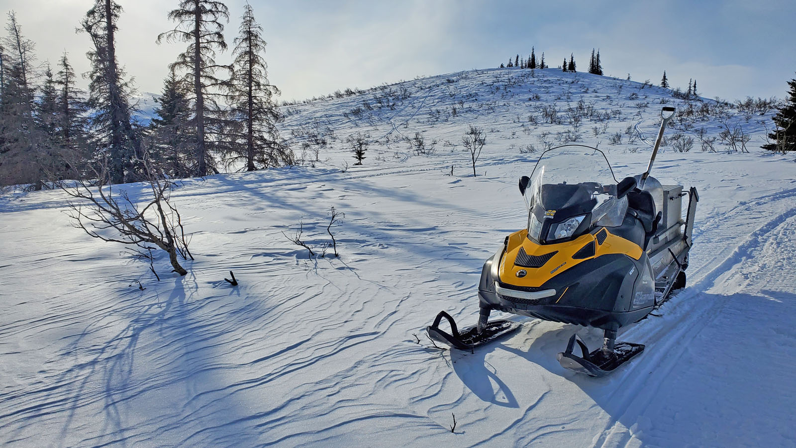
I powered up a long slope of face-slapping alders and popped out into open country.
I was above treeline on the north ridge! I
couldn't stop smiling, because I just love this place.
I've been here a bunch of times before. Always love coming
back. Can't believe it had
been so long since I was here last.
I switched to skis and skied snowmobile tracks to the snowmobile
turn-around highpoint just below the north summit. At this
higher elevation the wind was a lot stronger and the snow
surface had turned to hard and icy wind crust. Not
conducive conditions for going to the north summit with
Salomon ski boots and racing skis, like I had done in the past. But whatever, always
fun to be up on Mount Susitna.
Later I would
find out that I know the person that made this trail. He has
made trails up Mount Susitna the last two years. But they
are one shot deals. The next storm will likely erase the trail.
It was by sheer dumb luck that I decided to look for a trail up
Mount Susitna the day after this guy and his friends had made this trail.
Here are some
old pictures of skiing the north ridge of Mount Susitna. |
|
|
 |
 |
 |
|
Route from Derf Lake
up onto the North Ridge of Mount Susitna. |
Treeline on the
North Ridge. |
At treeline looking
back towards Derft Lake. |
 |
 |
 |
|
Trail on the North
Ridge of Mount Susitna. Beluga Mountain and the Yenlo
Hills in the distance. |
Mount Susitna main
(L) and north summits. Tower on the summit plateau can be
seen in the distance. |
At the snowmobile
turn-around spot. Looking towards Anchorage. |
|
|
|
|
 |
|
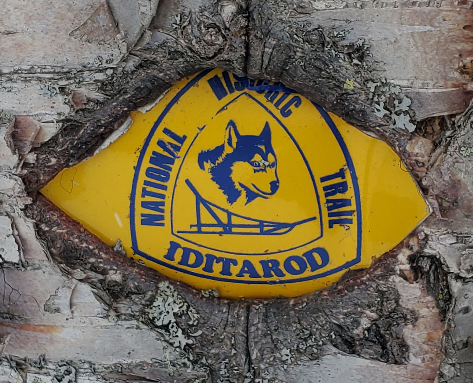
A Visit To
The Old Iditarod Trail:
This was a ski up Alexander Creek to the Old Iditarod Trail, and
then back via the Big Susitna River and Alexander Creek.
The Old Iditarod Trail was used by the early Iditarod dog sled
races, and it was used for dog sled freighting long before the
Iditarod race. In the 1980s the Iditarod sled dog race was
rerouted to use the Yentna River to get to Swentna. The
"Father of the Iditarod", Joe Redington, was against this
reroute. He thought mushing the original route of the
Iditarod Trail where possible should be the goal of the race.
But the flat, easy and spectator-friendly Yentna route won out.
Well, Joe should be smiling down from above these days ... as
his grandson just won the Iditarod.
When I skied the Iditaski races in the 1980s and the early
Susitna 100's, both of these races used this trail. The
Iditaski is no longer. And the Susitna 100 followed the
Iditarod in abandoning this historic trail. |
|
|
 |
 |
|
GPS track: 27 miles.
And yes, I took a wrong turn. Was following snowmobile
tracks and not paying attention. Whoops. |
The Iditarod Trail
became a national historic trail in 1978. So this trail
marker is upwards of 45 years old. I've been skiing past
this sign for perhaps 36 years. |
 |
A view from the Old
Iditarod Trail of Susitna Station, on the other side of the Big
Susitna River.
Once 600 people lived there. This spot was long a Dena'ina Athabascan village
site.
Now the State of Alaska/ AIDEA wants to build a bridge from Susitna Station across
the Big Su to support a 100 mile road to a gold mining prospect
an Australian mining company wants to develop near Rainy
Pass. Such a
road will be the ruin of the Western Susitna Valley.
 |
|
|
|
|
|
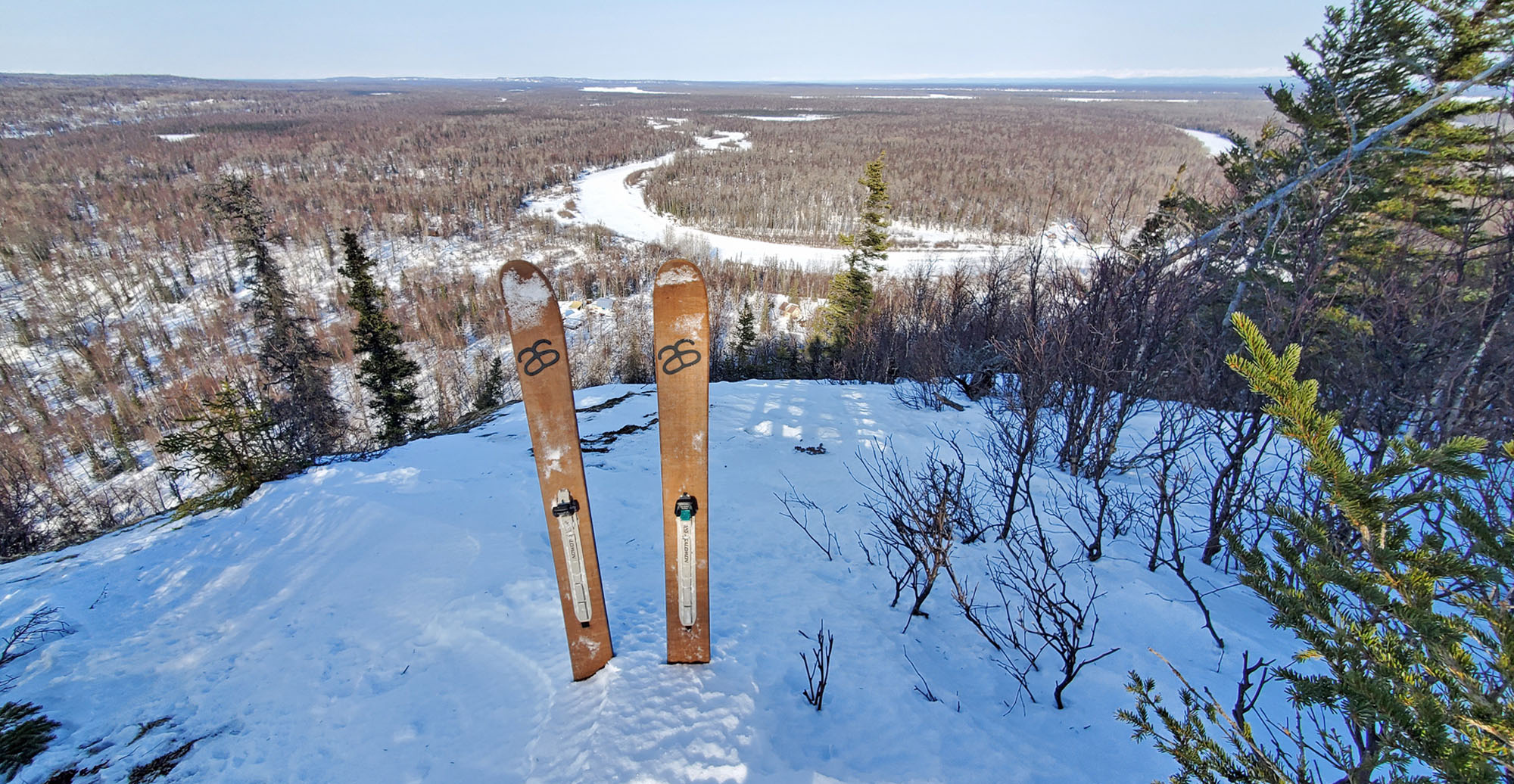
Dinglishna
Hill Hokdocking: I like my 'Hoks'. Short and fat
backcountry skis made by Altai Skis. I like using them for
boondocking. Hokdocking. Recently I took my Hoks to the top of
Dinglishna Hill, the mystical 479 foot tall, cliff-fortified granite guardian of the Hill
People of Alexander Creek. Luckily none of the Hill People
saw me, or I probably wouldn't be updating this web page now.
Cool hill ... surrounded by some scary-ass people. ;-) |
 |
|
|
|
|
|
Spousal
Abandonment Skiing: It's not uncommon for the Lower Big Susitna
River area to get slammed with strong winds. And it's sure
not much fun skiing out in the open in these conditions.
Unless of course, the wind is to your back. So my wife and
I make that happen. One spouse takes the other, via
snowmobile, as far upwind as they want to go. Then the
spouse doing the skiing gets abandoned, dumped, ditched, thrown
to the curb. And skis back to the cabin. |
 |
 |
 |
|
|
|
|
 |
|
Beluga
(and Tyonek) Winter Trail: I hadn't skied the Beluga
winter trail for a long time. It follows the gas
line from the west channel of the Big Susitna River to the
Beluga gas field road system. Lots of straight and flat.
Unique country that is open and windblown like western Alaska. |
 |
 |
 |
|
GPS track from
Alexander Creek. 28 miles RT. |
Following the gas
line out to the Chedatna Lakes area. Bald Mountain Ridge
in the distance. |
Mt. Susitna from the
gas line in the Chedatna Lakes area. |
|
|
|
|
|
Crust
Skiing Leads To New Community Trails: The last few years a
section of trail that the community of Alexander Creek
uses has been having a lot of snow drift issues. At about
mile 20 of the trail, the Big
Susitna River has cut close to the trail and the willow stands that fended
off the wind are now mostly gone. Folks, especially older ones,
were getting tired of shoveling a route through the drifts or
getting snowmobiles stuck or having freight sleds with 1000
pound loads tip over while crossing the 4-5 foot high drifts. As I had crust skied a lot in this Bell
Island area of the Big Susitna River, I knew of open cottonwood
country to the south where an alternate trail could quickly be
established. Fun to help out the community. And it's
fun scoping out and making winter trails. |
 |
 |
 |
|
Bell Island
cottonwoods ... the 'sequoias of the Susitna'. Yeah, a lot
smaller than real sequoias. But tall for this part of the world. |
|
Lots of signs like
this on Susitna Valley trails.
Good to see.
www.westsuwild.org |
|
a |
|
| Early March 2023:
Skiing With The Ghost Of The Galloping Russian |
 |
|
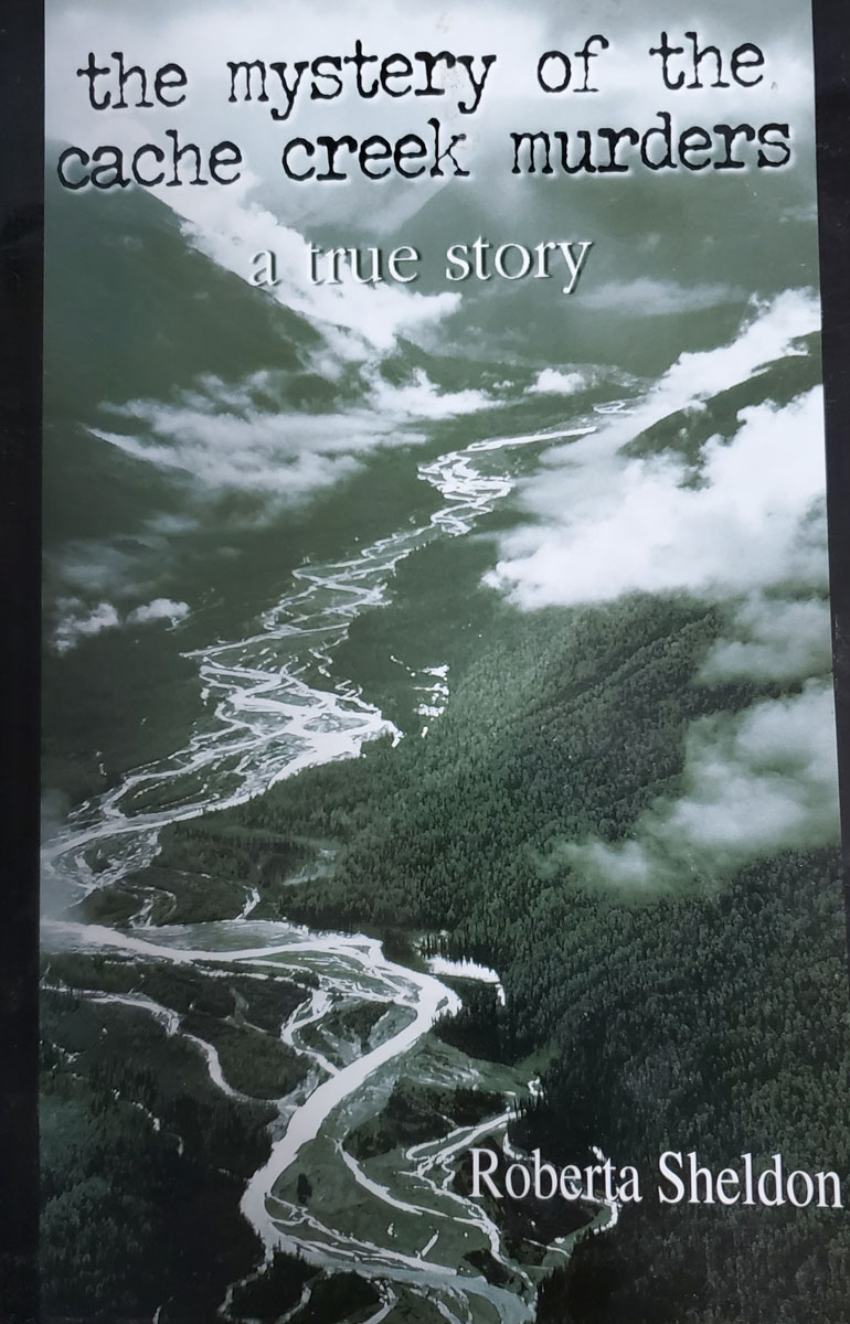
On page 14 of Roberta
Sheldon's book, "The Mystery of the Cache Creek Murders", she
talks about Nick Balabanoff. 'The Galloping Russian'.
Here is what she says (based in 1933):
"A big man, Balabanoff was Russian and had worked his claims
on Nugget Creek in Cache Creek country for several years now.
... An inveterate walker, Balabanoff thought nothing of walking
the 45 miles to Talkeetna when he ran out of snuff. Once
he hade his purchase, Balabanoff pocketed the little cans,
turned around and walked back to his camp."
Knowing this history, I
figured I'd try to recreate, on skis, a trek similar to what
Nick used to make 90 years ago. I don't know where his
gold claims were. But from Roberta Sheldon's book I knew Nick
frequented the Forks Roadhouse in Petersville. So I
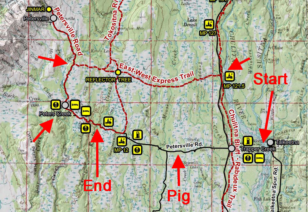
figured I'd try a Talkeetna to Forks Roadhouse ski.
Right off the bat I couldn't
keep up with Nick. There was no established route across
the Big Susitna River west of Talkeetna. And there was a lot of
open water with fast running current. No thanks. So
my wife dropped me off a couple miles to the west at the end of
the Susitna River Road in Trapper Creek.
I then skied the Susitna
River Road to the Curry Ridge Riders' Chulitna Bluff Trail,
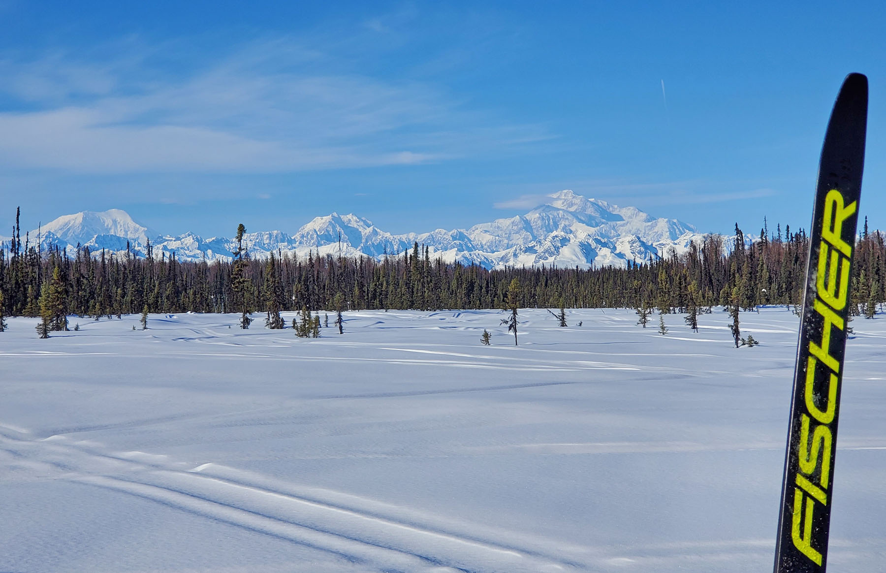
which I took to Mile 121 on the Parks Highway. Then I
skied the East - West Express trail to the Petersville Road and
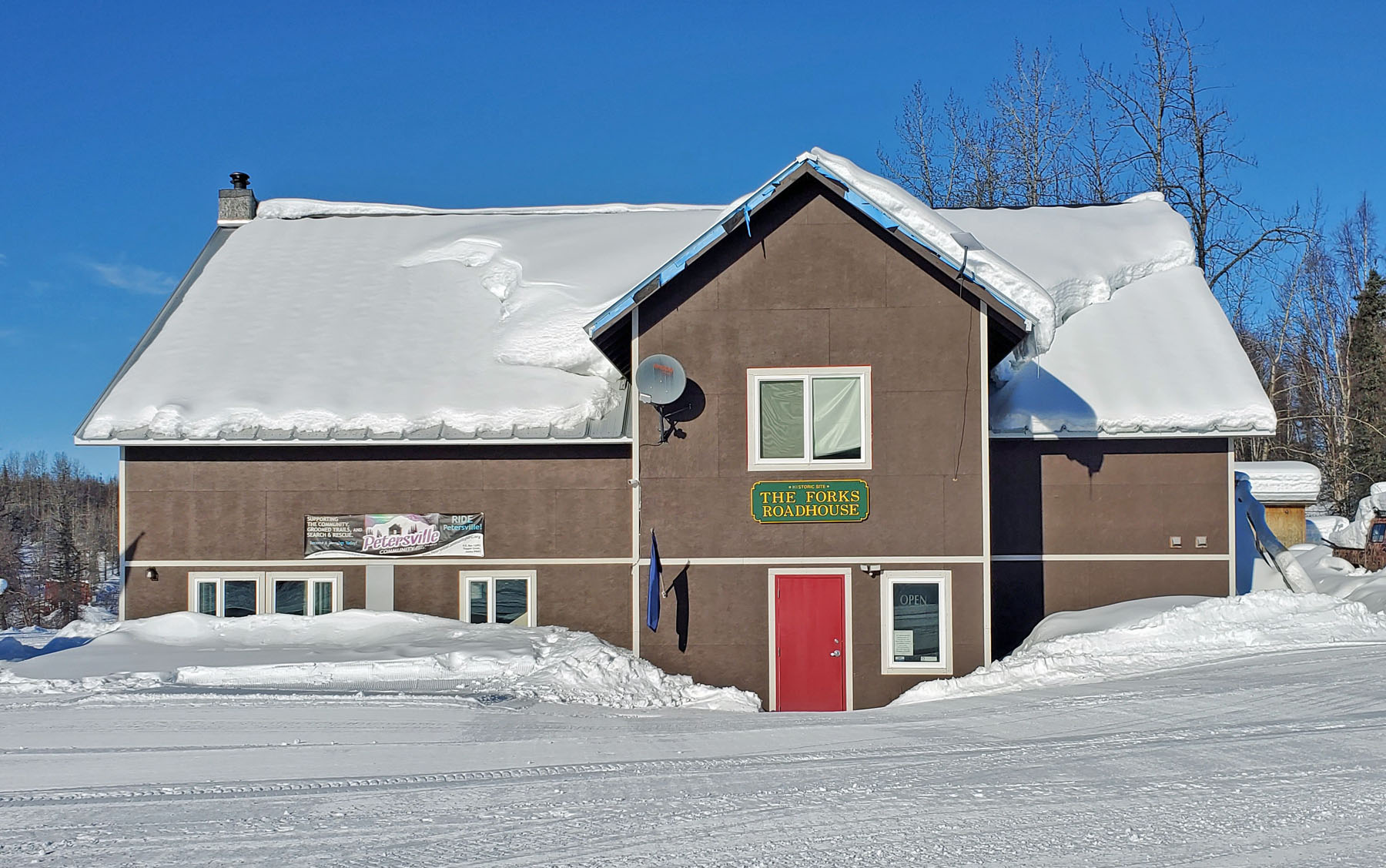
headed south to the Forks Roadhouse. The original
roadhouse was
taken by fire in 2012. Now a
nice Forks Roadhouse 2.0 takes it's place. The new
roadhouse was
closed, so I couldn't go to the bar and see if the ghost of Nick was there.
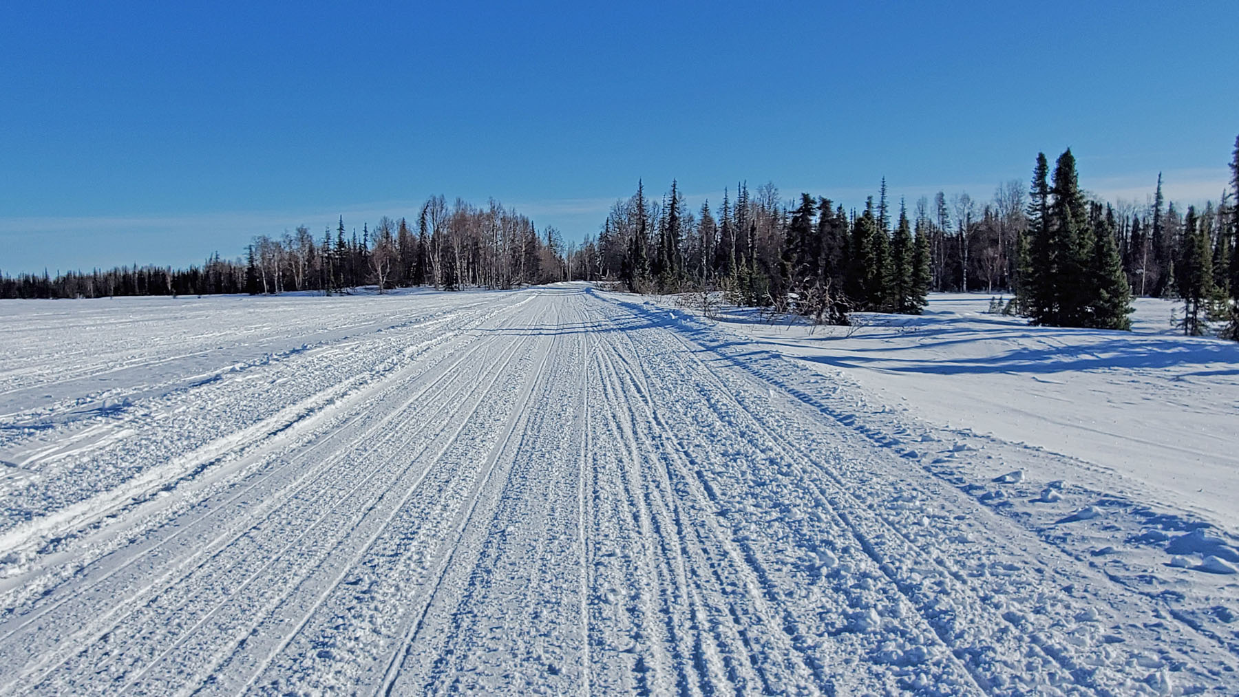
I then skied the rolling 5
miles to the Kroto Creek trailhead. Total mileage for the
day was 36 miles ... mostly on superbly groomed snowmobile
trails, all to myself, with killer Alaska Range views thanks to
late winter sunny and cloudless skies. I've been skiing
Curry Ridge Rider trails for nearly 20 years ... and they never
cease to amaze me.
While driving back out the Petersville Road I had to stop because a
pig was in the road. Yes, a pig. I got out and
herded the porker back through the rickety fence he had pushed
through. I sent him back to his many goat friends that
were lying in snow on tops of dilapidated cars.
I took a couple of minutes to try and fix the fence so he
wouldn't take off back into the road again. As I was
working on the fence the pig turned, and smiled at me. I
smiled back and said: "Nick Balabanoff, nice to meet you!"
I know a ghost's smile when I see one! ;-) |
a |
 |
 |
|
Excerpt from Roberta
Sheldon's "The Mystery of the Cache Creek Murders" |
Roberta Sheldon's
"The Mystery of the Cache Creek Murders".
Amazon link. |
Skiing the snow berm
of the Susitna River Road. Worked out well. |
a |
 |
 |
|
Chulitna Bluff
Trail, heading to Parks Highway Milepost 121. |
View from East-West
Express Trail. |
Heading towards the
Peters Hills on the East-West Trail. |
a |
 |
 |
|
Nearing the
Petersville Road. |
The reflector tree
at the Safari Lake Trail intersection is dead. But the phone booth
lives on! |
The re-built Forks
Roadhouse. |
a |
 |
|
Groomed snowmobile
trail heading to the Kroto Creek trailhead. |
Distance: 36 miles |
|
a |
|
| Early February 2023:
Quiz: What Kind Of Tracks Are These? |
 |
|
Often I have posted animal
track pictures on this web site. But here are some tracks
I have never posted a picture of. Can you guess what kind
of tracks they are? A moose lying down to rest? A
coyote rolling in the snow? A lost sled dog bedding down?
Nope.
These are scumbag tracks.
These are tracks from some
scumbag that laid on the snow as he/she used a battery powered
reciprocating saw to quickly cut off and steal the catalytic
converter from my truck. Scumbags steal catalytic
converters because they contain precious metals like platinum
and palladium that can be sold to unscrupulous metal recyclers.
Catalytic converter theft is a prevalent scourge these days.
I realized that I was often
putting myself at risk to be a victim of this crime, by parking
in remote locations.
Eventually my number came up.
So ... beware. This
happened at the Matanuska-Susitna Borough public parking lot on Ayrshire Road at Point Mackenzie. But it can happen most
anywhere.
If
your catalytic converter is cut off and stolen from your vehicle, you will
still likely be able to drive your vehicle (unless other stuff was cut
into). But it's gonna be loud driving. Because you
will be driving with an engine that has been disconnected from
the muffler.
If
this theft happens to you, hopefully you have decent
comprehensive auto insurance. The thief might get $50 for
the stolen item. But the cost to you will likely be over
$2000, minus whatever your insurance company
pays above your deductible amount.
I recently talked to a guy that commutes to Anchorage from the
Valley. He said a couple of weeks ago, during the height
of evening rush traffic, he went by an overturned truck,
something that is seen often on the Glenn Highway in the winter.
And he noticed that someone was at the truck cutting off the
catalytic converter. A thief boldly stealing as hundreds
of people pass by a few feet away. Welcome to the new
Alaska. |
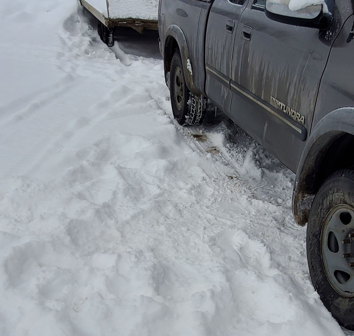
a |
 |
|
Cut. Cut.
Catalytic converter gone in 2 minutes. And so is the
thief. |
$2229.70 later ... a
new catalytic converter. I hear for some vehicles that replacement catalytic
converters can run to over $4500. Park defensively if you
can. |
|
a |
|
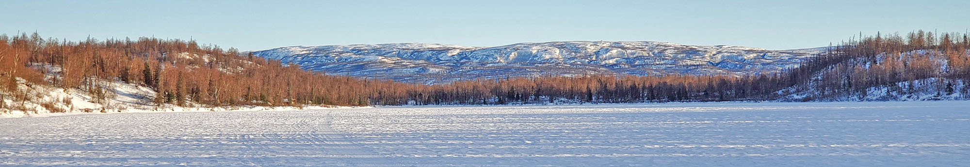
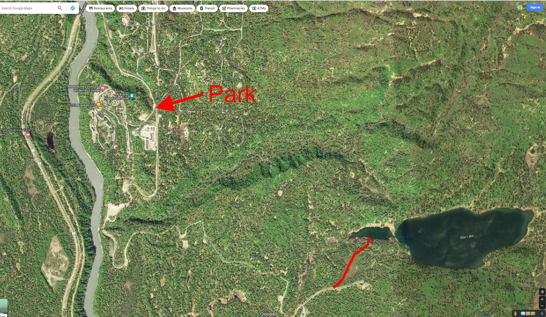
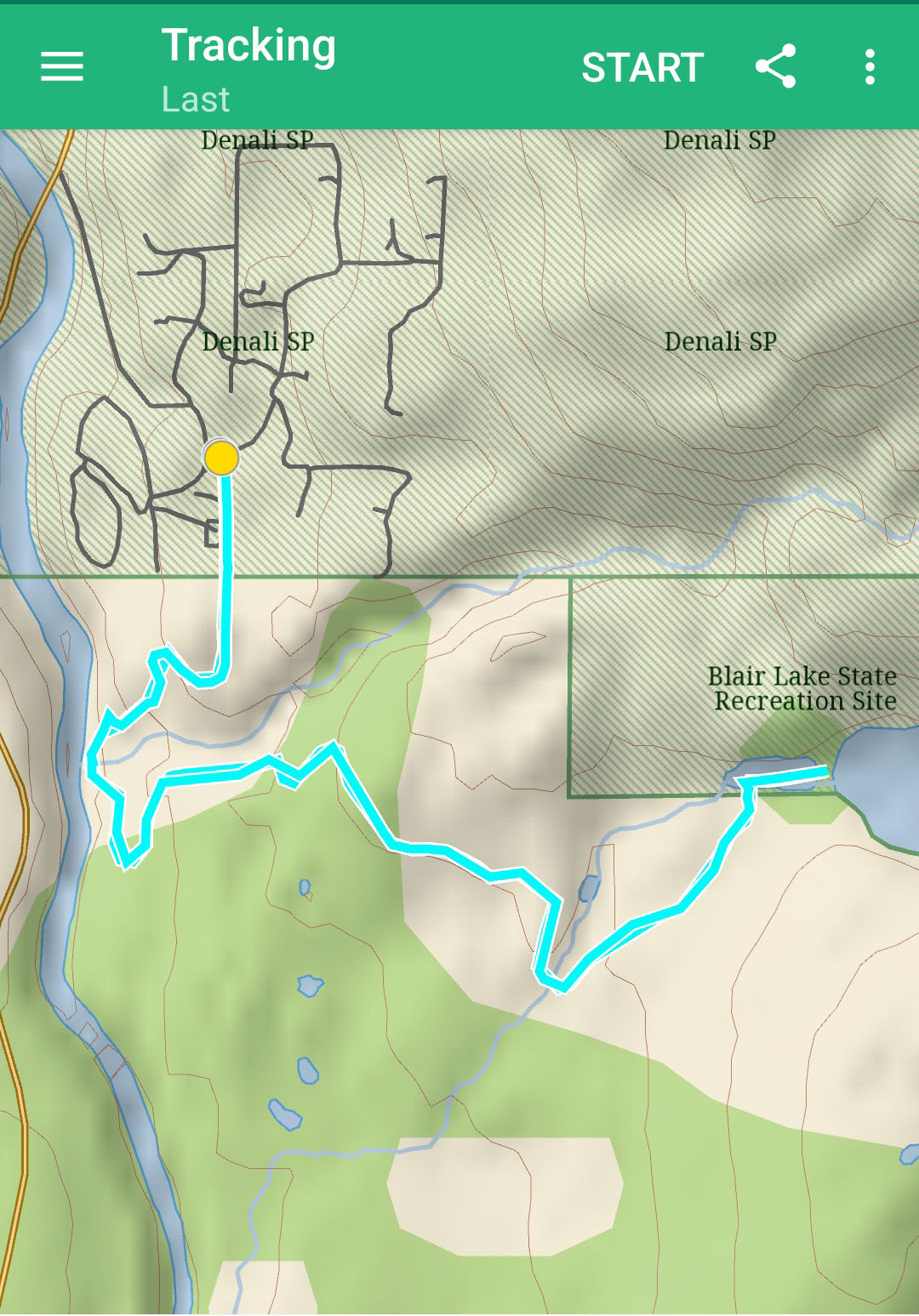
| Mid January 2023:
Blair Lake State Recreation Site |
|
| Early January 2023:
Three Months Of Rain ... The Gift That Keeps On Giving |
|
| Late December 2022:
A New Crust Skiing Access Point - Settlers Bay Coastal Park |
|
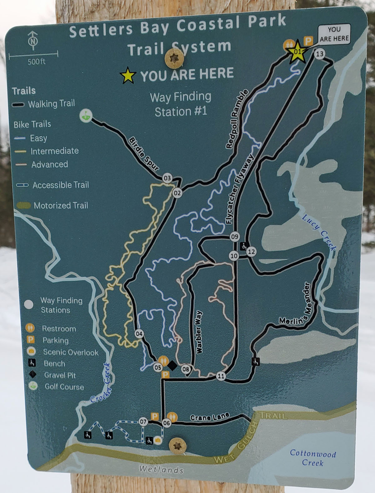
The last few years saw the
creation of the
Settlers Bay Coastal Park in Knik-Fairview, Alaska.
This new Matanuska-Susitna Borough park offers access to upper
Knik Arm tidal flats, which can be good crust skiing in the spring.
From the parking lot you have a choice of trails that will take
you to the bluff that overlooks the tidal flats. Crane
Lane is the trail that takes you down to the flats.
Crust skiing on the Knik Arm coastal flats can also
be accessed from the Knik Bar, to the south, or the Palmer Hay
Flats State Game Refuge trailhead to the north. So now
there is a third access point.
This is a surprisingly nice
park. Multi-use trails here are groomed periodically by an MSB snowmobile
pulling a drag. Latest grooming info is posted
here (at least it was late December 2022). I liked the Merlin's Meander trail
that works its way along old moraines. This 300 acre park does
not have a huge trail system. But if you enjoy checking
out new trails that you have never skied before ... this place
is worth a visit. |
a |
 |
 |
|
Settlers Bay Coastal
Park overlook, looking towards Anchorage. |
Map (click on map to
expand) |
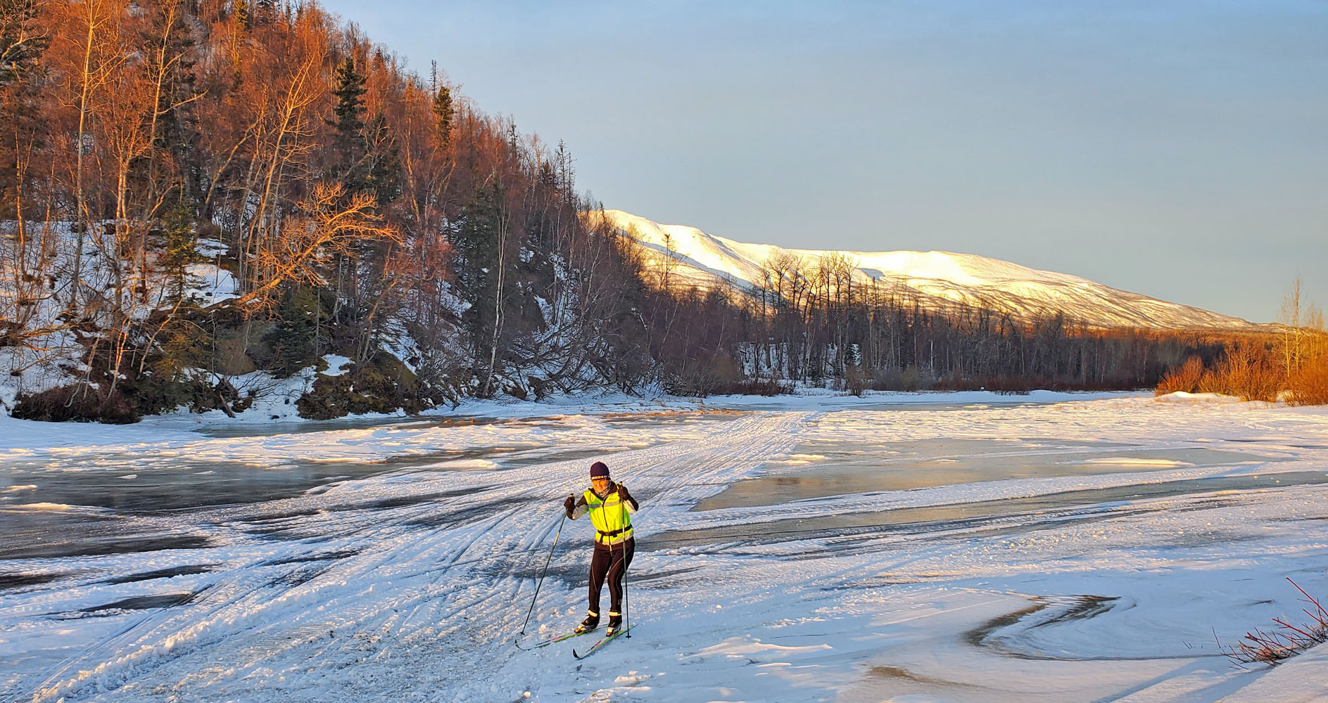
Skiing on the
coastal flats. Following ski tracks. Crust skiing is
a few months away. |
|
a |
|
| Ski Season 2022-23:
Ski Someplace New. Share. Repeat (for 20 years). |
|
This will be the 20th year
that I've posted ski trip reports on this web site. For
two decades now my modus operandi has been to find new places to
ski on xc racing skis and then share
information about the trail or crust skiing venue I visited.
The goal
of all of this, besides me having fun, is a knowledge base that
Southcentral Alaska cross country skiers can use for ideas of new
places to ski at. This website is that knowledge base.
Providing a bigger picture of where
skinny skis can take you helps the sport. Too much time
spent only skiing your local trails can lead to boredom and
skiing-malaise. Skiing at new
places fosters
enthusiasm and keeps your engagement with xc skiing vibrant and
healthy.
I hope this spring skiing season is half as good as last year
was. Spring crust skiing in
2022 was epic!
No ski-able snow in Anchorage
in September this year. So, no "9 month ski season" in
Anchorage
like last year. |
a |
|
a |
|
| Fall 2022:
Random Early Season Pictures ... |
|
|
|
|
|


