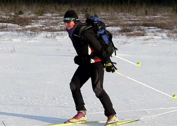
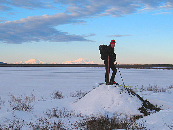
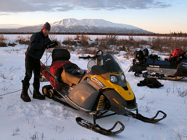
|
|
|
Home |
|
Intro |
Gear |
About |
Ski Trips: |
2024 |
23 |
22 |
21 |
20 |
19 |
18 |
17 |
16 |
15 |
14 |
13 |
12 |
11 |
10 |
09 |
08 |
07 |
06 |
05 |
04 |
UBXC |
Apps |
eBook |
|
2010/2011
by: Tim Kelley
|
|
|
|
|
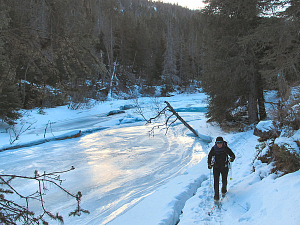
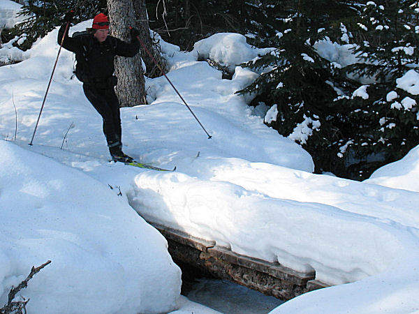
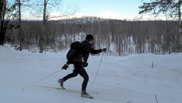
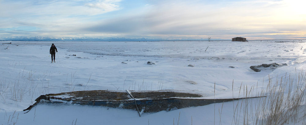
Skiing From Beach
to Hillside |
| February 27,
2011:
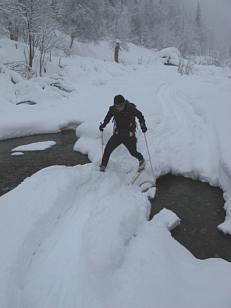
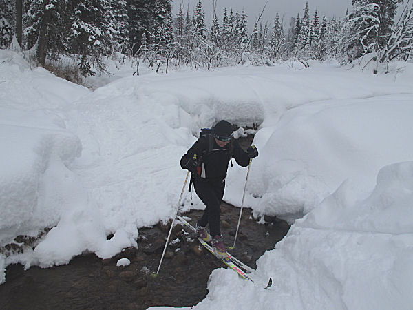
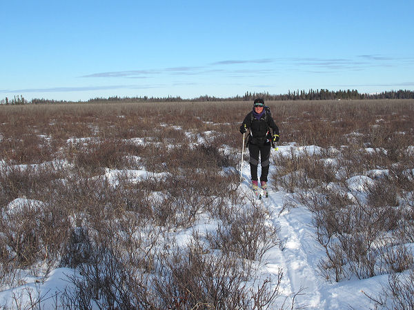
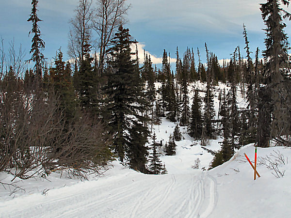
I figured it would be a fun challenge to try to and ski from
the Beach Lake Trails in Chugiak to the Hillside Trails in
Anchorage. From previous ski and mountain bike trips I
knew all of the trail sections that I would have to link up.
I just needed the right conditions to make it all come together.
Well, the right conditions showed up for this urban
trail connecting puzzle. This ski trip turned out to be fun due to its diversity:
groomed trails, un-groomed trails, mushing trails, skiing on roads, lakes, bike
trails and under power lines, skiing in places where they warn
of wolf attacks, skiing through a military base, running a few
miles, skiing next to
Alaska's busiest highway, skiing "secret" neighborhood trails ... yep, plenty of variety.
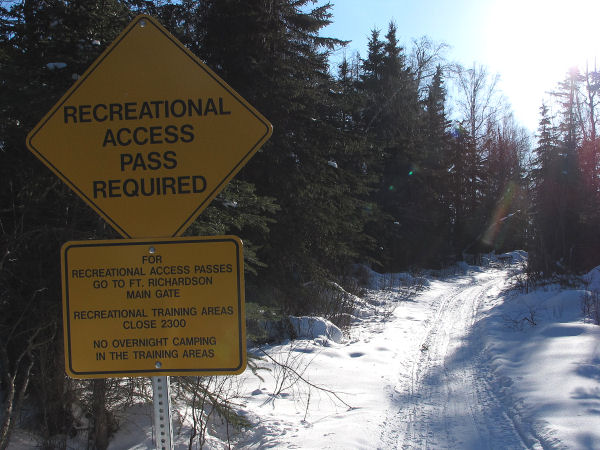
Here is a description of the
route: Chugiak High School. Beach Lake ski trails.
Beach Lake Road to Beach Lake. Beach Lake mushing trails
to the Conners Beach (military) Road. (Yes, I called in my
Recreation Access Permit number to the Army, and checked out when I
was done). Clunie Lake Road. Across Clunie Lake.
Clunie Lake Road to railroad crossing. Pole Line Road.
Davis Highway. Bike Trail around the National Guard
airfield (it was spread with gravel, had to run 2 miles), Dyea "Flagpole
Trails", bike trail along the Glenn Highway, Muldoon overpass,
Centennial Park, local Muldoon trails to power line on Fort
Rich, Far North Bicentennial Park, Tank Trail, Gasline Trail and
multi-use trail to Hillside parking lot on Abbot Road.
One bad thing that
happened on this ski trip is that I damaged my camera. Grrrr
... now it's on its way to Canon for repairs. So here are a few pictures leading up to
the demise of my camera. |
 |
 |
 |
 |
 |
|
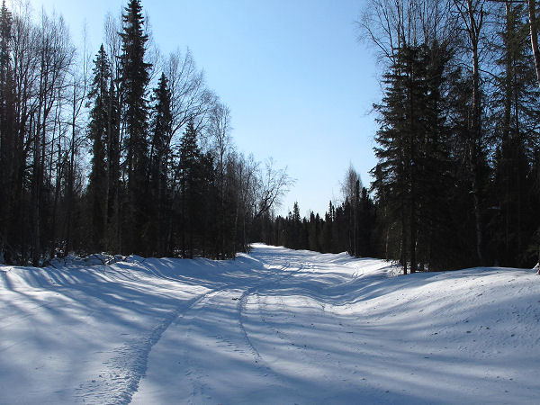
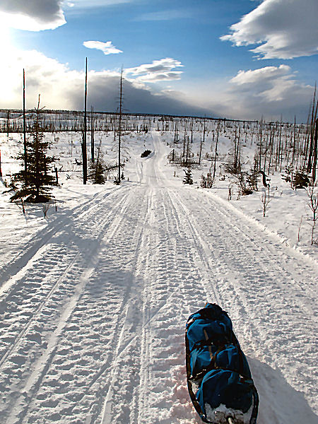
GPS track: 34 miles. |
Beach Lake mushing
trails. |
Wolf tracks on north
Fort Rich trail. |
Wind blown-in
military vehicle tracks (good skiing). |
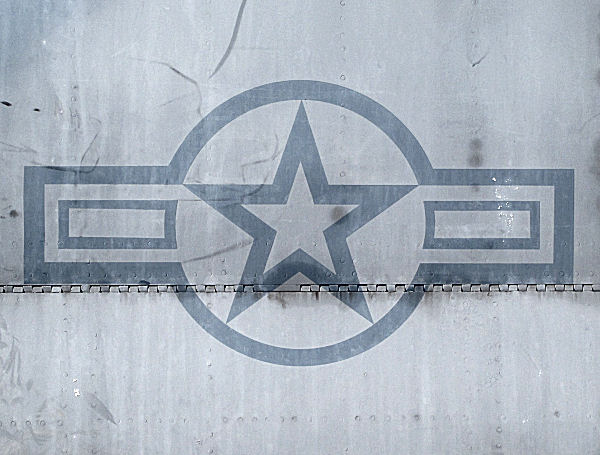
Insignia on old jet. |
 |
 |
 |
 |
 |
|
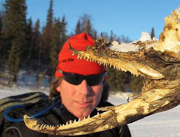
This was a cool
sight along the Conners Beach Road - remains of an F-15 Eagle. |
Insignia on old jet. |
I didn't see any
wolves, though I was hoping to.
Update:
The State would eventually kill 9 wolves on Fort Rich. |
Clunie Lake. |
Un-sanded northern
Fort Rich roads. FAST double-poling. |
|
|
|
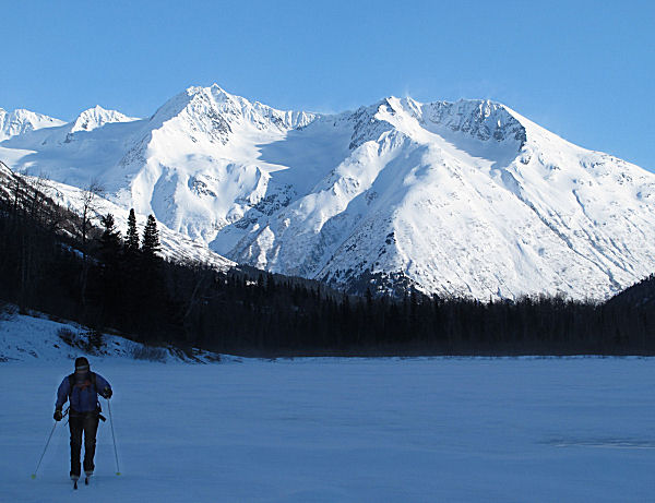
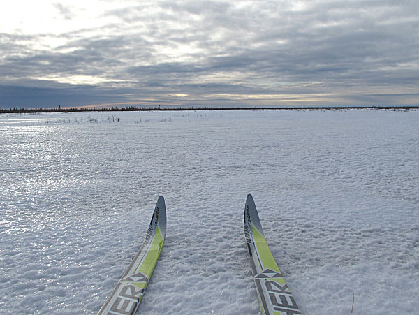
Ptarmigan Lake
(Moose Pass) |
| Late February
2011:
During the last weekend of February there were high winds
hammering Southcentral Alaska. I wanted to pick a ski
route that would at least partially be out of the wind, so I
suggested to my wife we ski to Ptarmigan Lake. This is the
only lake in the Moose Pass area I had not skied on and I had
wanted to check it out for quite a while. Snowmobiles are
not allowed on the 4 mile Chugach National Forest Ptarmigan
Creek Trail that leads to the lake. So it's a narrow
snowshoe trail that you can ski 75 percent of. The trail
was wind free, but we found plenty of wind on the lake as we
skied to the far end and back. |
 |
 |
 |
 |
|
GPS track: 17 miles
RT. |
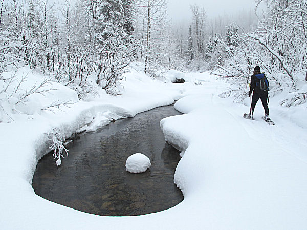
Skiing a snowshoe
trail next to Ptarmigan Creek. |
My wife skied
through this hole, but I chickened out! ;-) |
Skinny skis on a
skinny trail. |
 |
 |
 |
 |
|
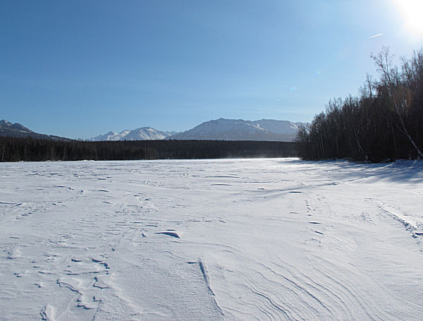
On Ptarmigan Lake,
heading east. |
Having fun bucking
the wind. The "fuzzy" surface of the lake in the distance
is blowing snow. |
The east end of the
lake, skiing back into the wind. Mountain ridges block the
sun from hitting this lake for most of the winter. |
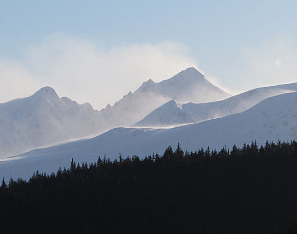
A windy day in the
Kenai Mountains. The high peak is Mt. Ascension.
Last summer Dante Petri and friends did a
cool July ski descent of this peak. |
|
|
 |
|
|
|
There is minimal
snow in the Kenai Mountains this winter. So avalanche
danger on this trail was low. On normal snow years there
is likely much higher avalanche exposure on this route, so
beware. |
|
|
|
|
Have You Skied All
of the Groomed Trail Systems in Anchorage? |
|
Here is a skiing
project for you if you live in or near Anchorage: Ski all trails on all
of the groomed trail systems in the Municipality of Anchorage (MOA).
By groomed I mean machine groomed using some kind of drag, not trails
that are skied-in or made by recreational snowmobilers, snowshoes,
winter bikes, foot, paw or hoof. Here is a list of what I think
the groomed trail systems in the Municipality of Anchorage are (I'm
listing them somewhat in north to south order, and somewhat grouping
them by the organizations that do the grooming):
Eklutna Lake
Campground trails, groomed by the Chugach State Park
Nordic Skiing Association of Anchorage (NSAA) Mirror Lake School Trails
Edmonds / Mirror Lake Trails (groomed infrequently)
Beach Lake Mushing Trails
Eagle River Nordic Ski Club / NSAA Chugiak / Beach Lake Trails
Eagle River High School Trails
Eagle River Nature Center Trails
Dyea Ski Trails (Fort Richardson)
Eagleglen Golf Course Ski Trails (Elmendorf AFB)
MOA groomed bike trails in the Anchorage Bowl (many, including Ship
Creek, Chester Creek, Campbell Creek and Coastal Trail)
NSAA Anchorage Bowl trails (Bartlett, Russian Jacks, Tour of Anchorage
Trail, Hillside, Kincaid)
APU Groomed Trails
BLM Groomed Trails in Far North Bicentennial Park
Chugach State Park Hillside Trails
Tozier Track Dog Mushing Trails
Campbel Lake Homeowners Association's groomed trail on Campbell Lake
Girdwood Nordic Ski Club Trails
Chugach Powder Guides cat track
There are also a few bandit groomed trail systems in the Muni. But
my life would be at risk if I identified them. So the above list
is all I can think of. If you are looking for a quick local trip
to ski someplace new and you haven't completed this list, well now you
have a goal! This of course isn't backcountry skiing, but it may
be some fun "skiing at new and different places" for you. It's all
good.
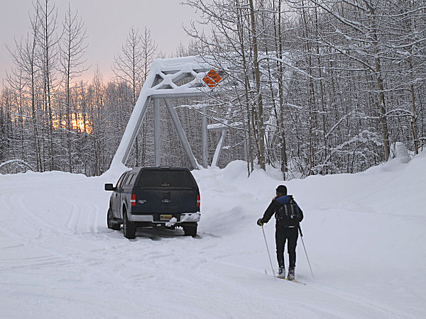
Recently I think I
finally wrapped up skiing all the groomed trail systems in the MOA.
I had two left - Dyea and Eagleglen. Don't feel bad if you haven't
heard of these trail systems. I would bet 90% of xc skiers in
Anchorage have never heard of or skied on these trails. Both of
these trail systems are on our military bases, so you need to go to the
main gate off the Glenn Highway and get a free RAP (Recreation Access
Permit) to ski these trails. I skied Eagleglen first. The
outer loop was just under 4 miles. It's about half golf course
skiing and half trails in the woods. It's pretty flat, really just
one hill, but it's neat skiing next to Ship Creek.
When I skied at the Dyea ski area I was surprised by the amount of
groomed trails they had. It wasn't really that much, but way more
than I had expected. The trails go right next to the big Fort Rich
flagpole you can see from the Glenn Highway. Of course when you
finish skiing here you have to tuck the little Dyea alpine skiing and
snowboard hill. There are usually a bunch of rote beginners on
this hill so they will be dazzled by your skill and prowess in bombing
this massive 50-60? foot vertical ski area.
 |
 |
 |
|
Eagleglen golf
course ski trails. This picture shows a skier, Ship Creek,
a suspension bridge across the creek and the club house. |
Checking out the ski
trails at Eagleglen has been on my low-priority, backburner
to-do list for 20 plus years. It's finally checked off the
list now. |
The Dyea Ski Area
trails go past the main Fort Richardson flagpole that you can
see from the Glenn Highway. |
|
|
|
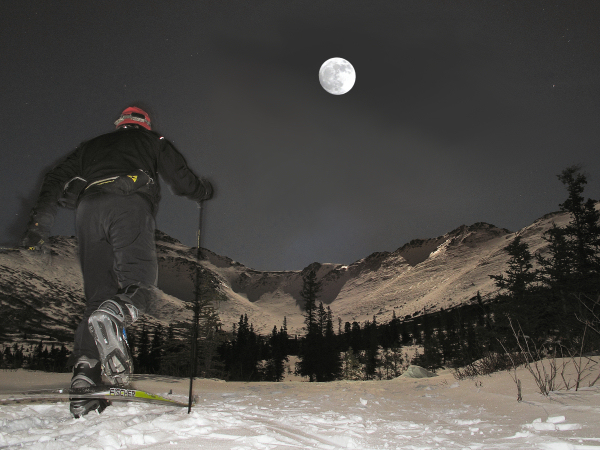
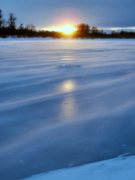
Recent Photos |
 |
 |
 |
|
Night skiing under nature's
floodlight in the Western Chugach Mountains. |
High winds racing to an
incoming low pressure system, vacuuming the snow off the Big
Susitna River. |
Real Alaskan women: 1) have
their own chainsaws, and 2) don't let others use their
chainsaws. "No! You'll just screw it up! Use your own damn
chainsaw!" |
|
|
|
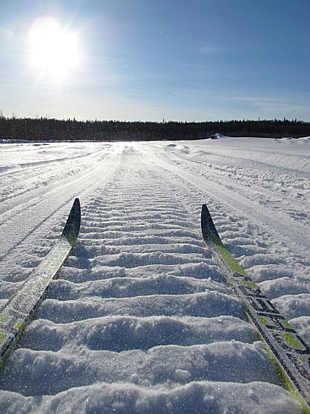
More Talkeetna Ski-Ramblings |
|
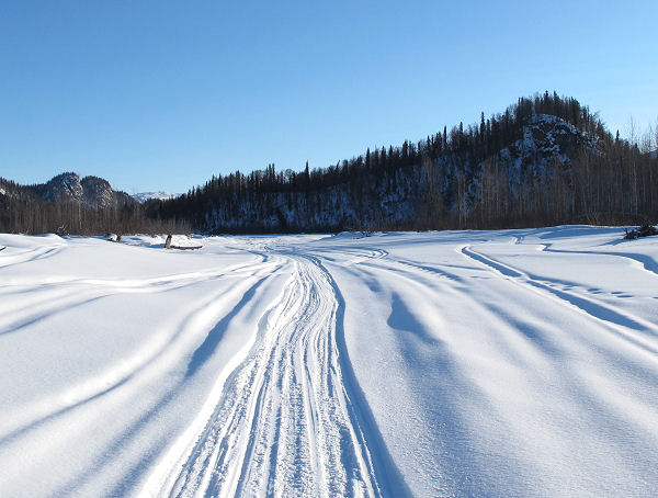
Talkeetna
River to Sheep River |
| February 11 &
12, 2011:
This winter my wife and I tried out staying at rental cabins in
Talkeetna a couple of times. Early winter finds Talkeetna
cabin rentals available with only a day's notice. And the
rental rates are discounted because of low demand. So this
turned out to be a good deal and a great way to spend time in
Talkeetna and check out some of their trails. On a recent
trip we skied the Luthman Trail and did two skis on or near the
Talkeetna River. Shown below are pictures from a 13 mile
loop I did with my wife. And a 28 mile river ski I did by
myself to get to the Sheep River and back. |
 |
 |
 |
 |
 |
|
GPS tracks: Yellow =
13 miles. Talkeetna River yellow + maroon = 28 miles RT. |
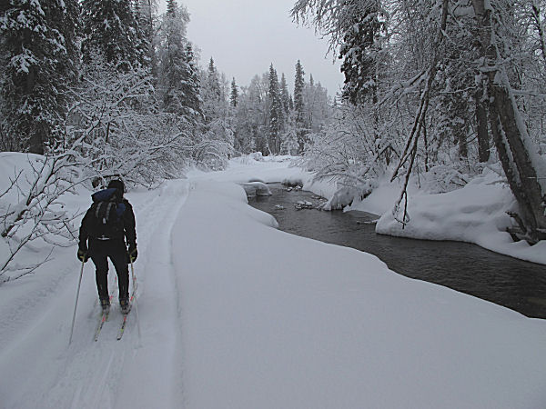
2/11:
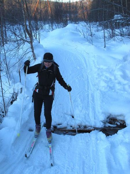
Skiing mushing trails to the south of the Talkeetna River. |
|
Stopping for tea at
Tim's Talkeetna Taj Mahal. |
| |
 |
 |
 |
|
| |
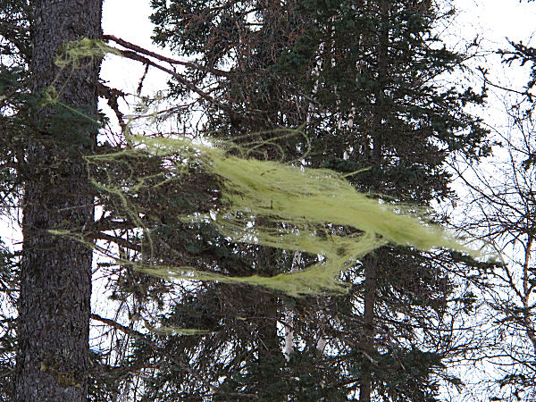
Sphagnum moss
blowing in the wind. |
Skiing a riverside
trail cut in the willows. |
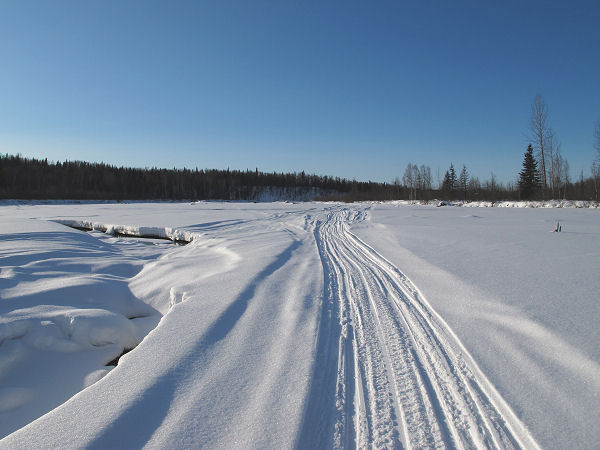
The snowmobile trail
on the Talkeetna River. |
|
 |
 |
 |
 |
 |
|
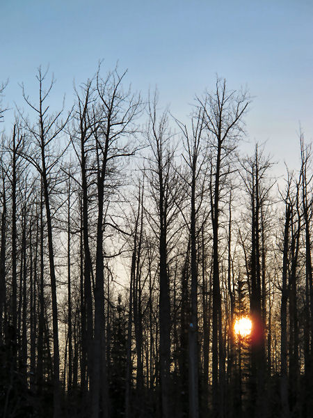
2/12:
Cottonwood sunrise at 15 degrees below zero. |
A river otter had
found salmon remains in the river and brought them here to munch
on them. |
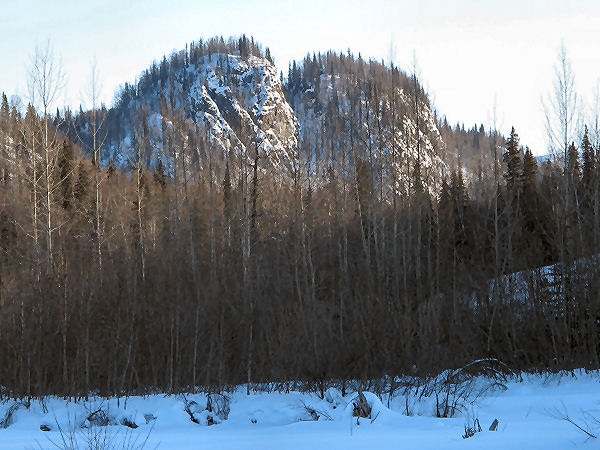
Just above the
Talkeetna River confluence with the Sheep River are these neat
looking granite intrusions. |
Heading back.
-5 F, wind at my back, sun in my face. |
|
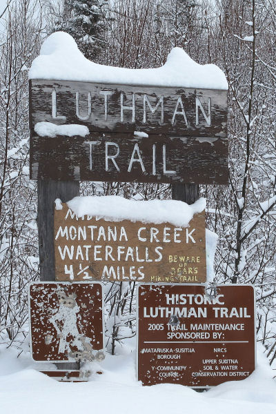
Luthman
Trail to Montana Creek Falls |
| February 10,
2011:
Until a month ago I had never heard of the Luthman Trail.
A little research showed that it was a popular hiking trail with
the Talkeetna locals, and the trail's destination was a cool
waterfall in an area that you would not think had large
waterfalls. I figured this trail would be a good candidate
for a winter trip with my wife. With fresh snowfall and
knowing we'd be following a creek, we decided to do a
combination snowshoe and ski. By snowshoeing in we made a
good trail for skiing out, and packed in some detours around wet
spots. We could tell that several days before we went a
couple of very determined snowmobilers fought their way up this
route to within a quarter mile of the falls. Without their
trail this trip to the falls would have been a very long and
slow slog through deep snow. |
 |
 |
 |
 |
 |
|
GPS track, 9 miles
RT. |
Trailhead on Yoder
Road. |
Snowshoeing in. |
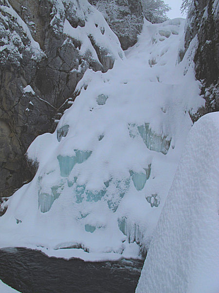
Approaching the
falls. |
The falls, frozen. |
 |
 |
 |
 |
 |
|
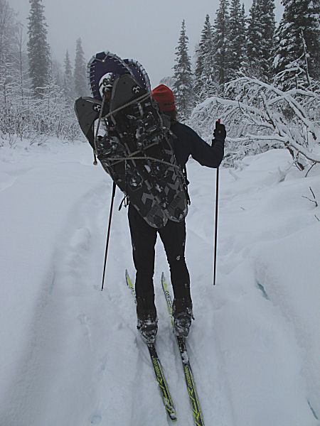
Heading down from
the falls. |
The slave husband
carries the skis in, snowshoes out. |
Skiing out. |
My wife deals with a
crumbling snow bridge. |
| |
 |
 |
 |
|
| |
Rock dancing. |
Arriving back at the
trailhead, which is next to the Montana Creek bridge. |
An
Aquatic Restoration and Research Institute photo of the
falls in summer. |
|
|
|
|
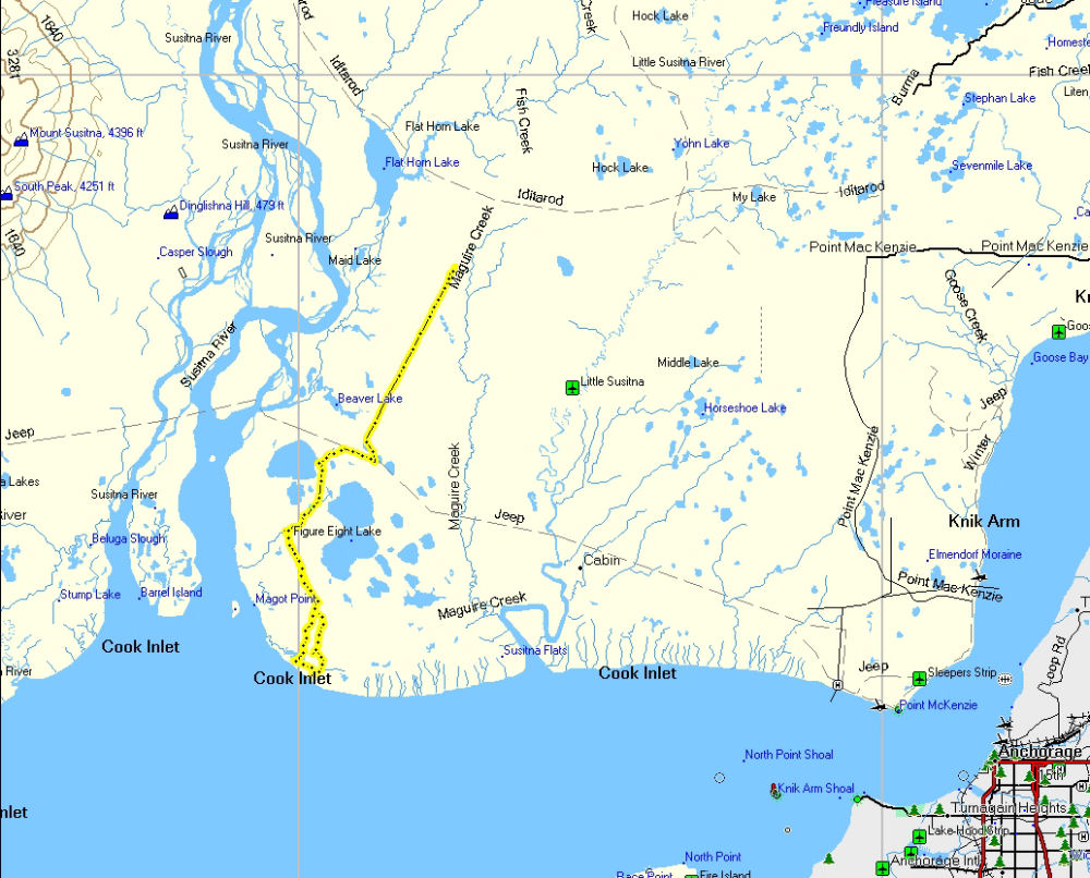
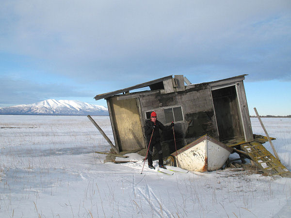
A Ski To My Wife's Past |
 |
|
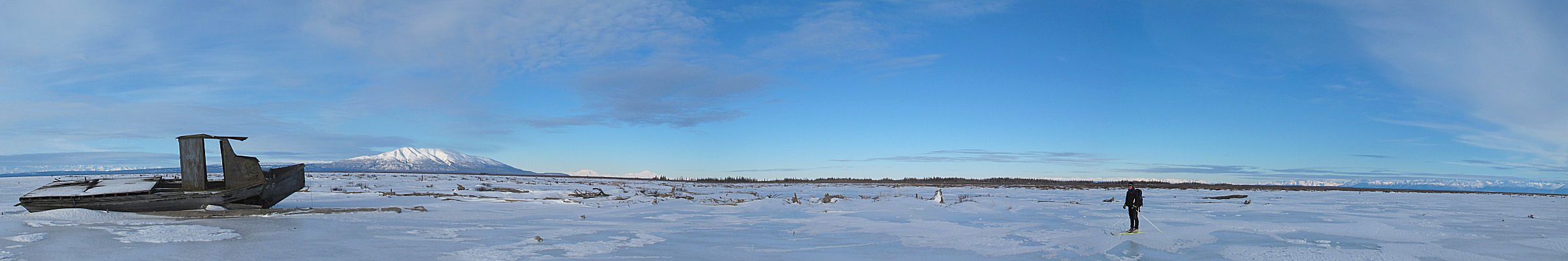
February 6,
2011:
When my wife was in her early teens she would work at her
family's commercial setnet fishing camp near the mouth of the
Big Susitna River. She would get flown out to this remote
location in her father's Super Cub and would spend the fishing
season wrestling salmon out of gill nets, pulling nets against
the Cook Inlet tides, pushing setnet skiffs off mud bars and
living at her family's remote fish camp. I had wondered
where this fish camp was. And it had been 40 years since
my wife had been there. So I suggested that we try to find
the old family fish camp ... on skis of course. We
snowmobiled to the Figure Eight Lake trail and then skied south
onto the Susitna coastal flats. We lucked out and were
able to find the old fish camp. Here are some pictures
from this ski trip ... |
 |
 |
 |
 |
 |
|
GPS track of our
route, 28 miles. |
Skis strapped to her
snowmobile ... she's ready to go! (as always) |
The start of this
ski trek involved following some obscure, long and non-descript
old seismic testing cut lines that were made a long time ago. |
Eventually we hit
the sweet zone ... winter crust we could skate fast on. |
 |
 |
 |
 |
 |
| |
Tracks of a wolf
pack. |
|
On an isolated,
treed moraine we stopped to get out of the wind and wax up for
skiing the brush zone to the coast. |
 |
 |
 |
 |
 |
|
Leaving the "tree
island" and heading south to the coast. |
The brush zone
looked endless and forbidding for skiing. But a mosaic of
moose trails made for easy travelling. |
At the high tide
mark we visited an old boat that my wife's father said was once
owned by Joe Redington Sr., founder of the Iditarod Sled Dog
Race. |
 |
 |
 |
 |
 |
|
We skied by this
classic setnetter abode. This house built (in the 50's) on
top of a skiff was where a Swiss couple named Joe and Lottie
Cameron lived when they were out here working the fishing
season. |
My wife's family's
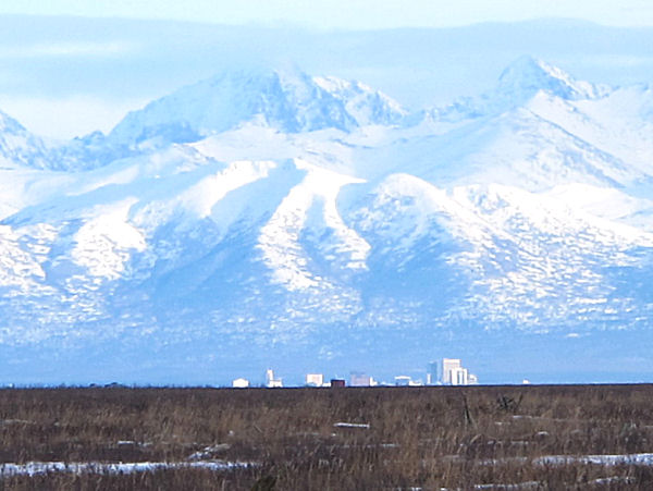
old fish camp. |
A view of Anchorage
in the distance. |
My wife leaving the
fish camp behind. |
 |
 |
 |
 |
 |
|
Tough physical work
as a kid, like working at fish camps, often makes for tough
adults ... as would be the case with this girl. |
Everyone has heard
chipmunks sing, like in Disney movies. It is a little
known fact that beavers sing too. This is where a very
famous singing beaver lives. It's the house of Justin
Beaver! |
|
Saddling up after a
good day of skiing to places we'd never skied to before. |
Nice Susitna sunset
to end the day. |
 |
|
|
|
100 Miles of Caribou Hills |
|
January 29-30, 2011:
This weekend I skied the 100 mile route that is used for the
Tustumena 200 Sled Dog Race (the T-200) . I did this as an
overnight campout trip. This is actually the 2nd time I have skied
this sled dog race course in the Caribou Hills area of the Kenai
Peninsula, my first time was in 2004. Since I skied this course in
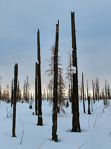
2004 a lot has changed. In 2007 there was a
massive
forest fire here. It was unbelievable to ski a bleak landscape
where trails, like the "5000 Road", once cut through dense timber.
So now that I have skied this 100 mile trail in both directions I can
arguably say I've done the T-200. The catch is, I set the record
for slowest time ever for the T-200 ... 7 years!! |
 |
 |
 |
 |
 |
|
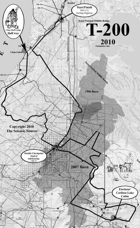
This is
approximately the course of the 2011 T-200. My GPS said
the route was 104 miles. |
Sled dog racing
trails are usually well marked by wooden lathes with reflective
tape. |
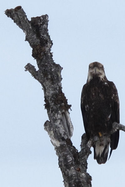
Near the start I
skied underneath a HUGE eagle. |
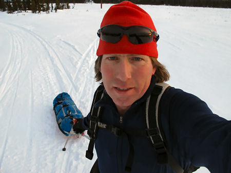
This shows my travel
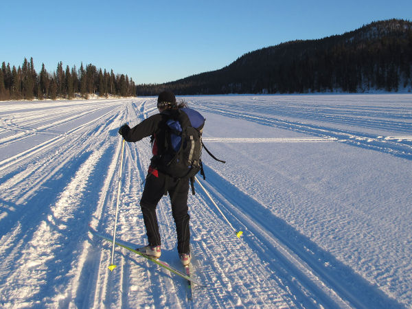
mode: a small Camelback pack and overnight gear in a sled. |
Working my way up
old oil and gas exploration seismic cut lines. The Caribou
Hills are crisscrossed with these. |
 |
 |
 |
 |
 |
|
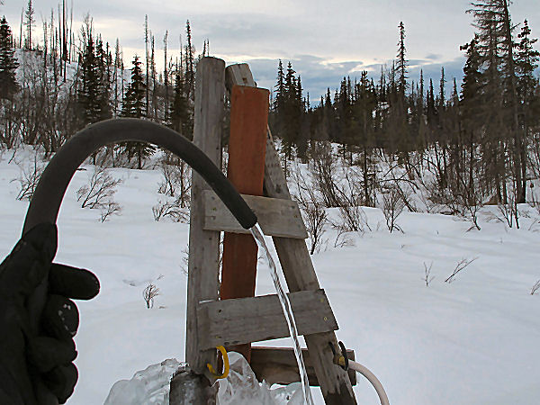
Up higher I came
across a spring cabin owners had tapped for a community
waterhole. |
At the first
checkpoint on Caribou Hills the T-200 mushers had gone by.
But the T-100 mushers were passing. Cook Inlet in the
distance. |
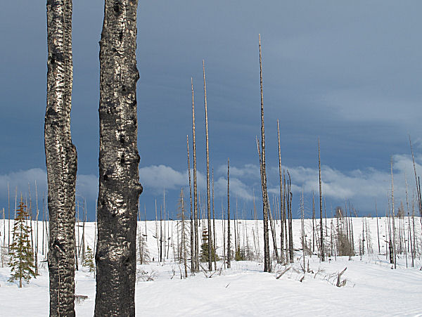
Signs of the massive
2007 forest fire that burned a big chunk of the Caribou Hills
area. |
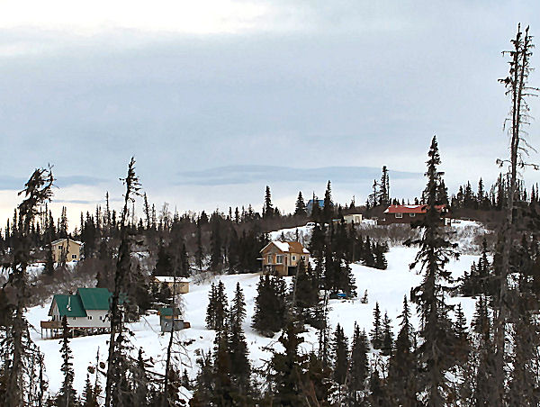
Near the top of the
Caribou Hills there are lots of private parcels, and lots of
cabins. |
A T-100 racer chases
another musher up on a seismic line cut on the Caribou Hills.
|
 |
 |
 |
 |
|
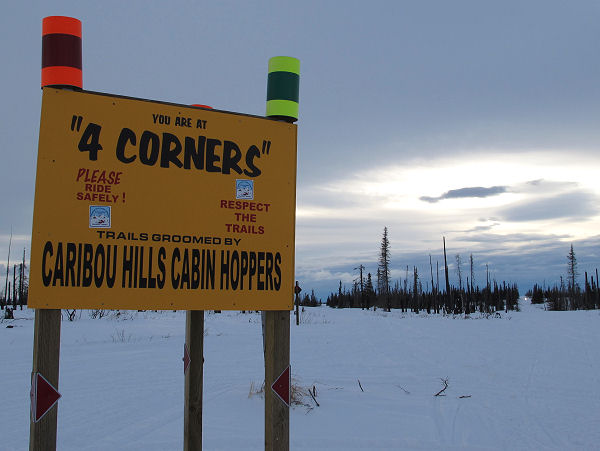
The
Caribou Hills Cabin Hoppers
snowmobile club grooms many of the trails in this area. |
The 1996 and 2007
forest fires in this area made for some desolate cabin sites,
with great views. |
When I see dangers
in the trail, like this sinkhole, I take the time to mark them
to alert mushers. |
A couple of T-100
mushers slowly climb through burned forest up one of the many
climbs in the Caribou Hills. The T-200 is the hilliest of
all the Iditarod qualifier races. By far. |
 |
 |
 |
 |
 |
|
I skied past Caribou
Lake in the dark, with a stop to chat with the T-100 mushers who
had a big bonfire on the lake, and set up camp for the night. I did 60
miles the first day. |
Breakfast before
dawn. My usual - a slurry of instant oatmeal and hot
chocolate with bagel. Quick and easy hydration and
calories. |
It's often easy to
see where you came from and where you are going on these trails.
Lots of straight shot seismic runs. |
A stark, post
apocalypse landscape at dawn. |
 |
 |
 |
 |
 |
|
Runway model turned
musher
Zoya DeNure of Paxon. Note the ski pole. Mushers
often kick and pole like xc skiers. |
|
T-200 racer
Kristy Berington of Kasilof. |
Crossed trail
markers mean ... watch out! Steep hills, overflow or rough
trail ahead. |
OK, I can see where
I will be going. A seismic line leads towards Tustumena
Lake. |
| |
 |
 |
 |
|
| |
Skiing through bleak
terrain on the way down from the Caribou Hills towards Clam
Gulch. |
Dee Dee Jonrowe and her team blows by me on their way to the
T-200 win. A 57 year old car crash and cancer survivor,
Dee Dee is a tough lady. |
|
|
|
|
Patrick's Kodiak
Crust |
|
Mid January 2011:
It seems like a skier worthy of envy in Alaska is Patrick
Saltonstall. Patrick has his own private island where crust skiing
can occur at any time during winter. The island is Kodiak Island
and it is private because he is often the only skier, or one of very few
skiers, out cruising Kodiak crust snow. Recently he met up with
long time ski racer Brian Glaspell and they both got some Kodiak
mountain skate skiing in. Here's a
short video that Patrick made to show what it's like. Check
out Patrick's YouTube
channel - he's a good skier and has videos of many of his Kodiak
ski-ventures.
 |
 |
 |
|
Patrick's back yard. |
Patrick, crust snow
and sun ... in early January! |
Brian Glaspell skiing Kodiak in January. |
|
Above photos from
Patrick Saltonstall's
blog. |
|
|
|
Talkeetna - Larson Lake |
 |
|
Mid January 2011:
For many years I have heard of and read about Larson Lake east
of Talkeetna. Looking at maps it seemed like Larson Lake would be
a cool place to ski to. I couldn't find any information on trails
to this lake, so I went up to Talkeetna with my wife and we started
wandering trails in the general direction of the lake until we found a
way to it. Most maps don't show recent roads east of Talkeetna or
even the Intertie (power line). There are a lot of cool mushing
and snowmobile trails to ski east of Talkeetna. And a fun way to
learn these trails is to just head out and ski-explore them. |
 |
 |
 |
 |
 |
|
"X" marks Larson Lake east
of Talkeetna. |
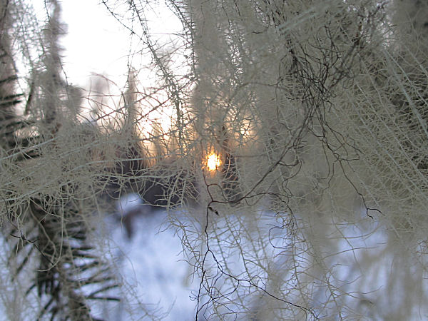
Skiing into the sunrise. |
I'm always ready with my
camera to document "wife crashes". But they rarely happen. |
The Intertie - backbone to
many feeder mushing and snowmobile trails. |
My wife arriving at the
south end of Larson Lake. |
|
|
 |
 |
 |
|
|
|
Looked like a coyote had dug
up a salmon jawbone. |
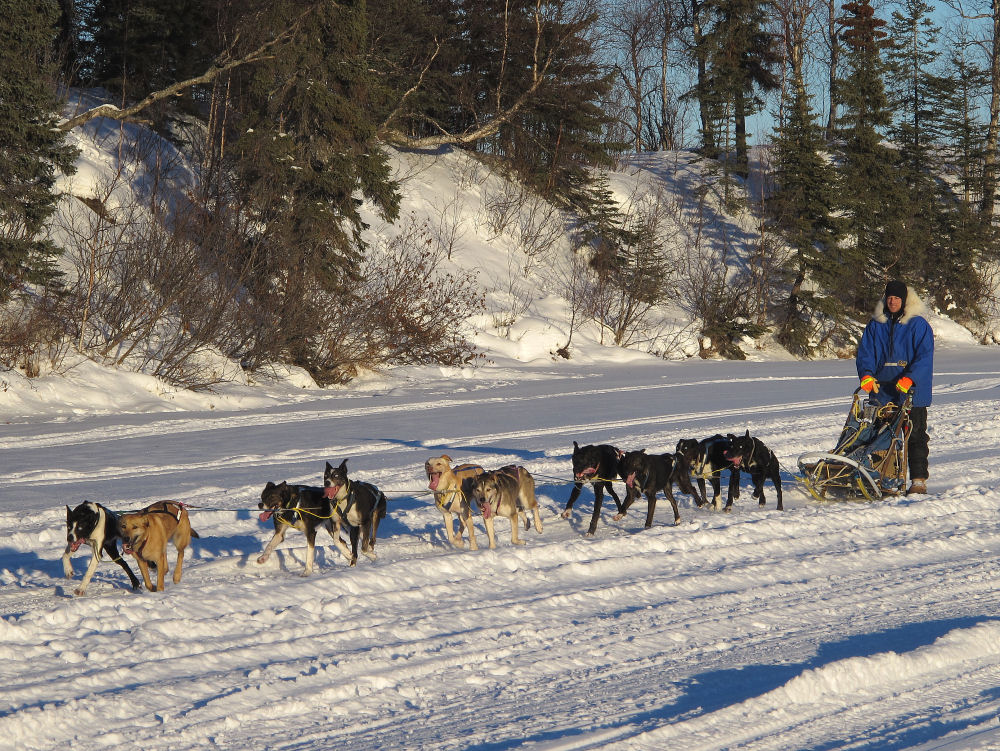
Nils Hahn and his great
looking dog team on Larson Lake. |
Ha ha ... now give me my
camera back please. |
|
 |
 |
 |
 |
 |
|
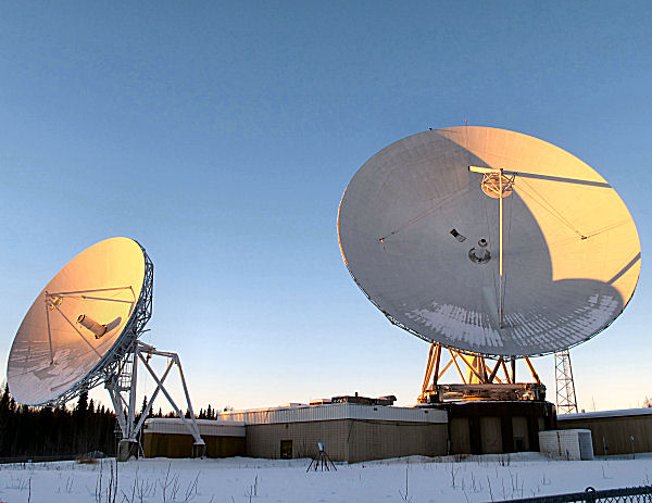
The abandoned Bartlett Earth
Station (1970's era satellite communications station). |
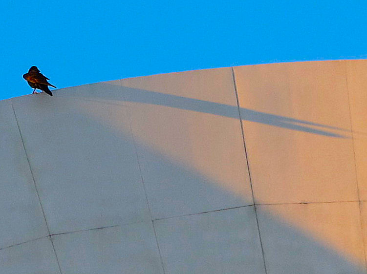
A raven admiring its shadow. |
Land of sphagnum moss and
glacial moraines. |
 |
 |
 |
 |
 |
|
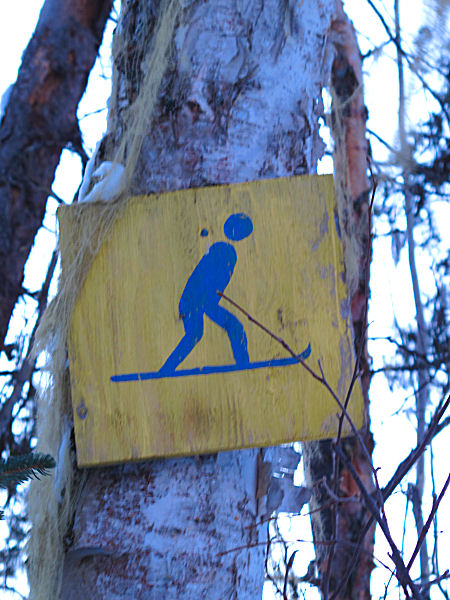
I knew Talkeetna was a
friendly place. But they even let snowboarders on their ski
trails?! |
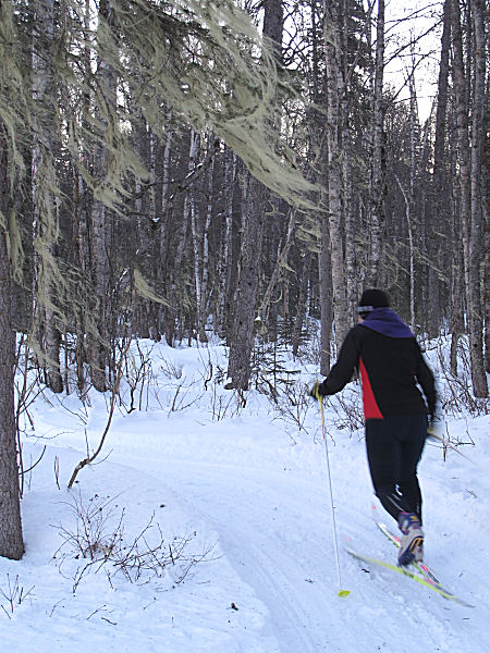
The Ridge Trail. Very
nice. |
STEEEEEEP !! |
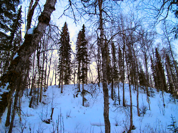
Nice skiing on tops of
moraines. |
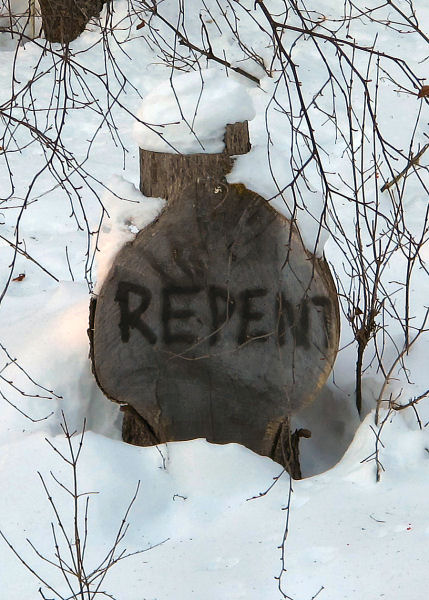
"REPENT ye skiers that never
leave thy groomed xc ski trails, or thou shalt never know thy true
Alaska!" ;-) |
|
|
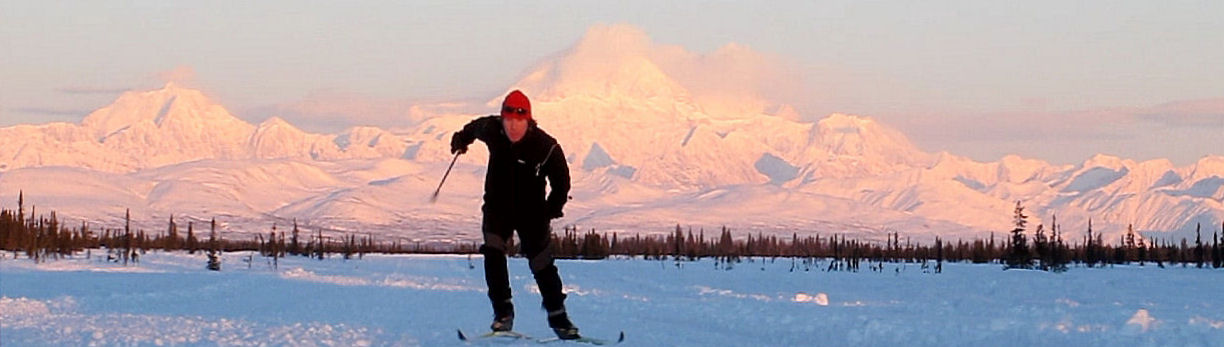
Curry Ridge Riders Trails - West Loop |
 |
|
January 7, 2011:
There were a few trails on the west side of the
Curry Ridge Riders
snowmobile club's great
groomed trail system in Petersville and Trapper Creek that I had not
skied. So I went and did a loop to check them out. This area
did not get hit as hard as Anchorage with the meltdown that came through
the week before. So it was good combi-skiing - skating the flats
and downs, striding the uphills. I chose a non-weekend day to do
this ski loop to minimize the number of snowmobile encounters. I
only saw about 10 snowmobilers. I had been sick for a while, so it
felt really good to be out skiing backcountry trails again. |
 |
 |
 |
 |
 |
|
Route, approx. 30 miles. |
Black spruce sunrise. |
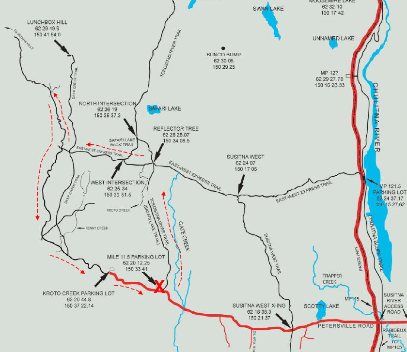
Safari Lake Trail |
Chunky at the start.
Better closer to the Peters Hills. |
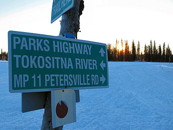
Lots of trail signage, it
would be hard to get lost here. |
 |
 |
 |
 |
 |
|
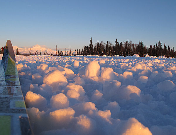
3 feet of snow. Not
that much for the Petersville area. |
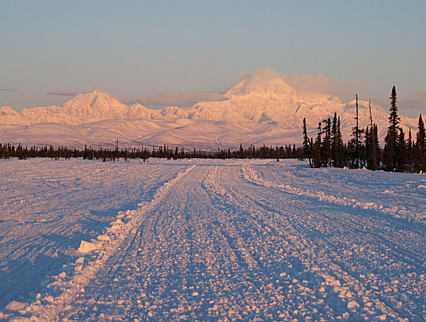
Nice conditions on the
East-West Trail heading to the Petersville Road. |
Low and blinding sun on the
Petersville Road. It's that time of year. |
The Forks Roadhouse |
Forks Roadhouse guard dog. |
 |
 |
 |
 |
 |
|
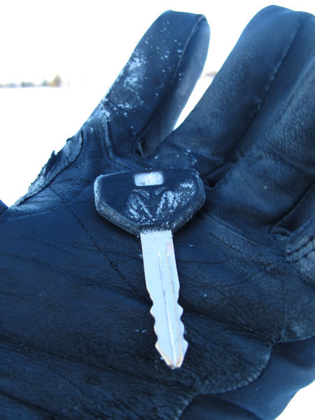
I found this Dodge key out
on the trail. Someone dropped it. Bummer. I left it at
Gate Creek Cabins. |
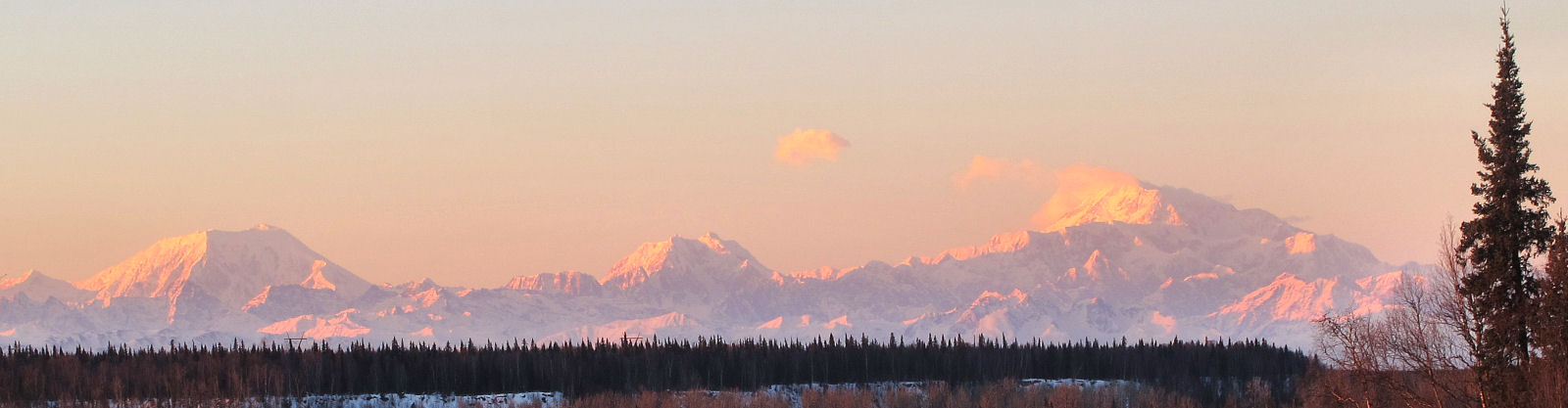
Mt. McKinley turned
cloud-free later in the day. Was a little chilly here, just south
of zero F. On clear days this area is usually 20 degrees colder
than Anchorage. |
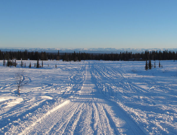
Good cruising on the
Petersville Road. |
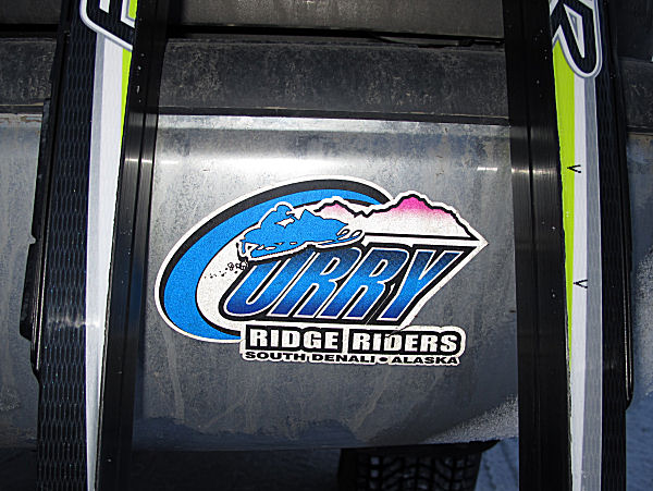
I'm a member of the Curry
Ridge Riders snowmobile club. I've actually never snowmobiled on
CRR trails. But I love to ski on them. |
I finally checked out Wal-Mikes
in Trapper Creek. Wow. Not many stores like this place!
Put it on your list to check it out. |
|
|
|