|
|
|
|
Home |
|
Intro |
Gear |
About |
Ski Trips: |
2024 |
23 |
22 |
21 |
20 |
19 |
18 |
17 |
16 |
15 |
14 |
13 |
12 |
11 |
10 |
09 |
08 |
07 |
06 |
05 |
04 |
UBXC |
Apps |
eBook |
|
2010/2011
by: Tim Kelley
|
|
|
|
|
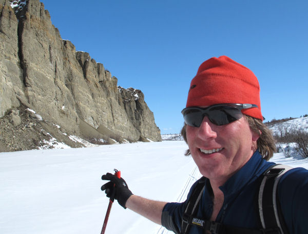
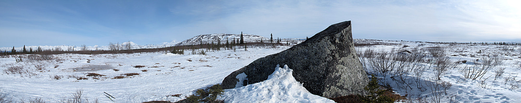
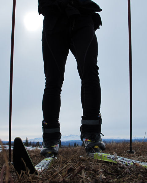
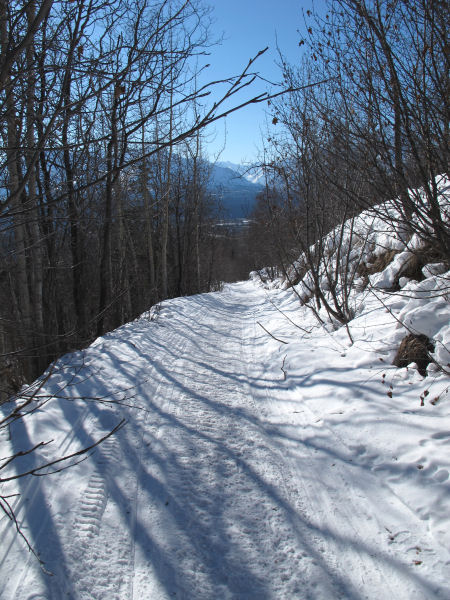
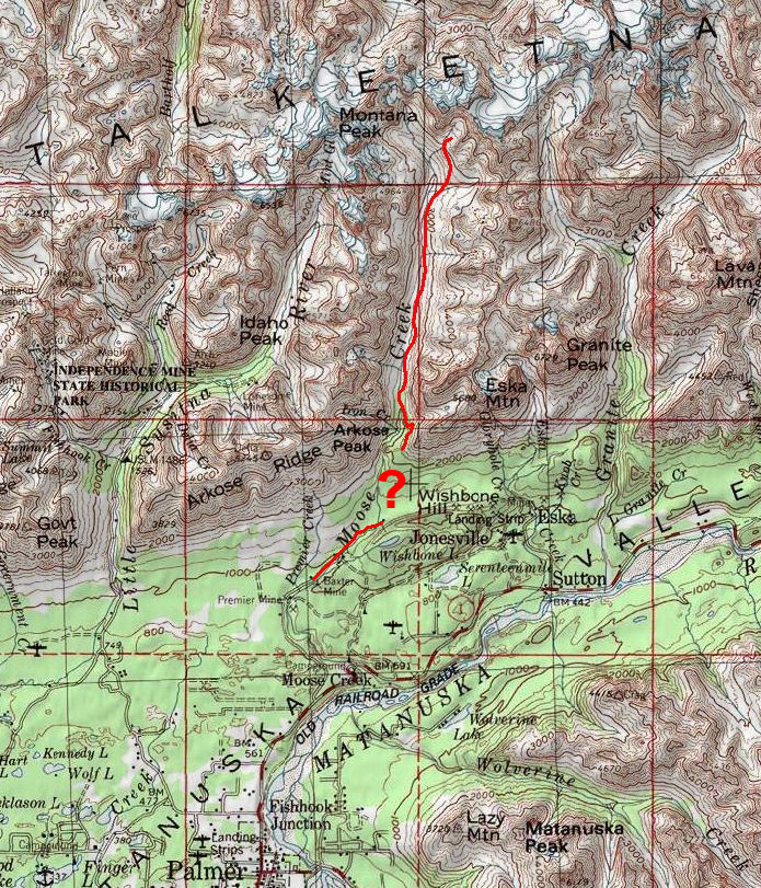
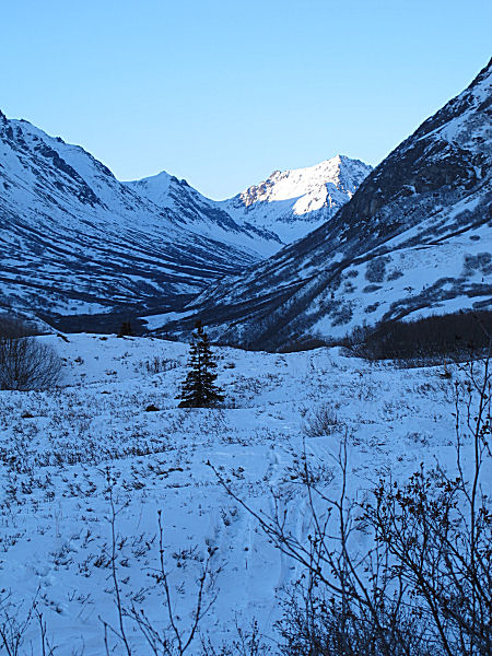
Skiing Out To
Pasture, And Back |
| April
15, 2011: I have long
heard of people snowmobiling to Horsepasture Pass north of
Eureka Summit. I had skied a lot around Eureka in the
past, but I had never made it over Monument Ridge and up the
Little Nelchina River to the Horsepasture Pass area. So
that became my goal for this ski trip. The last vestiges of
winter skiing conditions were holding on here - newish powder on
top of granularized snow. These snow conditions made for good
skate skiing on snowmobile trails. The amount of snowmobile
trails and routes in this eastern area of the Talkeena Mountains, and
to the north
of the Eureka Summit area, is
mind-boggling. Even by using a snowmobile it could take
years to explore all the trails in this area of Alaska.
This link
shows a map with a few of the trails in the Eureka area. |
 |
 |
 |
 |
 |
|
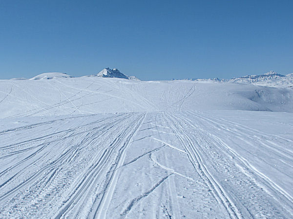
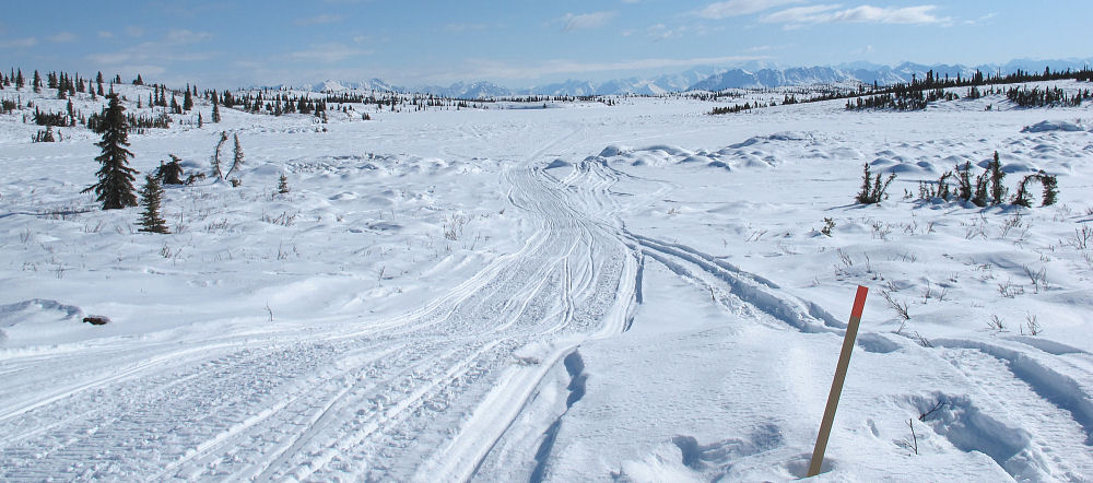
GPS track: 63 miles. |
No clouds, little
wind, cool temps ... this is gonna be a nice day. |
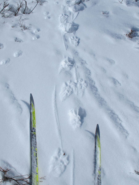
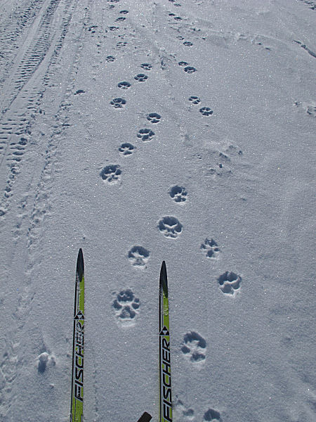
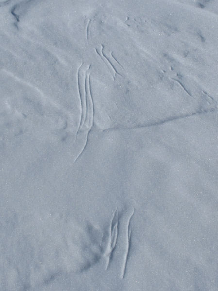
Furry footed lynx
tracks. |
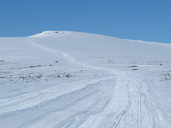
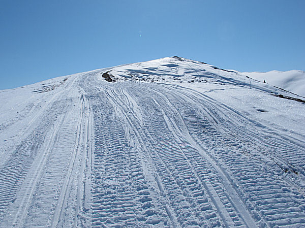
"Four corners".
Trail to top of Monument Ridge can be seen in the distance. |
Nearing the top of
Monument Ridge. |
 |
|
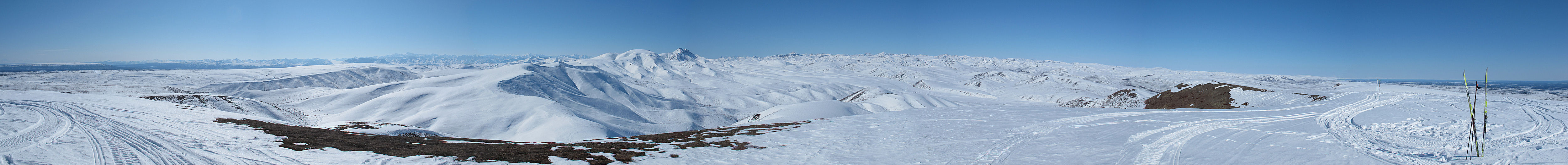
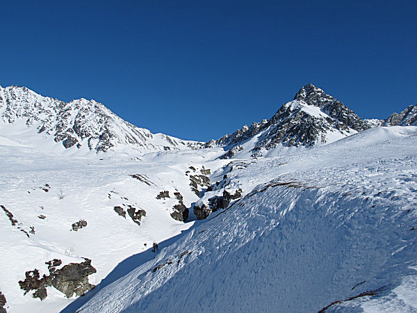
View from on top of
Monument Ridge. |
 |
 |
 |
 |
 |
|
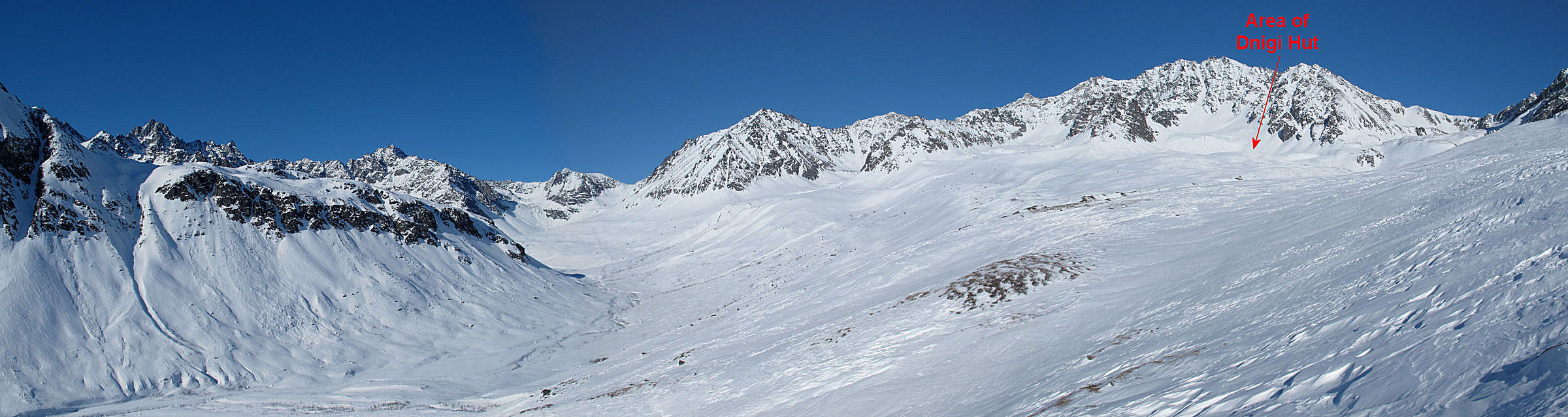
Red arrow points to
approximately where I'm heading - Horsepasture Pass. |
Nice skiing on top
of the ridges. |
Going off the back
(north) side of Monument Ridge you shed a lot of vertical in a
hurry. |
Little Nelchina
River valley. |
 |
 |
 |
 |
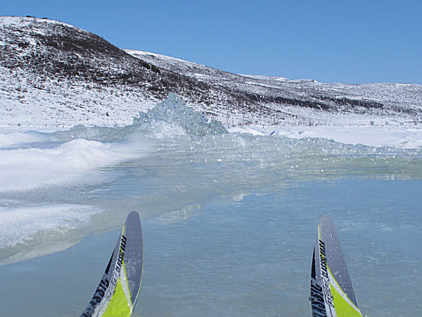
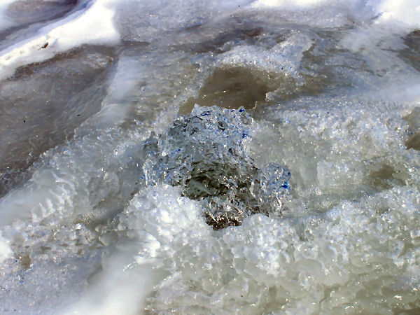
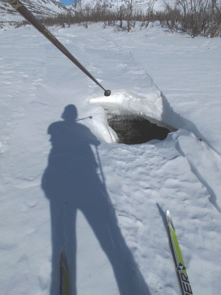
| This
"geyser" was the coolest thing I saw on the upper part
of the Little Nelchina River. Water pressure had
built up under the ice and a gushing and gurlgling water
spout had formed to relieve the pressure. I'm
pretty sure this was a miraculous appearance of a
"fountain of youth"! I drank some of this water
and immediately felt younger. Instead of feeling
like I was 54 ... I felt like I was maybe 52 again!
Amazing!! ;-) |
|
 |
|
Willow branches
chewed-up by a porcupine. |
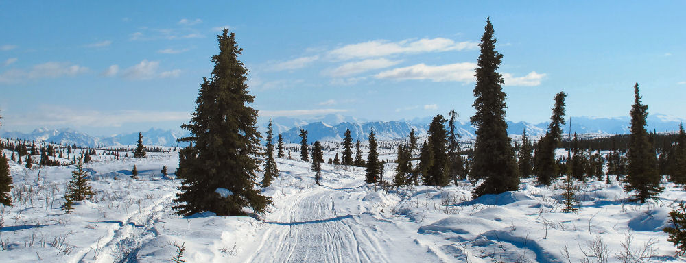
The upper Nelchina
River Valley is beautiful, but not the most exciting skiing. |
 |
 |
 |
|
Lower down on the
Little Nelchina River there was this striking bluff. There
was nothing else like this in the area, so this feature really
stood out. |
 |
 |
 |
|
On a few sections of
the "Outer Loop" trail there were places where miners hauling
equipment with tracked vehicles had trashed the trails.
But this was minimal. For the most part the snowmobile
trails here make for beautiful and great spring skiing. |
|
|
|
A Portage Pass
Picture Quiz |
|
Mid April
2011: The two pictures
below weren't taken at exactly the same spot at Portage Pass.
But they are close enough for this crust skiing picture quiz.
And the quiz question is ... what is different between the 2010
picture on the left and the 2011 picture on the right? The
answer is below (but look at the pictures first before you cheat
and jump to the answer!) |
 |
 |
| Portage
Pass - 2010 |
Portage
Pass - 2011 |
|
 |
 |
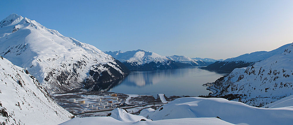
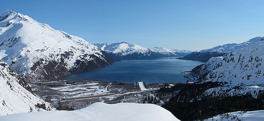
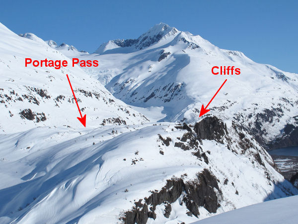
| For
people that have never skied to Portage Pass and wonder
what the ski route is like, this picture pretty much
shows the whole route. You start at the far end of
Portage Lake and then ski to the red arrow. |
Portage Pass
is a fun and safe ski destination. But skiers
should be aware that to the south of the pass there are
big cliffs that would hurt to fall off. |
|
|
Answer:
The main differences between the two pictures are the old fuel
tanks showing in the 2010 picture, and no tanks showing in
the 2011 photo. During World War II the military built
fuel storage tanks here and they were connected by a 50 mile
pipeline to Anchorage's Fort Richardson Army base and the
Elmendorf Air Force base. The fuel tanks were put here
because Whittier is a deep water port, and Anchorage was not.
So it was easier for tanker ships to offload here. Also,
with the fuel tanks being in persistently cloudy Whittier the
Army figured it would be tougher for Japanese fighter planes to find them
and bomb them. For around 65 years these tanks were
standing here until they were dismantled this last year. |
 |
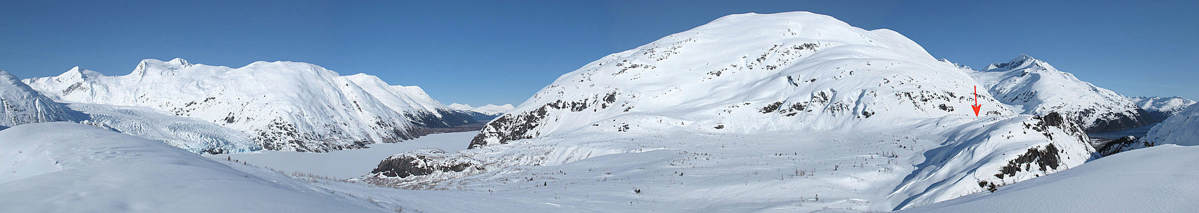
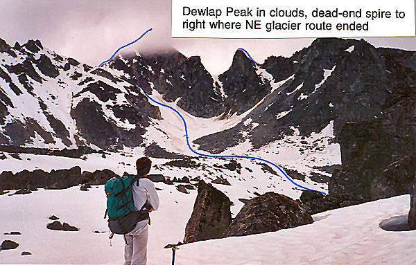
Blast From The Past
- Learnard Glacier NE of Portage Pass
The glacier you can see as you look
northeast from Portage Pass, and up past the tank farm site,
is Learnard Glacier. This view from Portage Pass
once enticed some xc skiers (Bill Spencer and me in
2000) to go climb the peaks that rim this glacier (some
pictures from that trip
here.) |
 |
|
|
|
|
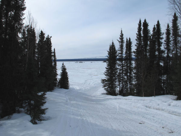
A 2nd Stop For
Portage Crust Skiers |
 |
 |
| Mid April
2011: If you crust ski
at Portage Lake ... |
... you might want to stop in
Girdwood on your way back and check out the brand new xc trails,
north of the main lodge. They are not complete yet, but 3
kilometers are groomed for out and back skiing. Shade from
the trees slows the snow from going soft, so it will likely be
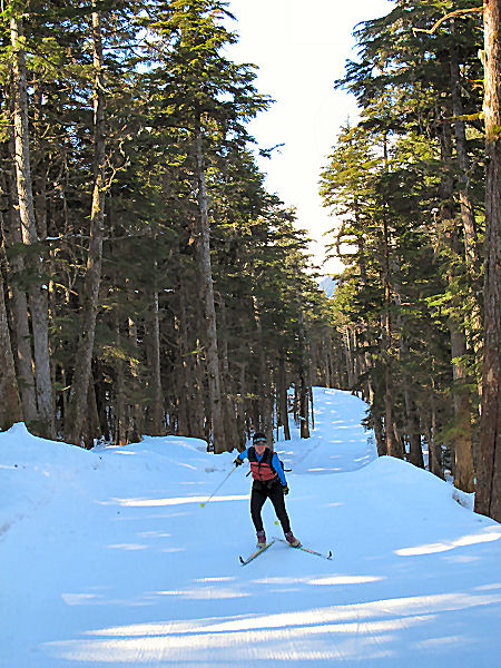
good skiing here after you ski Portage. |
|
|
|
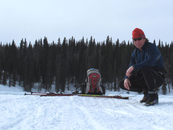
Kenai Krust Kruiser
- Dante Petri |
Early April 2011:
You'd think that near-record low snow depths for this time of
year would curtail skiers from knocking out new crust skiing
routes. But lack of snow is no factor to Dante Petri and
his crust skiing pals on the Kenai Peninsula.
Recently Dante and crew got some new ski routes in that I've
never seen done. Check it out
here.
Dante spends a lot of time in the backcountry cruising on most
anything that slides - skiiny skis, fat skis and snowboards.
And he does a great job of photo-documenting his outdoor
ventures on his blog: "A
Trail Called Life." The fact that Dante writes for a
living also shows in his blog ... it's well written stuff. One of my favorites from his blog is last
year's
July ski descent of Mount Ascension above Lost Lake.
I found out this year that Dante grew up in the same small town in Vermont that I grew up
in ... so he's a cool dude in my book! |
|
 |
|
Photo of Dante, from
Dante's blog. |
|
|
|
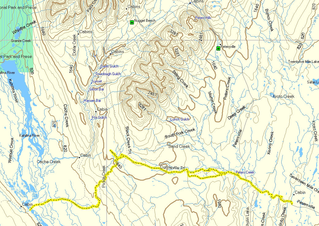
Collinsville Trail
to the Kahiltna River and Back |
| Late March
2011:
I had not skied much to the west of the Forks Roadhouse and the
Peters Hills. So I decided to check out the Collinsville
Trail. I skied out 27 miles to the west bank of the
Kahiltna River, and then skied back. This was a neat area
with trails that skate ski well. I need to go back and
ski-explore trails that go west beyond the Kahiltna. |
 |
 |
 |
 |
 |
|
GPS track: 54 miles
RT. |
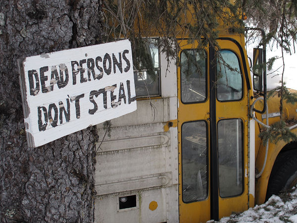
This
is not THE bus. The "Into The Wild" bus is up north near
Healy on the Stampede Trail. So I guess this is a WANNABE
bus. The sign may be grammatically challenged, but it is
pretty damn funny! |
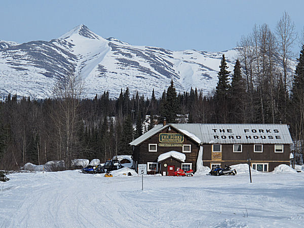
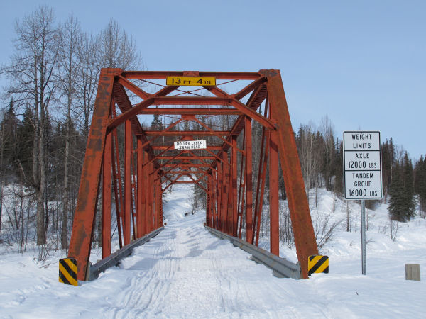
Going straight past
the Forks Roadhouse ... |
... and across the
iron bridge over Peters Creek. |
 |
 |
 |
|
The Curry Ridge
Riders did some test grooming west of the Forks Roadhouse.
If they have the money next year they will regularly groom this
area. |
On the Peters Hills
plateau the Collinsville Trail turns to descend to the Kahiltna
River at this glacial erratic. |
A wolf's "pee tree". |
 |
 |
 |
 |
 |
|
Usually this area
would have 4 or more feet of snow this time of year. But
not this year. There was not much of this tundra skiing.
But skiing downhill on smooth tundra is kinda fun. |
I really liked the
trail that descended to the Kahiltna River. Very skiable.
But it was a grunt coming back up. |
The trail abruptly
dumps you onto the Kahiltna River flood plain. |
Near the west bank
of the Kahiltna River. A nice day ... in "A" "K". |
 |
 |
 |
 |
 |
|
In the distance,
above the brush, you can see the Kahiltna Glacier. |
On the Kahiltna
River flood plain there were wolf tracks everywhere. And
so were signs of what they had been eating - moose. |
I'm always picking
up stuff people drop on snowmobile trails. This Polaris
windshield fastener (r) will come in handy. |
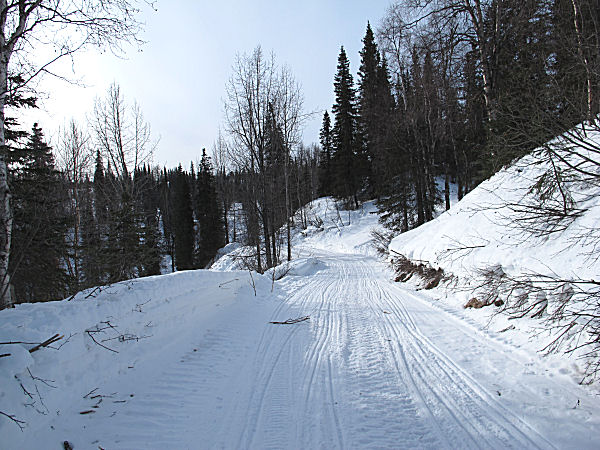
Buffed out trail
heading back to the Forks Roadhouse. |
| |
|
 |
|
|
| |
I
started out this picture series with death-related pictures.
So I will end it with another death-related picture, only this
one is real. The picture above shows the site where two
snowmobilers, a man and a woman in their early 20's,
were killed on the Petersville Road. This site was a
mile from the start/finish of this ski trip. The
snowmobile flew off the road here and crashed into these trees.
Troopers say that alcohol was a factor in these deaths. |
|
| |
|
|
|
|
|
Update:
Early April 2011:
My wife and I went back on this route 5 days later. Our
intent was to use a snowmobile to go west of the Kahiltna River
and set up a base where we could ski-explore trails for a
couple/ few days. But when we go to the Kahiltna River there was newly-formed deep overflow on
the river and we doubted we could safely get across by skis or
snowmobile, especially in the days to come given the warm
temps. We didn't want to get trapped on the west side of
the Kahiltna, so we played it cautious and turned back. Oh
well, looks like I'll have to try again next year. And
hopefully next year will be a better snow year in Southcentral
Alaska than this year was. |
 |
 |
 |
|
|
|
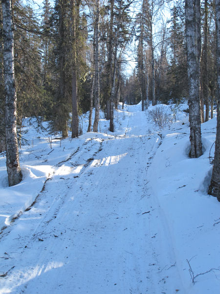
Hicks Creek Trail
in the Talkeetna Mountains |
|
|
|
|
Skiing Talkeetna's
Bald Mountain |
| March 13,
2011:
I had heard of snowmobilers going up Bald Mountain to the east
of Talkeetna. So for quite a while this had been a place I
wanted to ski to and check out. Though the snow conditions
were nothing to brag about, this was a scenic and fun ski to a
place I'd never been to before. This winter I wanted to
become less ignorant of the trails to the east of Talkeetna.
After 4 trips this winter to this area I now know a lot more
about the trails of this locale. But there is still a lot
more for me to learn. |
 |
|
The scenery was
pretty much the same this whole trip. It was kinda OK.
I guess. ;-) |
 |
 |
 |
 |
 |
|
Location of Bald
Mountain east of Talkeetna. |
A steep section line
trail led up to the high country. |
Snowmobile tracks
heading for Bald Mountain. |
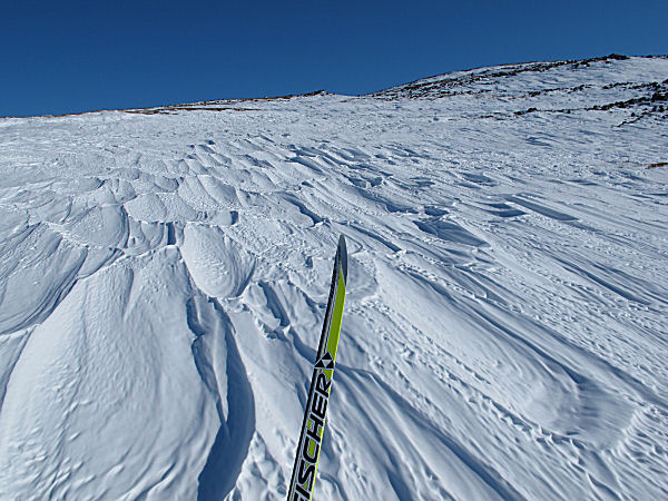
Thanks to 3 weeks of
strong winds - lots of sastrugi and wind-skank snow. |
 |
 |
|
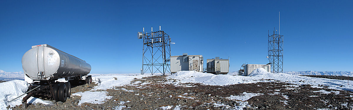
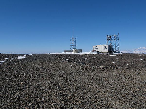
Communication
station stuff on top of Bald Mountain. |
View from on top of
Bald Mountain. |
 |
 |
 |
 |
|
Airstrip on top of
Bald Mountain. |
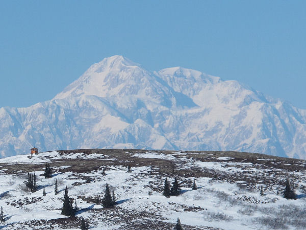
Cold on top.
Last look before heading down. |
On a distant ridge I
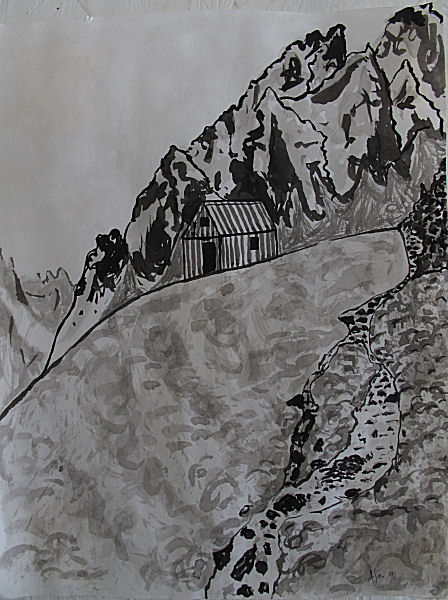
was surprised to see a cabin (on ridge to the left) |
I had to make a
detour to check it out. This private shelter cabin has an
unencumbered 360 degree view. It's likely the best view
from a cabin I've ever seen in Alaska. For the 360 view
click
here. |
|
|
|
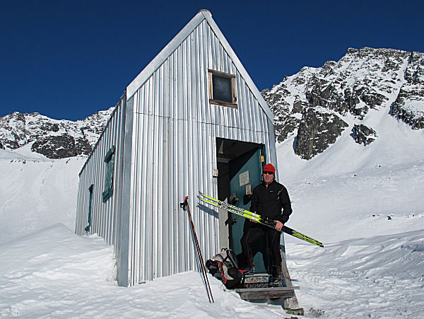
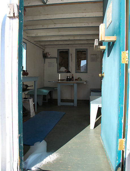
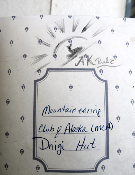
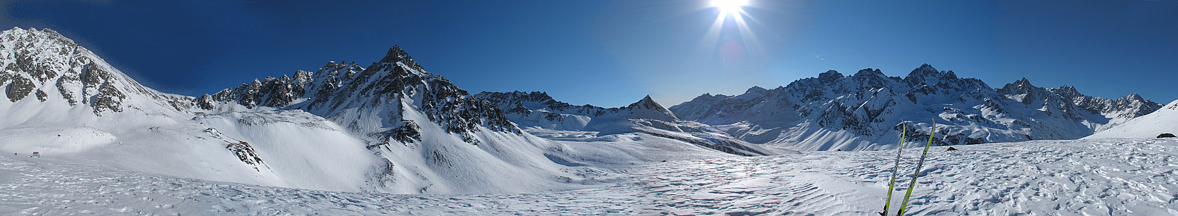
Dnigi Hut, Finally |
|
|
|
|
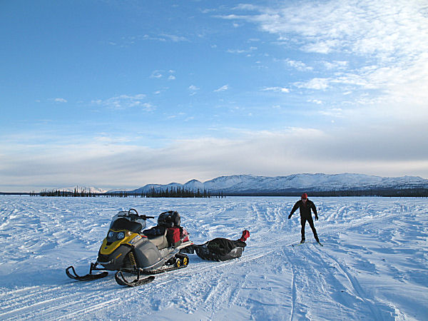
140 Mile Sno
Go-Skiing Loop |
Early March
2011:
One way to check out new country and get some skiing in is to
head off riding double on a snowmobile, and then take turns skiing sections of a
loop. Recently a planned ski trip didn't pan out so my
wife and I grabbed our snowmobile and took off from Alexander
Creek to the Talachuitna River, down the Swentna River to the
Yentna River and then back to Alexander Creek. This was a
140 mile loop done in a day. On sections such as Alexander
Lake to the Talachuitna , the Tal Vista Lodge Trail to Swentna,
the Skwentna River and upper Yentna River
we took turns getting in some skiing. This
is a fun way to cover a lot of ground, see new country and to
ski some new trails.
My camera is on its way back from repairs at Canon. And
our backup camera had battery issues. So ... not many
pictures this trip.
On another ski trip recently
I incorporated a stop at “Scary Tree” at the confluence of the
Yentna and Big Susitna Rivers to watch the passing of the
Iditarod mushers. What a spectacle. Not the mushers, but all
the people. Thousands of spectators on snowmobiles, grouped
around endless bonfires – laughing, cheering, eating hotdogs and
drinking. Overhead: an unbelievable amount of helicopters,
small planes, ultra-lights and even powered paragliders buzzing
back and forth. As the mushers passed there were several
instances of dog teams veering into the crowds as the lead dogs
bee-lined towards tables piled with hot dogs. It was one crazy,
huge party. Only in Alaska! It was fun to witness this madness
with my neighbors from Alexander Creek.
One last note: I lost track
of the number of times in the above two ski treks that I was
buzzed by small planes. It seems like there is a law in
Alaska that if you own a Super Cub you have to fly 10 feet over
the head of any skier you see on remote trails. Super Cubs
are the "Mosquitos of the Iditarod". When it's Iditarod
time they are swarming all over the place. It's pretty
entertaining when these planes buzz over you ... just as long
as you don't get a haircut by a propeller! |
 |
 |
 |
 |
|
Skiing the Tal Vista
Lodge trail west of Swentna. Beluga Mountain is in the
background and way to the south is Mt. Susitna. |
A nice section of
the Tal Vista Lodge Trail on the Swentna River. Note the
groomed trail. This is about 120 miles from the nearest
road system trailhead. |
My wife skis past
Joe and Norma Delia's cabin at Skwentna. After running the
Skwentna Iditarod checkpoint out of their home for 39 years, the
Delias are selling their place and moving to the road system. |
Luce's Lodge is
always a magnet for Yentna River travelers that are feeling
hungry. |
|
|
|
|
|


