|
|
|
|
Home |
|
Intro |
Gear |
About |
Trips: |
2026 |
25 |
24 |
23 |
22 |
21 |
20 |
19 |
18 |
17 |
16 |
15 |
14 |
13 |
12 |
11 |
10 |
09 |
08 |
07 |
06 |
05 |
04 |
UBXC |
Apps |
eBook |
|
2016/2017
by: Tim Kelley
|
|
|
|
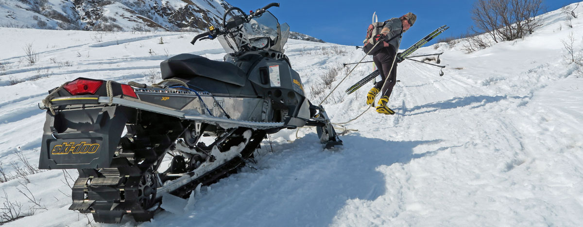
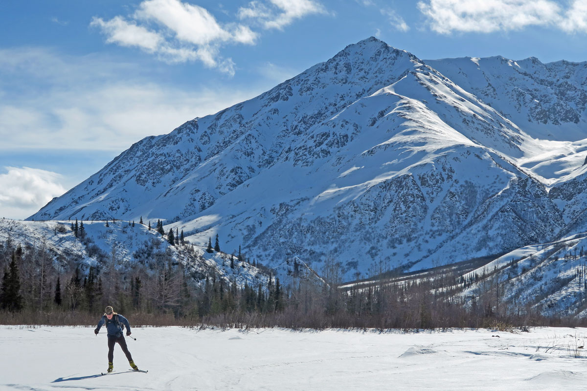
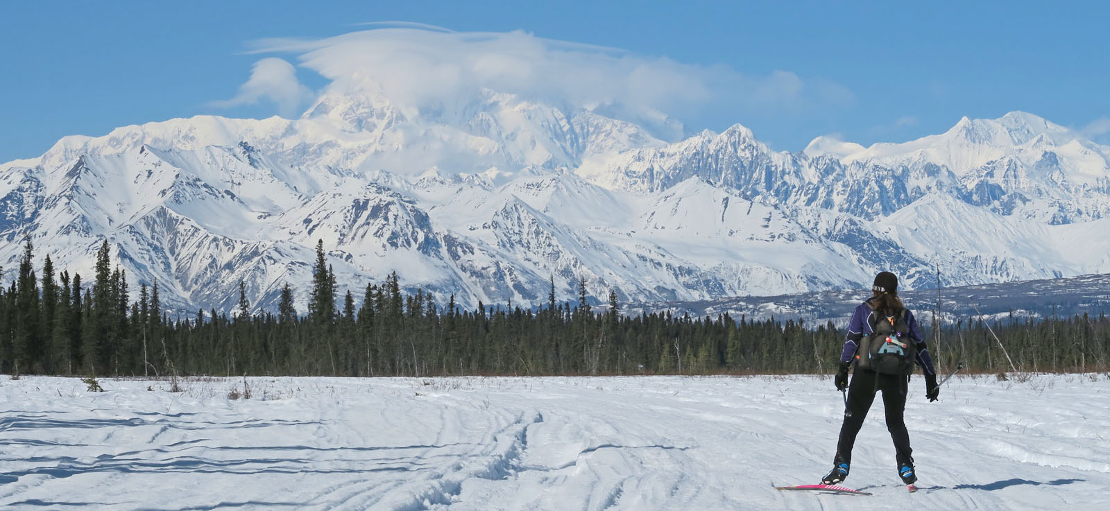
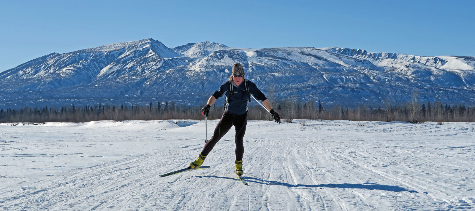
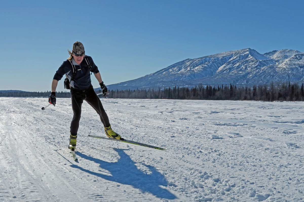
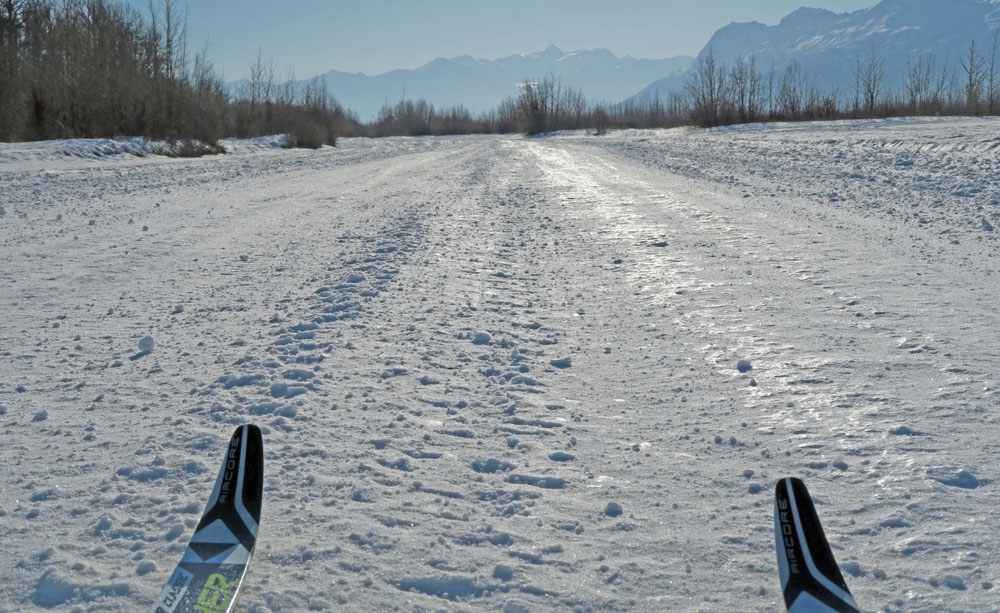
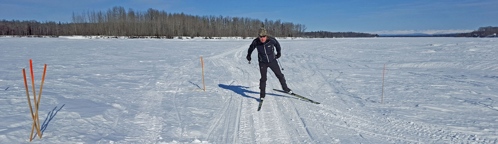
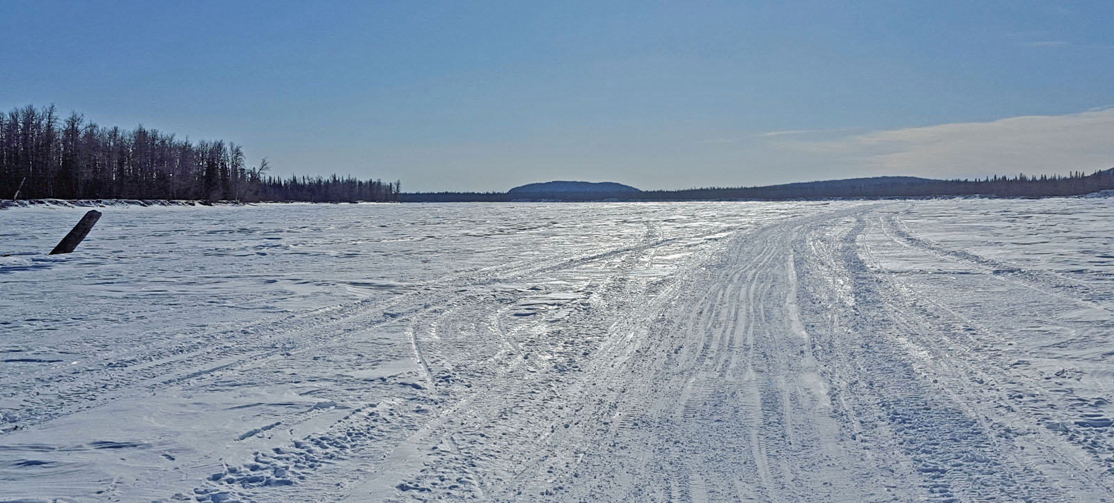
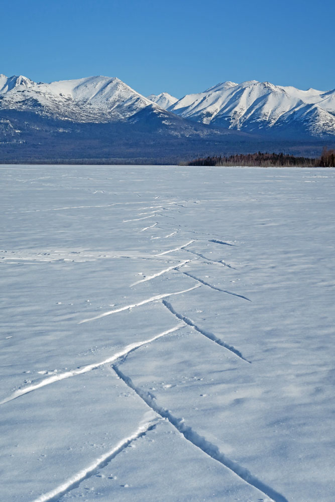
| Mid April 2017:
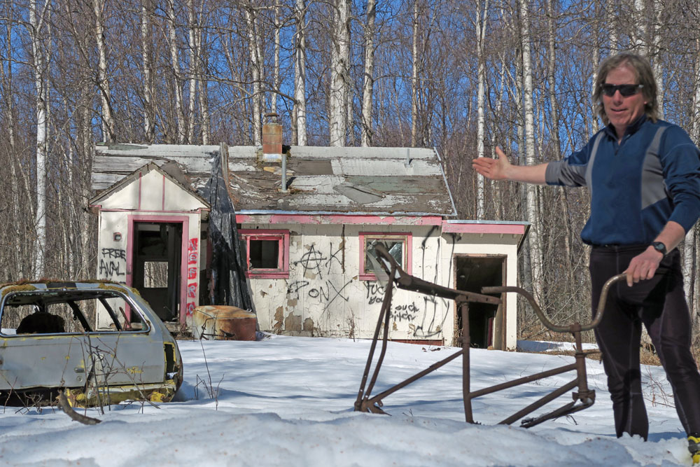
Crust Skiing Refuges |
 |
|
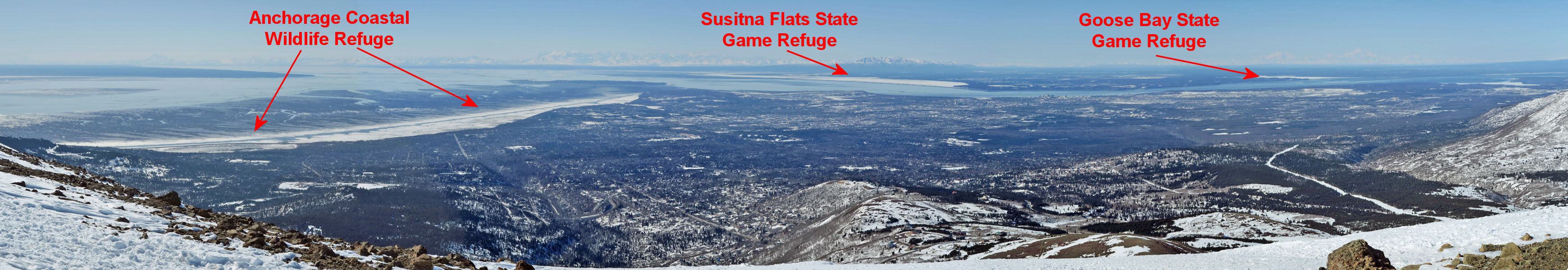
View, from the top
of Flattop, of three refuges near Anchorage that can offer good
crust skiing. |
|
|
|
Near
Anchorage there are a number of refuges with open areas at sea
level that can make for good crust skiing. The Anchorage
Coastal Wildlife Refuge is the most-skied of all these refuges.
The Goose Bay State Game Refuge is skied infrequently, and the
Susitna Flats State Game Refuge is hardly ever skied.
There are other similar areas near Anchorage, like the
Chickaloon Flats of the Kenai National Wildlife Refuge and the
Palmer Hay Flats State Game Refuge. But these two areas
seem to be more brushy and are often snow-sparse when crust
skiing conditions arrive.
I had crust
skied the
Anchorage Coastal Wildlife Refuge and
Susitna Flats State Game Refuge before (and I also skied
them this year). As for Goose Bay... I'd skied across the
bay (under the powerline) a couple of times, but I had never
crust skied this area. I finally crust skied Goose Bay, and
here are a few pictures from that ski ... |
|
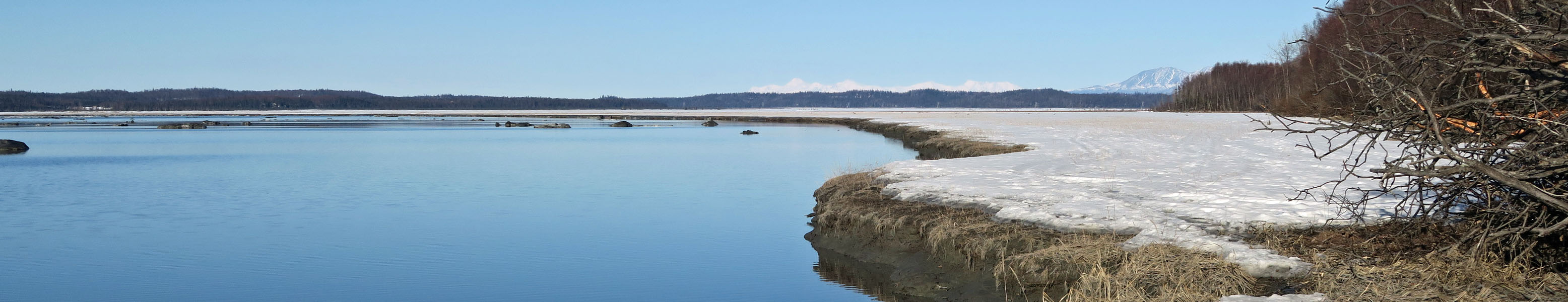
Goose Bay State Game Refuge |
 |
|
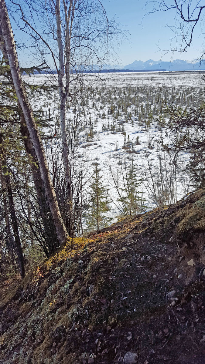
Northeast edge of
Goose Bay, south of the Goose Bay airport. |
 |
 |
 |
|
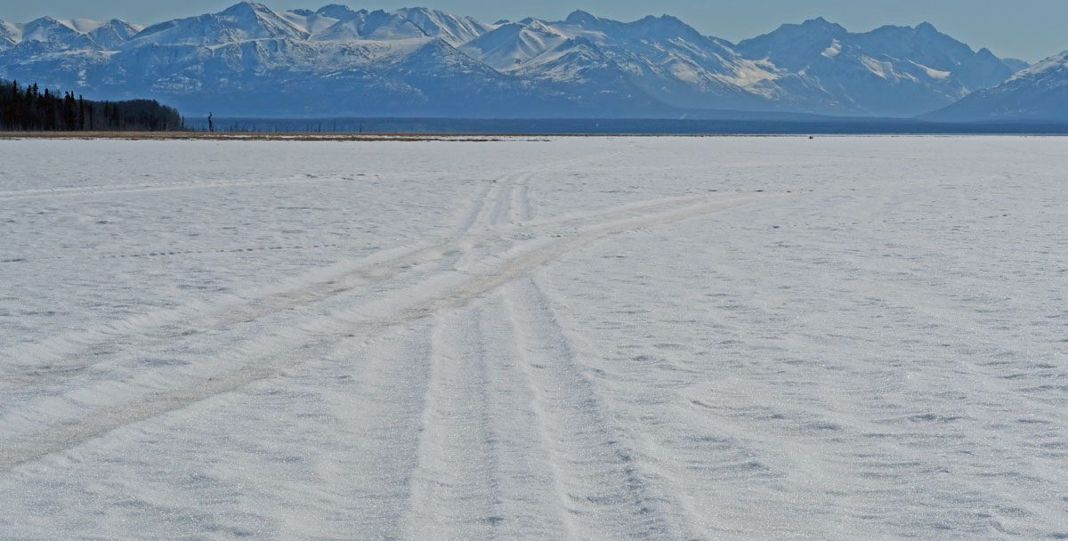
GPS track: 16 miles. |
View from the
southernmost edge of Goose Bay, looking back to where I started
skiing. |
A treasure on the
tidal flats. |
 |
|
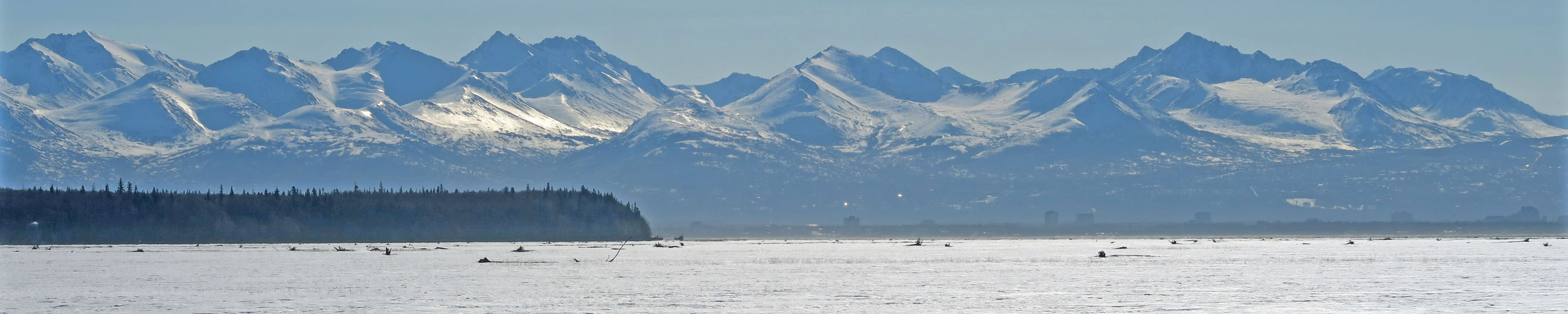
A view of Anchorage
that is not seen that often. Looking south from Goose Bay. |
 |
 |
 |
 |
|
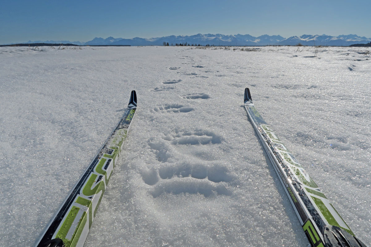
Looks like a
small(ish) brown bear was out walking here the previous evening. |
A neat ridge ran out
into the western part of the flats. Had to ski up it to
check it out. |
 |
 |
 |
 |
|
Good going.
But some of Goose Bay was too brushy to ski. |
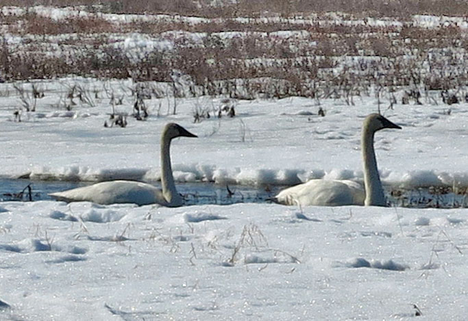
Swans. I
avoided and didn't disturb them. But they are telling me
it's time to take the crust skiing game to the mountains and
leave the tidal flats to the birds. Fine with me,
migratory birds don't need stress from skiers. |
As the crust
softened I followed old snowmobile trails to get back to where I
started. The compressed snow of snowmobile trails usually
lasts another hour, compared to untracked crust, before going
soft. |
If you are out crust
skiing, stop by and visit me at my new place at Goose Bay!
;-) |
|
|
|
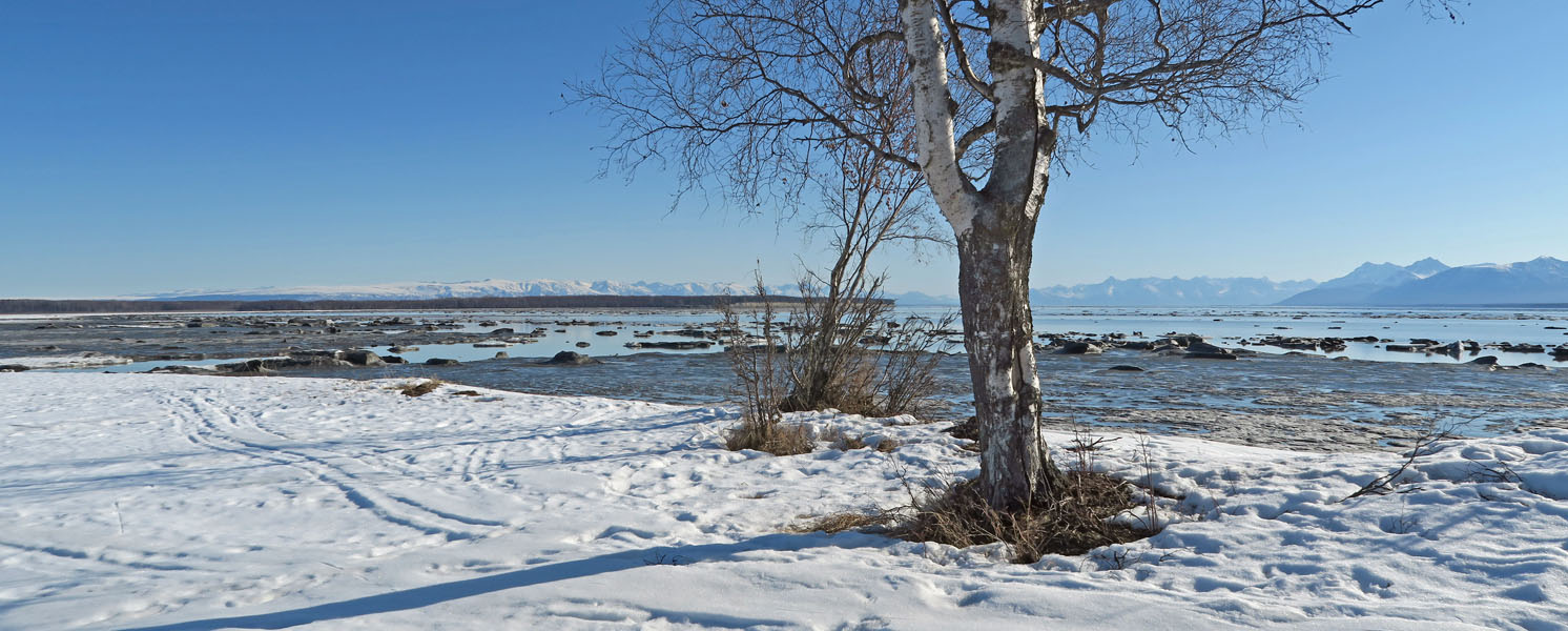
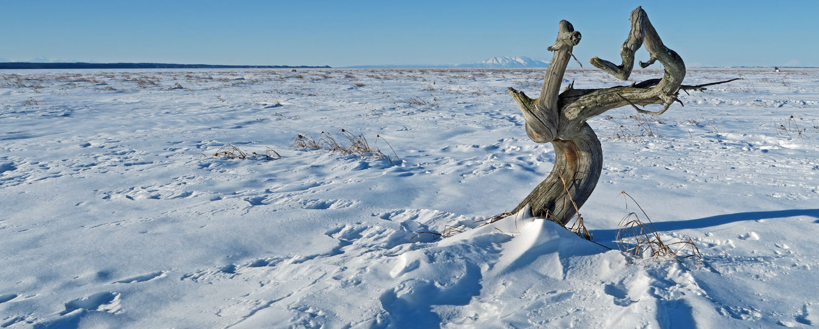
Susitna
Flats State Game Refuge |
 |
|
Mid-town Anchorage
office buildings as seen from the Susitna Flats State Game
Refuge |
|
|
|
I had skied
the Sustina Flats tidal areas a few times before in the winter.
So I figured I'd give spring crust skiing in this area a try.
The catch to skiing here is the access. You need snow to
ski the powerlines from the Pt. Mackenzie Road to get to the
coast. No snow would likely mean lots of water and mud.
It worked out for me. I got to the coast quickly on firm
crust snow. But the conditions on the flats weren't the
best. The crust was fragile and it started to go early.
To get out, I hopped on old snowmobile trails that offered
better support. Beautiful area that you can see from
Anchorage, but it is skied very infrequently. |
|
 |
 |
 |
|
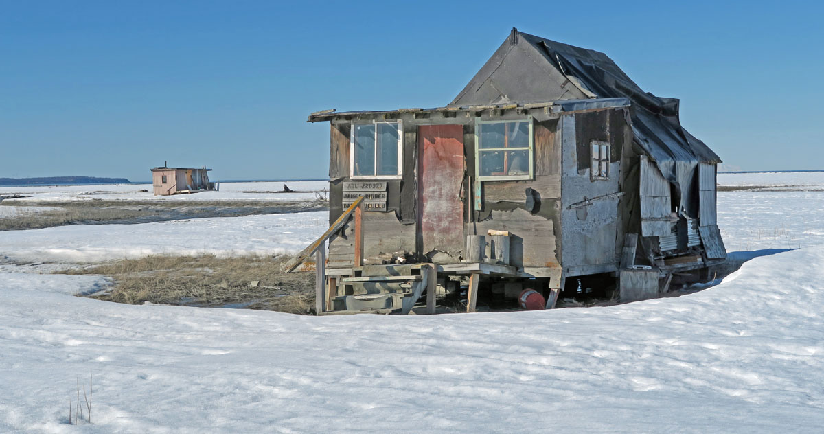
Lots of
setnetter cabins and duck shacks on the tidal flats. |
GPS track. |
There are a
bunch of old cabins on the east edge of the flats that
my father-in-law calls "The 49ers' cabins". In
1949 a group of folks homesteaded in the Talkeetna area,
and they would come down to Pt. Mackenzie to setnet
fish. This is one of their cabins that was moved a
mile from it's original location by storms and high
tides. |
| |
 |
|
| |
Hopped on
old snowmobile tracks to get out as the crust was going
soft. |
|
|
|
|
|
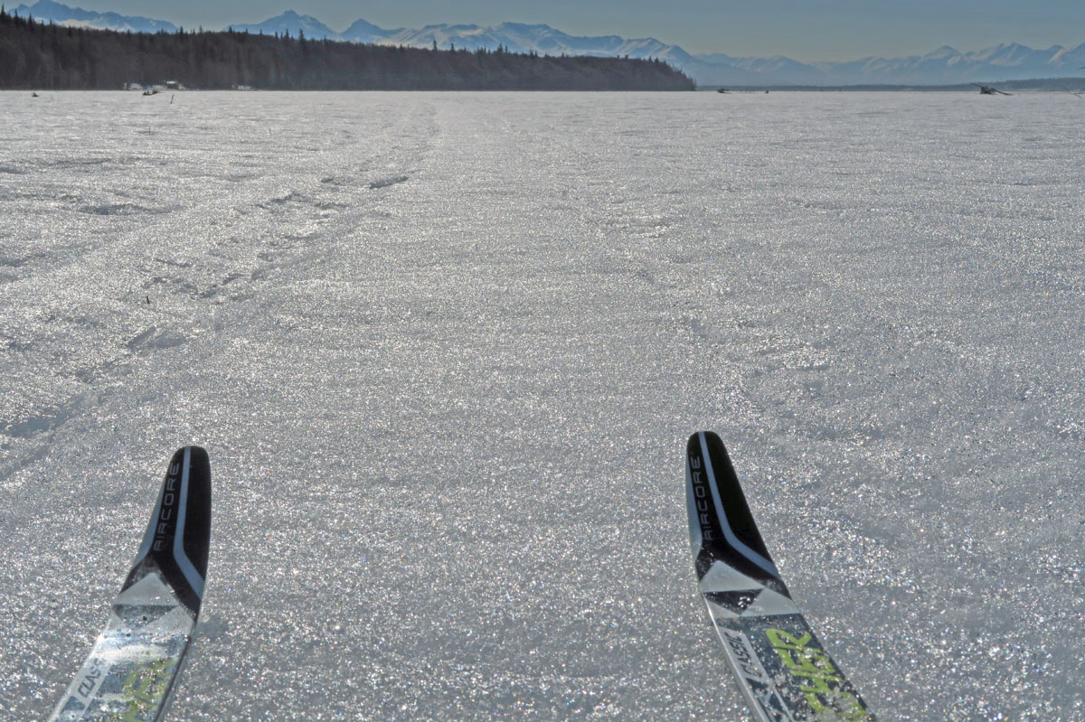
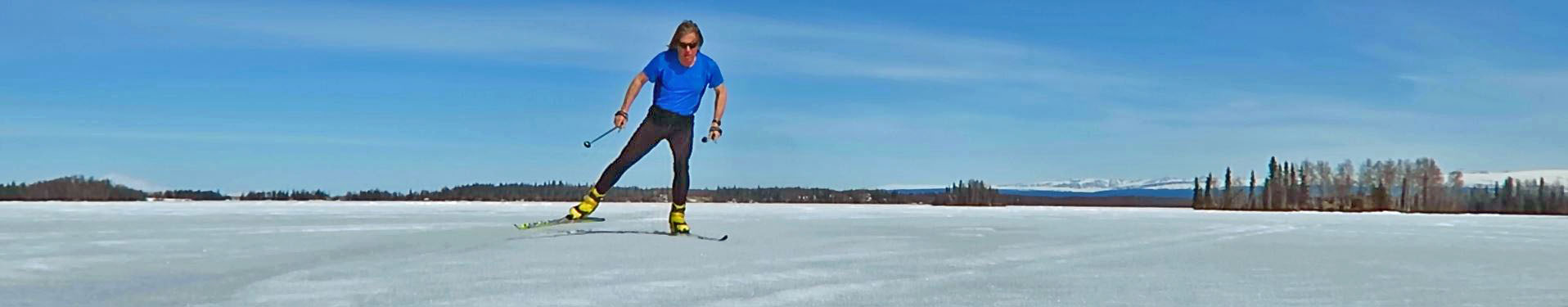
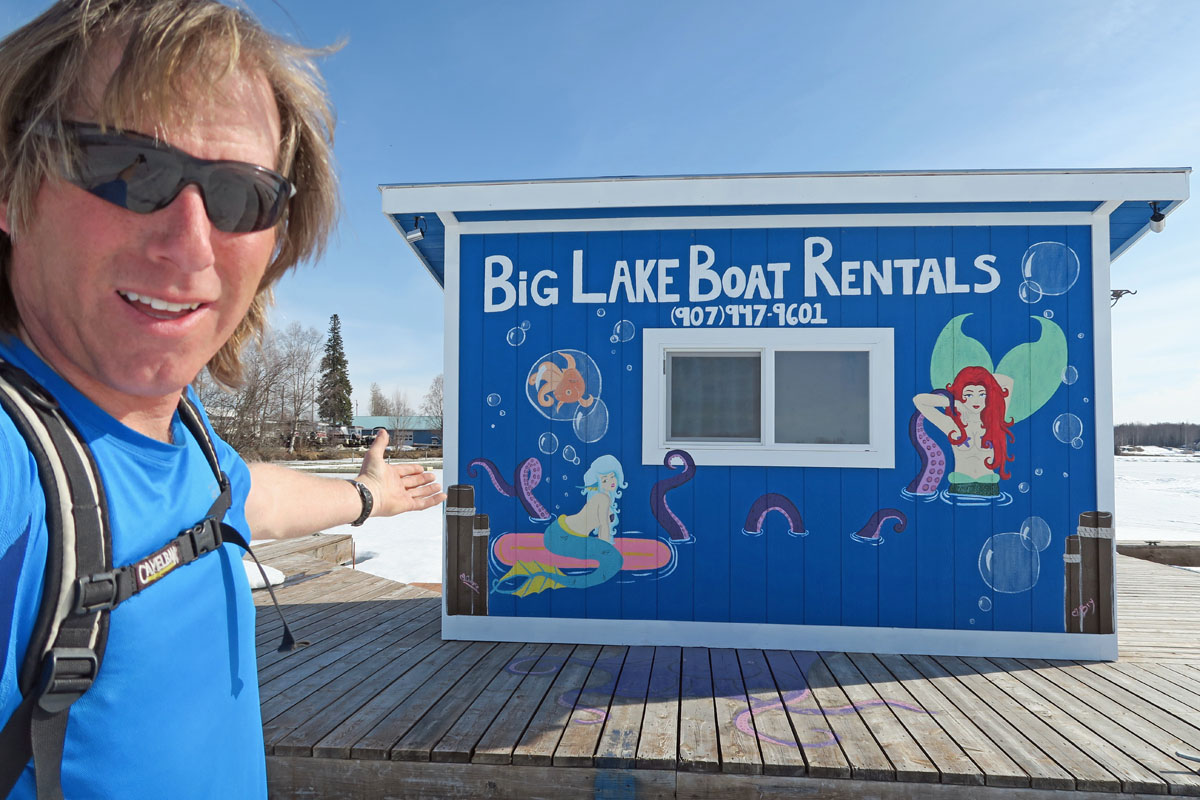
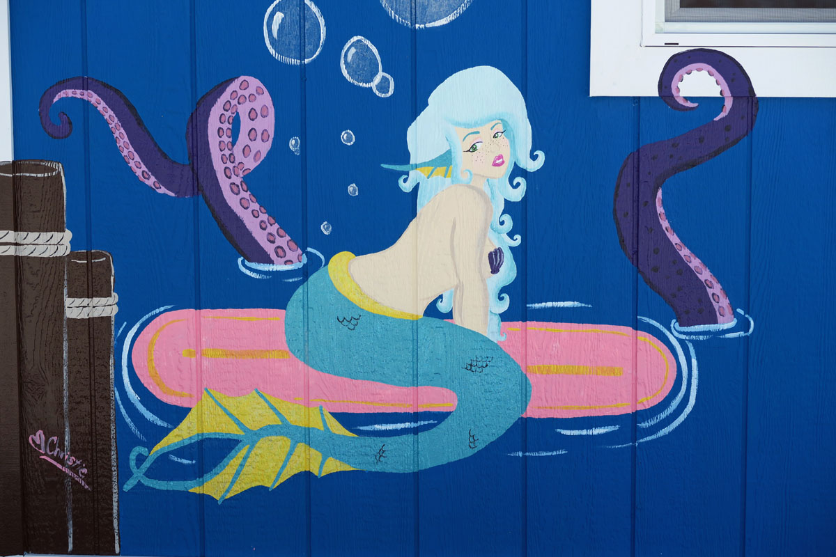
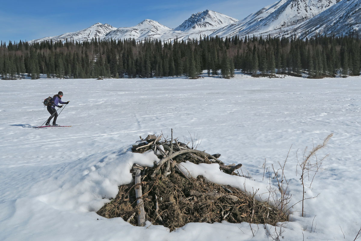
| Mid April 2017:
Crust Skiing With Mermaids |
|
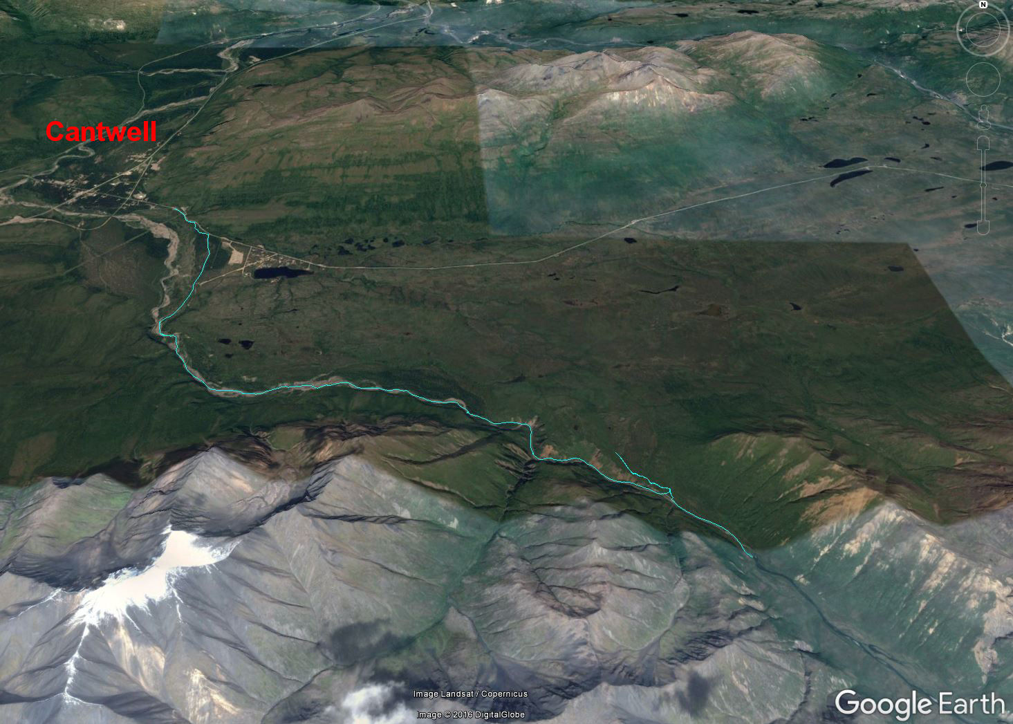
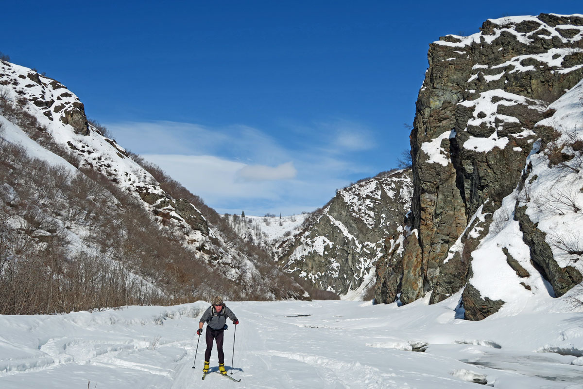
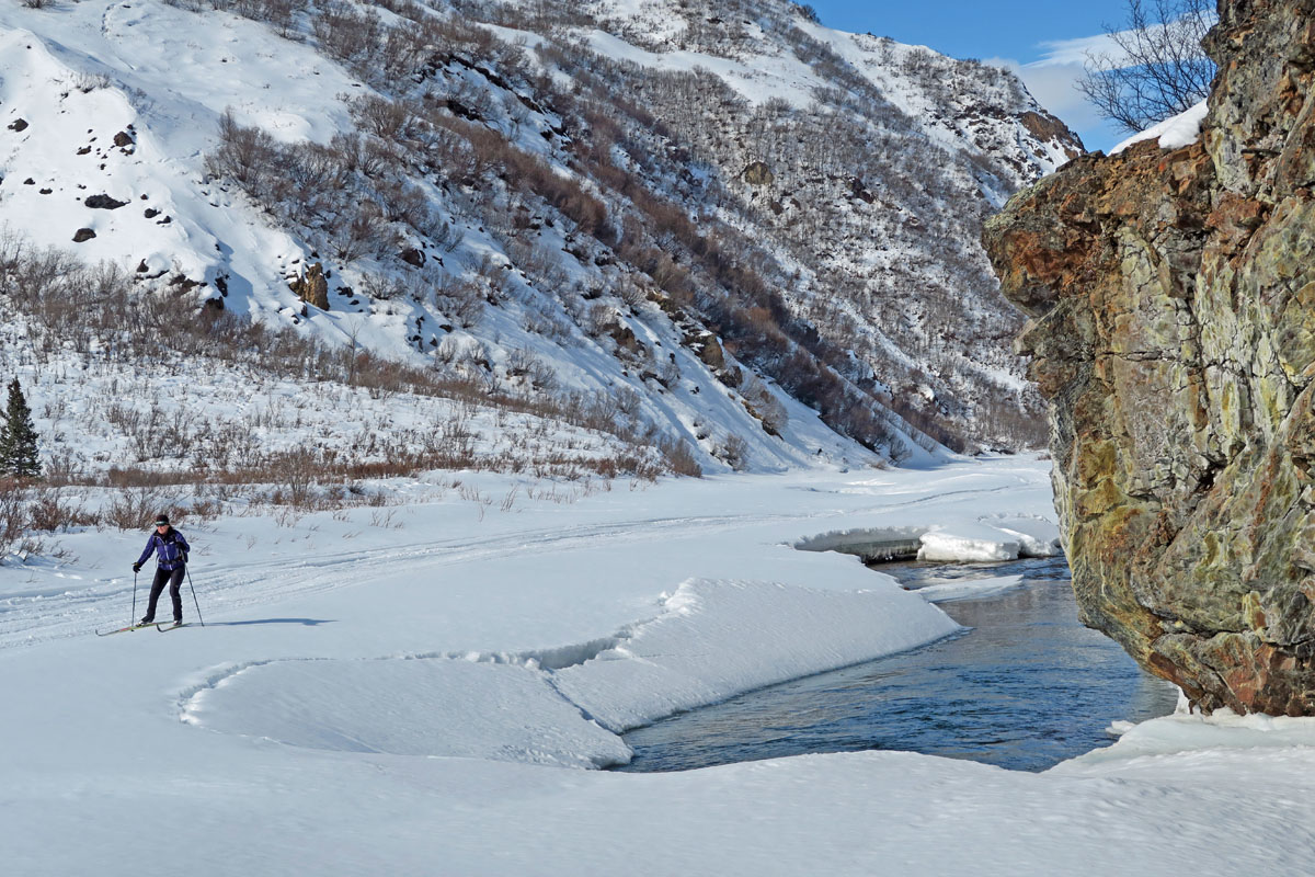
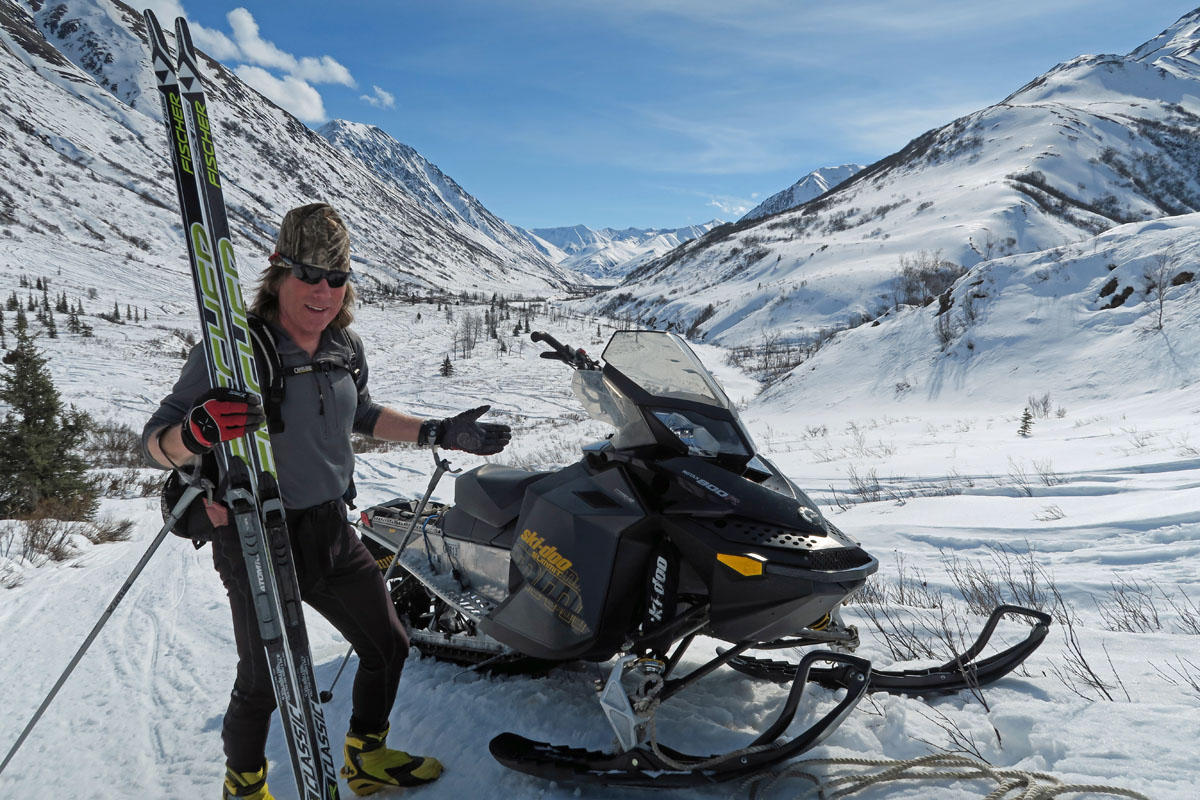
| Early April 2017:
Cantwell / Jack River |
|
| Early April 2017:
Chulitna Pass Recon |
|
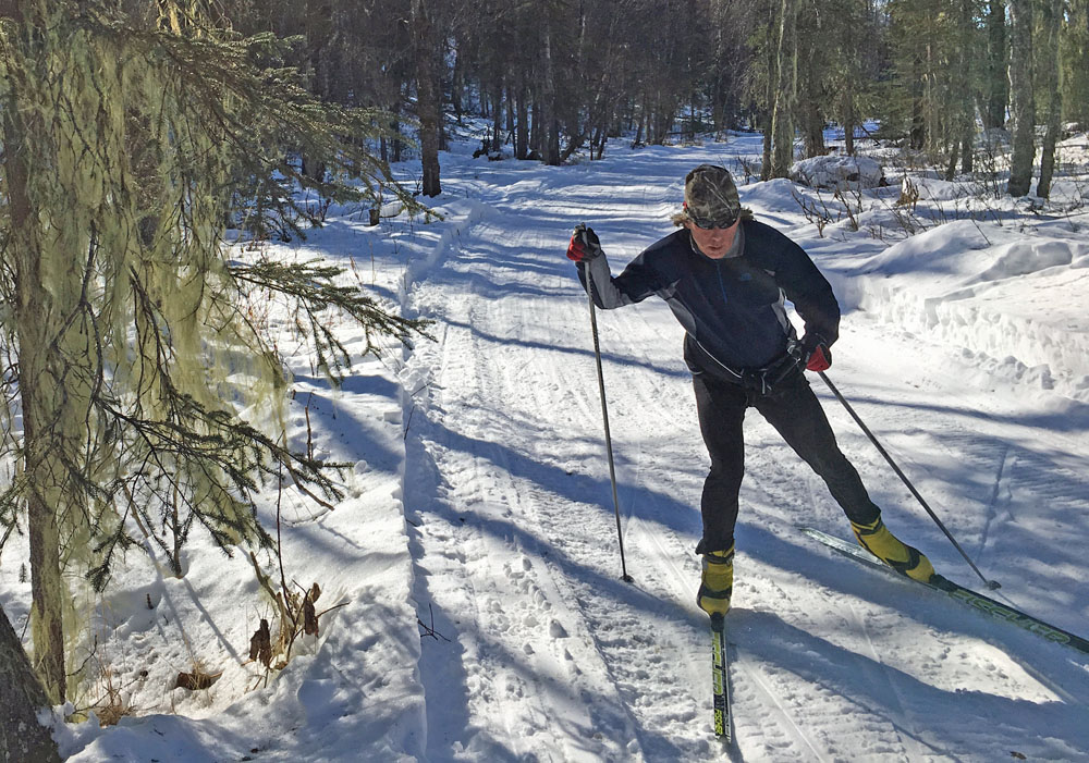
| Late March 2017:
Amber Lake To The Yentna River (At Lake Creek) |
 |
|
In the
Susitna Valley there are two kinds of trails: mapped
trails and tribal knowledge trails. The mapped trails are
pretty easy to find and ski, because, well, they are readily
found on maps. But cooler than mapped trails, in my
opinion, are tribal knowledge trails. These are trails
that cabin owners and area travelers know about, but you
probably won't find these trails on maps. When you hear
about such trails, the description always seems to be vague.
And it usually comes down to doing field research to find the
trail and what route it follows. Of course, this is all
good ... as it means you will spend more time skiing and
exploring to figure out a tribal knowledge trail. And more
skiing is always good!
This post is
about the Amber Lake Trail, a tribal knowledge trail. Though I'm not sure
this is
the real name of this trail because I have heard other names.
This trail starts on the Oilwell Road in the Trapper Creek area,
at Amber Lake. It then works it's way southwest to the
Kahiltna River and on to the Yentna River just below the mouth
of Lake Creek. The country this trail traverses is a nice
mix of wooded moraine country, sprinkled with glacial erratics
and interspersed with muskegs. It crosses the Kahiltna
River and ends at the super-highway winter trail on the Yentna
River. A lot of the trail is on old seismic lines made
for gas and oil exploration 50-60 years ago (notice the straight
lines on the map). As was the case when I was last on part
of this trail, a large tracked vehicle had been through
freighting mining supplies (I assume).
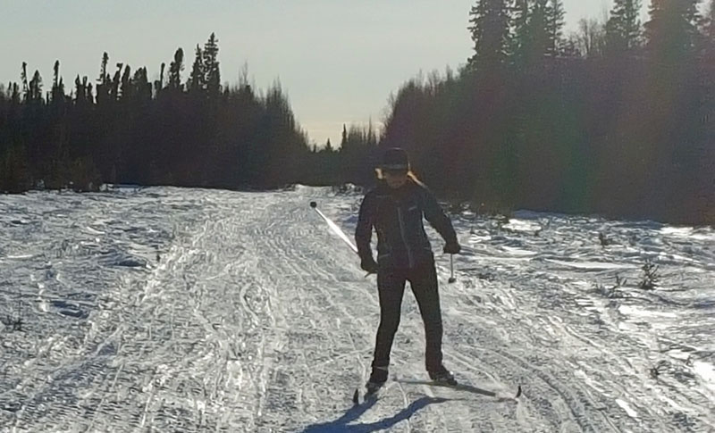
I skied this
35 mile trail from Amber Lake to Lake Creek, and my wife came
along on snowmobile. On the way back, my wife skied a part
of the trail that appealed to her. A beauty day in the Su
Valley skiing new country and getting tribal! ;-) |
 |
 |
 |
 |
|
GPS track: 35 miles
one way. |
Oilwell Road.
Fast skiing. |
Skiing past
usnea in
a spruce tree. Lots of this in the Talkeetna/Trapper Creek
area. Not much around Anchorage. |
A strategic turn.
22 miles to the Yentna. |
 |
 |
 |
|
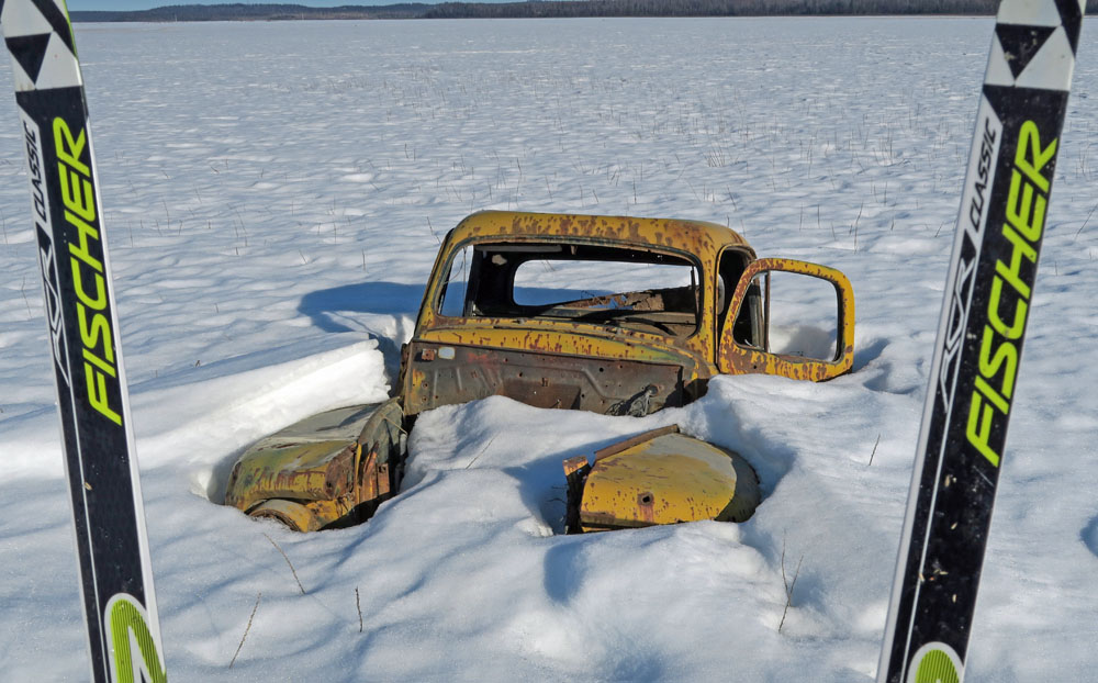
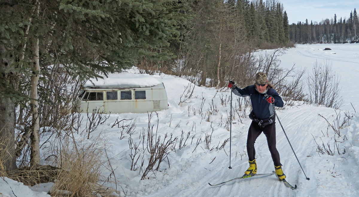
After crossing the
Kahiltna River I passed by an old VW bus. How it got here,
I haven't a clue. But I bet it's a good story. |
Lots of seismic line
skiing. Some of the seismic line skiing near the Yentna
was brushy. |
 |
 |
 |
|
On the Yentna River
super-highway. |
Cabins at the mouth
of Lake Creek. |
A good day to be a
"trail bagger", someone who has fun continually seeking out and
skiing new
trails. I've been trail bagging in AK for decades, and it
never gets old. |
|
|
 |
 |
|
|
|
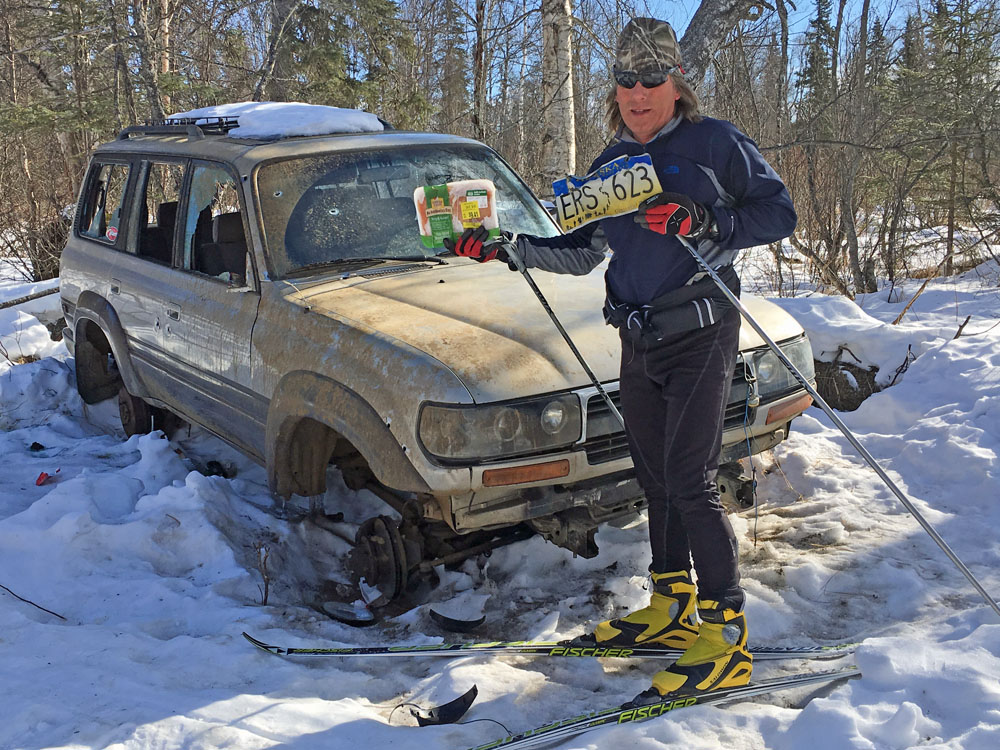
Oilwell Road
Chicken-Car-Jackers!: The unplowed, Southern reaches
of the Oilwell Road seem to be a favorite spot to take stolen
vehicles and get them stuck, and then strip tires and parts off
of them. On this trip I skied-upon two vehicles that I
assume met such a fate. The funny thing about each vehicle
is that there were packets of frozen chicken breasts next to
each vehicle. Probably there were groceries in one of
these vehicles when they were stolen. Apparently the
thieves weren't chicken eaters. But as we came back by
these vehicle, I could see the local ravens and eagles were glad
the thieves left the chicken for them! |
|
|
|
 |
|
|
|
A scarecrow set up
near the Oilwell Road, to scare away Chicken-Car-Jackers. |
|
|
|
|
| Late March 2017:
Tokositna River - Mile 131 Parks Highway to Chulitna River |
|
| Late March 2017:
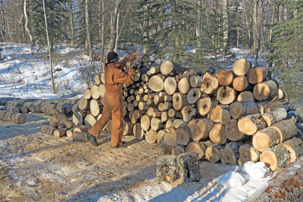
Local Trapper Creek Trails |
|
There are a
number of cool local Trapper Creek trails that are not shown on
the Curry Ridge Riders maps. These marked, un-groomed, low
usage multi-use trails link B&B's and rental lodging to the main
Curry Ridge Riders groomed trails. My wife and I recently
skied parts of the Blue Trail and the Red Trail. Neat
trails. Seems like the best way to find out about these
trails is to go stay at a place in Trapper Creek and ask the
proprietor for a map. If you stay at the
Northland Inn,
owner and xc skier Debbie Filter will give you one of these
secret maps. |
 |
 |
|
|
|
| Late March 2017:
Lower Susitna Valley Trail Loop |
|
| Mid March 2017:
Hunter Creek to Inner Lake George And Back |
|
| Mid March 2017:
Jim Creek To Knik River Gorge And Back |
 |
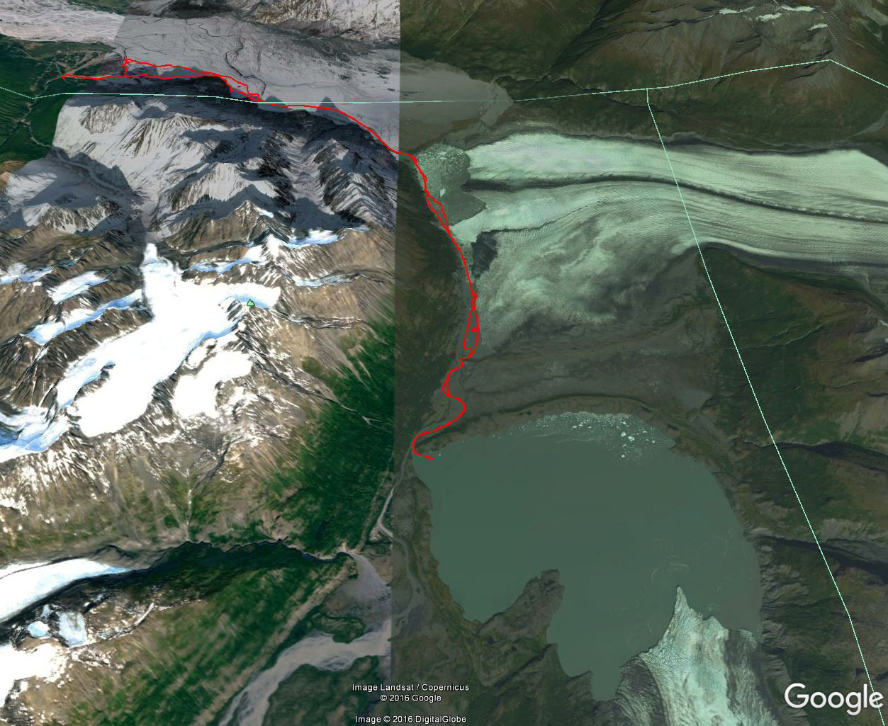
|
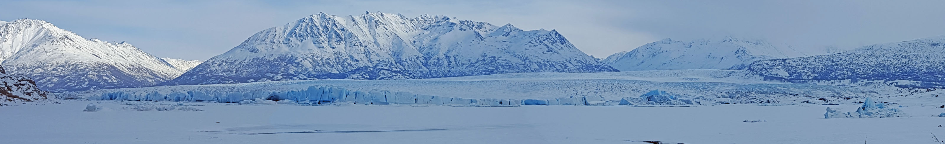
Earlier this
winter there was
Internet discussion about the Knik Glacier surging and
creating a dam of ice at the Knik River Gorge. The Knik
Glacier used to do this, prior to1964. A glacier-formed
ice damn would back-up water flow and eventually an outburst
flood would occur when water pressure above the damn won out
over the ice. Such floods, also called
jokuhlaups,
were massive and destructive in the old days of the Knik River
valley.
I was curious
about this situation in the Knik River Gorge, so I figured I'd
ski there and check it out. I headed out as I usually do
when I ski to the Knik Glacier, from the Jim Creek trailhead in
the Butte area. Only saw one person in a Jeep as I was
skiing up the valley. But when I got to the glacier lake
there were fat bike tracks and bikers everywhere. Come to
find out, these folks had come in from Hunter Creek. There
is now a legal access from there, it used to be that there
wasn't. So I ended up doing an extra 25 miles (round trip)
by my choice of trailhead. Doh! Oh well, extra miles
means you get in better shape.
I skied
through the gorge, with the exception of one short stretch where
you had to do some easy hiking between ice and rocks.
Definitely a neat place. I'm no glaciologist, but it seems
this tongue of the Knik Glacier has too small of a mass to make
a much of a dam. We'll see. And ... the next time I
go to this area ... I will definitely go from the Hunter Creek
trailhead! |
 |
 |
 |
 |
|
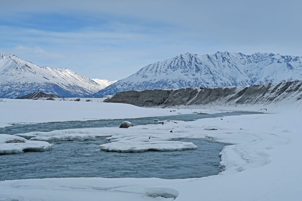
GPS track: 54 miles
out and back. |
Jim Creek "highway"
was icy and fast. |
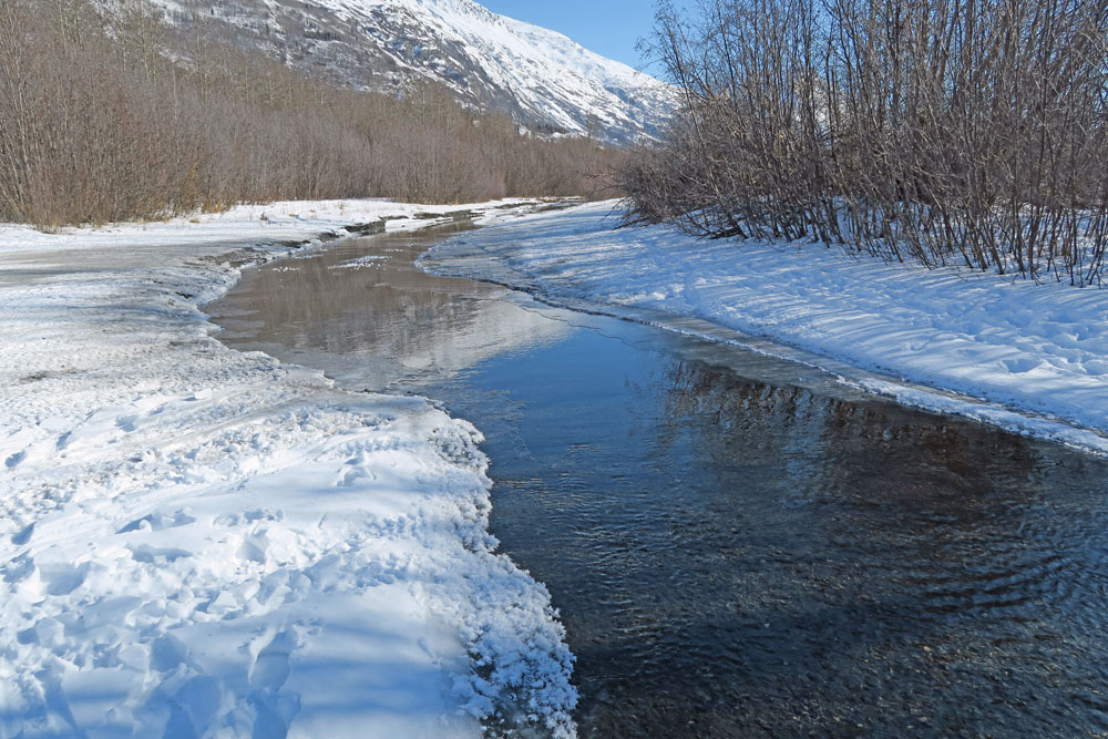
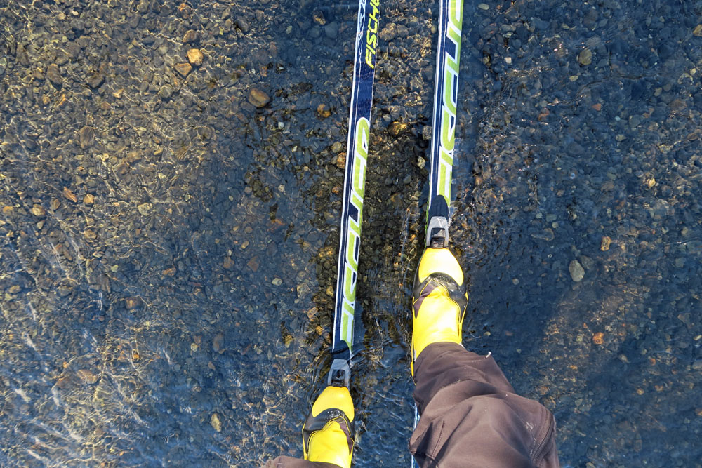
One stream crossing.
Shallow, so ... |
... you could dance
across it. |
 |
 |
|
An unraveled section
of culvert up near the glacier. Wonder what the story is
behind this? |
Bill Spencer and I
once climbed this peak. I had tried by myself previously
and turned back. When Bill and I got to the point that I
had previously turned around at, Bill said: "Hmmm. I see
why you turned back!" But we eventually found a way past
the crux and never took the rope out. |
 |
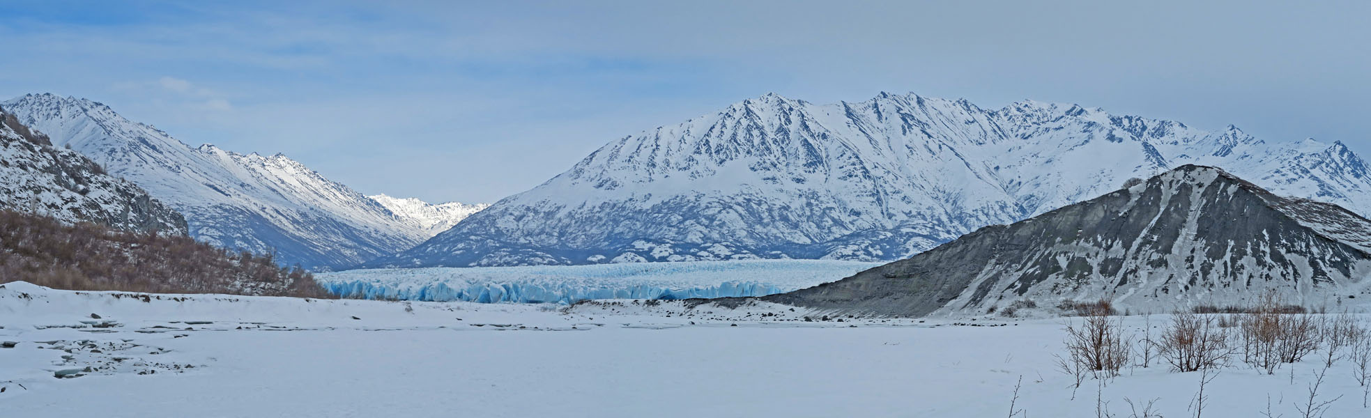
 |
|
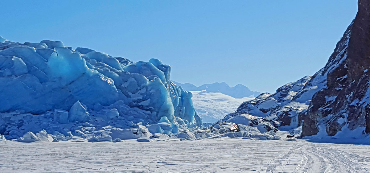
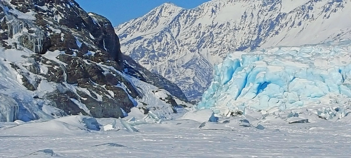
Approaching the Knik
River Gorge glacier bottleneck, from the north. |
South of the
bottleneck, looking north. |
|
|
 |
|
|
|
Dwight Iverson took
this photo of me talking to Jon Kunesh. I like Dwight and
Jon ... cool running into them. |
|
 |
 |
 |
 |
|
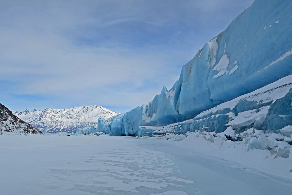
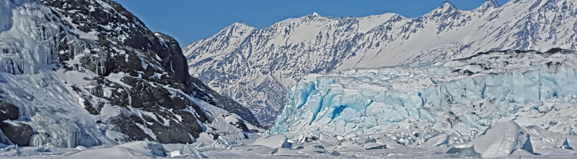
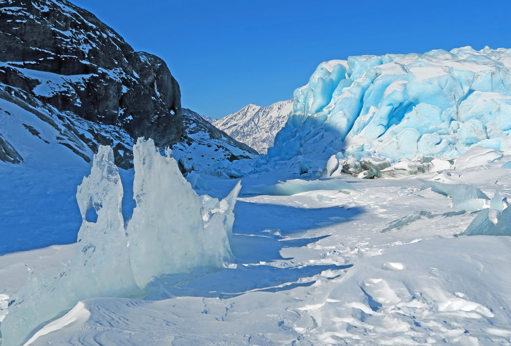
Requisite glacial
ice pictures. |
|
|
 |
|
|
|
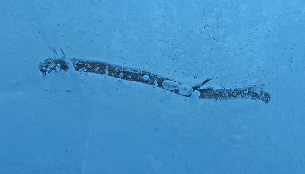
A stick imbedded in
glacier ice. I wonder how old the wood is?
My guess: This wood had been in the glacier for less than 100
years. I say this based on a
military plane crash on nearby Colony Glacier. The
plane crashed high up on the glacier, yet in 60 years parts from
the plane were showing up at the glacier terminus. This
stick was likely ripped off of a mountain and washed out onto
the glacier by an avalanche. And just like the plane
remains, the flow of the glacier eventually delivered the stick
to the glacier terminus. |
|
|
|
|
| Mid March 2017:
Old Trails, That Feel Like New Trails |
 |
|
I hadn't
skied much on my regular haunt Lower Susitna River trails, south
and west of Susitna Station, for the last 3 years due to warm
and snow-sparse winters. But finally we've had a decent
winter, so there's been good river skiing
recently. Mostly the good skiing is on snowmobile trails
... with some crust
skiing (on wind and sublimation crust). So it's been fun reconnecting with our cabin
backyard trails. Brings back memories of good adventures
of the past. Some of these memories are from boating, as
we boat some of these trails in the summer to get to our cabin.
It's probably
a rather unique situation: you are skiing with your wife on the
Big Susitna River and sharing memories of a different season, and
of a different world. Like pulling someone's jet boat off
the sand bar you are skiing over. Or hitting that same sand
bar full throttle yourself. Or stopping to rescue boaters
with a blown engine. Or walking a boat down a shallow
channel you mistakenly entered with 600 lbs of Malamutes on
board (and even though you are standing in only 6 inches of
water, the dogs refuse to get out because they can't see the
bottom in the murky water and assume that you are trying pull a
trick on them and get them to swim). Or the
times we dodged massive cottonwoods that were bouncing down the
river. Or the time we dodged a 300 foot length of old gas
pipeline that was rolling down the river. Or the times I
buzzed the Susitna Station whirlpool (and got yelled at by my
wife for doing it). Or watching brown bear, black bear,
moose and seals swim past the spot we are now skiing. Or
the time hooligan were running so thick you could catch them by
hand. Or the time we laughed non-stop because we couldn't
believe how hard it was down-pouring on us (in an open boat).
Or the times we pulled into the Big Su after getting the shit
scared out of us while crossing Cook Inlet from Anchorage.
Yep, lots of memories on these Lower Susitna trails. And
hopefully many more to come. |
 |
 |
 |
|
Trail groomed by
freight haulers on a Bell Island channel of the Big Susitna
River. |
General area of
trails. |
Main channel of the
Big Susitna River. |
 |
 |
 |
 |
|
West Channel
of the Big Su. |
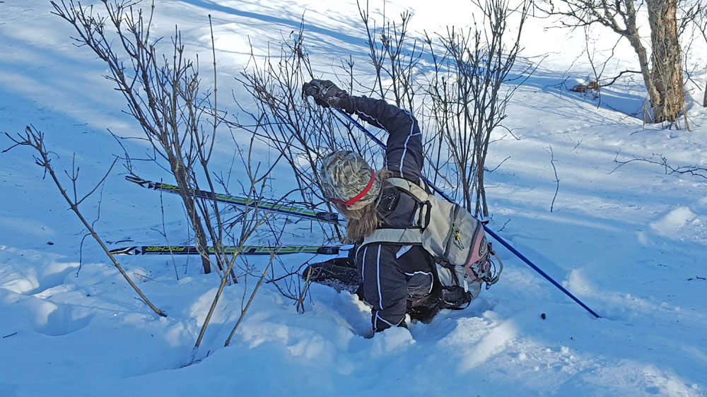
My wife
returning from a ski to the
Beluga road system. |
Showing off
to your spouse doesn't always work out the way you
planned. |
|
 |
 |
 |
|
Lots of wind in the
last two weeks. |
Something I learned
from Bill Spencer: the best Alaskan xc ski warm-ups are Carhartt
overalls. |
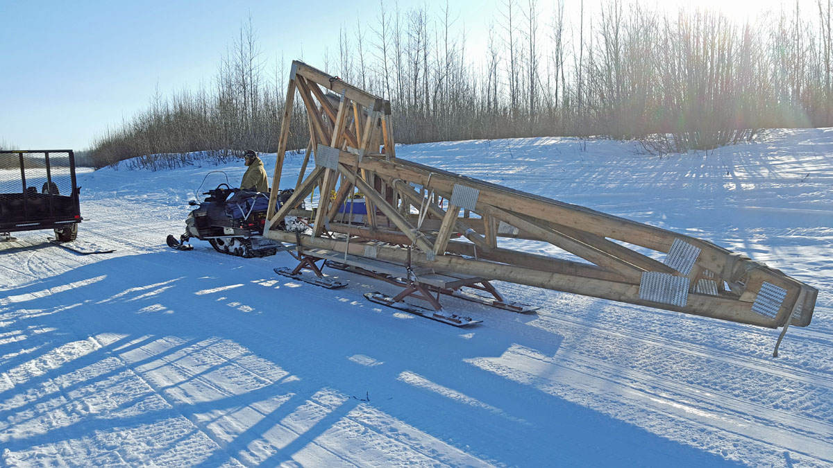
Can you ski faster
than this snowmobile? I would hope so. This was a
load of windows. Slow! |

 |
|
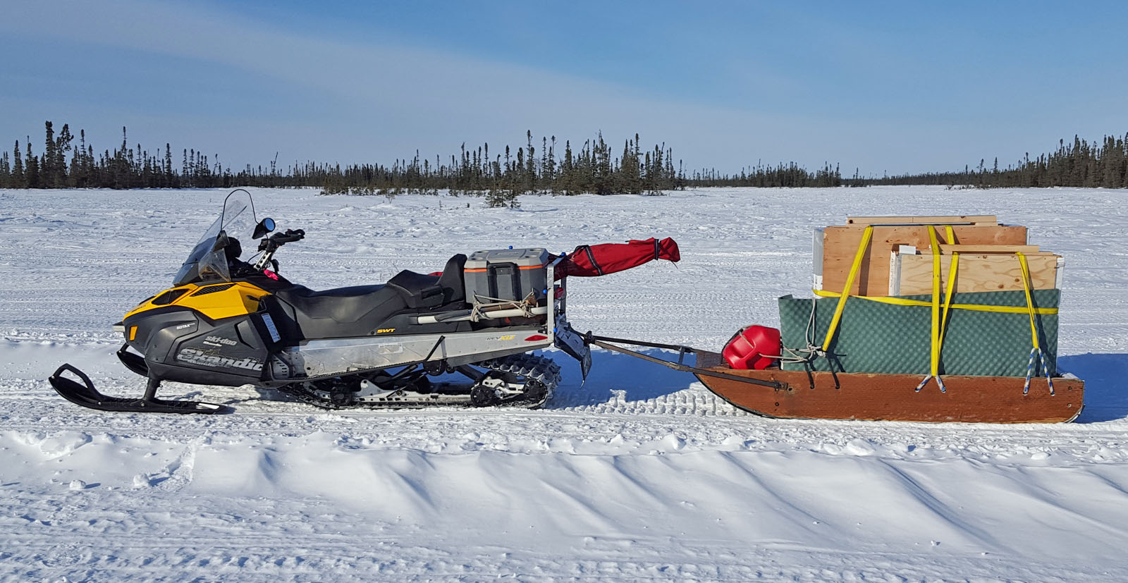
Good trails this
time of year in the Susitna Valley are often due to freight
haulers. Here my wife's cousin and partners transport roof
trusses out 25 miles from the nearest road. Often they
groom the trail first, so it is smooth going for heavy loads.
And that is a good deal for skate skiing. |
|
|
|
| Early March 2017:
Ski-Exploring The Chickaloon Tidal Flats |
 |
|
When I got
back to the Mystery Creek trailhead after this trip, I ran into
some seasoned Kenai-area snowmobilers. When they asked me
where I had been, I said "Pincher Creek Cabin".
Immediately they were impressed. "Wow, we tried to get
there a couple of times on snowmobiles, but never made it across
the Chickaloon River!" I then told them I did not cross
the Chickaloon on a snowmobile, but on skis instead as I skied
from the eastern edge of the Chickaloon Tidal flats to the cabin
and back. Soon I could tell that they were definitely
not impressed with me any more. Oh well.
I have been
looking at the Chickaloon Flats from our kitchen window for the
last 20 years. I couldn't believe I had been looking this
long without skiing this area. My wife and I had tried
earlier this year to check this area out. But dense fog
kept us from seeing much. I went back alone this time.
I drove my snowmobile out 30 miles out the Mystery Creek Road
and Enstar gas pipeline right of way and left it, skied across the
tidal flats to the Pincher Creek cabin and back and then spent
the night where I parked my snowmobile.
This area of
tidal flats is many times larger than the tidal flats to the
south of Anchorage. It seems like it is rarely visited,
except by small planes now and then. And maybe a few
snowmobilers. Huge crust skiing potential here, but
it is not an easy place to get to, unless you have a small
plane.
I got across
the Chickaloon River on skis pretty easily. But if
temperatures were warm, I could see how this wouldn't work.
The Chickaloon River is tidal influenced for its whole length
across the flats. You never know if the next tidal surge
with be easy or devastating on the river's ice cover.
I got the
feeling that I could not have skied much further than the
Pincher Creek cabin. Recent high winds had been scouring
the sandy bluffs that lead to Pt. Possession and the snow was
getting progressively sandier the further west I went.
Snowmobilers also told me that because the water comes up close
to the bluffs that lead to Pt. Possesion, that you never know if
there will be too many ice blocks to (easily) get through the
area. I'd like to connect to the Point Possesion, but I
will have to have more time and be prepared to hike.
Anyway, a
cool, quiet and unique location. Glad I went. And
glad I no longer will be looking out our kitchen window and feel the
need to say: "Damn! When am I going to ski the Chickaloon
Flats?!" |
 |
 |
 |
 |
|
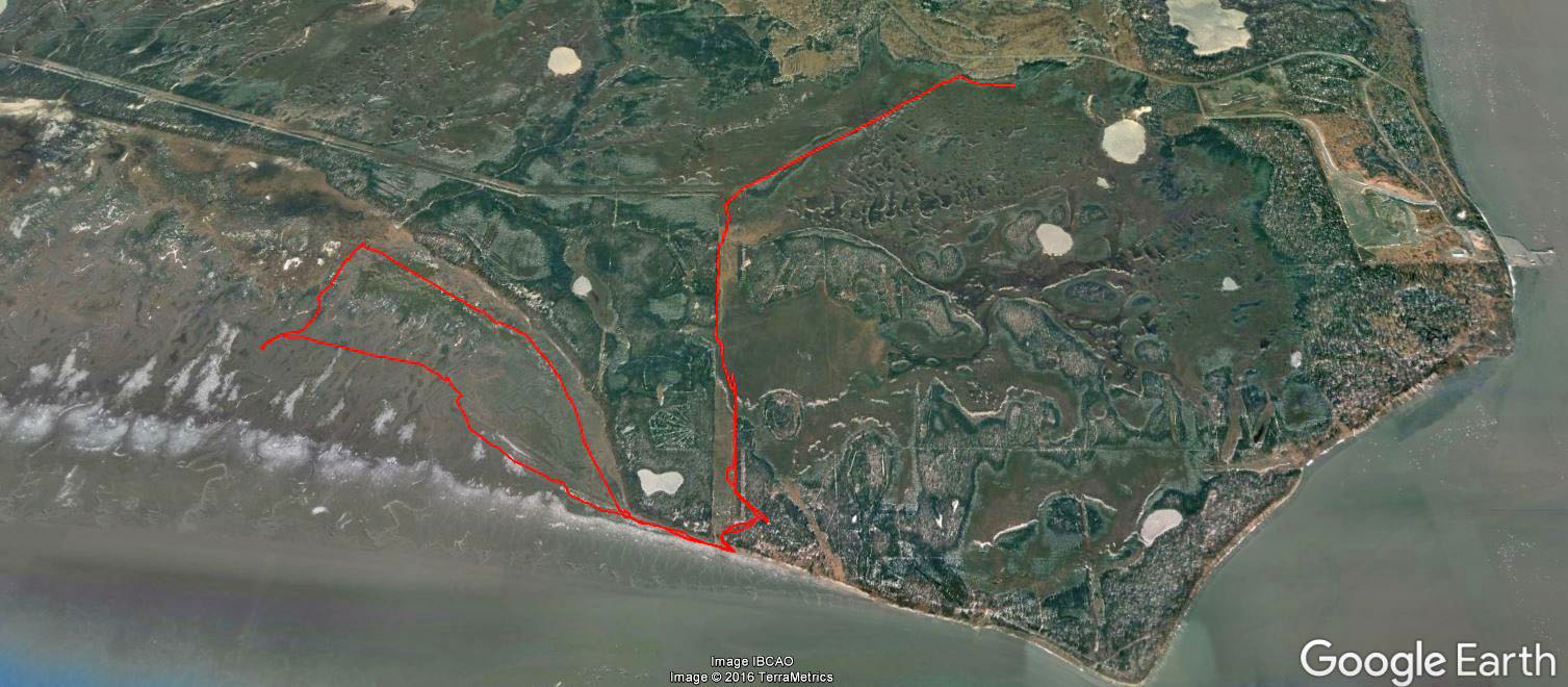
GPS track: Approx 26
miles out and back. |
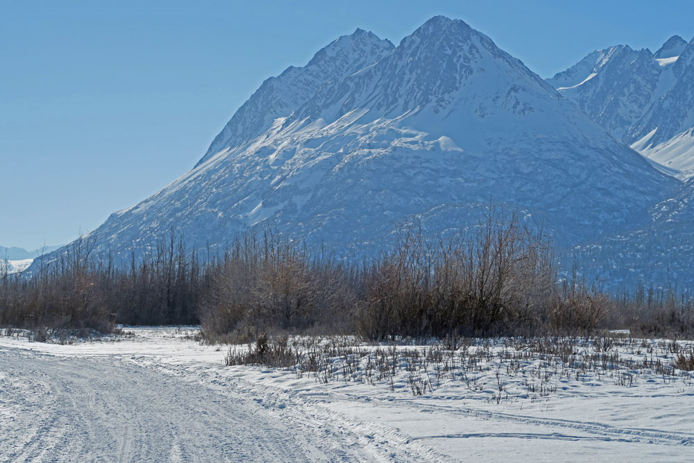
Gas line trail with
Chickaloon Flats in the distance. |
Leaving the mother
ship at the edge of the flats, and heading out on skis. |
The Chickaloon Flats
are the Anchorage Coastal Refuge tidal flats on steroids. |
 |
 |
 |
|
Huge amount of crust
skiing potential here. But unless you have a small plane,
access is not easy. |
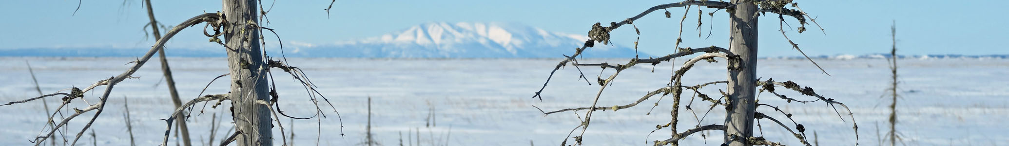
Point Possession and
Mount Susitna in the distance. |
Remnants of a duck
hunting blind? An old wall tent
platform? |
 |
 |
 |
|
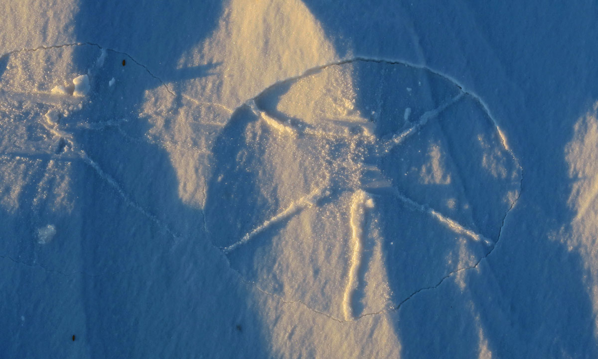
Pincher Creek cabin. |
The Kenai National
Wildlife Refuge Pincher Creek Cabin. Anchorage in the
distance. I signed the log book and headed back. |
While skiing back, I
noticed my outgoing track had made this odd design on breakable
wind crust. A crust star?! |
 |
 |
|
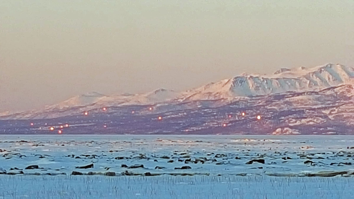
The glint of the
setting sun off windows in Anchorage, |
"Earthquake tree
sunset" These black spruce trees fell victim to the 1964
earthquake. The ground sank, their roots contacted salt
water and the trees became "preserved". Have been standing
dead for 53 years. |
 |
 |
|
I got too dehydrated
during this ski. So setting up this camp in sub-zero temps
was not fun. Cold hands and feet until I got hydrated
again. |
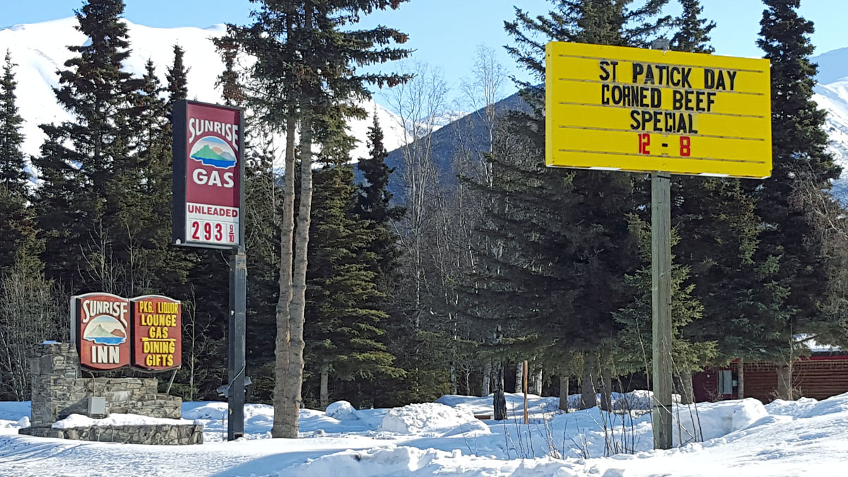
No celebrating St.
Patrick's Day in Cooper Landing this year. They are
celebrating "St Patick Day" instead. |
|
|
|
|
|
|
|
|
|