|
|
|
|
Home |
|
Intro |
Gear |
About |
Trips: |
2026 |
25 |
24 |
23 |
22 |
21 |
20 |
19 |
18 |
17 |
16 |
15 |
14 |
13 |
12 |
11 |
10 |
09 |
08 |
07 |
06 |
05 |
04 |
UBXC |
Apps |
eBook |
|
2009/2010
by: Tim Kelley
|
|
|
|
|
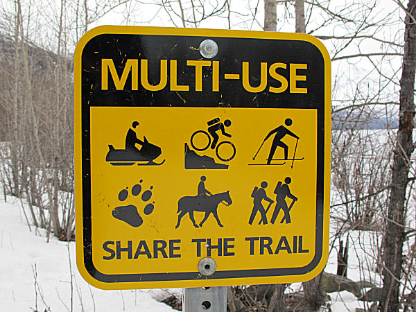
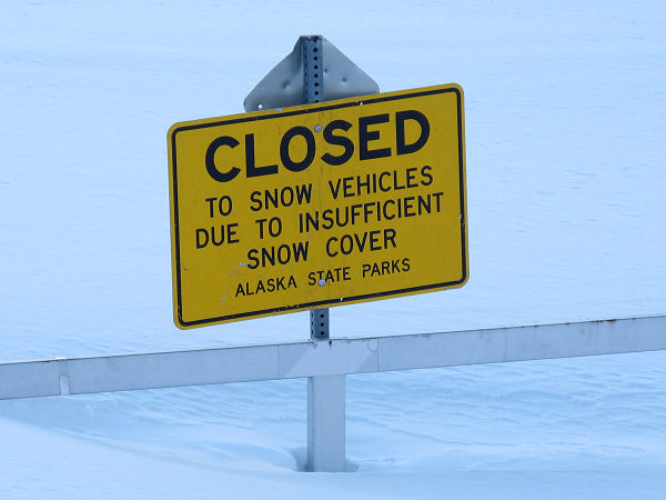
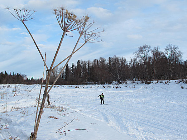
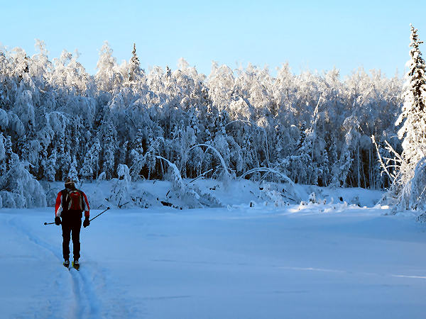
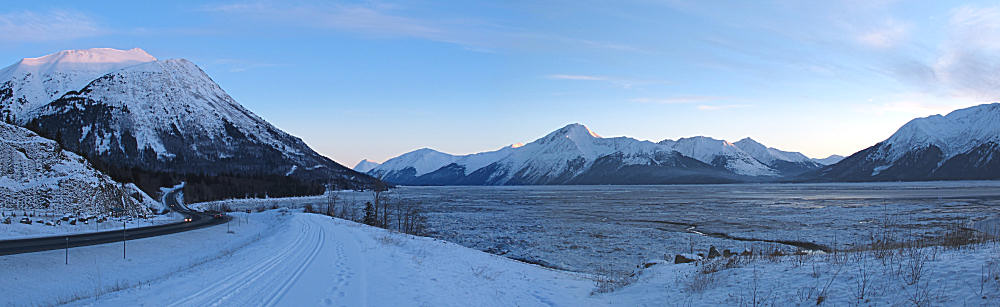
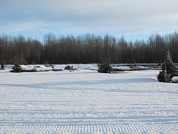
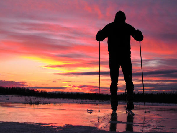
Eklutna Lakeside
Trail, in the Rain |
| Late
February 2010:
Southcentral Alaska has been going through a warm period.
Temperatures have been staying above freezing around the clock.
I sure hope winter returns soon. Until then, good skiing
can usually be found in these conditions on multi-use / snowmobile-friendly trails,
like the Eklutna Lakeside Trail. It was 42 degrees F. and
sprinkling rain for this 24 mile out and back ski. But the
skiing conditions were pretty good. |
 |
 |
 |
 |
 |
 |
|
|
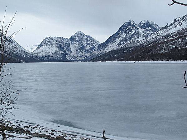
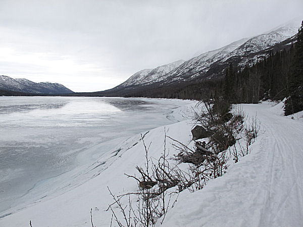
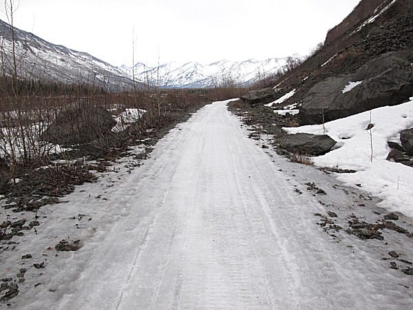
The Eklutna Lakeside
Trail was wet icy-granular which made for good skate skiing.
The lake was too icy for skiing and too rough for Nordic blading. |
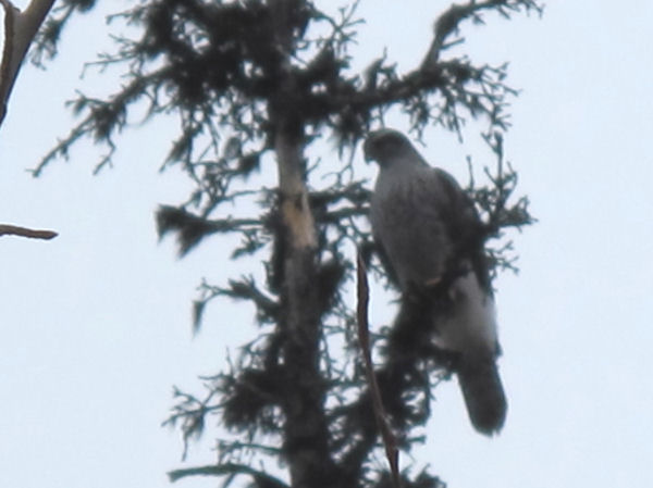
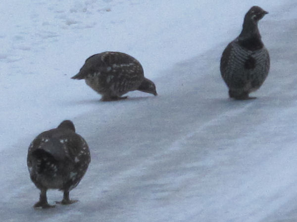
This guy flapped by,
2 feet above my head, to say Hello. I think he/she is a
Red-Tailed Hawk. |
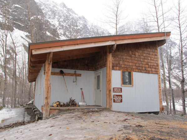
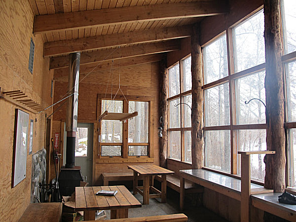
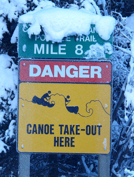
The public use Serenity Falls
Cabin, 12 miles in. |
 |
 |
 |
 |
 |
|
|
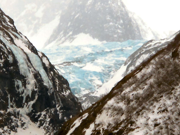
Wow ... not much for
snow on the Eklutna Glacier in February. |
An old military
bridge across the Eklutna River. |
Back in the 50's and
60's the military would stage glacier training operations from
this area. More info
here. |
Near the Serenity
Falls Cabin the trail got a bit lean. |
|
|
|
|
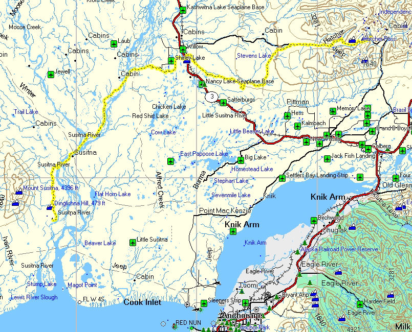
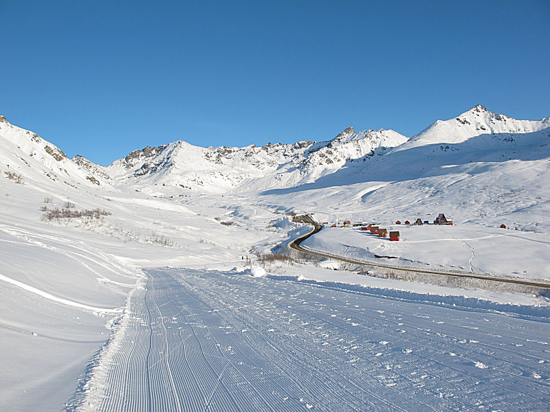
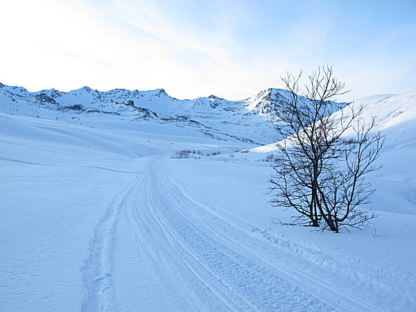
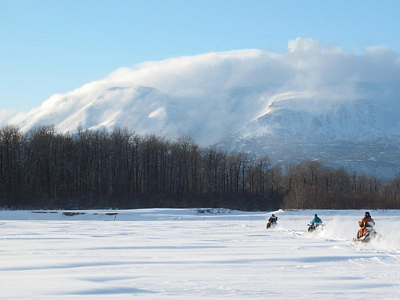
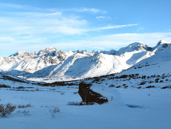
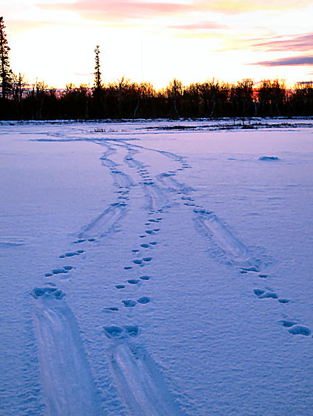
Hatcher Pass to
Alexander Creek |

GPS track: 86
miles. |
Mid
February 2010: A
ski trip that had been on my list for a while was to ski from
Hatcher Pass to my wife's and my cabin at Alexander Creek.
I had to wait over a year until I could combine logistics and a
nice day to pull this ski trip off. Finally, on February
13th, I got my chance and did this 86 mile trek in one 10 hour
push.
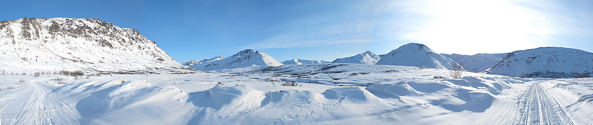
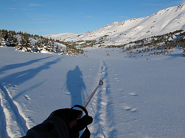
I started at
the Hatcher Pass Lodge and headed up the freshly groomed road to
Hatcher Pass. The grooming stopped at the pass as
snowmobiling was still closed there due to low snow. I
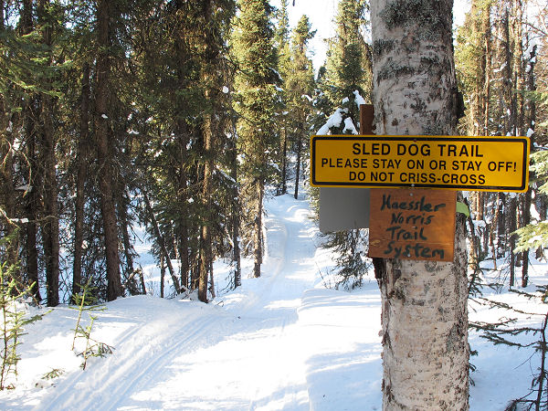
then skied the Fishhook-Willow Road down to the Herning Trail,
then onto the Haesller-Norris Trails which I followed to Willow.
In Willow I skied over to Long Lake and got on the Willow Trail
Committee trails and went to Deshka Landing. I then skied
the Big Susitna River and Kroto Slough down to the Yentna, then
to Susitna Station and on to the cut-off to Mile 10 of Alexander
Creek and down the homestretch to our cabin.
This was a
really fun link-up of many cool trails that I have skied and
learned over the years. |
 |
 |
 |
 |
 |
|
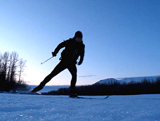
My wife took this
picture of me after she dropped me off at Hatcher Pass. |
A freshly groomed
trail to the pass, and no snowmachine traffic. Definitely
a unique situation. |
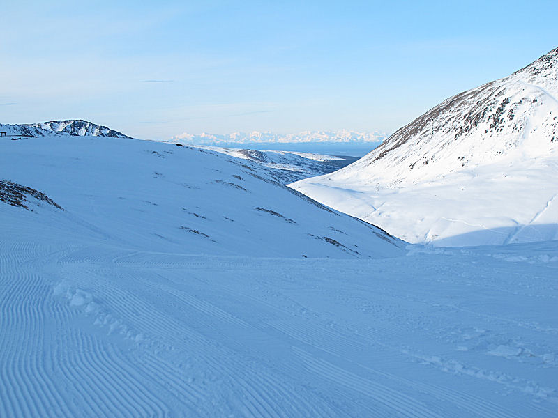
From the top of
Hatcher Pass you can just barely see Mt. Susitna peeking over
the ridge in the distance. That's basically where I'm
heading to. |
It was very quiet at
Hatcher Pass. I only saw 2 snowmachines (they were outside
of the park) due to the closure. |
Often this is a wide,
groomed trail. Not this year. But nevertheless - it
was good skiing. |
 |
 |
 |
|
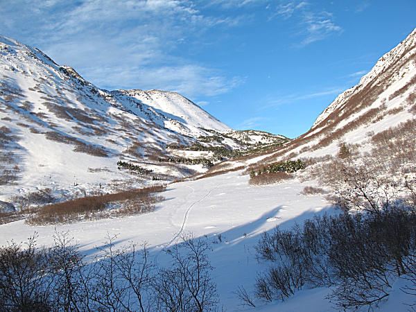
I was surprised to
find that the Fishook-Willow Road had been plowed all the way up
to the Lucky Shot Gold Mining Project. This is not normal.
The skiing was still good on the plowed road. But when it
warms up this route is going to be lost pretty fast. |
"Dualies" (double
back wheeled pickup trucks) make good double poling tracks. |
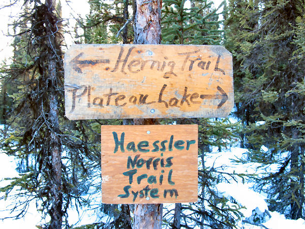
At this sign I turn
off the road and get on the Herning Trail. |
 |
 |
 |
 |
 |
|
The Herning Trail,
because it was laid out in the old days as a dog sled freighting
route, has a great flow to it. |
A ways out of
Houston I took a right off the Herning Trail and headed
northwest towards Willow. |
Plateau Lake |
The Haessler-Norris
mushing trail system is beautiful skiing. But I'm always
looking as far down the trail as possible to watch out for
oncoming teams of canine athletes. I didn't see any dog
teams this day. |
 |
 |
 |
 |
 |
|
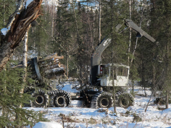
The "Woodcutters
Row" trail is aptly named. It skirts the edge of a logging
operation. |
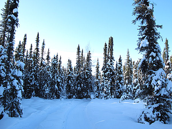
The Haessler-Norris
trail goes through lots of areas of dense, snow-laden spruce
forest. |
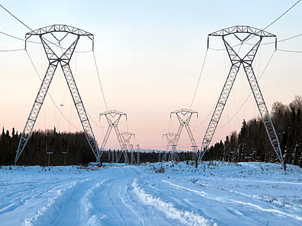
Following the power
line that goes to the top of Mt. McKinley. ;-) |
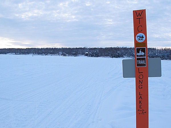
A Willow Trail
Committee marker on Long Lake. |
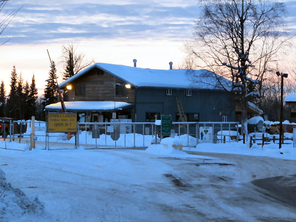
Passing through
Deshka Landing. |
 |
 |
 |
 |
 |
|
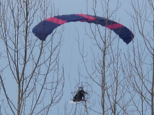
At Deshka Landing I
saw a flying snowmobile! "Hey, watch out for those ....
trees!" |
A few miles below
Deshka Landing is a BIG opening in the Big Su. I
definitely wanted to ski by this before it got dark.
Update: Sadly, later
this year a snowmobiler would drown here. |
Darkness falls as I
head down Kroto Slough. When a ski trip you have long tried to
do is playing out ... darkness, daylight - it's all good. |
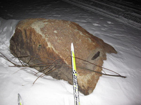
Getting near our
cabin. This is the "Big Rock". It's a glacial
erratic, the only rock that shows up in the first 10 miles of
Alexander Creek. |
I round the last
bend and see that my wife has her
living Christmas tree lit up (by
generator). My wife observes a very long Christmas tree
season (about 5 months). |
|
|
Moose Can Read!
... and other
goings on in the Lower Susitna Drainage |
 |
|
Early
February 2010: This
moose cracked me up. I was skiing down Alexander Creek and
she saw me coming. So she ran up to a "Posted / No
Hunting" sign and stayed there. She seemed to be saying:
"Check out the sign: Posted! No Trespassing! No
HUNTING! ... You can't touch me!" She seemed to have
figured out that "Posted" signs would bring her safety.
Well, it's
commendable that Susitna Valley moose have taught themselves how
to read. But while this moose's logic is good in theory, it
really doesn't match reality. As most Alexander Creek
residents will attest, when winter moose hunters come from
outside of this village to hunt here - 9 times out of 10 these
moose hunters can't read signs (or maps or game regulations or
even snowmobile fuel gauges). |
 |
 |
 |
 |
 |
|
Recently the Lower
Susitna area got a bout of strong winds from the south.
This is fairly rare, as the prevailing winds here are from the
north. All the leaves that showed up on the snow, in
February, made you realize that something odd had happened.
Leaves that had withstood months of harsh north winds were
all dislodged by a strong blow from the opposite direction. |
"Hey! Where
the heck did that dog come from!?"
That's Cali from
Alexander Creek. Whenever she wants to go someplace she
hops a ride on a passing snowmobile sled. |
When you ski through
moose tracks and you feel no resistance (the tracks haven't
begun to set up) - then you know the tracks are fresh and the
moose is right in front of you, or maybe right besides you! |
West of the Big Su
you can still find snow that was colored over a month ago by the
New Years Eve "blue moon". ;-) |
 |
 |
 |
 |
|
Skiing Alexander
Creek. |
Skiing past a
Susitna River log jam. |
A Valentines Day
potluck dinner at the Drapers drew 100% of the current
population of Alexander Creek. 15 people showed up.
Good food, nice folks ... a neat Alaskan small town gathering. |
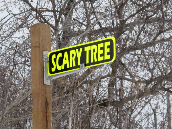
A point near where
the Yentna and Big Susitna Rivers meet is called "Scary Tree".
This name came from an ancient, and "scary" looking, big
cottonwood tree that once resided at this spot. The old
tree was taken out by the bank-eroding forces of these big
glacial rivers. Someone recently put a sign up to ensure
that the Scary Tree place name is not forgotten. But now
it's not really Scary Tree. It's more like "Scary
Treated 6 foot 4 by 4 From Home Depot". |
|
|
|
January Crust
Skiing on the Ingram Creek Tidal Flats |
|
|
 |
|
Map of the often, but not always, ski-able areas on the
Turnagain Arm tidal flats on either side of Ingram Creek.
Check when the high tide will be before you go. |
|
|
|
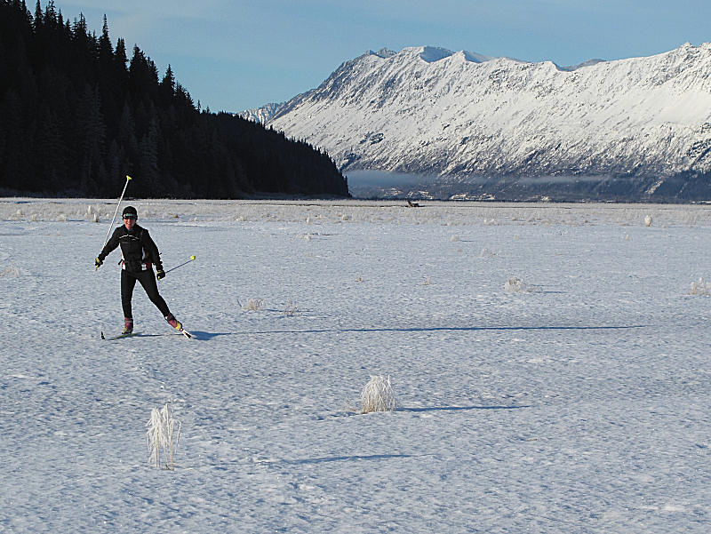
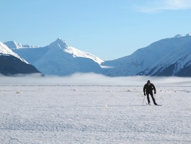
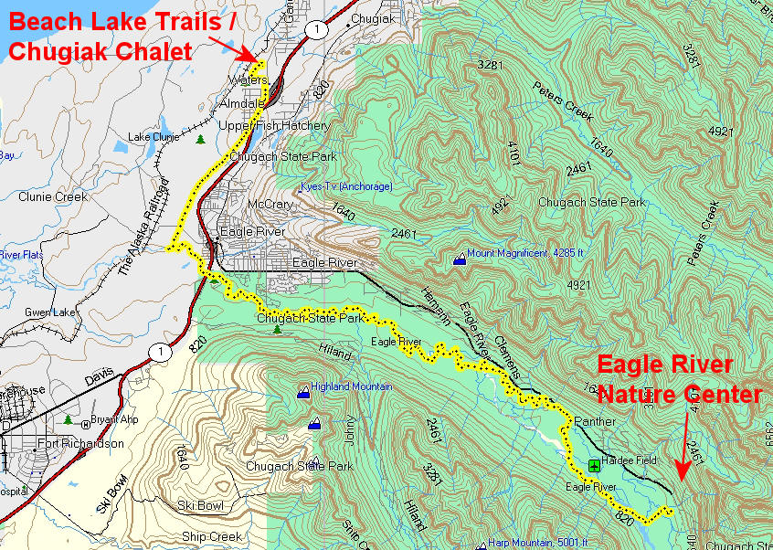
Eagle River Nature
Center to Chugiak Ski Trails |
Late January
2010: I teamed
up with Benji Uffenbeck to ski a new Eagle River route we had
been talking about. The idea was to ski from his house
near the Eagle River Nature Center to the chalet at the Beach
Lake / Chugiak trail system. We skied down Eagle River,
which was good going mostly on snowmobile trails, until we were
a mile or so downriver from the Glenn Highway bridge. Then
our plans changed thanks to the Eagle River sewage treatment
plant. We didn't realize that the effluent of the poop
plant was a strong flow of warm, and pungent, water that
kept Eagle River unfrozen and open from this point on.
Whoops. So, we "Plan B'ed" it and skied a power line,
subdivision roads and through random backyards until we got to
Chugiak High School and the trail system. Skiing the
"Benji Trail" was a fun combination of nice river skating
... followed by some entertaining skinny-ski boondocking.
Note: To ski on Fort Richardson property you need to get a
Recreation Access Pernit. It's quick, easy and free to
get one. Just stop by the main gate of Fort Rich and an MP
will get some info (drivers license) from you, take your
picture, give you an ID card ... and you will be ready to go.
Note to Fort Richardson:
Perhaps there should be more signage along Eagle River near the
sewage plant? Eagle River is a popular skiing route
and you can't tell when you enter Fort Richardson property. |
 |
 |
 |
 |
 |
|
GPS track: 25.4
miles. |
Good snowmobile
trails for skating on Eagle River. |
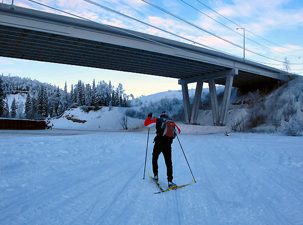
Reaching the Bypass
bridge. |
Heading towards the
infamous Eagle River campground rapids. Site of many canoe
and raft rescues. |
We followed a
snowmobile trail along the side of the frozen rapids.
It was no problem skiing this section. |
 |
 |
 |
 |
 |
|
Waxing up at the
campground. The Glenn Highway bridge is in the distance. |
Downriver from the
Glenn Highway we found good ski trails to follow. |
We skied past this
unique looking house. It's the only house I noticed along
the river west of the Glenn Highway bridge. |
Due to lack of signs
telling us to stay out ... we wandered onto Fort Rich, and had
to find a way out. The Army needs more signage in this
area. |
Benji enjoys some
quality skinny-ski boondocking near the end of the ski route. |
|
|
|
Skiing From Coast To coasT |
Late January
2010: I waited
until conditions were right so I could ski from coast to coasT,
in a day! What coasts am I referring to? The coast
of Anchorage to coasT Pizza in Girdwood, Alaska. The second
spelling above of coast should be a hint if you have been to
Girdwood. This fine
restaurant used to be a tacos place. But when the
restaurant switched to a pizza joint, the sign letters were rearranged from "Tacos" to "coasT"
... thus the capital "T" at the end of the name.
Starting from the coast of Cook Inlet at Westchester
Lagoon I skated to the Gasline Trail at Hillside and then strided
up
to 4000 foot Ship Pass and on to Indian Pass. Then I "survival
skied" down the ratty snowshoers' trench of a trail to Indian
(not too fun because of little snow). Once in Indian I
skied the bike trail to Girdwood until my skis were at the door
of coasT Pizza.It's
fairly rare that you can do this ski because the Bird to
Girdwood (B2G) pathway is often stripped of snow due to warm
Turnagain Arm winds. And skiing across the Bird Flats area
can be dangerous due to avalanche run-outs. But this year
was a unique combination of little snow in the mountains, so
avalanche possibilities were very low, and ski-able snow covered
the B2G trail. |

GPS track: 47 miles. |
 |
 |
 |
 |
|
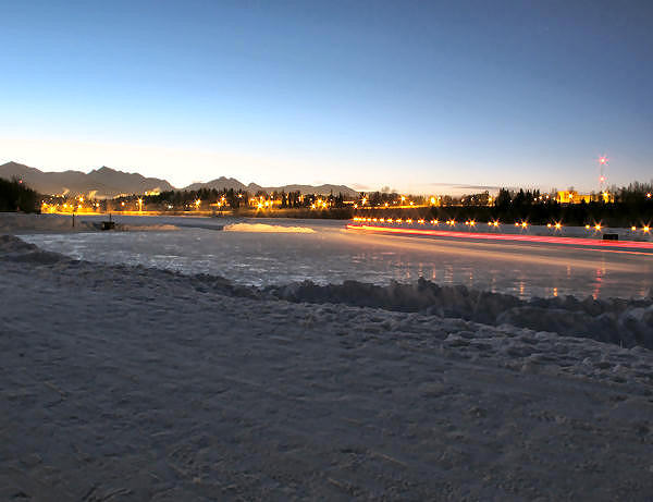
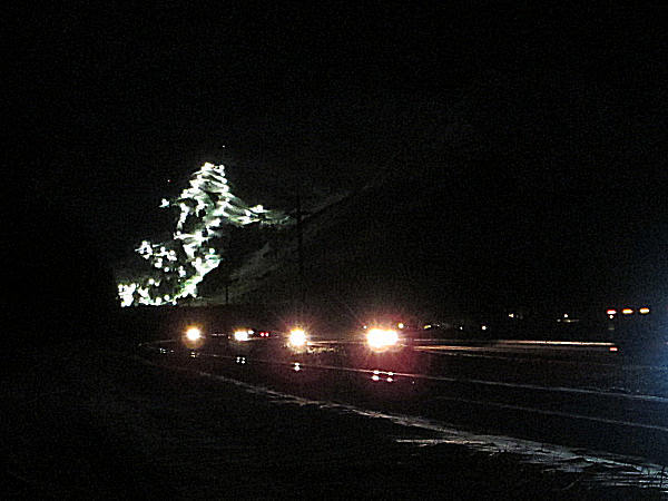
A long-exposure photo of
a plow truck on the Westchester Lagoon skating area. |
Christmas tree on
trail next to the lake at APU. |
A truly Alaskan stop
sign. |
Breakfast time in
Far North Bicentennial Park. |
 |
 |
 |
 |
 |
 |
 |
|
Powerline Trail.
A kicker that allows snowboarders to go big and grab onto the
high voltage lines above. Doh! |
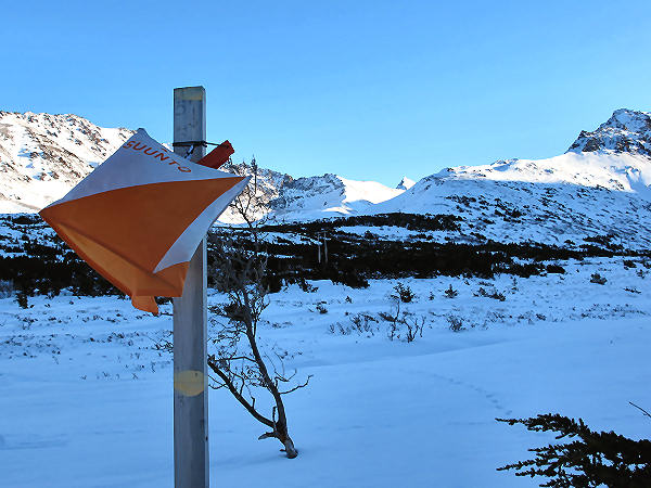
At the "German
Bridge". Looking up towards Ship Pass. (Note to AOC:
Are you guys missing a mountain orienteering race control?) |
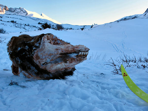
Moose skull and Ship
Pass in the distance. |
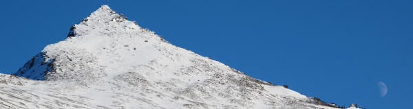
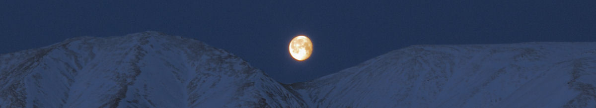
The Ramp and the
moon above. Below, wind kicking up snow plumes on The
Wedge. |
I followed tracks of
a guy who was skinning up to the pass. He had monster ski
pole baskets. |
I caught up to him
at the Pass. "You've got skis that are really skinny" he said.
I responded: "You've got pole baskets that are really freakin' huge!" |
 |
 |
 |
 |
 |
 |
|
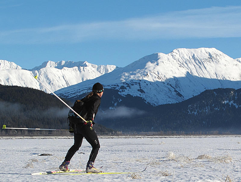
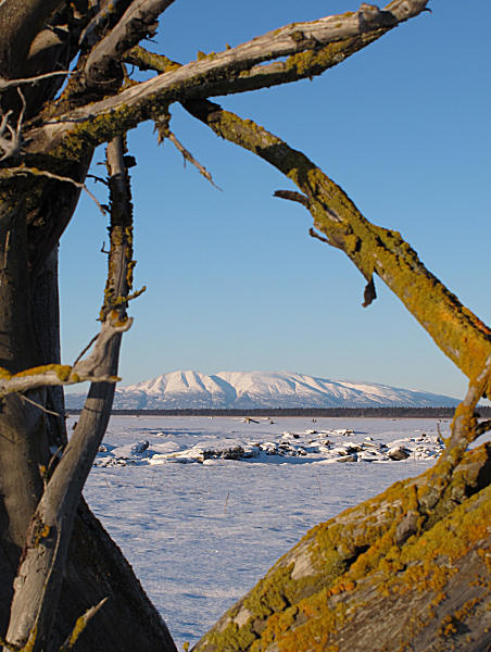
Ship Pass, 4050'.
Our backyard paradise, the Western Chugach Mountains, in the
distance. |
A big glacial
erratic, and looking down Ship Creek Valley |
Looking back up
toward Ship Pass. |
At Indian Pass.
Old ski tracks lead towards Arctic Valley. |
Heading down the
valley towards Indian. A big lynx had made the most recent
tracks here. |
Skiing above the
trees was really good. But skiing down the trail through
the woods was lousy, survival skiing. More snow is needed
here ... badly. |
 |
 |
 |
 |
 |
 |
|
Heading from Indian
to Bird. |
I had to make a
quick stop in Bird to fuel up on Snickers, Gatorade and
Snickers. |
Sunset. This
ski trip took longer than I expected (due to Indian Pass area
2 mph slogging). So I finished in the dark. |
Getting close. |
I made it ... coast
to coasT! Now it's time to eat ... |
Before I left
Anchorage I knew exactly what I'd be eating at coasT Pizza -
their spinach and feta quesadillas!!! |
|
|
|
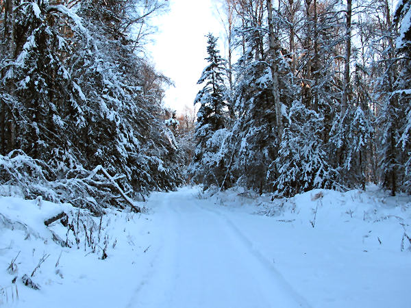
Familiar Trails,
That Never Get Old |
Mid January
2010: I've skied
this route many times in the last 20 years, but I think this is
the first time I've posted info about it on this web site.
This is the general ski route to my wife's and my cabin west of
the Susitna River. Starting at the Point Mackenzie
General Store it heads out the Enstar Gasline trail to the Big
Susitna River. At the Big Su there are a number of ways
you can go. So the distance is 24 to 28 miles.
Past the turnoff to Flathorn Lake, the route the Su 100 takes, I
have never seen another skier on this trail in 20 years.
But I have seen skiers in the Alexander Creek area. Mostly
they are Thiele-clan relatives ... the Thieles homesteaded at
Alexander Creek in the 1930's and 86 year old Carl Thiele still
lives there. He's lived at this remote, no road access
location for 70 years. His wife, who is in her late 70's,
still xc skis out there. So that makes me a young punk
whippersnapper when it comes to skiers west of the Big Su.
While skiing the Gasline trail I met a friend that retired and
moved to a remote property west of the Big Su. What he had
to say impressed me: "I can't believe how lucky we are to live
out here. Every time I travel out here I love this place
even more." This guy is 60 and has probably been coming to
the Alexander Creek area for 55 years. Sure sounds like a
real Alaskan to me. |
 |
 |
 |
 |
 |
|
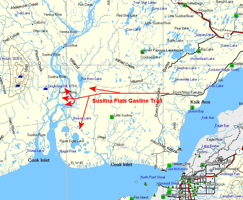
The Gasline Trail in
the Lower Susitna Drainage. Arrows show major trail
offshoots. |
Skiing south of the
"5 Fingers" on the West Channel of the Big Susitna River on the
28 mile route back to Pt. Mac. |
Recently there has
been good crust skiing on the Big Susitna and in the Bell Island
area. |
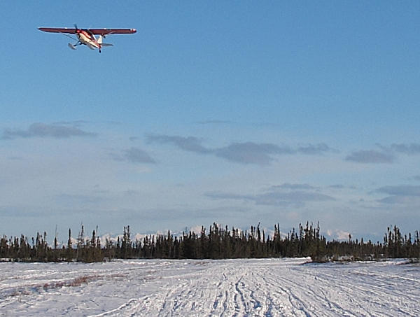
A state trooper
plane patrols winter moose hunters. This is a good thing.
The plane radios to troopers on snowmobiles of activity worth
investigating. |
The Gasline Trail.
By snowmobile, skis, dogsled, ski-joring, Nordic skates or truck
- I have probably traveled this trail 300 or more times in the
last 20 years. |
 |
 |
 |
 |
|
Susitna River Monsters: The picture on the left shows
cottonwood trees that fell into the Big Su. You can see
that they are all pointed the same direction, downstream.
The heavy roots drag behind the trunk as the trees move
downstream with the current. Often the tree will "rock" in
the water. So the end of the trunk can suddenly emerge and
stick high out of the water before submerging again.
Seeing this in a boat as you travel upstream is creepy.
And it's dangerous. You wouldn't want to ram a boat bow
into a river monster like the one in the picture on the right. |
While skiing in the
Chedatna Lakes area I saw the distinctive tracks of three river
otters. I followed their tracks to their front door. |
 |
 |
 |
 |
 |
|
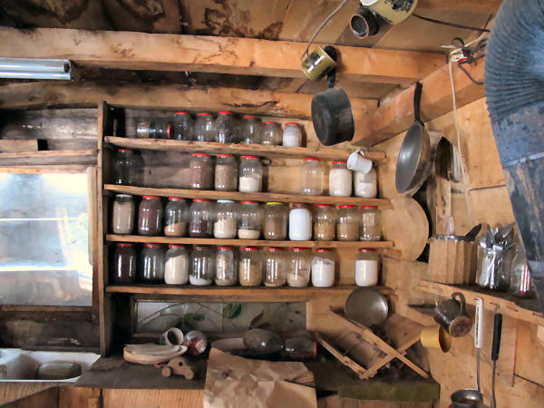
Someone's highbush
cranberry cold storage facility. |
My wife and I were
out snowshoe exploring and we stopped by this very remote, old
cabin that is being reclaimed by the forces of nature. 30
years ago the folks that lived here walked away from it and left
everything. It's a snapshot of a rustic life, frozen in
time ... and slowly rotting away. |
 |
 |
 |
|
Chedatna Lakes |
A swarm of very
rare Susitna fire flies showed up one night. I tried
catching some with my bare hands. They tasted pretty good. |
|
|
|
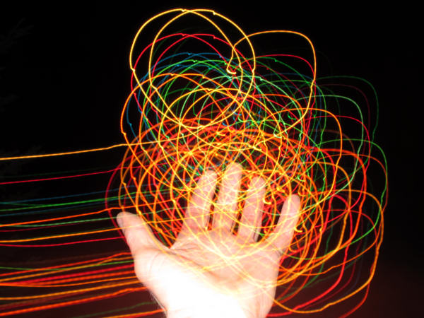
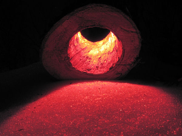
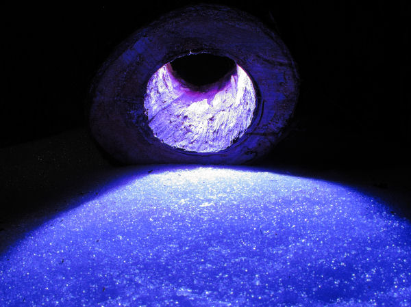
The Artsy Side of
Alaska's Most Hated Plant |
 |
 |
 |
 |
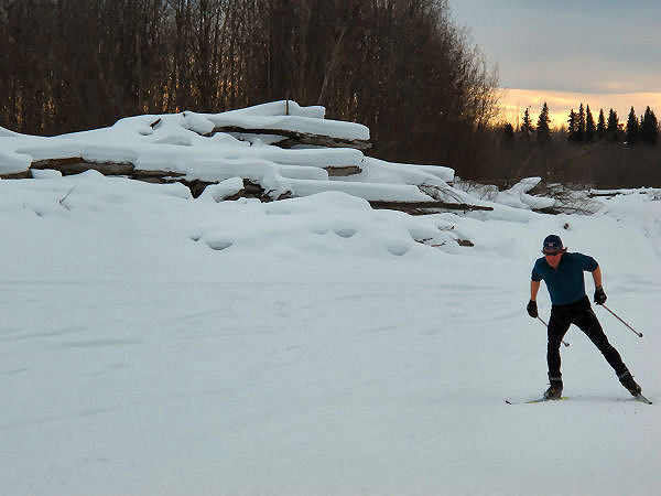
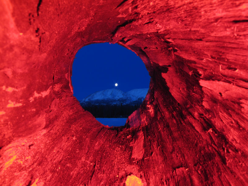
| Mid January
2010: Due to the
nasty, blistering rashes that cow parsnip can inflict on those
that rub against it in the summer ... it's likely the most hated
plant in Alaska. The other day I was skiing with my wife
and noticed how the new snow was building up on dead cow parsnip
stalks. And I thought: "Hey - this might make a good
nighttime, colored-flash, photography experiment ..." |
 |
|
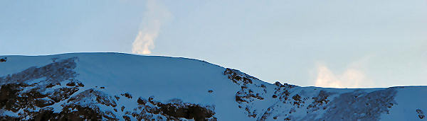
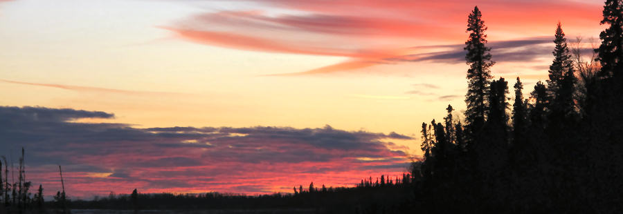
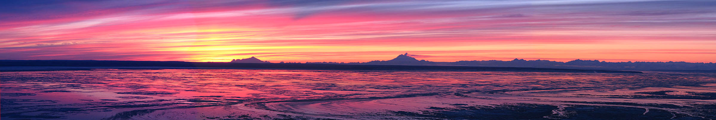
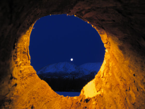
Our local volcano is
still fizzling and burping. If you expand this sunset
picture you can see a steam cloud rising from Mount Redoubt, and
a plume drifting northward. |
|
|
|
Little Susitna
Tidal Flats Ski-Exploring |
| Early January
2010: Over the
past few years I have been doing a number of ski trips on
Northern Cook Inlet tidal flats. These are fun ski treks
because you go to unique places where people rarely ski, the
skiing is often good and it's neat to see what other folks have
been up to in these remote locations. Like many Alaskans,
I had flown over the Little Susitna tidal flats area many
times. But I had never skied there. So if I hadn't
skied there, that's all the reason I need to head there
with my skis. I'm glad I did - cool place, beautiful day,
only saw 1 person (a local musher) ...
and the skiing was good. |
 |
 |
 |
 |
 |
 |
|
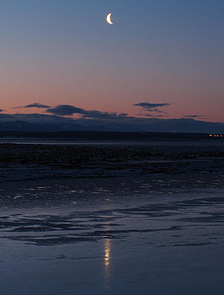
GPS track: 32 miles |
Moonshine on Knik
Arm. |
This ski started and
ended where the Beluga transmission line crosses the Pt.
Mackenzie Road. I followed the power line to
the inlet where I went east to check out an old boat wreck. The
trail along the bluff was good and I passed by lots of interesting old stuff. |
 |
 |
 |
 |
 |
 |
|
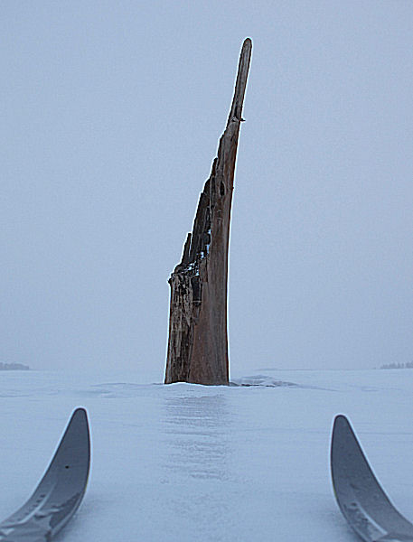
I figured I had
seen this abandoned barge, that was towed and left here in the 50's, from
the air - for 34 years. Finally ... I got around to skiing
to it. |
Skiing the "soak
zone", where high tides wet the snow and it freezes and makes
good skating. Wolves like the soak zones too, see tracks
in above picture. Anchorage in the distance. |
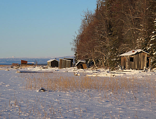
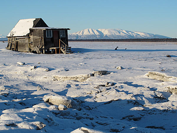
Old 1950's setnet
fishing cabins once built by a group of old homesteaders that my
father-in-law refers to as the "49'ers". |
Common sights in
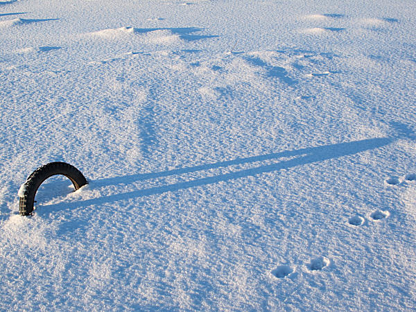
winter - long shadows and wolf tracks. |
There was a touch of
classic skiing on this loop, but 95 percent of it was skating -
mostly on crust snow. |
|
 |
 |
 |
 |
 |
 |
|
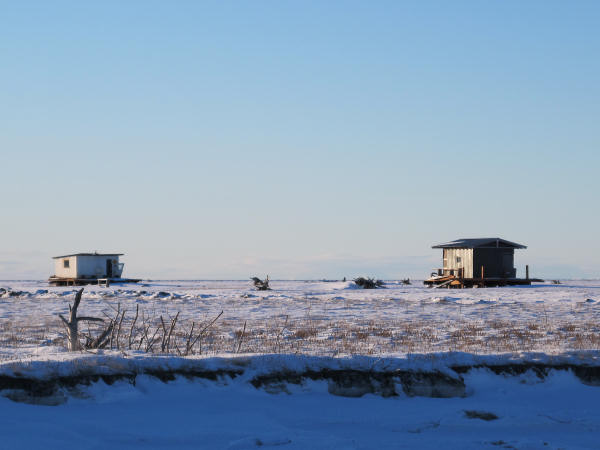
There are many duck
hunting cabins on the Susitna Flats tidal area. I probably
skied by 30 of them. People pay the state permit fees to
keep these cabins here. I don't believe that any new duck
hunting cabins can be built. |
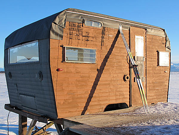
This dome cabin was
once on a raised platform, but got blown off of it. |
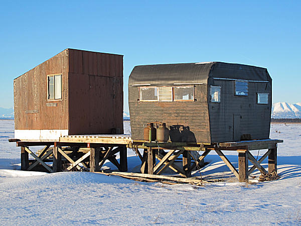
Of all the duck
hunting cabins I saw - this was the one I was the most impressed
with. It had a separate storage and drying building. And
the living area was a classy 60's (?) Caravan trailer. I
award
this gem ... 5 stars! |
 |
 |
 |
 |
 |
|
A bear-proof window
cover on a duck shack. |
Skate tracks.
The west side of Fire Island can be seen in the distance. |
Crust skiing in
early January. No complaints. |
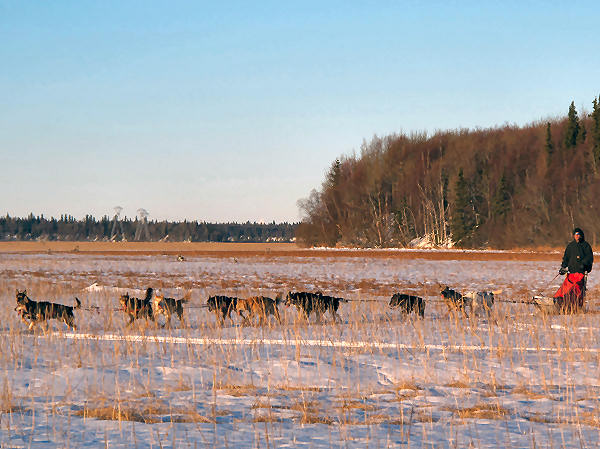
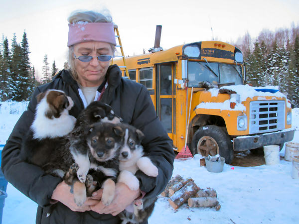
I met Justin mushing
his pals near the Little Susitna River. Justin invited me to
stop by his place (a remote site next to the power line).
Nice folks. |
|
|
|
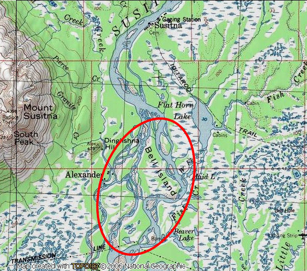
Bell Island Crust
Skiing |
|
|
|
|
|
|
|
|


