|
|
|
|
Home |
|
Intro |
Gear |
About |
Trips: |
2026 |
25 |
24 |
23 |
22 |
21 |
20 |
19 |
18 |
17 |
16 |
15 |
14 |
13 |
12 |
11 |
10 |
09 |
08 |
07 |
06 |
05 |
04 |
UBXC |
Apps |
eBook |
|
2009/2010
by: Tim
Kelley
|
|
|
|
|
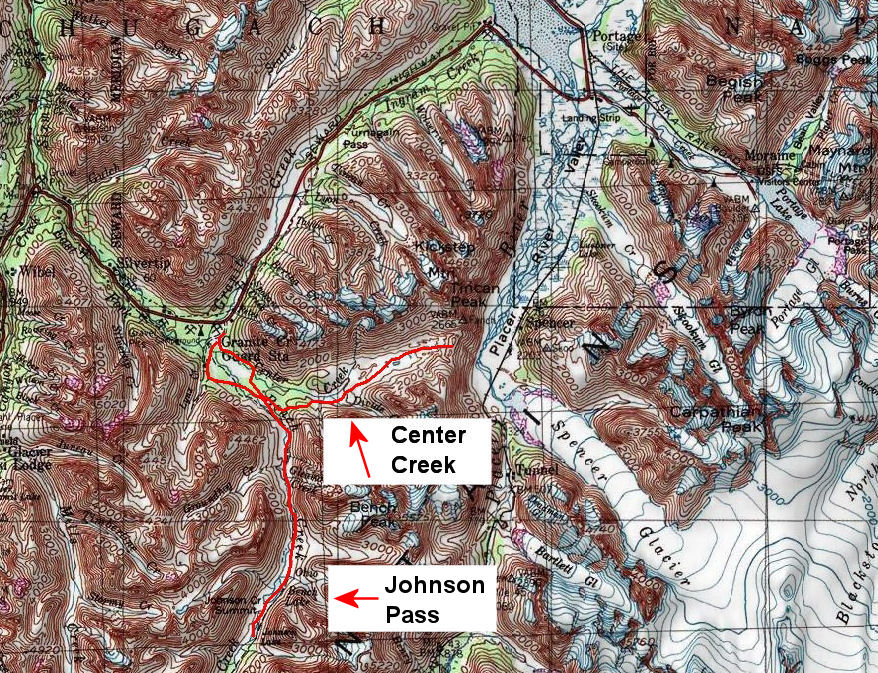
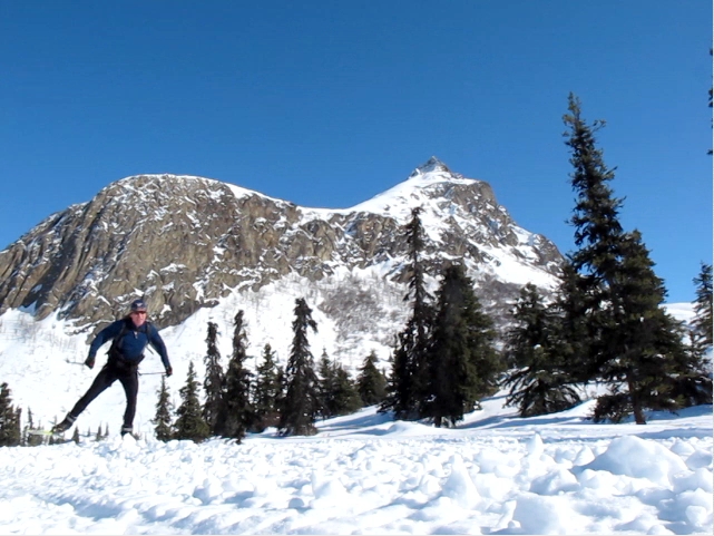
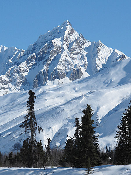
Johnson Pass - 100 Years of Crust Cruising |
|
|
|
|
48 Miles, 0 Vertical, 50 SPF Sunblock |
 |
|
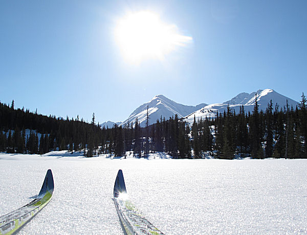
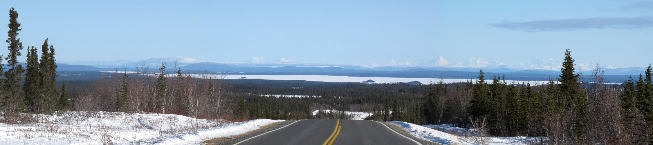
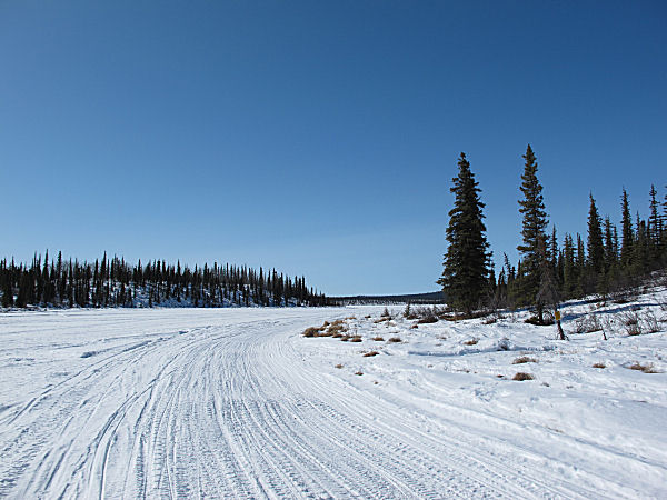
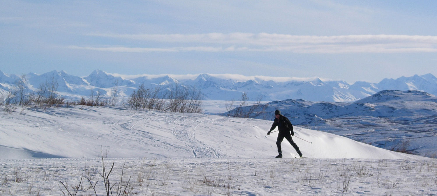
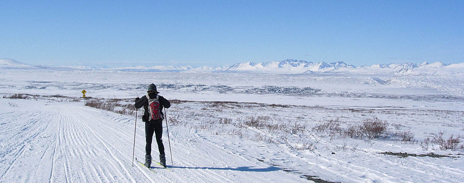
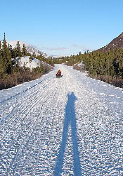
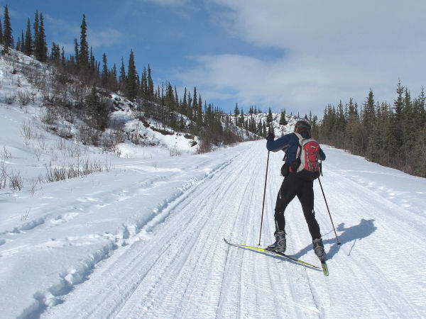
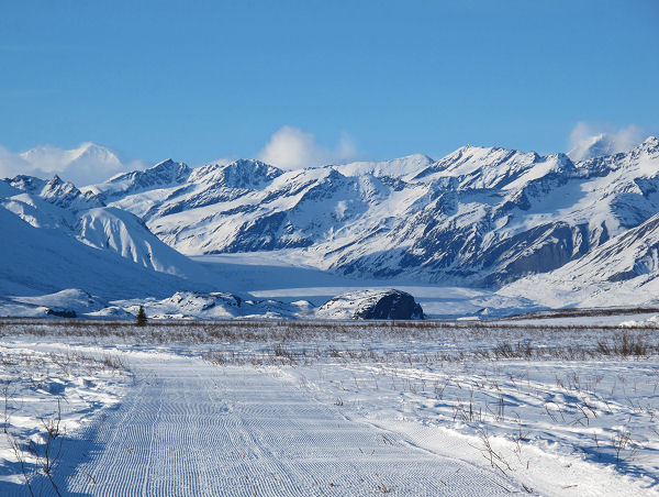
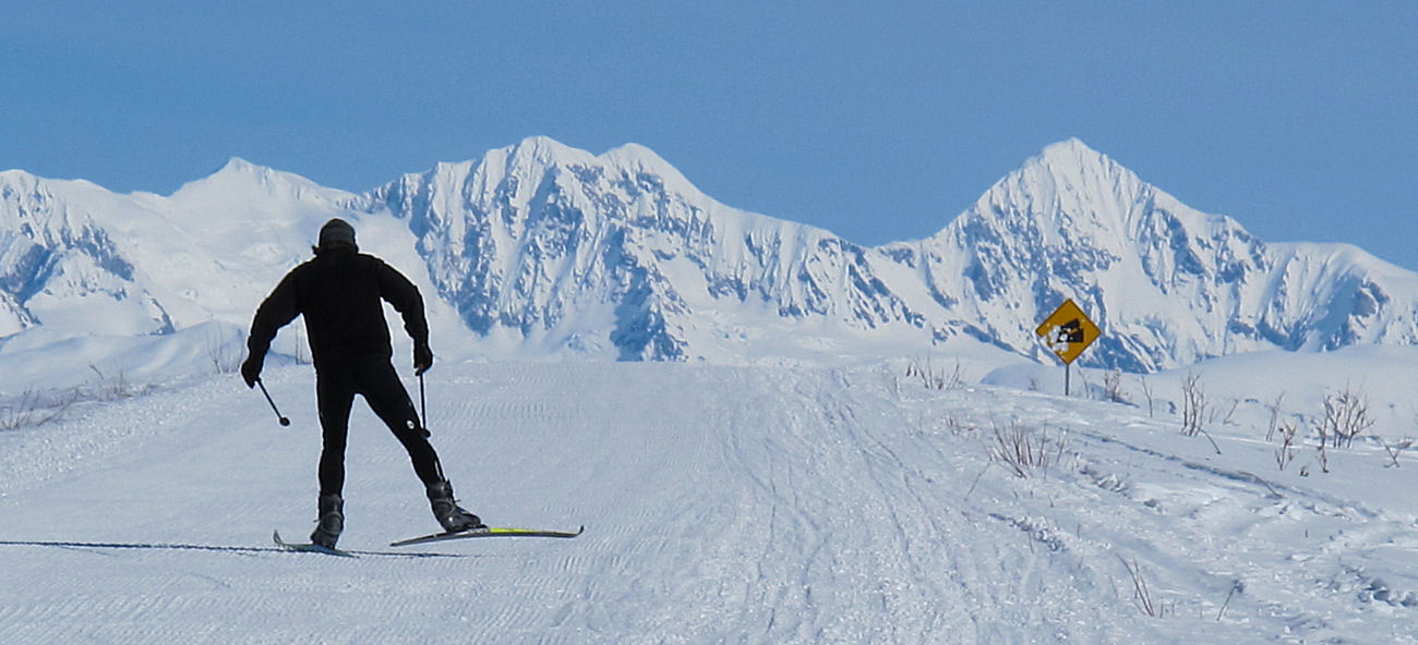
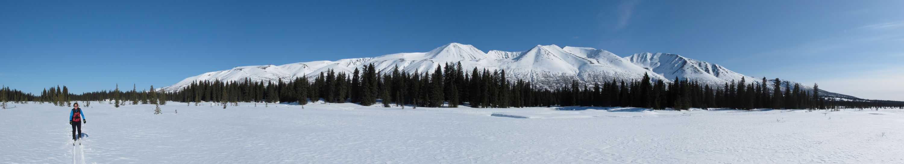
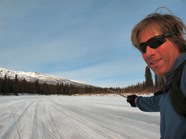
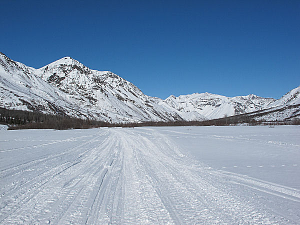
On the Lake Louise
road. Lake Louise ahead, Alaska Range peaks in the
distance. |
 |
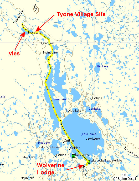
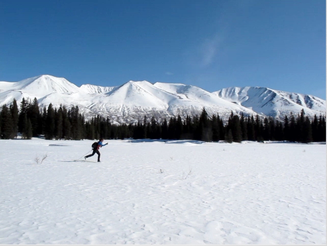
Early April
2010: Last year
I skied Lake Louise and Susitna Lake, but I didn't feel that I
did the ski trip justice. It was a substantially south of
zero (F) day and the trip was more diagonal shuffling than fun
skiing. This year I waited until it warmed up a bit and
the snow sped up ... and I went back. I did a 48 mile out
and back ski on snowmobile trails from the Wolverine Lodge,
across Lake Louise, across Susitna Lake and on to the north
outlet of Tyone Lake. It was a little chilly at the start
(10 F), but the cloudless skis warmed things up into the mid
30's. Zero vertical, V2 skating the whole way ... nice day
to check out some new country on skis. |
|
GPS track: 48 miles. |
 |
 |
 |
 |
 |
|
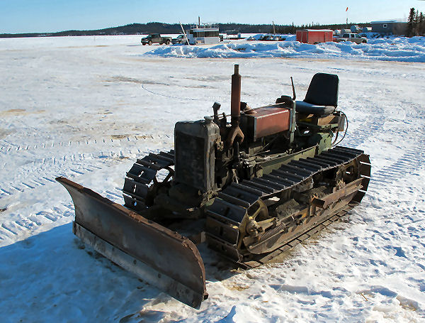
Only wimps would
plow parking lots on Lake Louise at 30 below while inside a
heated truck. Real men do the job on a cab-less 60? year
old mini-dozer ... like this one! |
I saw less than a
dozen snowmobilers. All were lake residents or
recreational property owners hauling supplies or building
materials. |
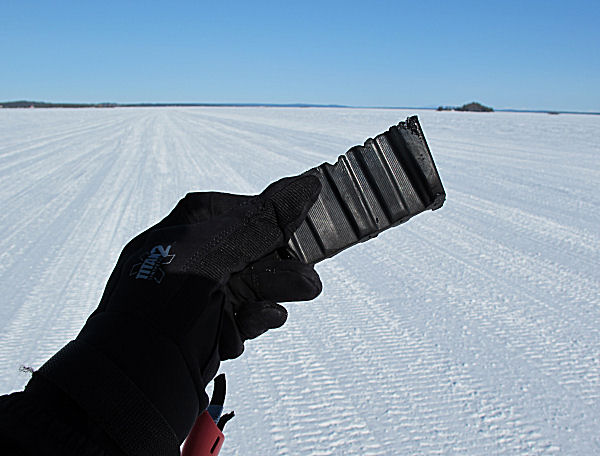
You find these on
trails quite a bit. This is a lug that broke off a
snowmobile track. People try to ride deep-lugged mountain
sleds on hardpacked trails and wreck their tracks. And
have to pay $1200 for a new one. Duh. |
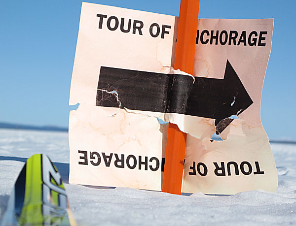
I don't know what
the story was here. On Lake Louise there was a cross
country ski "trail marker" and a Tour Of Anchorage sign?!
Maybe a skier has a cabin up here? I don't know. |
 |
 |
 |
 |
 |
|
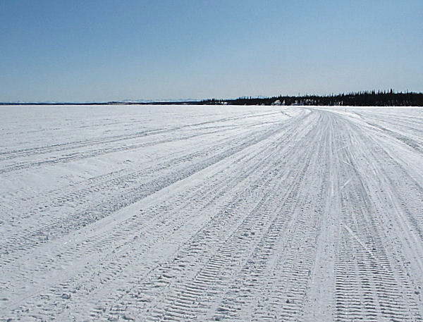
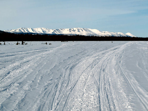
Lake Susitna.
Long, flat, wide ... and good skating. |
A Lake Susitna ice
fishing shanty with the basics: a grill and a huge-a** satellite
dish. |
Tyone Lake is a lot
narrower than Sustina or Louise lakes. Natives referred to
this areas as "small timber country". (Shem Pete's Alaska,
page 221) |
This location really
stuck out in this area. It was once the site (100 years
ago and on back) of Tyone Village, an Ahtna Indian settlement. |
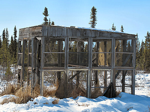
Across the lake from
the Tyone Village site was this old fish drying house.
Screens kept bugs off the fish as it hung from the roof and was
smoked. |
 |
 |
 |
 |
 |
|
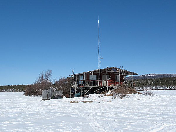
Perched on a very
small bit of glacial moraine that stuck up out of Tyone Lake was
this gem of a cabin. |
This creaky old
cabin is apparently: "Ivie's Isle of View". |
Ivie lays down the
law concerning his cabin with this sign! |
Nice view from the
front porch on Ivie's island. |
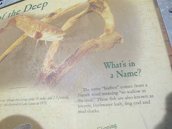
An interpretive sign
next to Lake Louise mentioned that burbot comes from a French
word meaning: "to wallow in the mud". And that these fish
are also called "lawyers". Funny! |
|
|
|
Skiing The Denali
Highway |
|
|

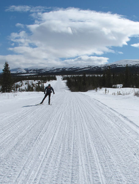
Denali Highway map |
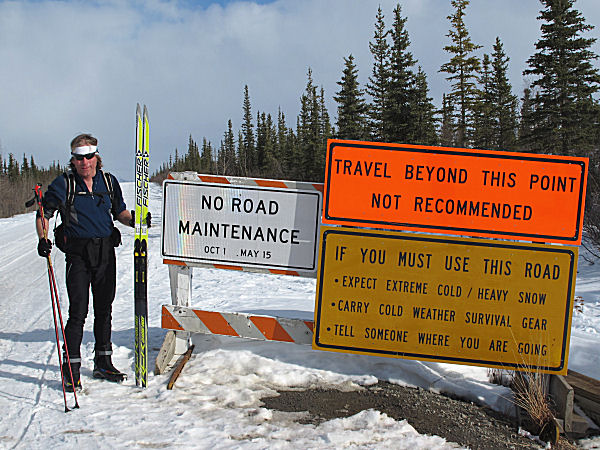
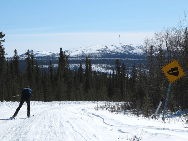
Late March /
Early April 2010:
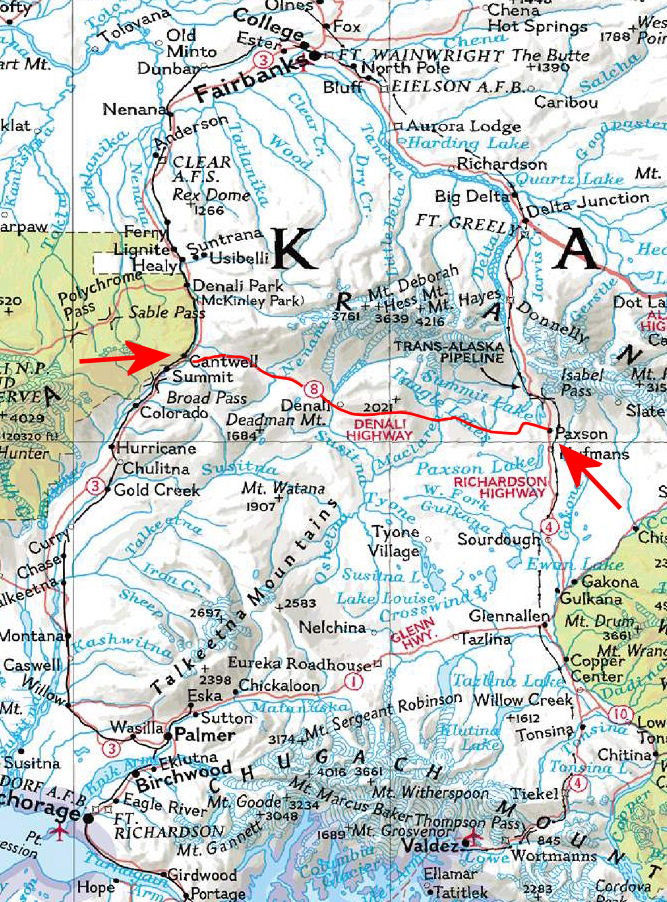
The Denali Highway is a 131 mile road from Paxson to Cantwell
that is closed to automotive travel in the winter. Skiing
this route, which is a snowmobile trail in the winter, is
something I've wanted to do for a long time. I tried
skiing this route last year but bailed due to blizzard
conditions. Waiting until this year turned out to be a
good deal as the weather was great.
I did the ski from Paxson to Cantwell in two days: 68 miles the
first day, 63 miles the second day. My wife came along on
snowmobile while I skied across, then she and I took turns
skiing the super-nice stretches on the way back. We stayed
at Denali Highway lodges while doing this ski trip, so that was
fun. We saw a lot of animals: caribou, moose, ptarmigan,
peregrine falcons and a big wolf. And in 260 miles we only
encountered 6 travelers (two groups of 3) on snowmobiles.
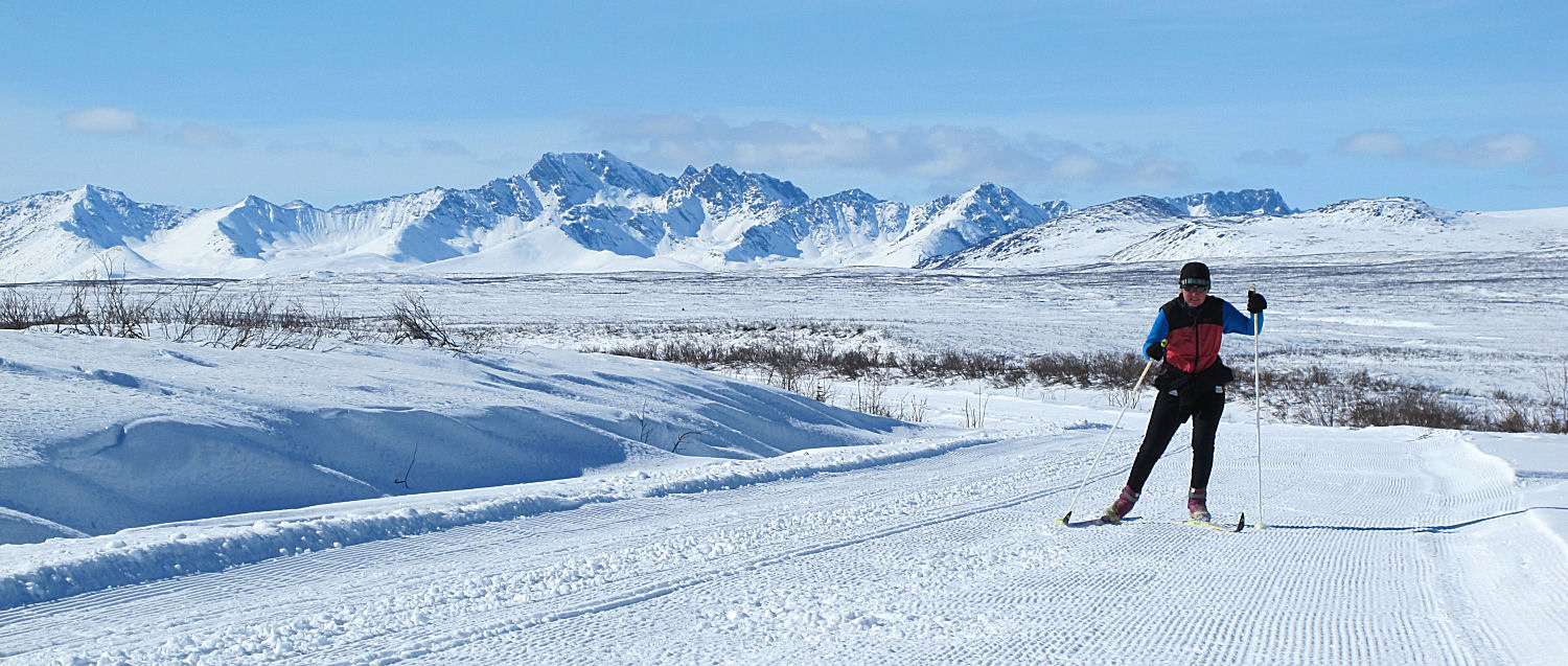
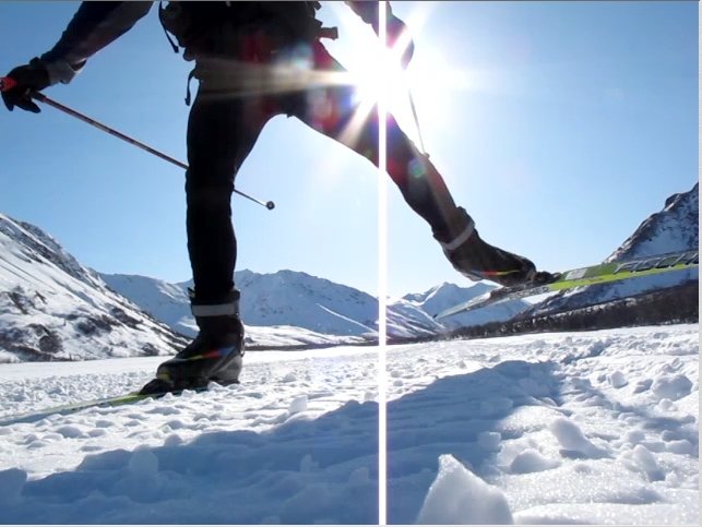
All of the skiing we did was skating, and some of the skiing on
the return trip was on freshly groomed corduroy! |
|
Paxson To
Cantwell |
 |
 |
 |
|
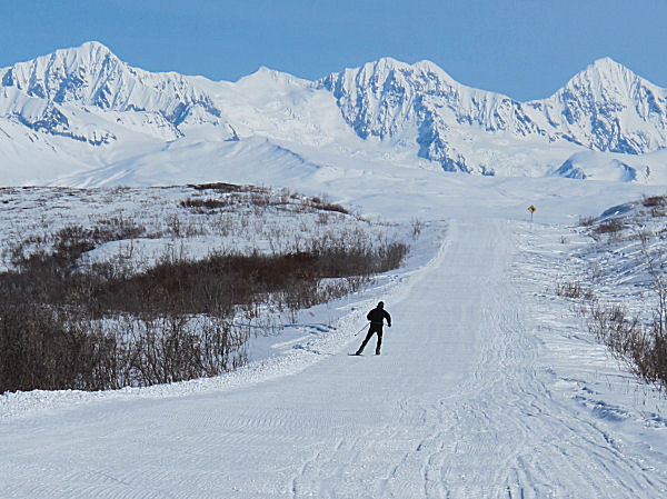
Heading out,
climbing up over the ridge of Paxson Mountain. |
My wife, on her
snowmobile, met me on 13 Mile Ridge. |
Nearing the top of
13 Mile Ridge, the Alaska Range is in the background. |
 |
 |
 |
 |
 |
|
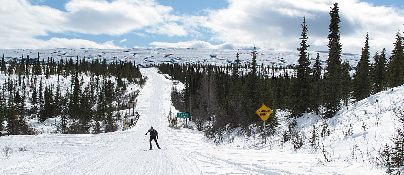
Running across some
bare pavement near Tangle Lakes. |
Tangle Lakes area. |
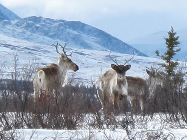
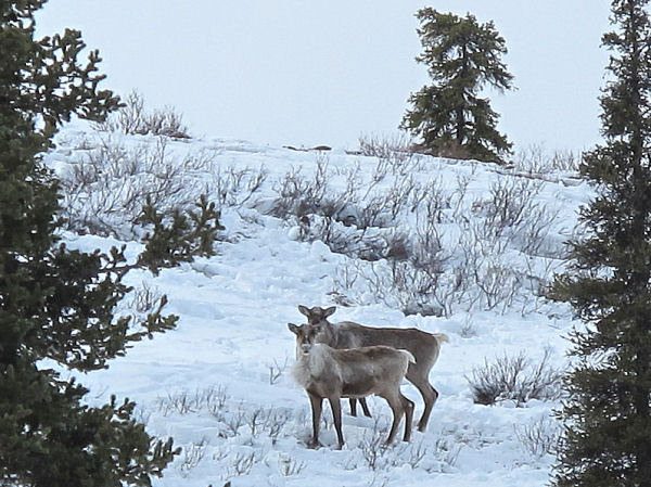
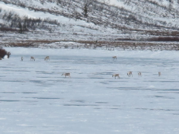
Caribou on Tangle
Lake. |
Still a little ways
to go. ;-) |
The 2nd highest
highway pass in Alaska (Atigun Pass on the Dalton Highway is the
highest at 4800'). |
 |
 |
 |
|
Heading down from
Maclaren Summit. |
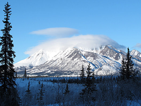
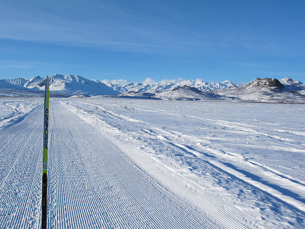
Clearwater Mountains |
This is my favorite
part of the Denali Highway ... where it travels on top of long
meandering glacial eskers. Very unique. |
| |
 |
 |
 |
|
| |
For 3 miles on
the south side of the Clearwater Mountains the snow was lean.
You can see where my wife was driving in the ditch. |
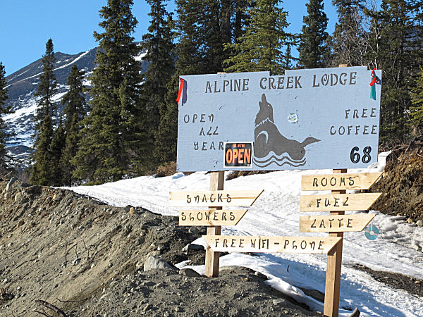
We stayed at
Alpine Creek Lodge
at the halfway point - Mile 68. Neat place and we really
liked Craig and John who were running the place. |
It took about 9
hours to get to Alpine Creek Lodge (where it had hit 60 in the
afternoon). I was beat and slept for 10 hours. |
|
 |
 |
 |
 |
 |
|
The next morning - I
wave as my wife leaves me! ;-) |
Clouds over the
northern Talkeetna Mountains. |
The bridge over the
Sustina River. |
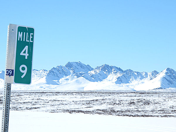
100 miles from
Paxson. Mile signs were replaced last year - so every mile
from 22 on was marked. |
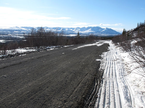
Nice trail. |
 |
 |
 |
|
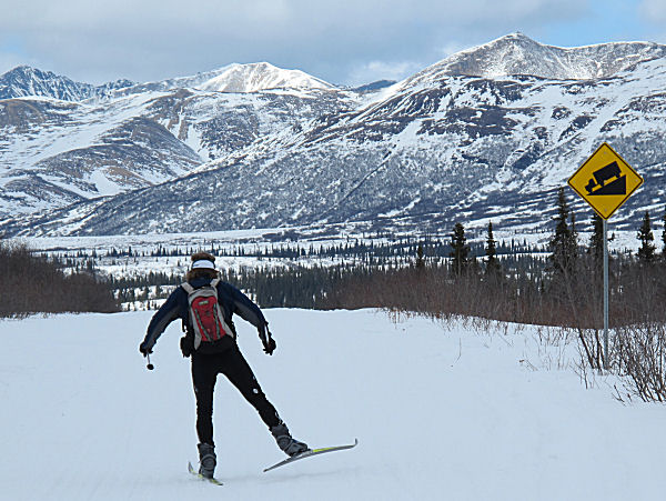
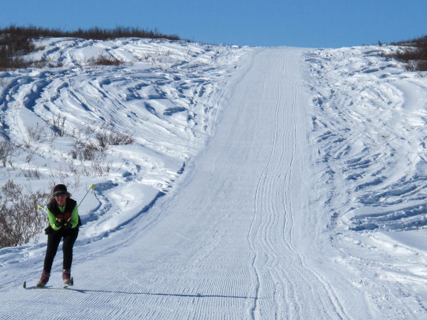
You better like
skiing up hills if you ski the Denali Highway. |
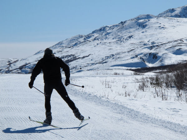
Gittin' after it on another
uphill. |
Topping out on a big
climb to the Denali Borough / Matanuska Susitna Borough border. |
 |
 |
 |
 |
 |
|
Caribou tracks. |
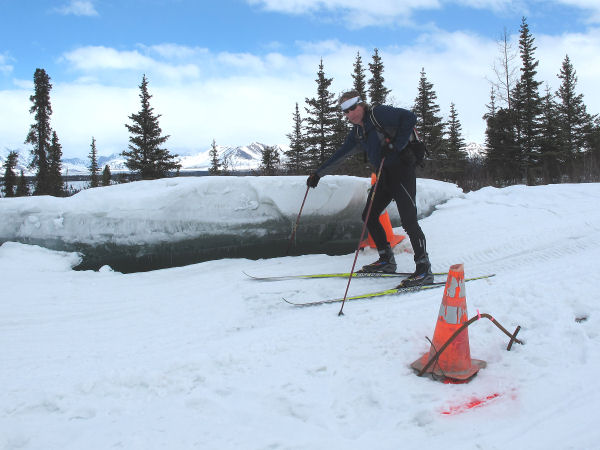
Big, buckled section
of overflow on the road. |
Going down ... |
End in sight.
The day 2 ski took about 8 hours to complete. |
Skied the Denali
Highway ... check. (And it was fun!) |
|
Cantwell To
Paxson |
 |
 |
 |
|
On the way back it
was my wife's turn to do most of the skiing. She skied the
choice sections of the highway while I drove the
snowmobile (and took pictures) during two more beautiful days in
Alaska. |
 |
 |
 |
 |
 |
|
It's my wife's turn
to ski and the Denali Highway groomer (Alan Echols) lays fresh
corduroy for her! |
Leaving the
Clearwater Mountains in the distance. |
My wife skates down
towards Crazy Notch. |
And then she
tuck-skates down to Maclaren Lodge. |
 |
 |
 |
 |
 |
|
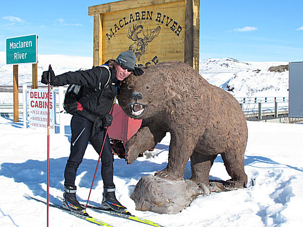
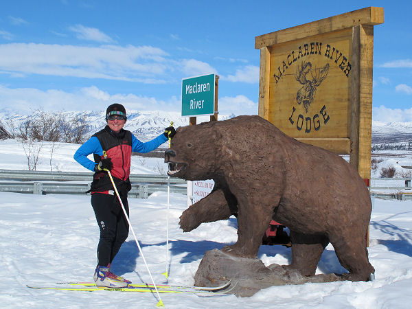
We stayed at Alan
And Susie Echol's
Maclaren River Lodge. Cool place in a beautiful area. |
Though I was a bit
tired from skiing 131 miles the previous two days - I had to
check out the groomed trails that Alan Echols sets to the
Maclaren Glacier (these are only some of the 100 miles of trails
that Alan grooms primarily for snowmobilers). Phenomenal
skate-skiing conditions and jaw-dropping views of the Alaska
Range. |
A sizeable slab
avalanche that had let loose from a wind-loaded river bluff. |
 |
|
The next day we
headed from Maclaren River Lodge back to Paxson. Here is
the view of the Alaska Range from Maclaren Summit. |
 |
 |
 |
 |
 |
|
My wife skates first
tracks on fresh corduroy. The last two days we were on the
Denali Highway we met no other travelers on the road. |
When it comes to
driving snowmobiles ... my wife thinks snow is overrated. |
Skiing the last
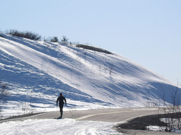
stretch into Paxson. |
| |
 |
|
 |
 |
 |
 |
|
Final tuck into
Paxson. |
Damn! That was
a fun ski trip! Great weather, good skiing and it was fun
meeting the Denali Highway folks. |
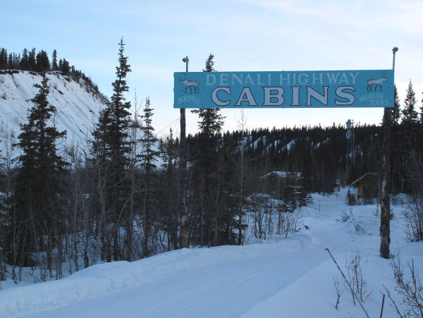
Arriving back at
Audie and Jenny's Denali
Highway Cabins. |
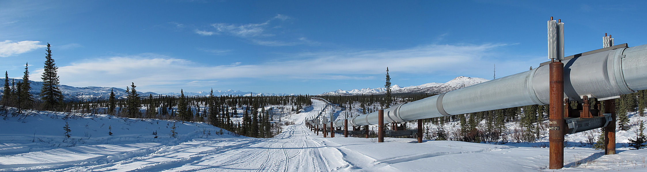
Audie showed us some
of the many neat trails in the Paxson area - including this one that
climbs up to and goes along the Trans Alaska Pipeline.
Wow! |
| |
|
|
|
|
A note on
Denali Highway trip logistics:
If you live in Anchorage, doing a ski trip across the Denali
Highway can be a daunting logistical undertaking. If you
want to drop off a vehicle on the other side of the highway, so
that you have a way to get home, there is a lot of driving
involved.
Say for
example you want to ski from Paxson to Cantwell and have a car
waiting for you in Cantwell. Most likely the logistics
needed to set this arrangement up would go like this: 1) drive
two vehicles from Anchorage to Cantwell (210 miles x 2 = 420
driving miles), 2) drive from Cantwell to Wasilla to Paxson (390
miles), 3) ski from Paxson to Cantwell, 4) drive from Cantwell
to Wasilla to Paxson (390 miles), 5) drive the two vehicles from
Paxson to Anchorage (260 miles x 2 = 520 driving miles).
Total driving miles: 1720.
Instead of
driving 1720 miles to do this trip one can use a snowmobile to
simplify the logistics, like this: 1) drive from Anchorage to
Paxson (260 miles), 2) ski from Paxson to Cantwell and have
someone come along on a snowmobile (131 miles), 3) at Cantwell
double up on the snowmobile and drive back to Paxson (131
miles), 4) drive back to Anchorage (260 miles). Total
driving miles: auto - 520, snowmobile - 262, total - 782.
The
snowmobile option is almost 1000 miles less driving than the
"drop a vehicle at the other end" technique. If you
figure, using rough estimates, that a vehicle gets 20 mpg and a
four-stroke snowmobile also gets 20 mpg, then the drop-off
option would consume 86 gallons of gas and the snowmobile option
would use 34 gallons of gas. Using a snowmobile can be a
simpler, less time-consuming and a cheaper way to support this
trip.
|
|
December 2010 update:
I've gotten a few emails asking
about skiing from lodge to lodge on the Denali Highway.
Basically, there are lodges that are open in the winter on the
east half of the Denali Highway, but none between the Alpine
Creek Lodge and Cantwell on the west half. You may notice
from the pictures above that the east side of the Denali Highway
is arguably the most scenic. So if you don't have a
snowmobile or car arrangement for getting home from the other
side of the Denali Highway, you can always do an out and back
ski from Paxson. You can drive up to Paxson and stay at
Audie and Jen's Denali Highway Cabins (or Paxson Lodge if Audie
and Jen's place is booked up). Then you can ski on to the
Echol's Maclaren River Lodge (42 miles from Paxson) and the
Bundy's Alpine Creek Lodge (68 miles from Paxson, 26 from Maclaren).
And then turn around and ski back to Paxson. Links to
these lodges' web sites can be found above.
The best time to ski the Denali Highway, in my opinion, is late
February to early April (before the Arctic Man weekend).
Usually the temperatures are warming, there's lots of light and
the snow is faster during this period. I don't stay at
remote Alaskan lodges too often, but when I do I like to follow
the rule of "arrive as a guest, leave as a friend". The
folks that run these places are friendly, likeable and unique,
and you learn a lot by listening to their stories of life on the
Denali Highway. At remote lodges I also like talking to
the other guests, like snowmobilers. They are often cool
folks that have great stories (about anything and everything),
and often give you ideas for future ski trips on winter trails.
Make friends with everyone you meet and your trip will be more
fun. Plus - the more skiers, snowmobilers and mushers that
know and like each other... the better it makes Alaskan winter
trails. |
|
|
|
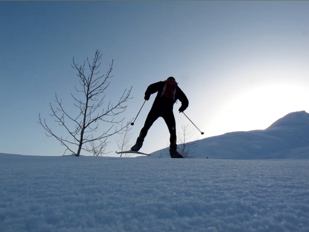
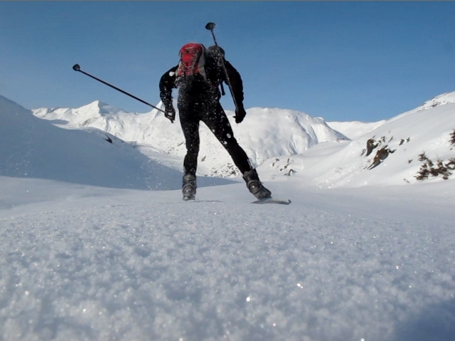
Let There Be Crust! |
| Late March
2010: I once read
something about this on the Internet. I think it's called crust
skiing or something like that. It's kinda neat - you can
skate on top of the snow, go anywhere you want and you don't
even need groomed tracks. It's pretty cool !!
;-) |
 |
 |
 |
 |
 |
|
Ahhhh .... |
Heading to Portage
Pass. |
Three wolves were at
the pass before I was. |
Tracks show fun. |
Black dot at the end
of the arrow is another crust skier. Skier small.
Glacier big. |
 |
|
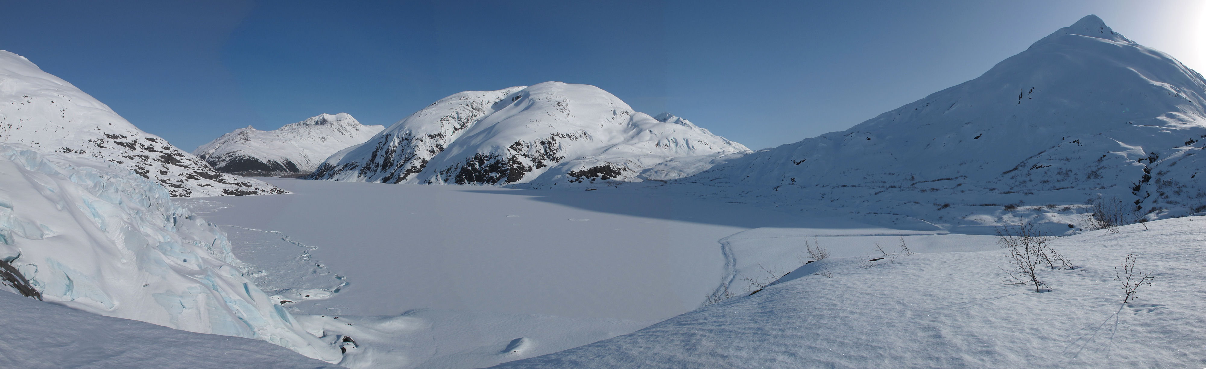
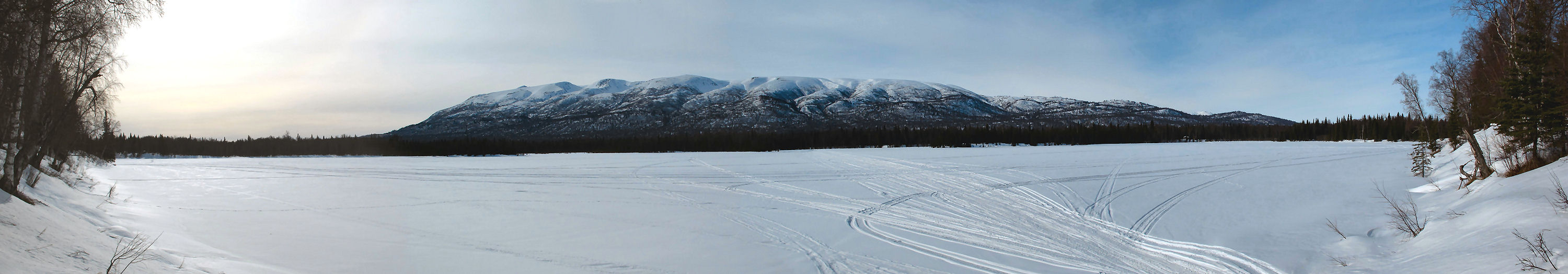
This panoramic view
is from up on the ridge above the east side of Portage Glacier.
It shows the glacier terminus, Portage Lake and Portage Pass in
the center. Mountains seen in this photo are: Begich Peak
(in the distance), Maynard Mountain (center) and Bard Peak
(right). |
 |
 |
 |
 |
 |
|
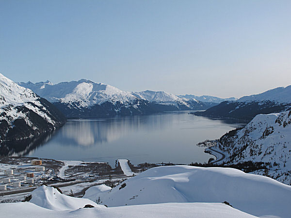
Passage Canal,
gateway to Prince William Sound. |
Heading back down.
Whoops! I forgot my camera! |
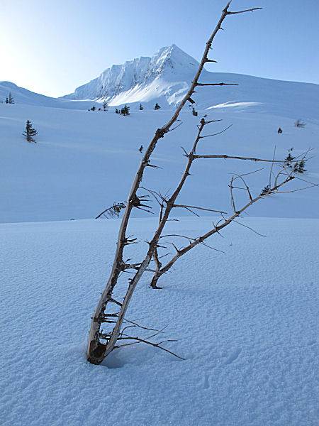
The bark is absent
on the windward side of these dead trees. This is a windy
place (usually). |
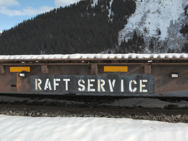
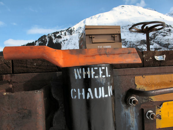
This was worth a
chuckle. I was skiing the lower Portage Valley and passed
by a flatcar used to haul rafts to Spencer Lake. A
container on the rail car said: "Wheel Chaulks". Uhmm ...
don't you mean "Wheel Chocks"??!! Chaulk (Eng.), or chalk
(U.S.), is very soft material and probably wouldn't make good stoppers
for the wheels used by the Alaska Realrode (did I spell
this last word right? ... awh heck, it sounds right so it's
close enough!) ;-) |
|
|
|
A Circle 'Round Susitna |
| Late March
2010: Last year
I hiked and skied up Mount Susitna a few times, so this year I
wanted to ski a circle around the mountain. I tried to do
this backcountry and trails loop the previous week but high
winds shut me down. This delay actually worked out well
because I got great weather on my 2nd try and my wild wife could
go with me for the first (and by far the toughest) half of this
59 mile loop. To do this loop we snowmobiled to our
friends' cabin on the north end of this route and then skied the
Wolverine Creek and Lewis River drainages to the south ridge of
Mount Susitna. We then switched to snowshoes and endured a
long and brutal bushwhack through alders, devils club and black
spruce to get to the Ivan River and the Enstar gas line.
We then skied the gas line and reached the snow-less West
Channel of the Big Susitna River in the dark. We hiked
sand bars north into the wind until we reached Alexander Creek,
then skied to our cabin where we spent the night. The next
day I skied the 30 miles up Alexander Creek, to Derf Lake and
along the Thomas Trail to get to where we left our snowmobile.
Fun loop, even though there was a bit of bushwhacking brutality. |
 |
 |
 |
 |
 |
|
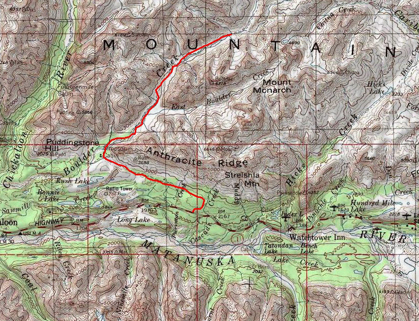
Area map |
GPS track: 59 miles. |
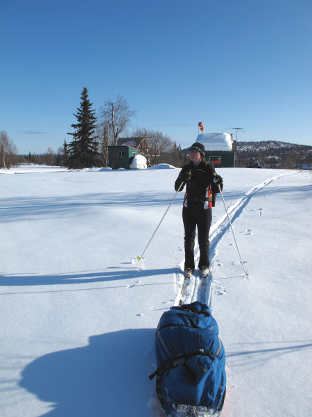
Heading out from
Allen and Cindi's cabin. I pulled a sled with emergency
gear ... and snowshoes (which we used for bushwhacking through heavy
brush). |
My wife quickly
tires of my route choices and takes over. ;-) |
We hugged the east
side of Little Mount Susitna (Theodore Mountain) to avoid big
gullies heading into the Wolverine Creek canyon. |
 |
 |
 |
 |
 |
|
Pulling out of
another gulley. |
Beautiful, sparsely
treed and infrequently traveled country. |
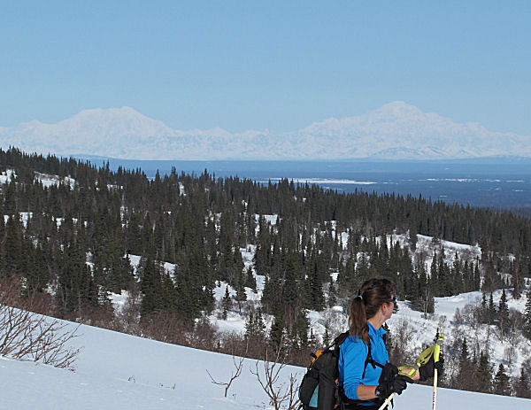
Mts. Foraker and
McKinley to the north.. |
Heading into the
Lewis River headwater flats area. |
 |
|
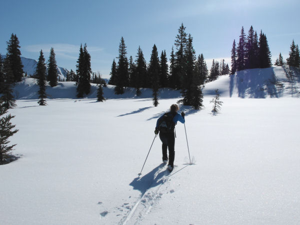
Skiing the backside
of Mount Susitna. In this picture (and the picture below)
you can see the North, Main and South summits |
 |
|
Skiing the
huge open area of the Lewis River headwater flats. The
west side of Mount Susitna is in the background. It's
hard for snowmobiles to get here (due to gullies, canyons,
mountain ridges, heavy brush and
distance) ... so we saw no snowmobile tracks here at all.
People skiing here is very rare. The easiest way to get
here would be by ski plane or helicopter. |
 |
 |
 |
 |
 |
|
My wife shows good
form as she rips across the Lewis River headwater flats. |
Heading up to
the south ridge of Mount Susitna. |
No pictures during
the brutal alder, devils club and black spruce snowshoe bushwhack
... until here at the Ivan River, just before we switched back
to skis. |
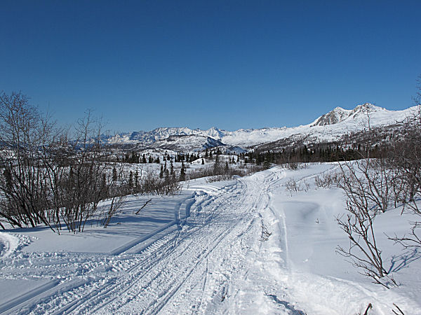
The next day:
Iced-up, screamer-fast, sno-go trail on Alexander Creek ... let's make
it happen! |
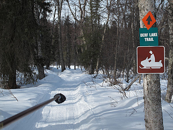
Start of the Derf
Lake Trail. |
| |
 |
|
| |
There are several
cabins at Derf Lake, and they have great "front seat" views of
Mount Susitna. |
|
 |
 |
 |
 |
 |
|
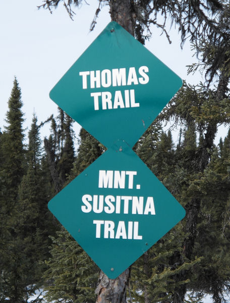
Big swamps north of
Derf Lake on the Thomas Trail. |
|
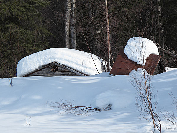
Old trapper cabin
from the 50's still hanging in there. |
Many snowmobilers
can't follow well marked trails ... and need "reminder signs"
that let them know they are going the wrong way. |
Near the end of the
loop, looking south at Mount Susitna. Thanks to Allen and
Cindi ! And of course - thanks to my favorite
hell-bushwhacking partner - my wife! |
|
|
|
Curing the Clear Weather Headache |
|
|
|
|
No More Headlamps |
| Mid March
2010: The switch
to Daylight Savings Time means that skiers that work for a
living in Alaska can now finish an after-work ski ... while it is still light
out. No more headlamp skiing. |
 |
 |
 |
| |
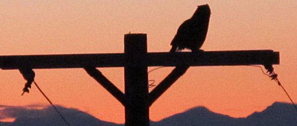
A
couple of years ago two Great Horned Owls, Nim and Rod, were
born in our neighborhood. They went through their dorky
teenager stage, but now they are studly terror-birds. When
you are out skiing they often fly from tree to tree ahead of
you, or just above you. Recently I figured out why they do
this. Once the sound of my skis in a turn spooked a rabbit next
to the trail. The rabbit ran out into an opening and Nim
swooped down and she nailed it. It seems Nim and Rod have
developed a symbiotic relationship with neighborhood skiers.
Skiers flush out their prey, Nim and Rod swoop down, kill it and
gorge away. Maybe xc skiing isn't that earth-friendly of a
sport ... if you cause a rabbit to meet a gruesome demise every
time you go skiing. |
|
|
|
|
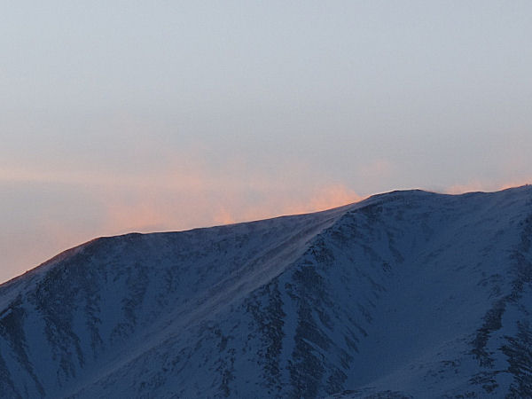
Blown Away |
| Mid March
2010: High winds
curtailed a Susitna Valley ski loop I was trying to do. |
 |
 |
 |
 |
 |
 |
|
High winds kicking
in at sunset. |
|
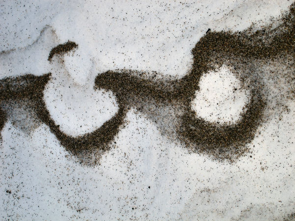
A wind ravaged trail
on the Big Susitna River. |
Strange
wind-designed sand drifts on the Big Su. |
|
A Susitna River
Sand-Jester. |
|
|
|
Adventure Balancing |
|
 |
Early March
2010: Balance.
It's a good thing when it comes to your spouse. Pretty
much for every ski adventure I do by myself, and post on this
web site, I do another adventure of my wife's choice. And
because I have a tough and fearless wife from an old-time
Alaskan homesteader and Alaskan Native background, her
adventures often make mine seem very tame.
Recently my wife's adventure call was to snowmachine 100 miles
out off the road system to pick up some moose antlers at a
remote fly-in hunting cabin. I had been to this place
before, in the foothills of the Tordrillo Range - when there was
a trail. This time - no trail. Not even a hint of a
trail. After 6 hours of GPS assisted traveling we couldn't
find a way over the last steep glacial moraine ridge just before
the cabin. After many attempts to get over the ridge we
found ourselves wallowing in chest deep snow trying to get our
snowmachine unstuck, for the 17th time. Soaked in sweat I
said: "Ya know, it's getting late, we're 98 miles out in the
middle of nowhere ... this doesn't look that good, we should
think about heading back." Her response (that did not
surprise me in the least): "Come on. We're almost there.
We can make it."As
you can see from the picture, we made it. And because this
picture is posted on the web, we made it back.
Man, I need a break.
I gotta do something easy like a long ski trip, before my wife
comes up with her next adventure idea. ;-) |
|
|
|
|
|
|
|