|
|
|
Home |
|
Intro |
Gear |
About |
Trips: |
2026 |
25 |
24 |
23 |
22 |
21 |
20 |
19 |
18 |
17 |
16 |
15 |
14 |
13 |
12 |
11 |
10 |
09 |
08 |
07 |
06 |
05 |
04 |
UBXC |
Apps |
eBook |
|
2007/2008
by: Tim Kelley
|
|
October - March |
April - September |
|
|
Tail End of a 12
Month Ski Season |
 |
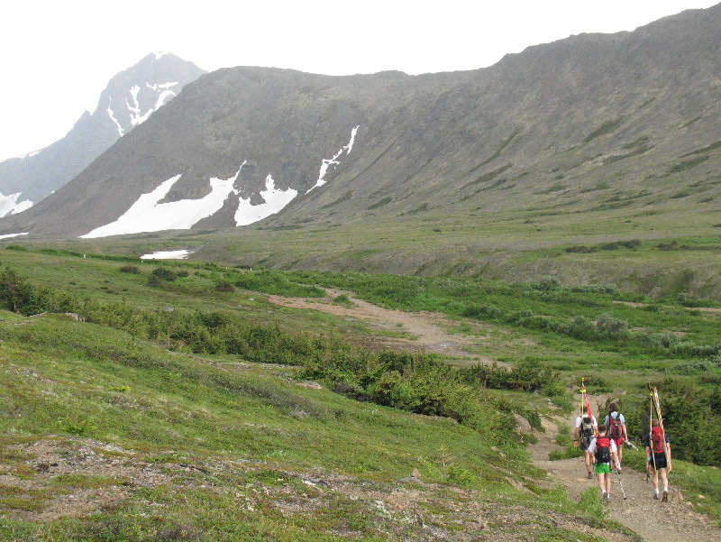
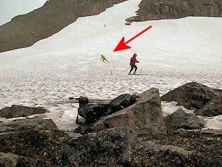
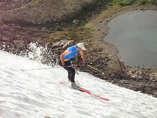
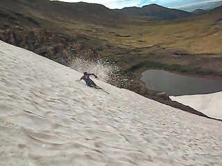
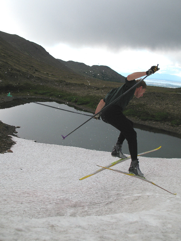
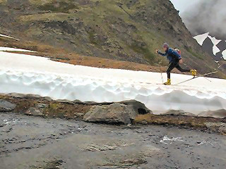
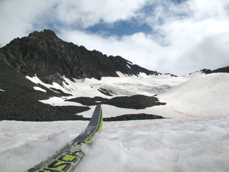
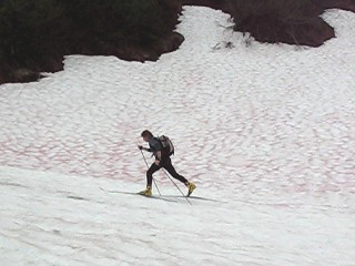
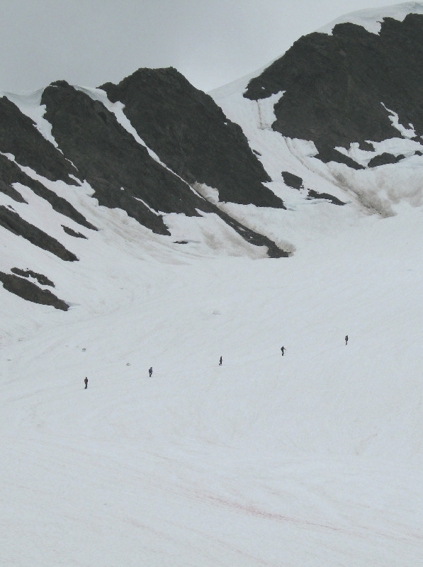
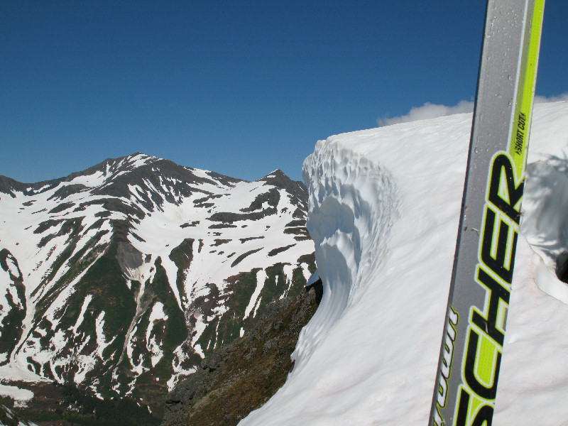
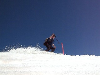
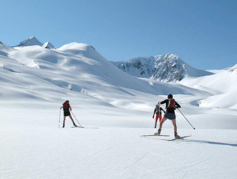
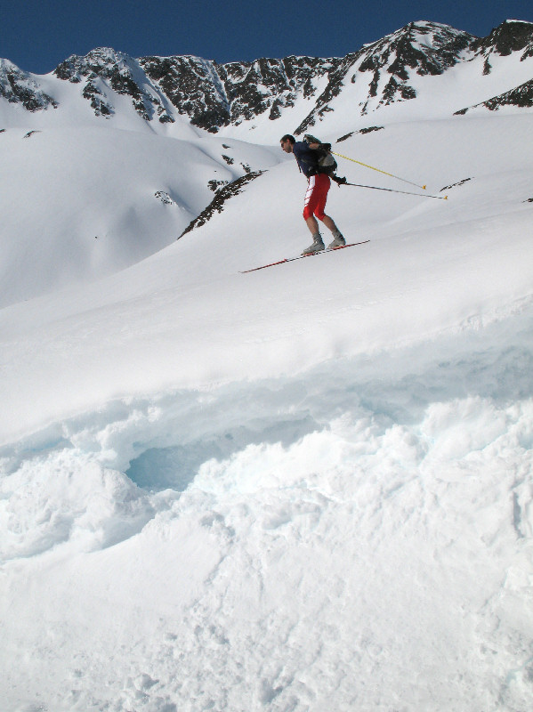
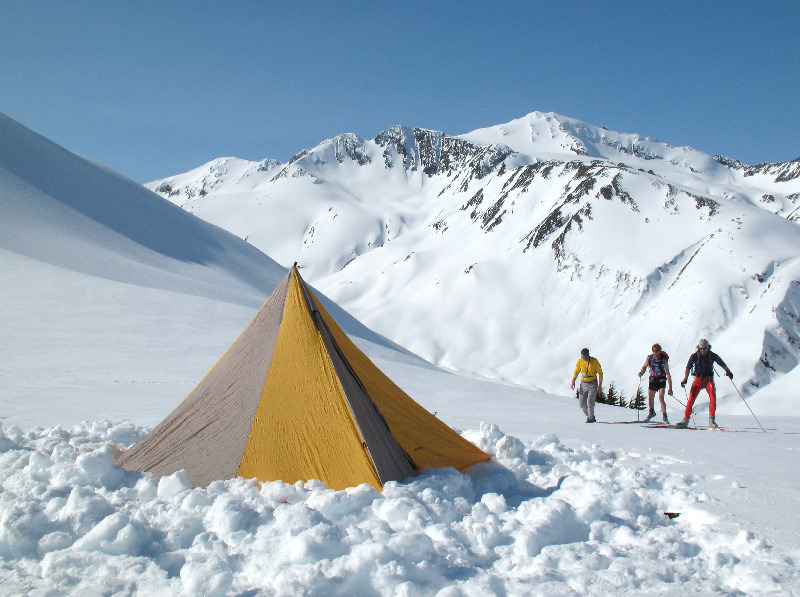
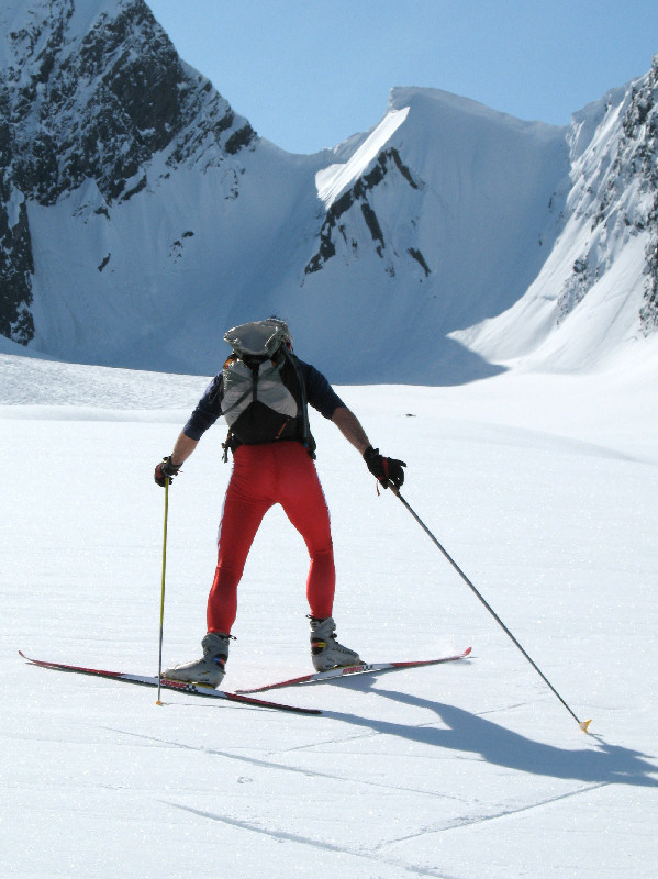
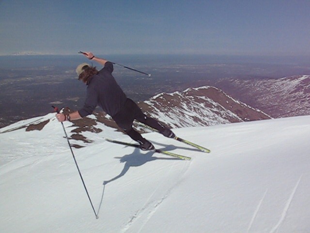
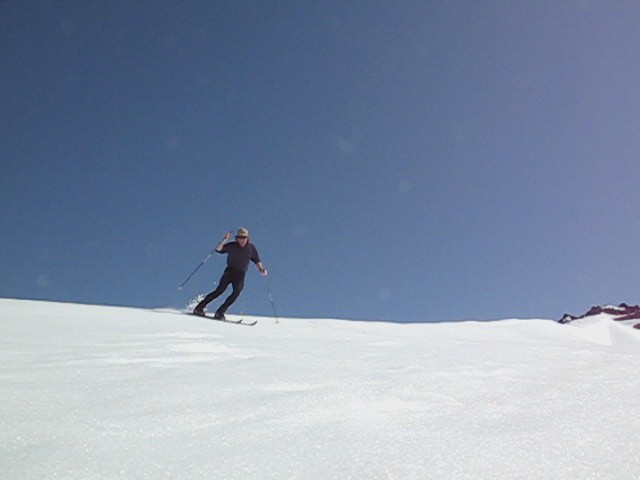
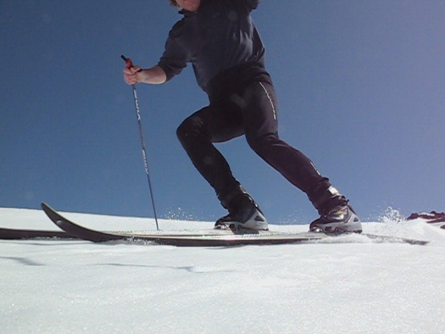
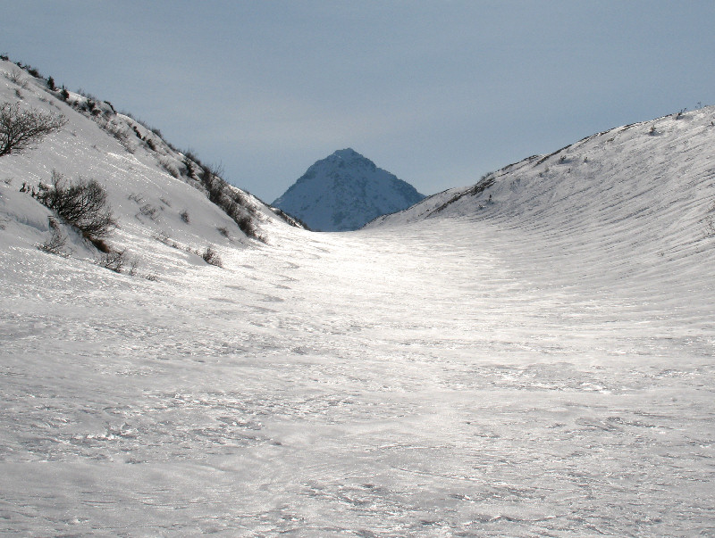
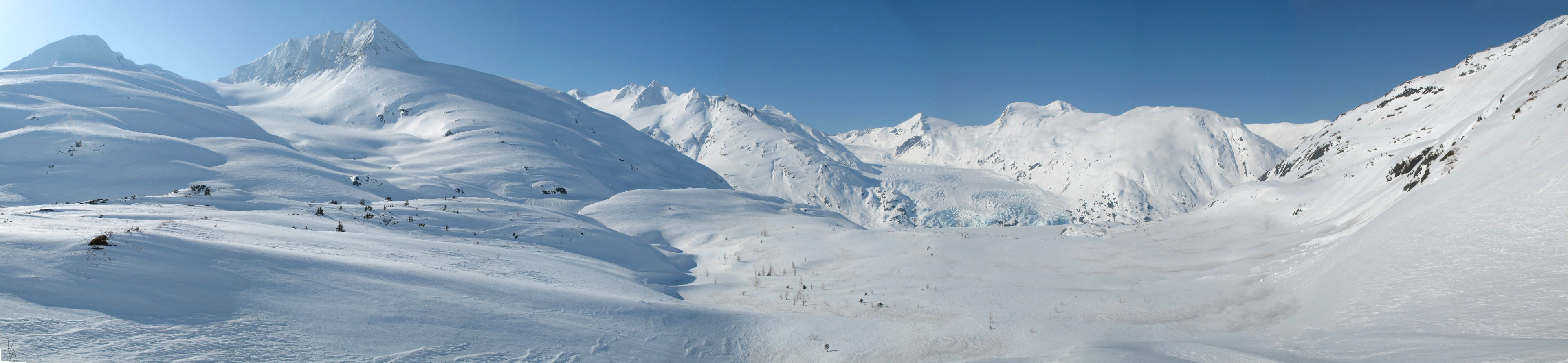
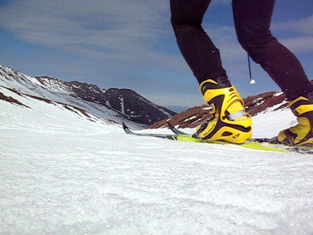
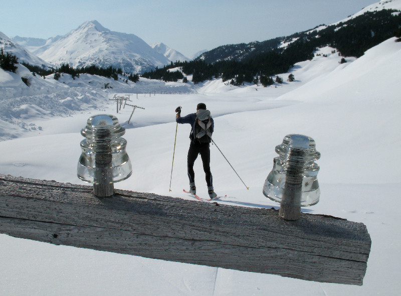
Lane Glacier,
Talkeetna Mountains - 07 September
2008: My goal of skiing
12 consecutive months this ski season turned out to be pretty easy to
obtain. Thanks to a record cold spring and summer there was plenty
of snow for times when you needed a skiing-fix. Though I had never
skied the Lane Glacier before, this place is no summer skiing secret.
I would guess that this popular glacier is snowboarded or skied just about
every weekend of the spring and summer. |
 |
|
Snowfields above the Lane
Glacier, looking west |
Skiing the Lane on 07-Sep-08 |
 |
 |
 |
 |
 |
|
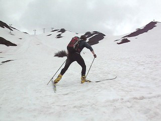
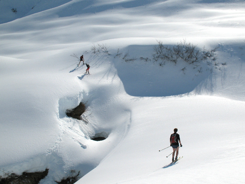
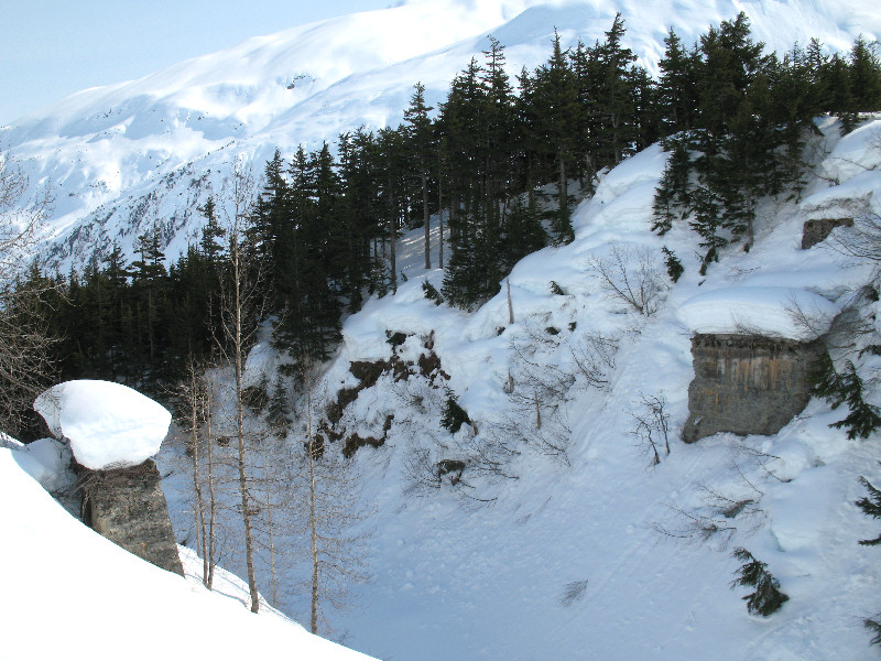
Lane Hut |
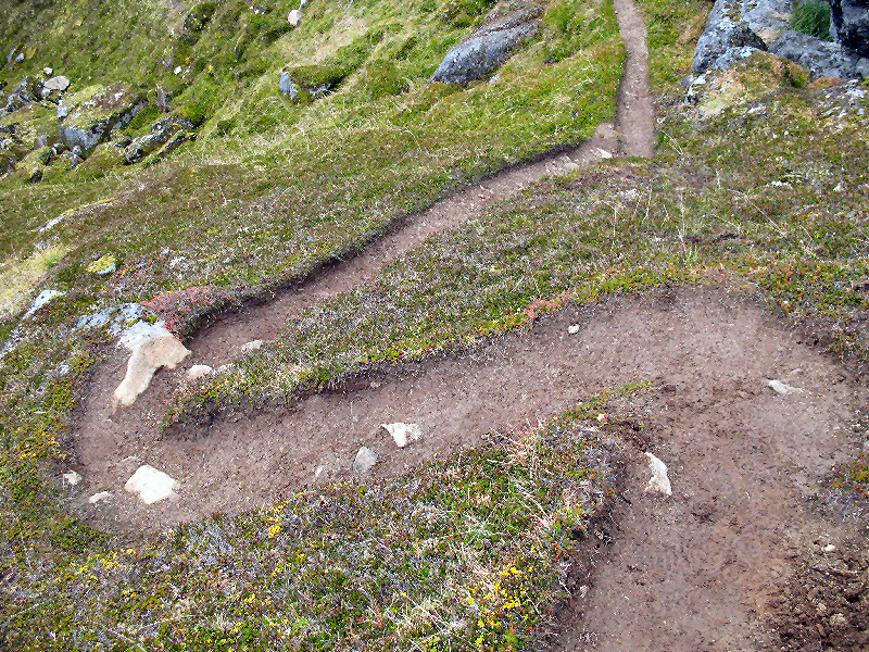
These pack horse
trails were made 100 or so years ago by gold miners. Now
snowboarders, skiers and hikers keep these trail defined |
Snowboarder and "Boarder
Collie" |
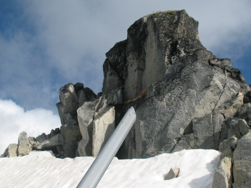
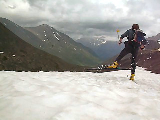
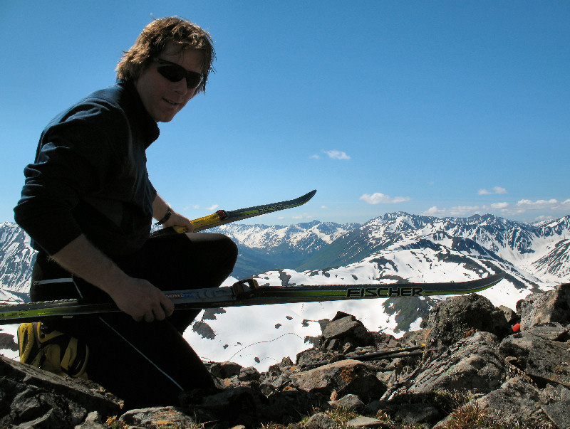
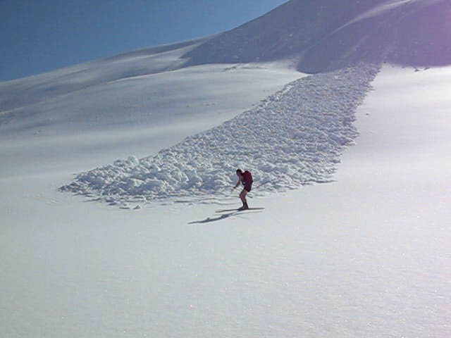
Summit of Didlikama |
|
 |
|
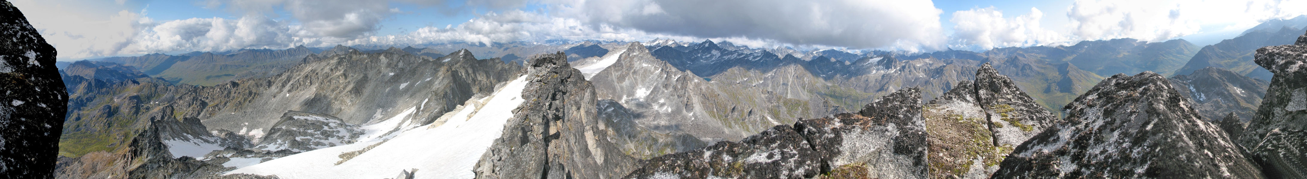
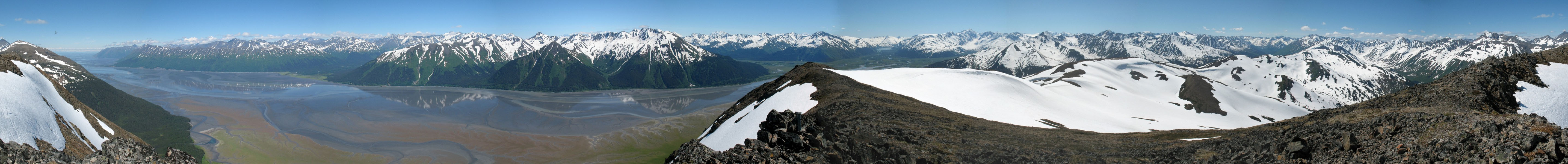
Panoramic photo from just
below the summit of Didlikama (this photo taken on a previous trip to
Didlikama on 30-Aug-08) |
| |
 |
|
 |
|
| |
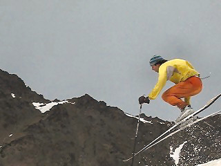
Peter Doner (in lead) cranks down from the summit area of
Didlikama, heading for the Lane Glacier below (this photo taken
30-Aug-08) |
|
12 months of skiing this
ski season (Oct 07 to Sep 08) |
|
|
|
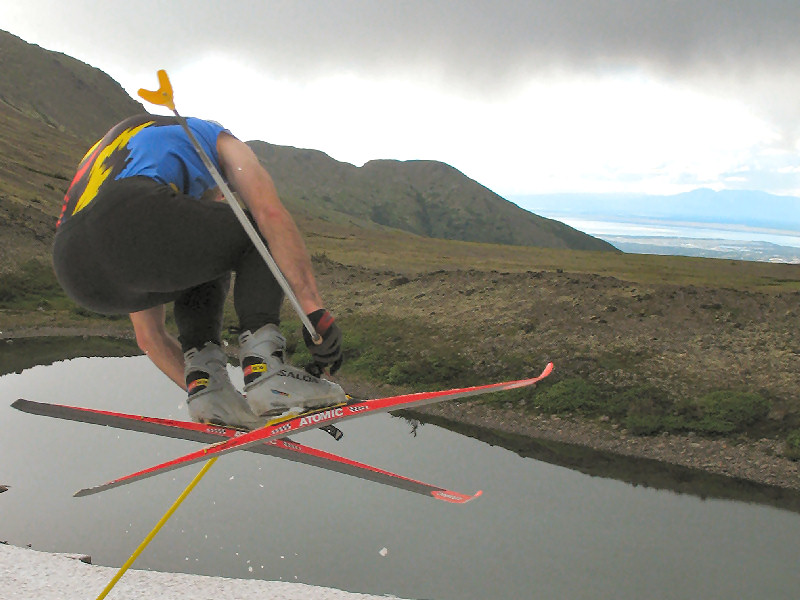
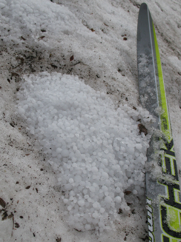
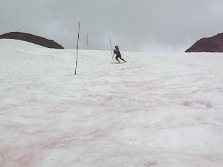
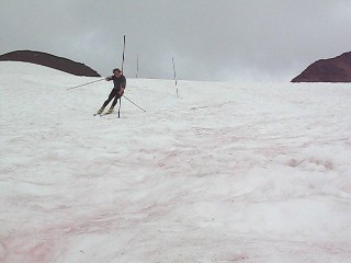
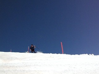
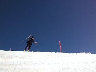
8 - 8 - 8
World Championships of the World Summer Slalom, Extreme and Big Air
XC Skiing Competition
The first
ever ON-SNOW XC skiing competition in AUGUST in Anchorage, AK |
 |
Rabbit Creek Valley,
Anchorage - 08 August
2008: This was a
memorable, yet strange, day. It started out as a crystal clear
day, an oddity for the summer of 2008. After work we headed out hiking in sunshine towards the site of the 8-8-8
ski fest, only to soon get overtaken by a monster thunder and lightning
squall that hammered hail on us. We ignored the lightning strikes
around us as we set up the slalom course, because we knew we couldn't
reschedule this event. 8-8-8 only occurs once ever ONE THOUSAND
years! So the chance to ski-link "8's" on 8-8-8 is a one-shot deal
in your life!! Click
here to see Cory's
pictures. |
 |
|
Hiking in. Skiing
venue in the distance. |
Cory goes big!
Anchorage in the distance. |
|
|
 |
PLAY VIDEO
(Once on YouTube
press "Watch in High Quality") |
|
|
|
|
|
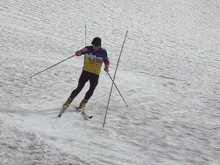
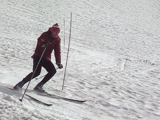
Summer XC Slalom
SmackDown |
 |
 |
 |
 |
 |
|
1st Cory - 15.55 |
2nd Tim K. - 15.80 |
3rd (tie) Benji -
15.92 |
3rd (tie) Tim M. - 15.92 |
4th Ian- 16.24 |
|
|
Summer XC Extreme
Mountain Event |
 |
 |
 |
 |
|
Results: 1st Tim M.,
2nd Cory, 3rd (tie) Ian and Tim K., 4th Benji |
|
Summer XC Big Air
Hang-Time Showdown |
 |
 |
 |
 |
 |
|
1st Cory |
2nd (tie) Benji, Ian, Tim M. |
3rd Tim K. (photo by Cory) |
|
 |
 |
 |
|
Hailstones from the thunder
squall fell on the
snowfield, rolled downhill and collected in sun cups in the snow. |
Skiing "8's", made on 8 - 8 -
8 |
Hiking out. The next
official 8-8-8 ski competition is in 1000 years on 8 August 3008.
But there are sister events in 80 years: 8/8/88 and in 800 years:
8/8/888. I'll see you in '88. No wait, I won't ... I'll be
dead. ;-) |
|
|
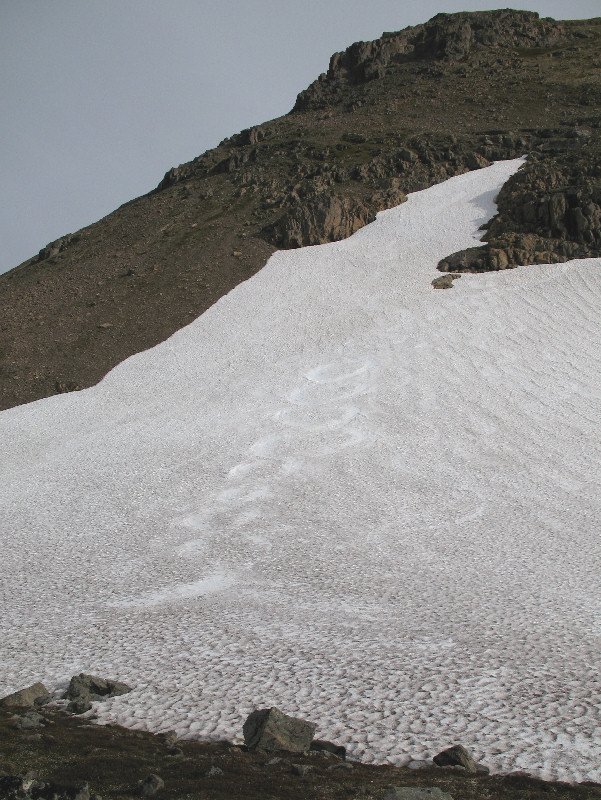
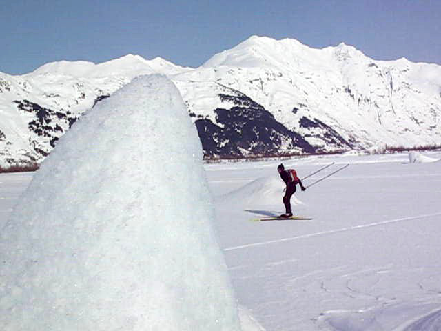
Crow Pass and Above
Summer Ski Touring |
 |
Crow Pass - 20 July
2008: Not the greatest
weather this late July weekend. So what to do? Hey, how
about heading out to do some ski touring! I ran up to Crow Pass
with my skis to check out the skiing. A while later my GPS said I
got in about 8 miles of random snowfield cruising and turn cranking in
the area between Crow Pass, the Raven Glacier and the base of Summit
Mountain.
I saw tracks from
other skiers that were up here the day before. Right on fellow
winter worshippers!! Hang in there ... next ski season is not long
off!! |
 |
|
Heading to Crow Pass |
|
Summer links |
 |
 |
 |
|
The snowfield by the Forest
Service cabin is going fast. Better skiing up high. |
|
Lots of snow on the Raven
Glacier, but I'm not skiing on a glacier alone and un-roped |
Skiing snowfields below
Summit Mountain |
 |
 |
 |
 |
|
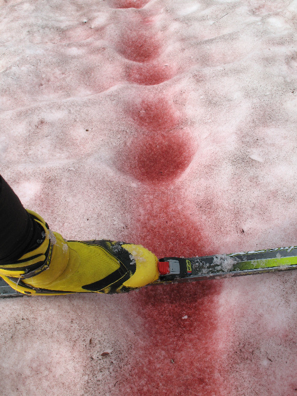
Map of my random wanderings |
Rather gruesome looking
algae, eh?! This snow phenomenon is called:
watermelon snow. |
Skating back down to Crow
Pass |
|
|
Mid-July XC Skiing
at the Alyeska Glacier Bowl |
 |
Girdwood - 13 July 2008:
In the early 1980's xc skier racers used to regularly hike up to the
Glacier Bowl at the Alyeska Ski Area, stomp in a ski loop and get some
summer on-snow ski training in. Hardly anyone does this these days
as getting helicoptered to the Eagle Glacier is the preferred choice.
I figured this area
would still be good skiing mid-July this year thanks to the cold and
cloudy spring and summer we've had. Sure 'nuff. The ski-able
snowline came way down below the tram station. There was tons of
snow in the Glacier Bowl for a good ski loop with, of course, the
requisite slalom course. And skiing back down offered a long run
of great snow that got your quads aching. My kind of summer indeed
!! |
 |
 |
 |
 |
|
The Alyeska Glacier Bowl.
XC skiing here is done on a snowfield below the glacier. |
|
|
|
|
|
 |
 |
 |
 |
|
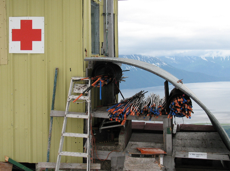
If you need poles for a
slalom course, Alyeska graciously provides slalom poles to summer-time
xc skiers that need them. At least I think that's why they leave
the poles out!? ;-) |
Mid-July 2008 and you could
still ski from the top to way down below the tram station (seen on
ridge) |
Guided glacier trekking tour |
 |
 |
 |
 |
 |
 |
|
Bang that gate! Smack
it down! |
Training for next month's
(August 2008) World Championship of the World XC Summer Slalom SmackDown! |
|
|
Seattle
Ridge Summer Skiing |
 |
 |
 |
 |
 |
 |
|
July 1st frost in Anchorage.
No kidding. |
Heading from Turnagain Pass
to Seattle Ridge snowline |
Cornice, Seattle Creek
drainage |
Turnagain Pass to my left in
the distance |
Black bear an hour or so
ahead of me |
Portage Lake in the distance |
 |
 |
 |
|
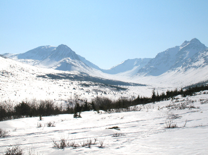
Summit of Pyramid Peak |
Looking south from Summit of
Pyramid Peak. Tons of snow for July. |
Pyramid Peak from Girdwood |
 |
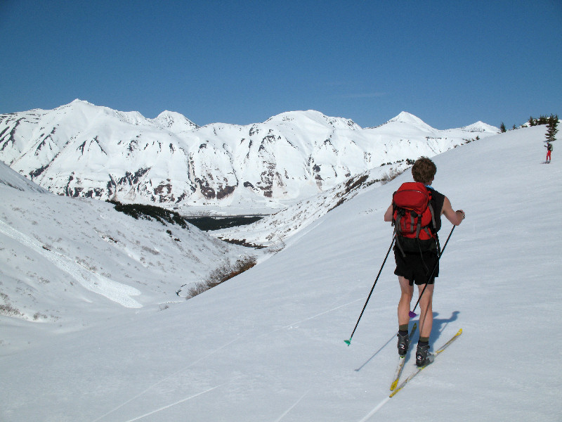
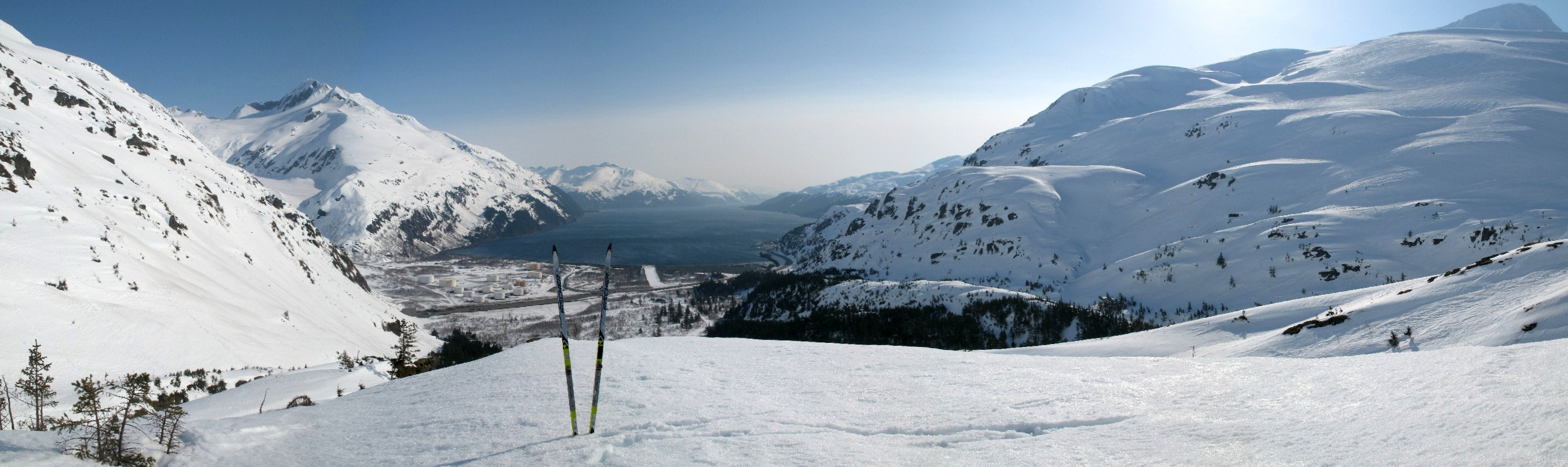
Seattle Ridge - July
1, 2008: Sunshine!
The first sunny day since mid-May!! Well, it seemed like it at
least. I have
wanted to ski Seattle Ridge on the "snowmobilers' side" of Turnagain
Pass for quite some time. So I waited for July 1st. July?
Yes ... this has been a heck of a cool (as in temperatures) spring and
early summer. So there is much more snow around for this time of
year than most people can remember. No complaints from me!
For this ski trip I used waxless
skis. The snow was consolidated summer snow that kept you from
sinking in more than an inch even in the afternoon. After
hiking from Turnagain Pass to snow level at 1500 feet (on the snowmobile
route to ridge-top) I was able to ski all the way to Pyramid Peak.
Out and back was about a 12 mile hike/ski. |
 |
|
Ridge leading north to
Pyramid Peak. Looks like a fun ski route. And it was. |
Blue: hiking, Red: skiing |
 |
|
360 degree panoramic view
from the top of Pyramid Peak (click on this image to expand it) |
 |
 |
 |
 |
 |
 |
 |
 |
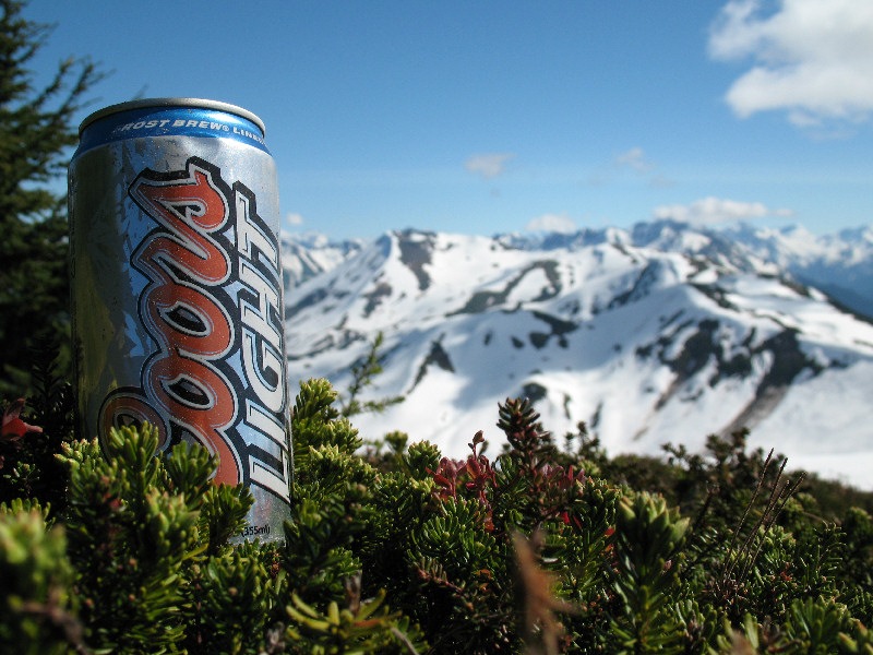
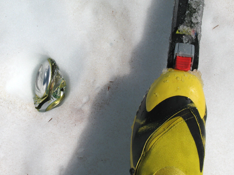
Seattle Ridge is a dump. It's
covered with snowmobiler trash. It's disgusting. And I say
this as a fellow snowmobiler (scroll down to see proof). Beer cans
in particular are ALL over the place. Come on folks, clean up your
act!! I hauled a bunch of
stuff out. Stuff that I will use actually. Wish I had brought a
bigger pack!! |
 |
 |
 |
 |
 |
 |
|
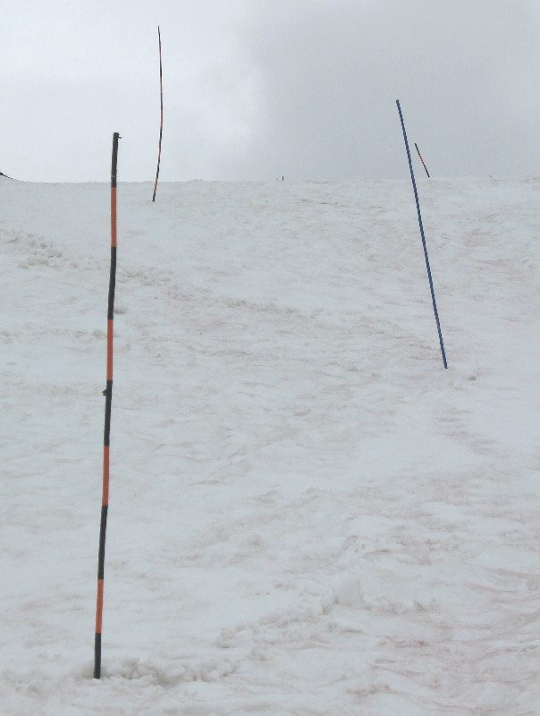
I made good use of some
snowmobile trail markers I found lying on the snow. I set up a
slalom course and had fun running gates. |
|
|
Culross Island
Ridge Rambling |
 |
 |
 |
 |
|
Heading up onto the backbone
ridge of Culross Island, Prince William Sound |
Heading south on the
island's main ridge |
 |
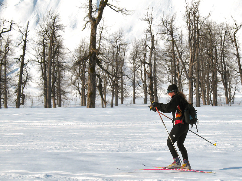
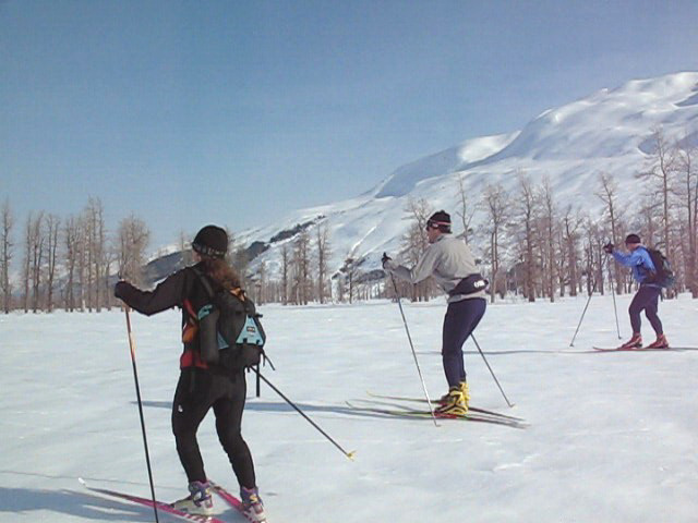
Culross Island - May
30, 2008: The plan was
to ski-explore the southern end of Culross Island by skate skis (we had
skied the northern section of the island's main ridge each of the last
two years). But changing weather forced the backup plan of using
wax-less classic skis. It wasn't as much fun as crust skiing in
the sun on this island, but it was cool to chalk up skiing some new
terrain in Prince William Sound. Skiers: Tim M., Benji, Cory and
Tim K. |
 |
|
Port Nellie Juan in the
distance |
|
|
Up into the clouds |
 |
 |
 |
 |
|
Cory the Cloud Shredder |
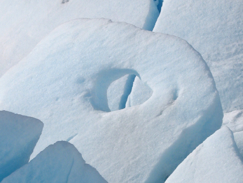
This looks like a crevasse,
but there are no glaciers here. It's a snowpack stress crack |
May 30th, elevation 150
feet, snow depth 8-9 feet. We skied down a new route to the left
of the trees in the background |
Back at sea level.
Ski-able snow started at an elevation of about 3 feet, and 30 feet from
the water |
|
Click here
to see Cory Smith's pictures from this ski trip |
|
|
All cTurnagain Pass
Crust, Late and Great |
 |
 |
 |
 |
 |
 |
|
Skiing up, and back down,
the Lyon Creek drainage |
 |
 |
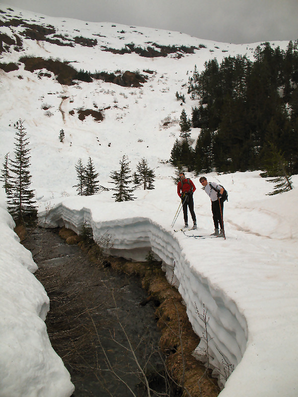
Turnagain Pass - May
17, 2008: As a backup
plan for a ski trip that didn't work out this morning, we (Tim M., Cory,
Benji and I) hit Turnagain Pass. We found lots of snow for
mid-to-late May (10 feet at the weather station) ... and some fine crust
skiing. |
 |
 |
|
|
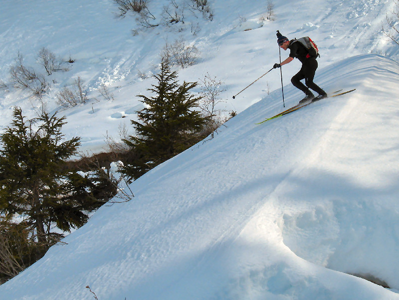
Climbing up Center Ridge |
|
We met b/c skier & kiter
Todd Kelsey who was
camping on Center Ridge with his wife |
Tincan Creek drainage |
 |
 |
 |
 |
 |
|
Skiing down the Tincan Creek
drainage |
|
Cranking turns down off
Center Ridge |
|
|
|
|
All cDon't Forget
Spring Classic Skiing ... |
 |
 |
 |
|
Expanding the picture above
will show what Anchorage skiers' backyard looks like in mid-May.
Anchorage is in the distance between the skis in this picture. |
|
Anchorage - May 2008:
"Performance" spring skiing is usually equated with skate skiing.
But spring corn snow can make for some great classic skiing.
Waxless skis can be a good choice for these conditions. I recently
bought a pair of Fischer Superlight Crowns (so I could be like Tim
Miller!!). They are versatile and fun skis for corn and summer
snow striding, and they are good in the turns. |
 |
 |
 |
 |
 |
 |
|
Spraying fallen skiers in
the face with wet corn snow is not nice ... |
|
... but damn, it sure is fun ! |
|
|
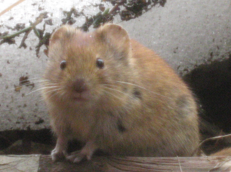
All cBeware of the
Crust Voles !!! |
 |
|
|
|
Beware!!
If you inexplicably crash while crust skiing ... the problem is likely
NOT your skiing ability. Most likely you were attacked by a crust
vole and didn't realize it. These devious monsters go ballistic
when they smell wool socks skiing by their dens. They are as
fast as lightning and with their extremely powerful forearms (see above)
they can quickly trip you and cause you to have a yard-sale crash.
If this happens to you - start screaming at the top of your lungs and
flail your poles wildly to drive off the voles. Or else the beasts
will tear into your ankle and rip chunks of your socks off to use as
bedding in their dens. Don't be tricked by the cute and innocent
facade these psycho-rodents project. It's all just an act!
These are very dangerous animals!!!! |
|
|
All cIt's Crust
Skiing Before Work Season |
|
Rabbit Creek Valley / Powerline Pass
Valley / Portage Lake and Pass - April 2008 |
 |
 |
 |
 |
 |
|
Crust before work in
Rabbit Creek Valley |
Snowshoeing on crust!
What!? |
Beautiful mountains with
less than beautiful names |
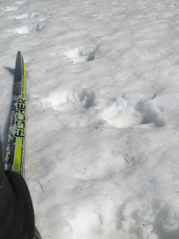
Sheep tracks |
Rabbit Creek mile-long
halfpipe |
 |
 |
 |
 |
 |
|
Anchorage's favorite
valley, S. Fork Cambell Creek / "Powerline Pass" Valley |
The infamous weather
station thang |
Portage Glacier |
Haze in distance is
Mongolian dust and Siberian smoke |
Don't ski next to Maynard
Mountain during warm afternoons |
 |
 |
 |
|
|
Looking southwest towards
Portage Glacier from Portage Pass. Plenty of places to crust
cruise here. |
|
 |
 |
 |
 |
|
View of Passage Canal
from the pass. Nice view before going to work. |
Hey! Who's been
shooting holes in Portage Glacier !!! |
|
|
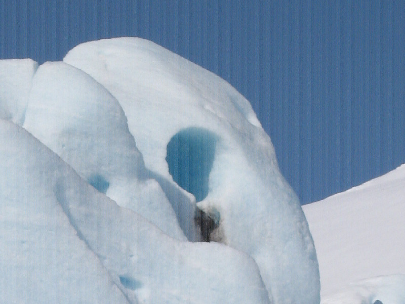
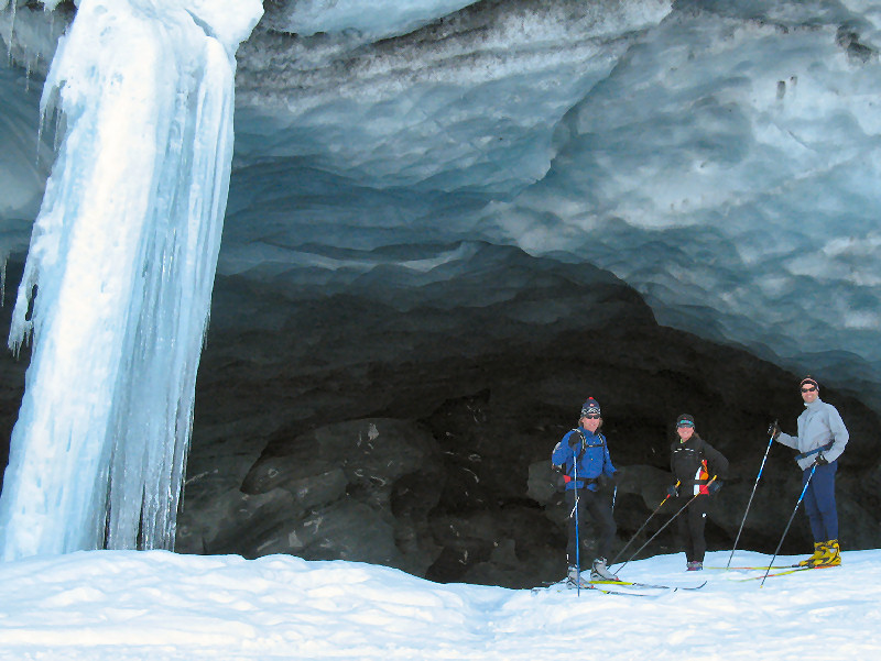
All cSkookum is
Skookum |
|
Portage -
April 2008:
"Skookum" is a Chinook word with a double meaning: 1) strong
or heroic, or 2) demon or evil spirit. Crust skiing to the Skookum Glacier right now (April 20th) is definitely
skookum. By that I mean the crust snow is good (very strong and
heroic). But be careful of the skookum spirits that live in the
back of the ice cave! |
 |
 |
 |
 |
|
|
All cGrandview
Without the Train |
 |
Kenai Mountains -
April 2008:
Lots of skiers have ridden the Alaska Railroad and Nordic Skiing
Association of Anchorage ski train to Grandview to go skiing. But
why ride there, when you can ski there?! After all, it's only a 32
mile (50 km) round trip crust ski from Portage. It's a little
tricky getting from Spencer Lake over the ridge and into the Grandview
Valley. But it's worth it once you get there. This was my
fourth time skiing from Portage into the Grandview Valley. It was
Cory Smith's and Benji Uffenbeck's first time skiing to the Grand ...
but I'm betting they will be going back again, and again, and ... !! |
 |
|
Closing in on Grandview |
Skiing past the Bartlett
Glacier on the way out |
 |
 |
 |
 |
 |
 |
|
Heading out ... Crust On !! |
Spencer Lake |
Benji shoots the curl |
Uhm Benji ... it's falling!
Splat. |
Breaking out into the
Grandview Valley. Cory scopes the Promised Land |
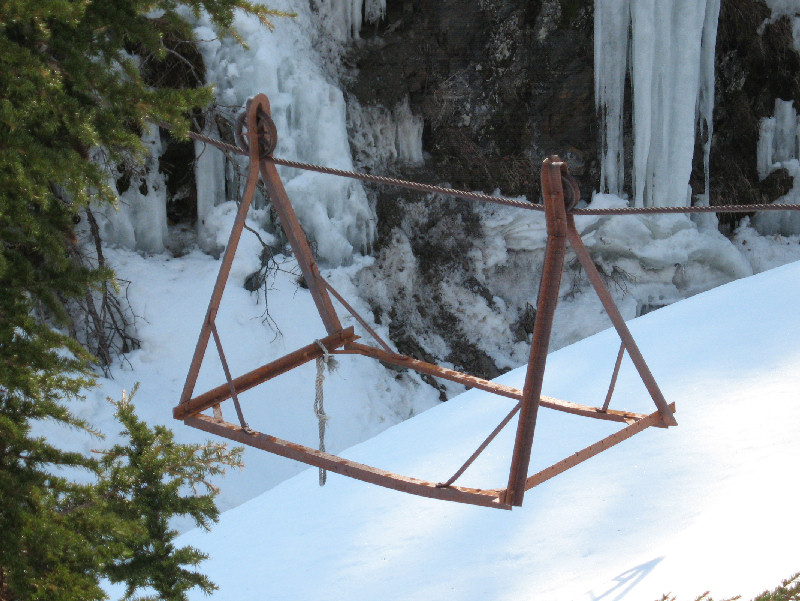
Do you dare cross the gorge
on the Hand Tram from Hell?! |
 |
 |
 |
 |
 |
 |
|
Benji rips and shreds |
Old train trestle supports |
Team shot at Grandview |
|
Checking out the serpentine
railroad tracks |
|
|
 |
 |
 |
 |
|
|
|
Cory carves |
Rocket crust |
Hero snow |
Cory likes snow bridges with
character! |
|
|
Check out
Cory
Smith's pictures from this trip! |
|
|
All cHow to Recycle
Ski Wax |
 |
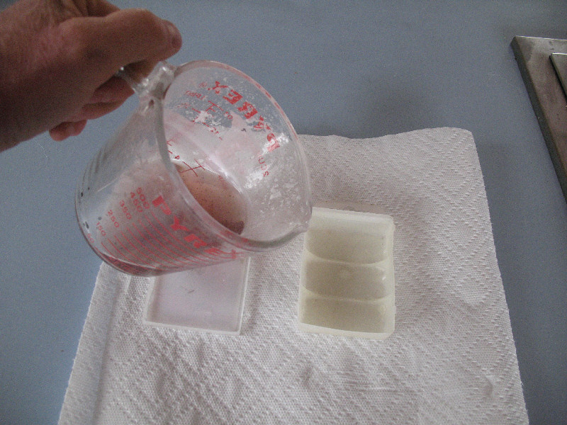
Question:
Were does most Swix, Toko, Holmenkol, Solda, etc ski wax end up?
Answer:
Landfills. Skis
end up using a small fraction of the product wax companies sell you.
Most ski wax is destined to wax shavings that people usually throw in
the trash, along with the container the wax came in. A more
environmentally responsible option is to save your ski wax shavings in
recycled Ziploc bags. You can save them per wax type. Or you
can do like me - save them as either "warm" (Swix purple, red and yellow
for example) or "cold" (Swix blue and colder). In the spring, take
the wax shavings, melt them in a Pyrex cup and pour them back into the
original containers. You probably wouldn't want to race on recycled wax.
But it is great for training, ski storage or ... spring skiing! |
 |
|
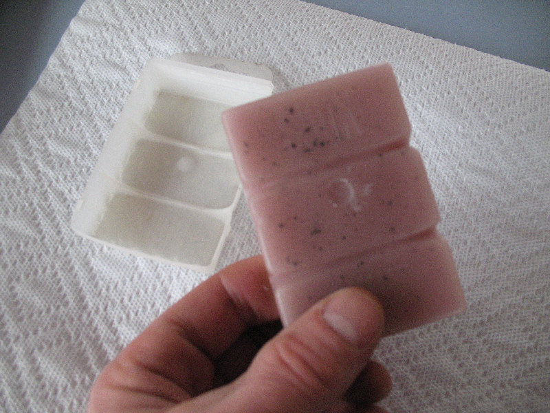
Save wax shavings in
recycled Ziploc bags. A Pyrex measuring cup is all the equipment
you will need. |
Hey Swix ... I guess you
aren't going to get any money from me for THIS bar of wax!! |
 |
 |
 |
 |
|
Stuff the wax shavings into
the Pyrex cup and warm them until they become liquid. |
What to use to form the wax?
How about the original package the wax came in !! Recycling times
two. |
After pouring the wax ...
let it cool. |
The finished product.
This bar is mostly Swix CH red with some purple and yellow. The
black flecks are base scrapings. Whoops, I better scrape less
energetically. |
|
|
All cSkiing in the Backdoor
of
Lost Lake |
 |
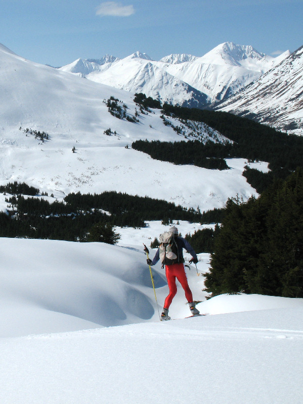
Kenai Mountains -
April 2008:
When I skied to Lost Lake last year I saw snowmobile tracks coming in
from the west. There is no formal trail to the west so I asked a
snowmobiler where the sno-go trail led to. He said the Snug Harbor
Road ... and I immediately put this trail on my "to do" skiing trip
list. The beginning and ending sections of this 26 mile route are
ratty and bumpy snowmobile trails. But the central section is
incredibly nice. One could mistake this area for the tree-less
mountains of central Norway (the Jutenheimen) or the hills northeast of
Nome. There was
no sign of spring crust snow on this mid-April ski. Cold powder
classic skiing and lots of wind were being served up. But hey ...
it was a sunny April day in Alaska and there was lots of snow.
That's the ticket! |
 |
|
Mt. Ascension framed by a
wind eroded arch of sastrugi |
Ski route: Mile ~10 Snug
Harbor Road, Lost Lake, Primrose - 26 miles. |
 |
 |
 |
 |
 |
 |
|
Initial (long) climb, Cooper
Lake in the distance |
Heading to the pass that
leads into the Boulder Creek drainage |
Soft trails, cool country |
Mt. Ascension from the NW |
Heading towards Martin Creek
Pass |
Martin Creek Pass was "wind
devil central" |
 |
|
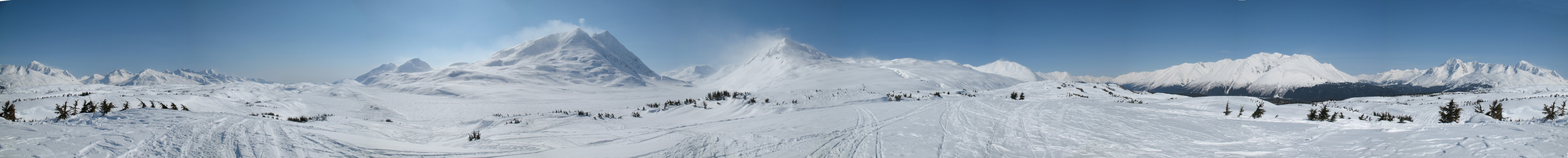
360 degree panoramic shot
from the headwaters of Boulder Creek. This is snowmobile country.
And for a good reason - it can't get much better snowmobiling than this. |
 |
 |
 |
 |
 |
 |
|
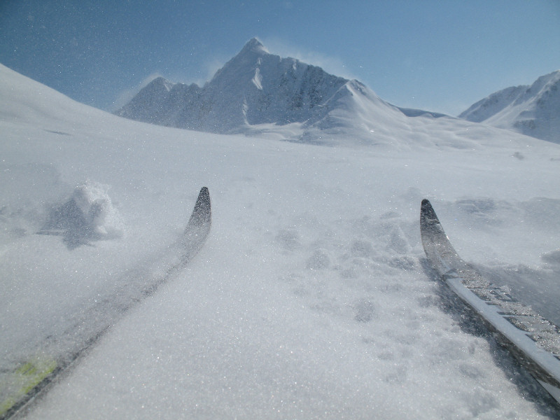
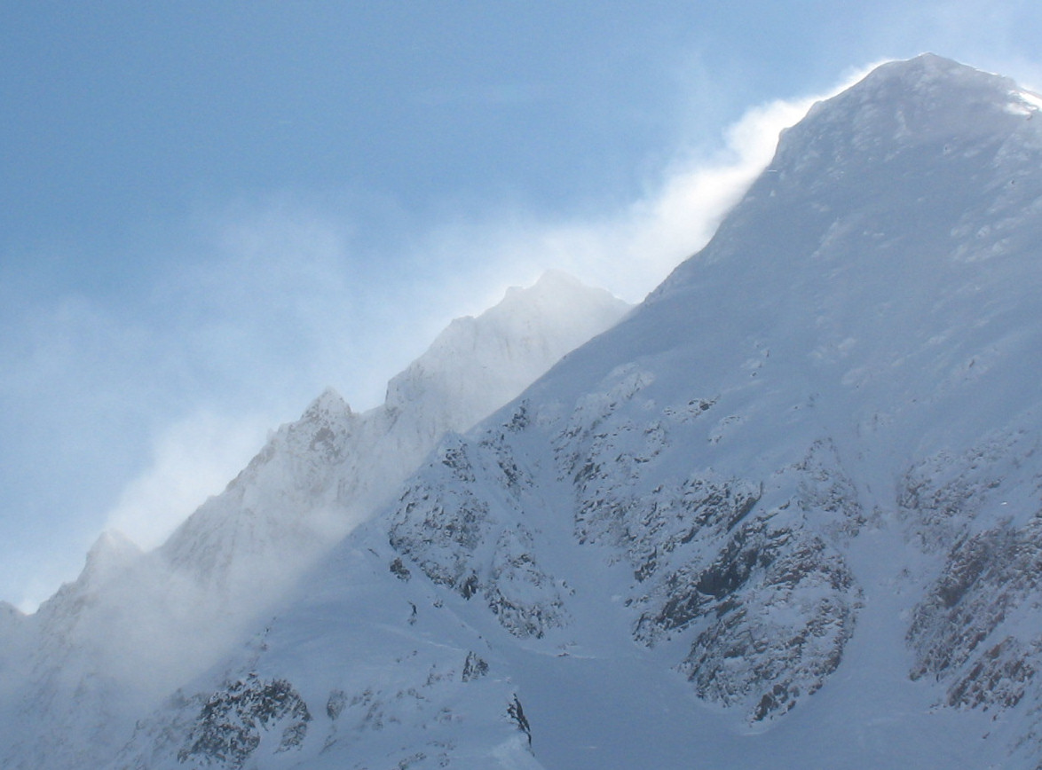
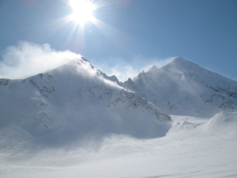
Mt. Ascencion |
Wind pictures: Lots of snow
moving on the ground and plumes of snow coming off the mountaintops |
Lost Lake, thar-she-be! |
 |
|
360 degree panoramic from a ridge
above Lost Lake. The "backdoor" to Lost Lake lies between the two
main mountains in the center of this picture. |
|
|
 |
 |
 |
 |
|
|
|
2 minute old sno-go track on
a windy Lost Lake |
Lost Lake |
Old Primrose Mine cabin -
smothered with snow |
Sno-go trench-trail.
Listen before you commit! |
|
|
|
October - March |
April - September |
|
Alaska Backcountry XC Skiing |
2009 Skiing Pictures
2007 Skiing Pictures
2006 Skiing Pictures
2005 Skiing Pictures
2004 Skiing Pictures |
|