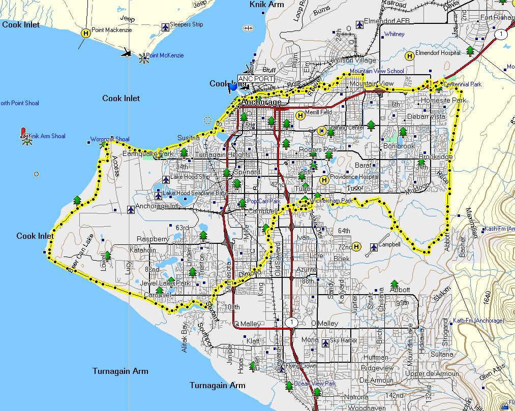
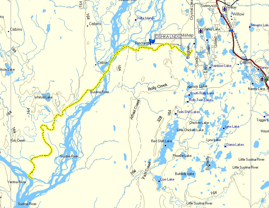
Anchorage -
30 December 2008: With
the opening of the Ship Creek bike trail, from the AK Railroad
headquarters to Mountain View, I figured this new trail might
help open up a new ski loop around Anchorage. And as I
would find out - it does. Overall this was a fun and
diverse ski loop (though I did flail a bit in finding the route
between Lake Otis Parkway and the New Seward Highway). I
wanted to do this ski loop without using any Nordic Skiing
Association of Anchorage trails. So I used Municipality of
Anchorage trails, a dog mushing trail, a number of very cool
local ski-touring and snowshoeing trails, a little bit of
snow-covered sidewalk and road skiing and a touch of good old
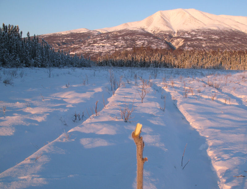
fashion trail busting through untracked snow. Temperatures
ranged from -10 F to -22 F for this 44 mile loop. The map
and pictures below show you how this ski loop plays out.
GPS track: 44 miles.
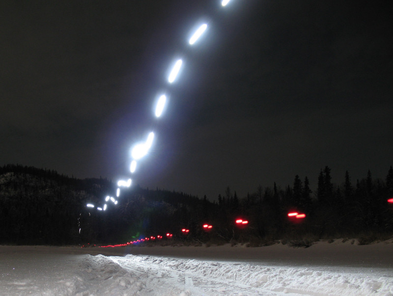
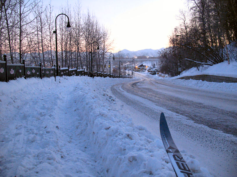
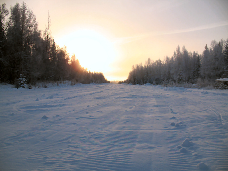
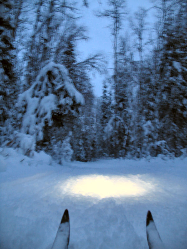
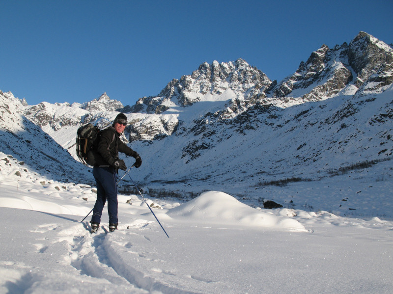
The start at
Westchester Lagoon. -15 degrees. Where is everyone?!
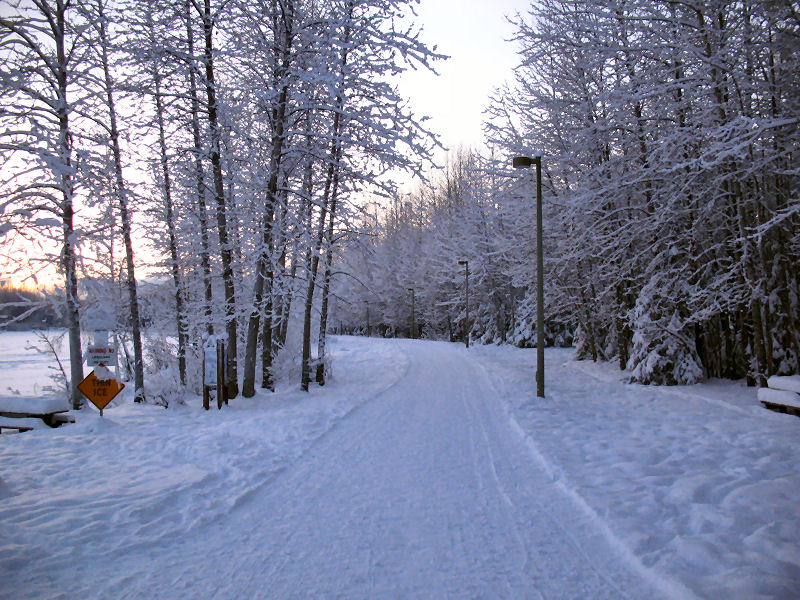
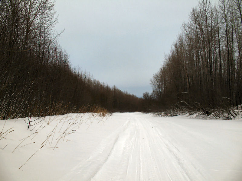
Skiing the bike trail
towards the Port of Anchorage.
The wonder of the
Ship Creek bike trail - the spiral access and bridge across Ship
Creek and the railroad.
Good skiing on the
roads of Mountain View.
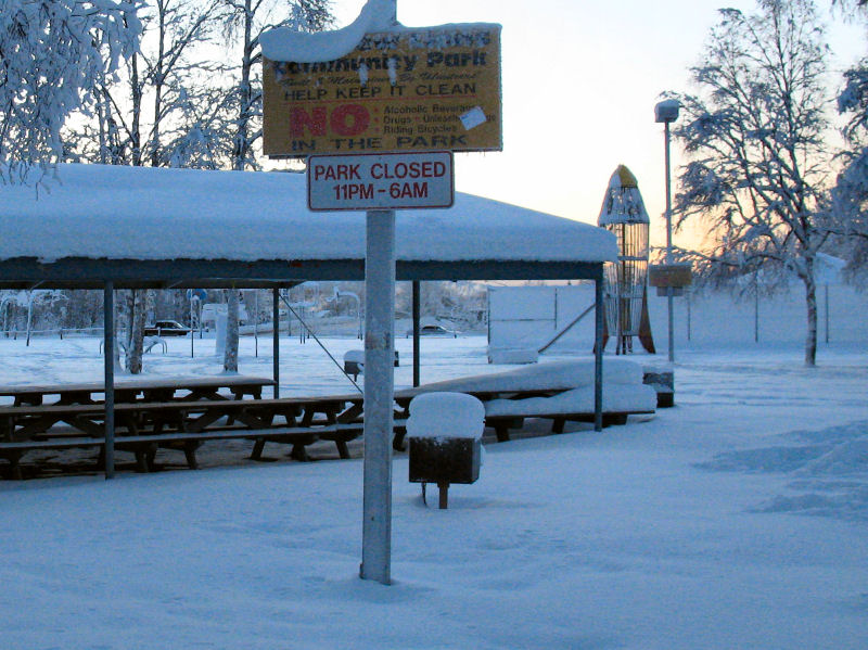
Mountain View Park.
-18 F and no kids playing on the metal rocket ship.
Skiing the "bike
trail" along the Glenn Highway. The only recent biker was
a moose.
Skied past the new
Target.
Miscreant-central
pedestrian underpass near Bartlett High School.
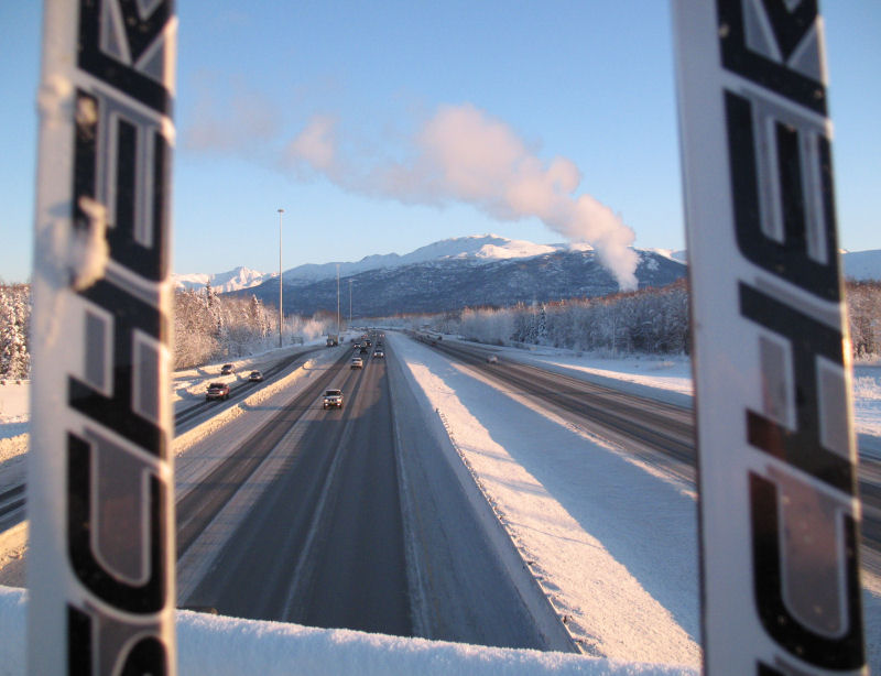
Crossing over the
Glenn Highway.
Centennial Park
sledding hill and 2 tough kids playing at 18 F below.
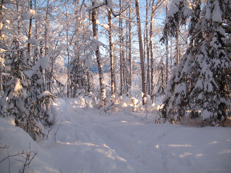
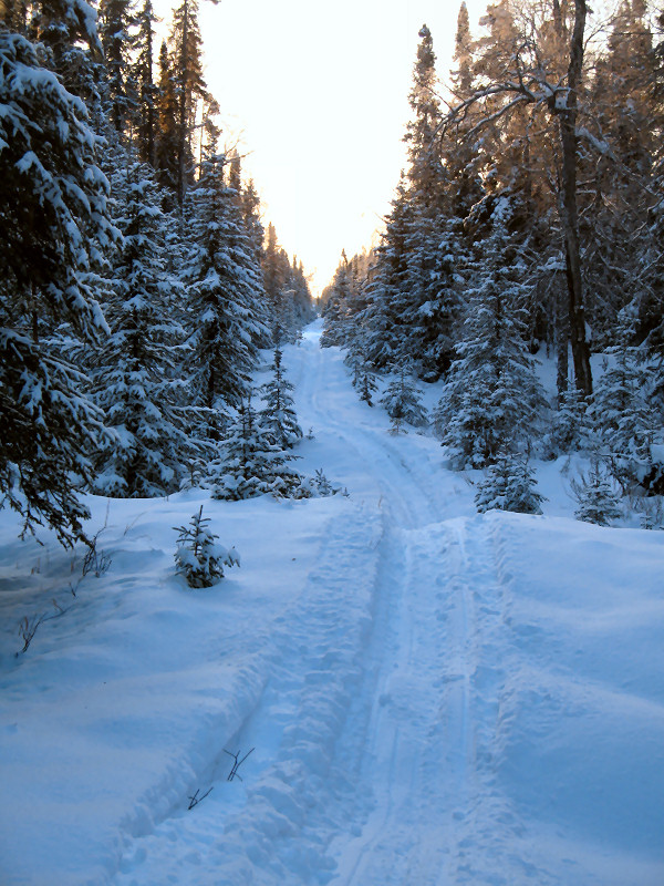
Beautiful local
trail ...
... that leads to a
secret moose gate and onto Fort Richardson.
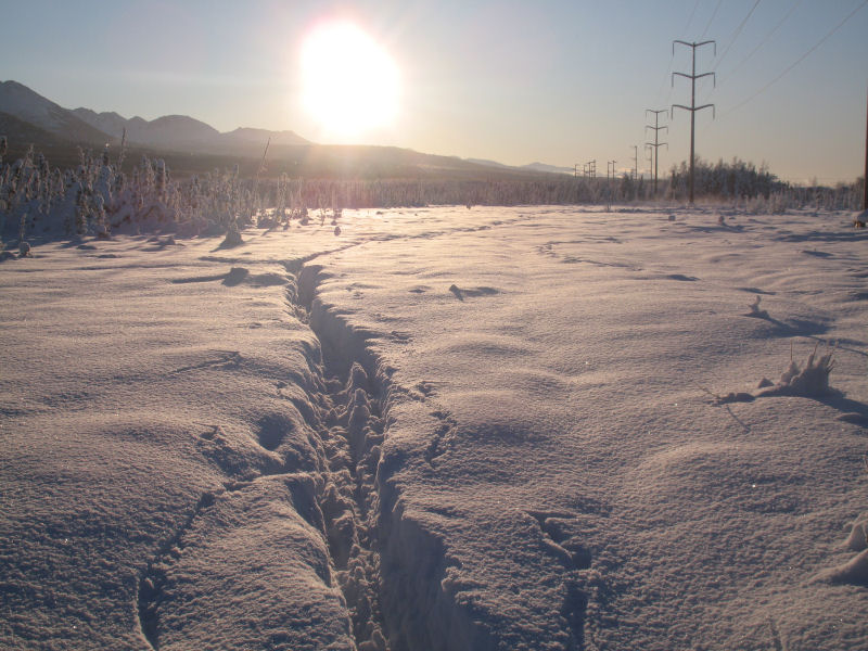
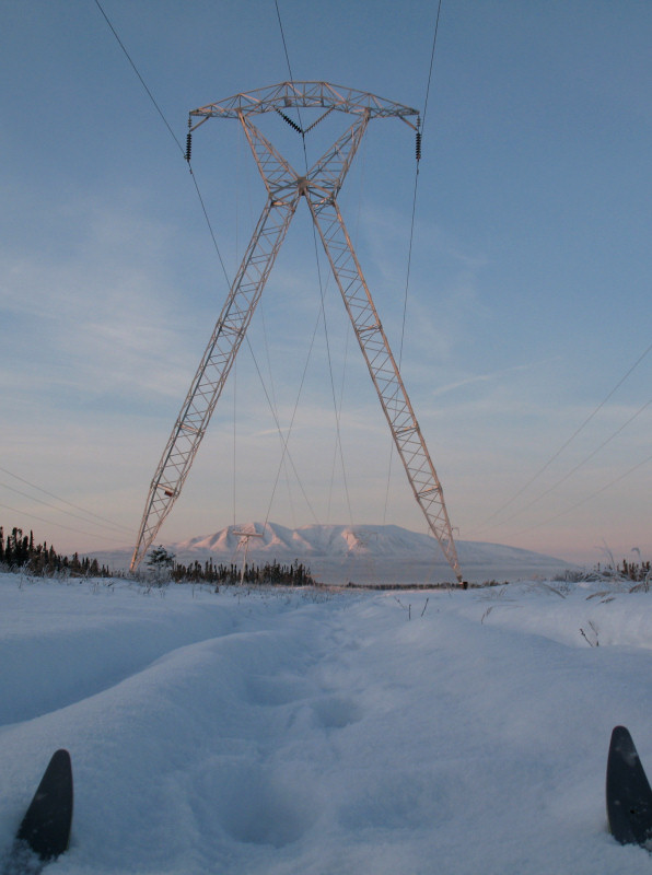
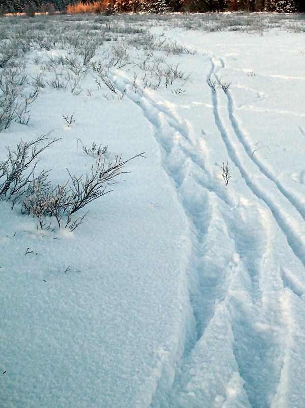
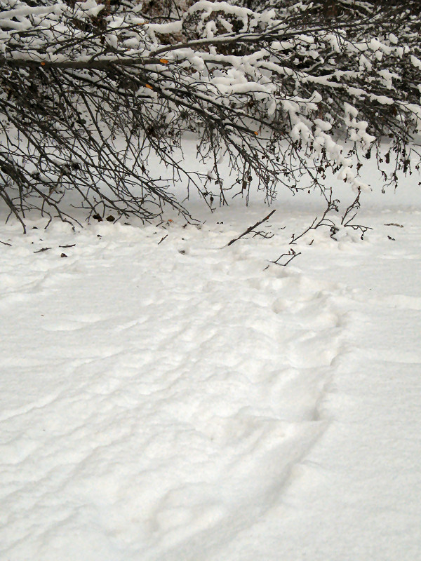
Skiing the power
line east of Muldoon.
Maybe not a trail to
brag about, but it gets it done.
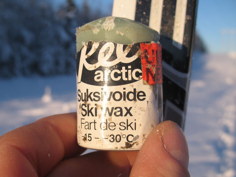
Wax of the day.
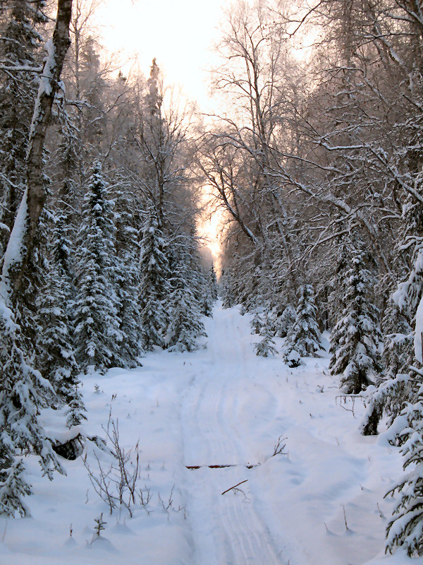
The beautiful Tank
Trail in Far North Bicentennial Park.
Dog trail heading
towards Tudor. The first Tour of Anchorage ski race
followed this trail.
Big iron bridge over
Campbell Creek before Lake Otis Park.
Scooting under the
New Seward Highway bridges.
The MOA-groomed
Campbell Creek bike trail was great skiing.
Following snowshoe
tracks on Campbell Creek to the Dimond bridge.
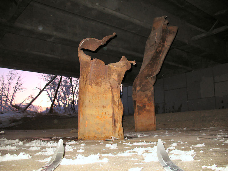
Twisted and
mutilated I-beams under the Dimond bridge. Was this damage
done during the '64 quake? I wonder.
VERY fresh privately
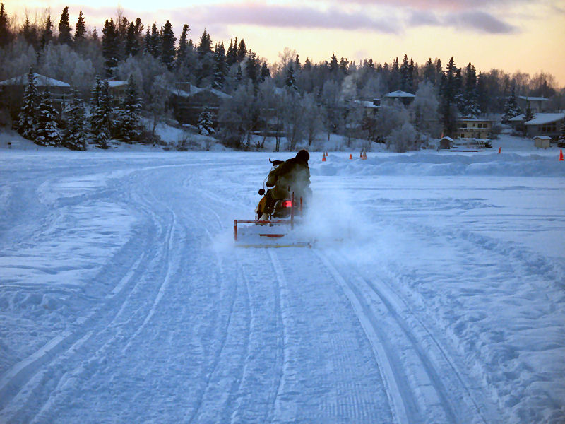
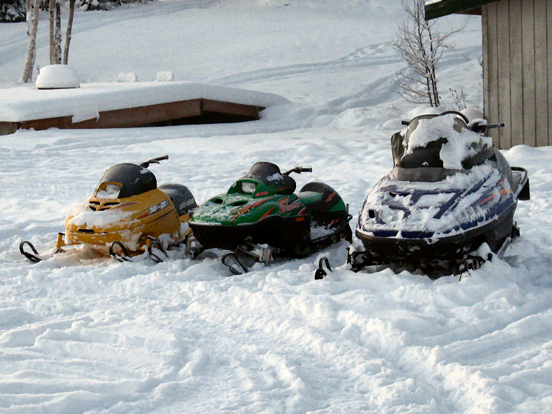
groomed tracks on Campbell Lake. Thanks!
A momma snowmobile
and her two babies nesting on Campbell Lake.
Off into the sunset
on the Anchorage Coastal Plain.
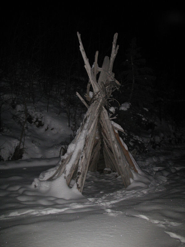
Shaman's hut on the
on the way to Pt. Campbell.
I went inside and
the shaman appeared in a cloud of smoke and told me to get out.
Sorry dude.
When I popped out
onto the Tony Knowles Coastal Trail I chuckled. Tracks set
under face-high tree branches ... a time honored NSAA tradition.
Almost there.
Back at Westchester
Lagoon. -18 F and still only my vehicle in the parking
lot. Geez folks, you're missing out on some good skiing !!
;-)
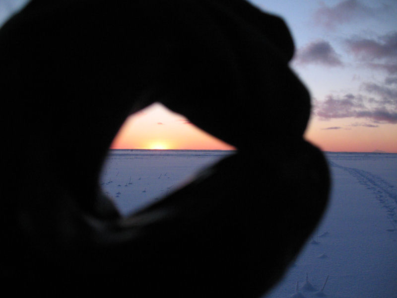
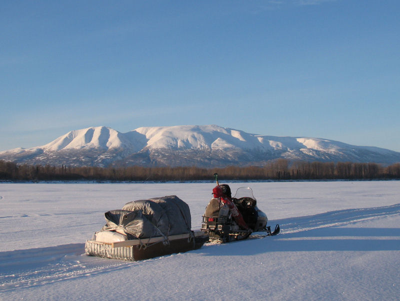
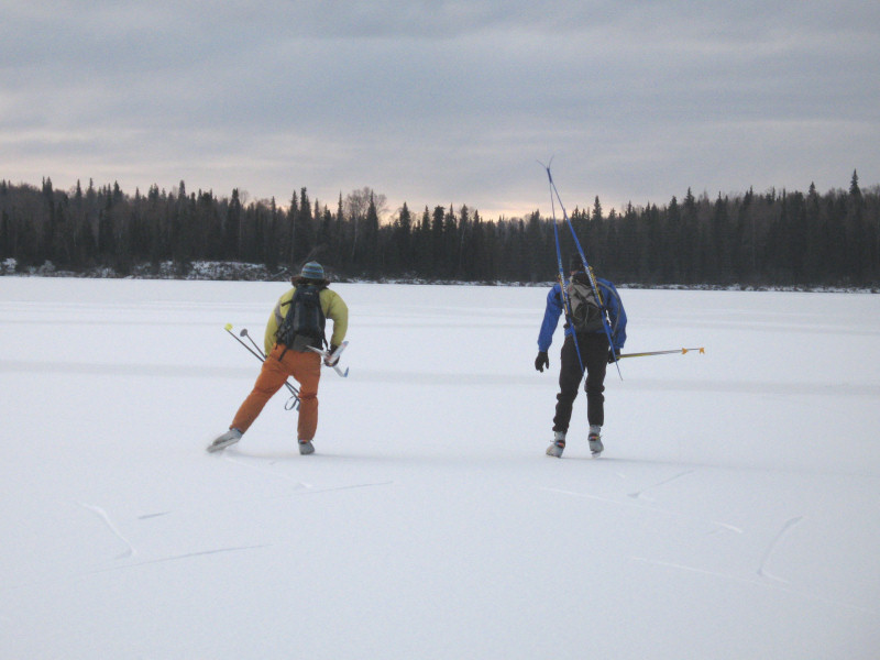
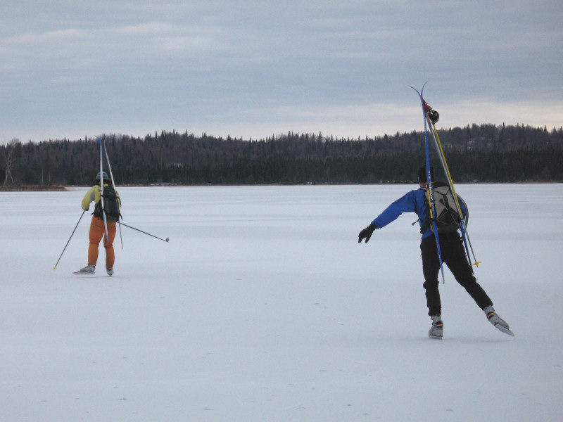
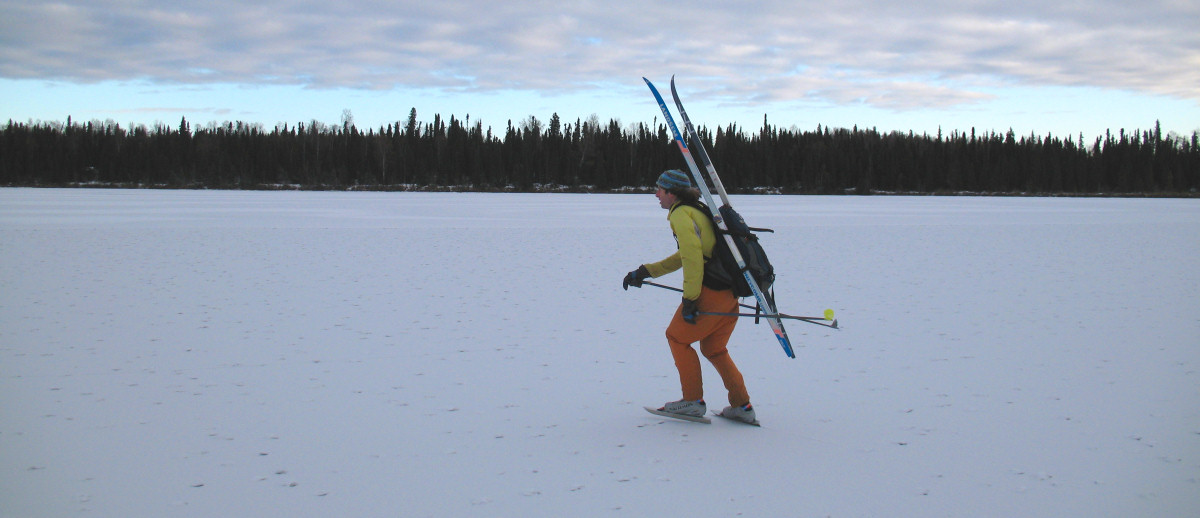
Skiing the Straight
Line
Susitna Game
Flats - 14 December 2008: When
flying over the Lower Susitna Valley or Northern Kenai Peninsula
you can see lots of straight lines cut through the forests
below. These are seismic lines. In the late 1950s
these swaths were cut when this area of Alaska was being
explored for oil and gas deposits. Ever since the seismic
lines were cut, they have made good winter trails.
I wanted to make a ski loop
on the Susitna Game Flats using some seismic lines I had never
skied. The catch with new backcountry ski loops is you
often never know if the loop will go when you start out.
You often never know what the trail conditions will be for the
entire loop. There have been times in the past when
friends and I got three quarters of the way around a loop, the
trail ended and the option of wading bottomless snow caused a
retreat and death march back to the start. So, you try to
do the unknown part of the loop first. I knew if I got to
Figure Eight Lake there would be a good trail, thanks to ice
fishermen, back to the Point MacKenzie trailhead. I lucked
out in that a couple of snowmobiles had broken trail down the
long seismic lines west of the Little Su to the transmission
line. So I was able to pull off this 40 mile loop.
Thanks a lot to these unknown snowmobilers for their trail
breaking efforts!!!
GPS track: 40 miles.
The lines on the map are straight ... because that's the way the
trails are!
The start saw a grim
fog layer. It was 15 to 20 below F the whole day.
But soon the fog
burned off.
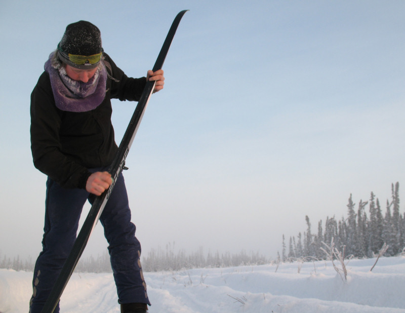
Waxing up for the
seismic lines. This ski was about 50/50 classic skiing and
skating.
Luckily the seismic
line I wanted to ski had seen 2 snowmobilers run through it a
day before.
A straight shot, the
seismic line goes and goes.
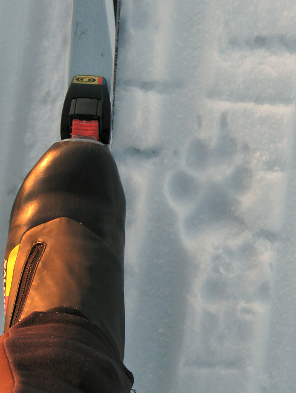
River otter tracks
I detoured to check
out the old Ward Gay homestead on the Little Su (it's off the
road system). A huge runway! I figured I'd come back
when I was invited.
A cool old tracked
vehicle, with a custom carrying rack on top, was at the end of the runway.
The seismic trail
keeps going south ...
... until you hit
the Beluga to Anchorage (and Wasilla) electric transmission
line.
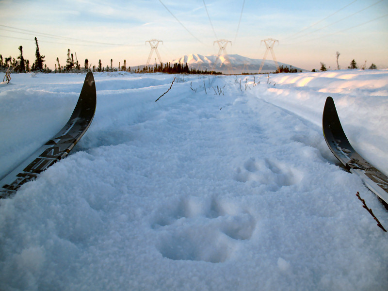
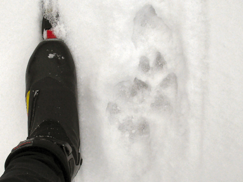
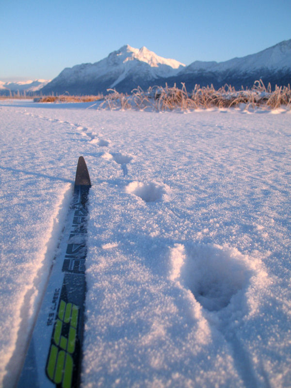
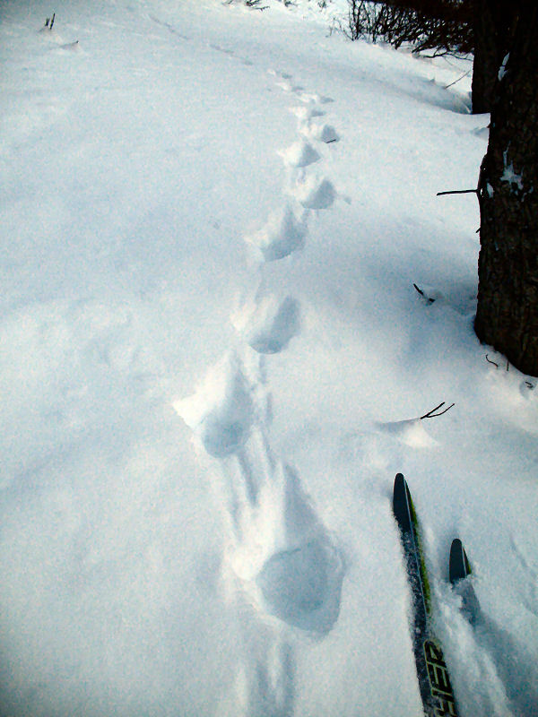
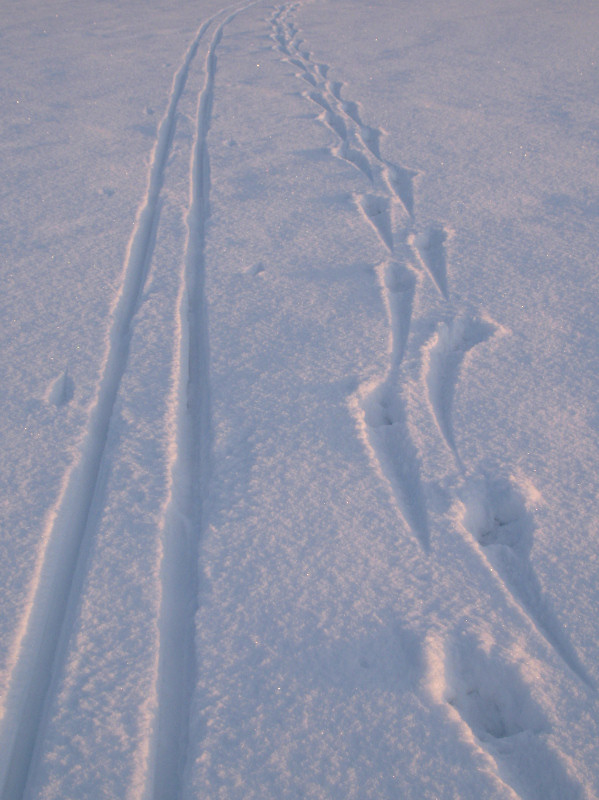
I followed a large
wolf's tracks while skiing under the power line.
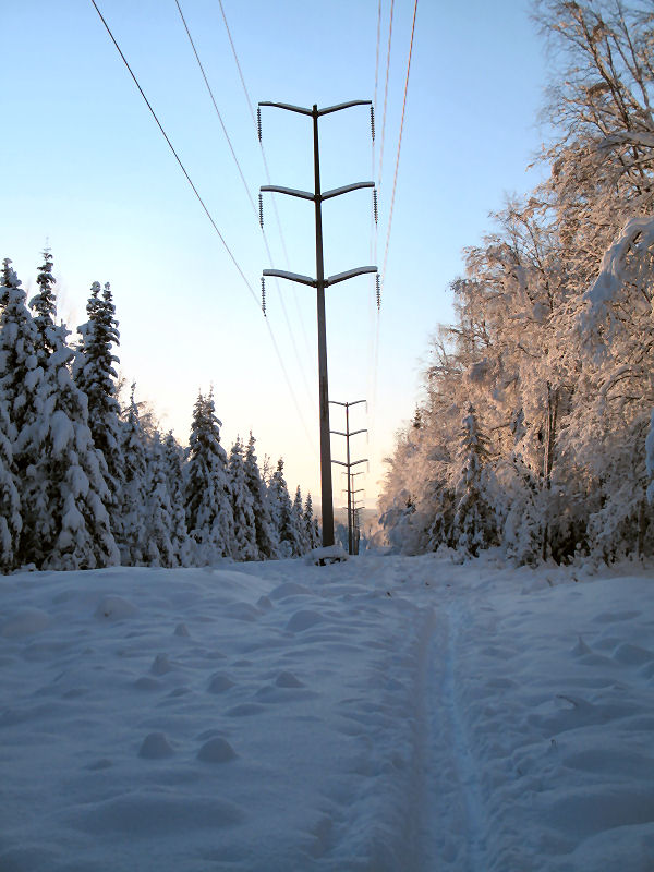
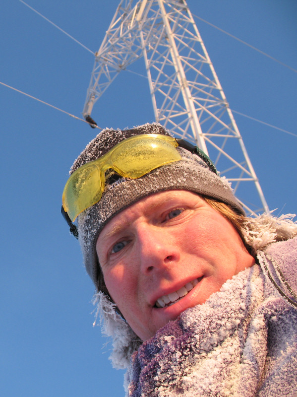
Behind me is one of
the many big towers holding the electric lines that power
Anchorage.
Still following the
wolf tracks as the power line heads northwest towards Mt.
Susitna.
Finally - the Figure
Eight Lake trail. It was classic skiing to here. Now
it will be good skating the 16 miles back.
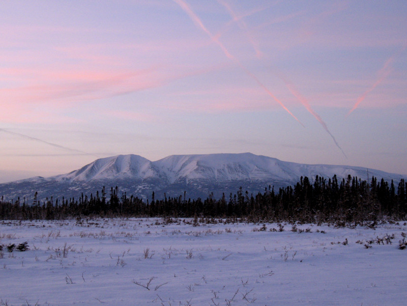
Colorful contrails
over Mt. Susitna.
And a contrail to
the south, looking back down the Figure Eight Lake Trail.
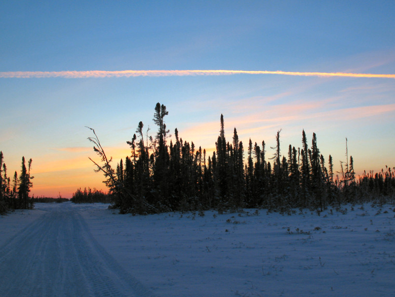
Darkness caught up
to me on the Gasline Trail superhighway. The last 10 miles
went fast.
Backcountry Skiing
Ain't Always Pretty
Mount Susitna Area -
12 December 2008:
You may notice that I post lots of artsy, "Alaska is beautiful" shots on
this web site. Well, not all that you see while skiing the
backcountry of Alaska is beautiful. Some of what you might happen
to see is rather grim.
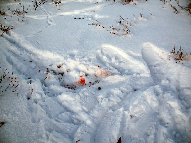
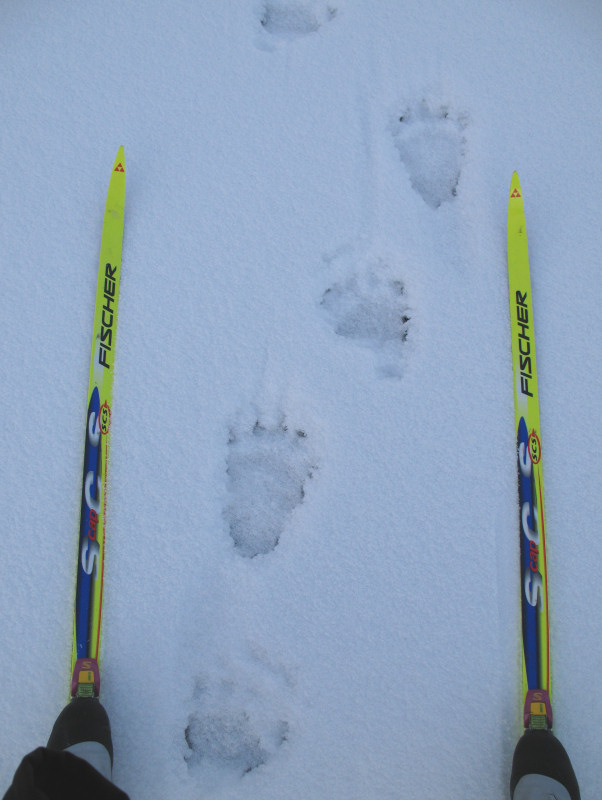
Wolf hunters' Super Cub ski tracks and a sapling cut by a
propeller.
Snowshoe tracks heading from the ski plane to an aerial wolf
kill site.
The snowshoe tracks arrive at the site where a wolf was gunned
down from the air.
Blood that dripped from the wolf carcass as it was dragged back
to the plane.
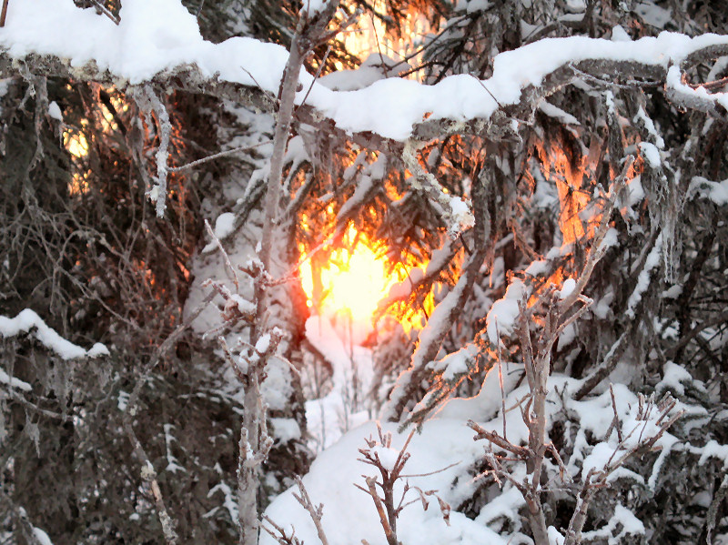
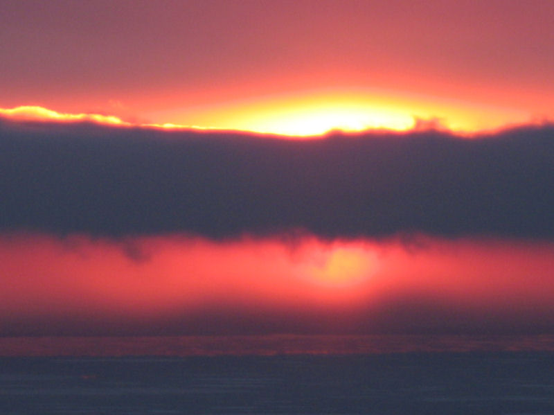
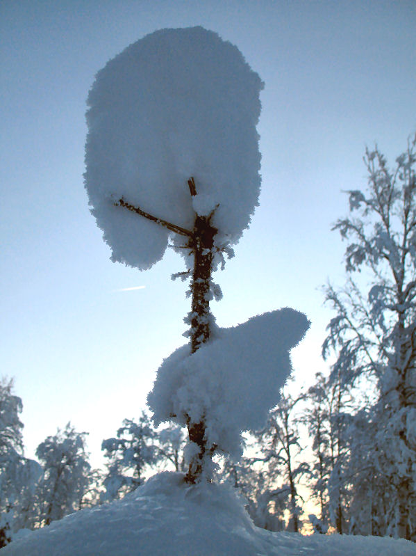
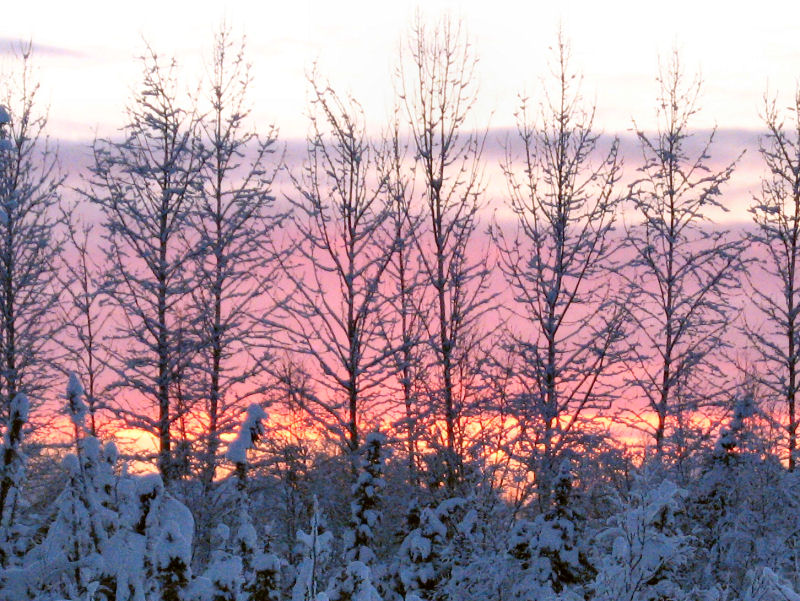
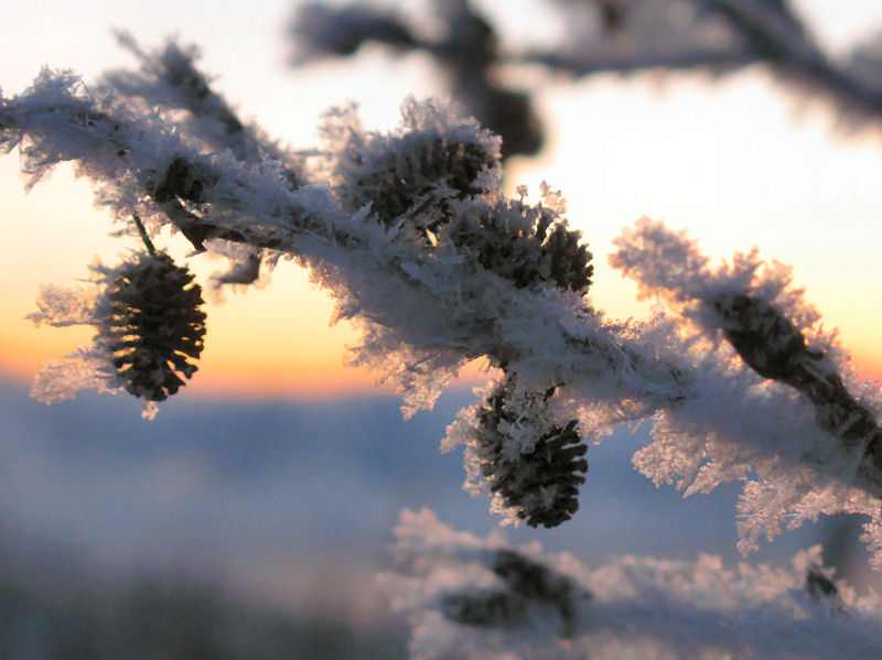
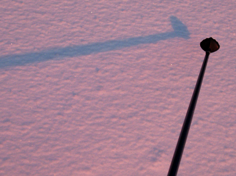
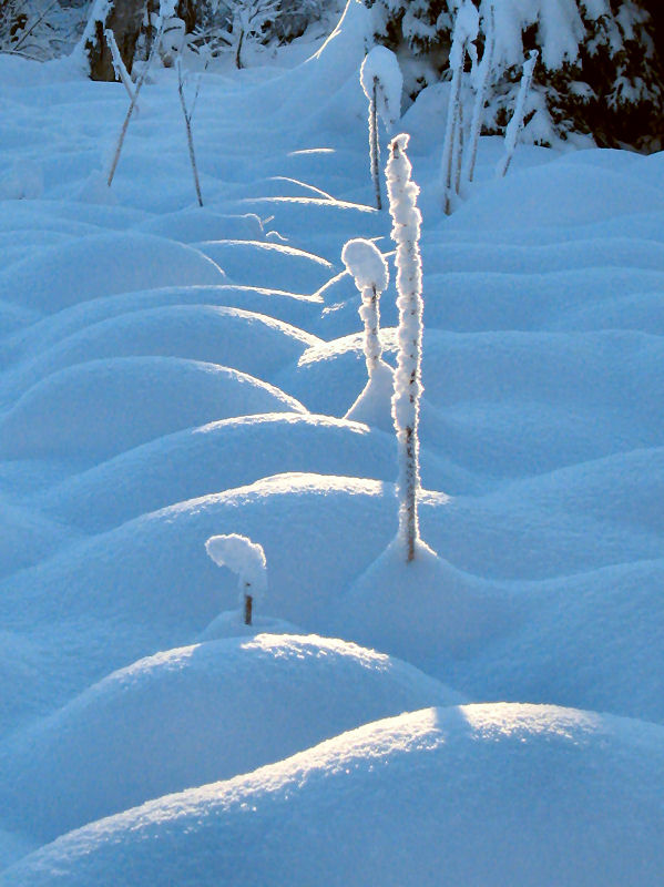
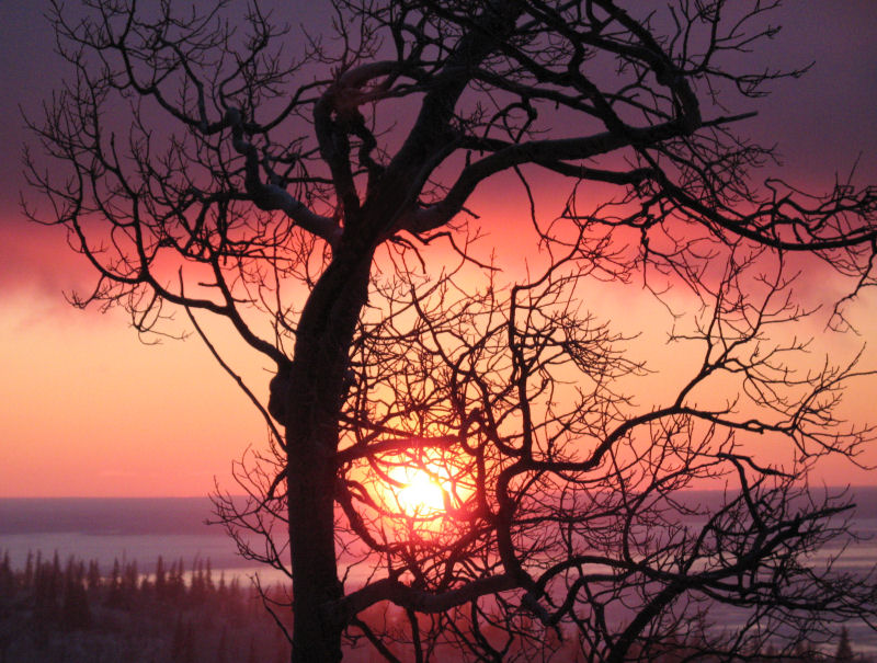
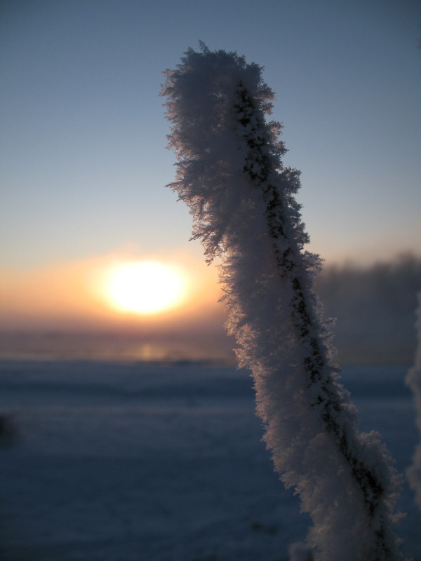
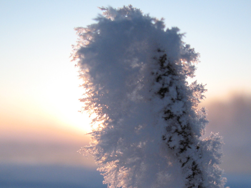
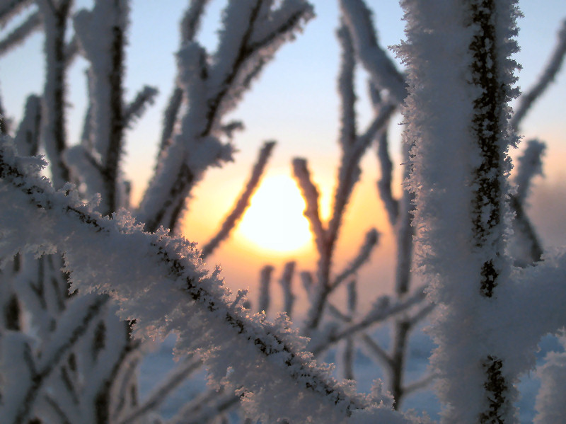
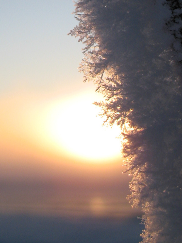
December Light
South Central
Alaska - December 2008: Yep
... sunlight in December in Alaska is sure in short supply.
And with the sun so low on the horizon, entire valleys can be
cloaked in shadows and never see direct sunlight all day.
But for what light there is ... it's an arctic alpenglow kind of
light that you wish you saw more of during the year. These
pictures were taken on December 2008 ski outings and show some
of the light that I'm talking about.
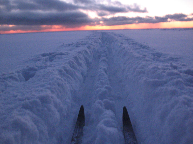
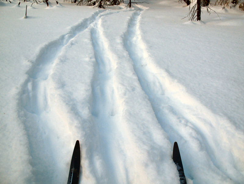
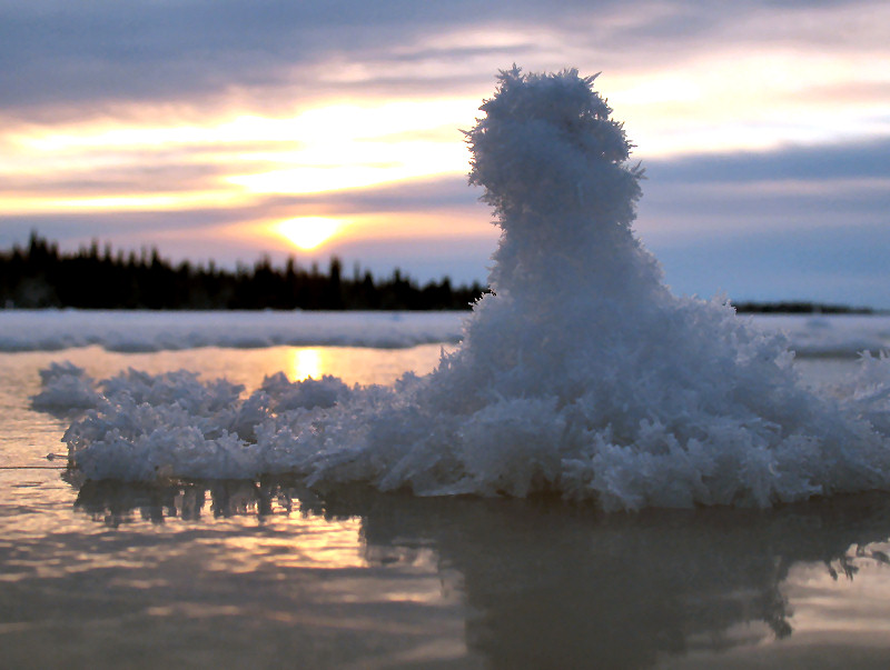
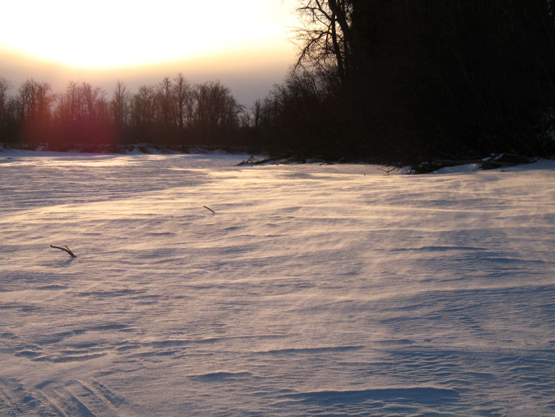
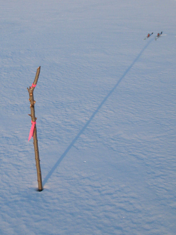
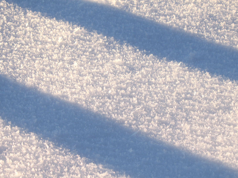
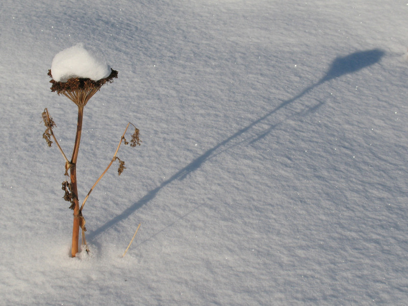
Drifting snow crystals on the Big Susitna River
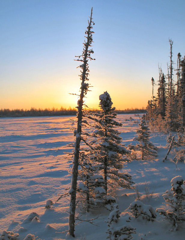
Trail marker, and shadow to skis
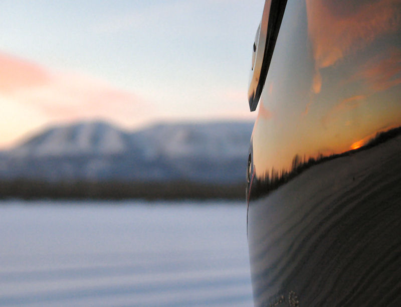
Mt. Susitna,
reflection of sunset on a snowmobile helmet.
And if that wasn't enough,
here is a music (Stonegrind) video slideshow of many of these
pictures:
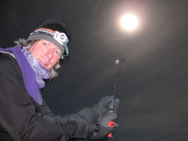
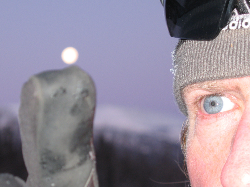
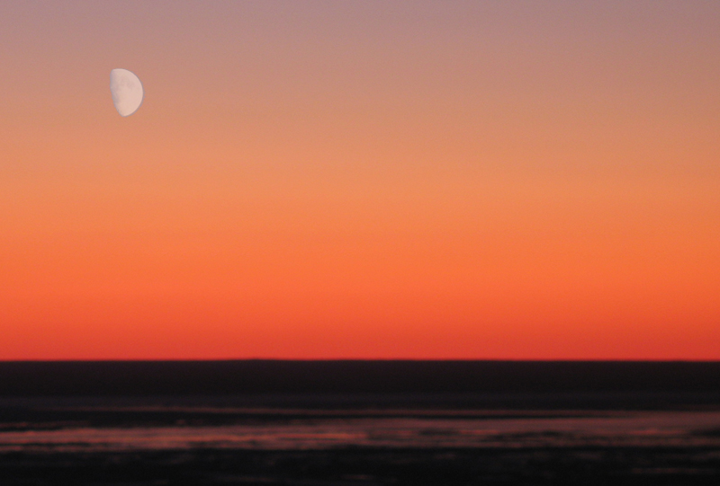
Moon Shots
Western Susitna
Valley Drainage - Mid December 2008: This
was the 2nd winter month in a row with a full moon coupled with little
or no cloud cover. Cool. I had to go out for a 2nd ski at
night and do some "camera biathlon" at 15 below zero. Take a shot.
Ski like crazy to warm up. Take a shot. Ski like crazy to
warm up. The moonlight shots below were taken with an 8
second exposure and an initial shutter delay.
Turn that headlamp off!
You don't need it!
What's the big deal about
flying to the moon? ...
... Heck, you can just reach
up and grab it!!
Hey, how did you do that!?
My attempt at photographing
my moon shadow.
Don't ski near Mt. Susitna!
There are ghosts! The worst kind! SKIER GHOSTS!!!
After moonlight skiing at
-15 F it is nice to walk into a warm cabin.
The next morning.
It takes a lot of
concentration to balance the moon on your finger!
Willow Wandering
Willow - Early
December 2008: I went to
Willow to see how the trails were doing. I found out it's still
early. Because the Big Su has not frozen up enough, a lot of
connector trails are still not in. But I was able to check out a
couple of trails I had never been on before: the Corral Hill Trail and
the "GCI Trail". By doing this I was able to get in a good 42 mile
ski from the Crystal Lake parking lot to "Scary Tree" on the Yentna
River and back.
GPS track. Out
and back - 42 miles.
A neat driveway
arch.
All hail the Willow
Trail Committee! I love Willow.
The Corrall Hill
Trail is beautiful ...
... and it has a
great overlook of the Big Su below Deshka Landing.
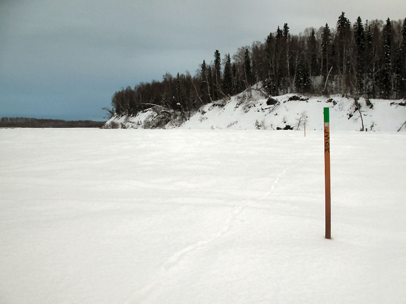
The Lower Susitna
Drainage Association grooms trails on the Big Su and Yentna
Rivers.
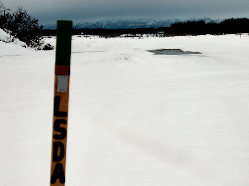
The
LDSA had re-routed the trail around a lead that had opened up.
(This spot is always bad for leads opening up) But they
left the old trail markers in. This is not good! At
night or after it snows folks can follow the old markers
straight into the open water!!!! So I picked up the old
trail makers and made and "X" to keep people on the new, safe
trail. The last picture above I took on the way in.
You can see two snowmobilers taking the left at the "X", instead
of going straight into the water. Dang, a cross country
skier looking out for snowmobilers ... maybe cross country
skiers aren't that bad after all. ;-)
Nice skiing on Kroto
Slough.
But the GCI Trail
had some wet spots.
Yep, some really wet
spots.
The GCI Trail did
had some good open swamp skiing.
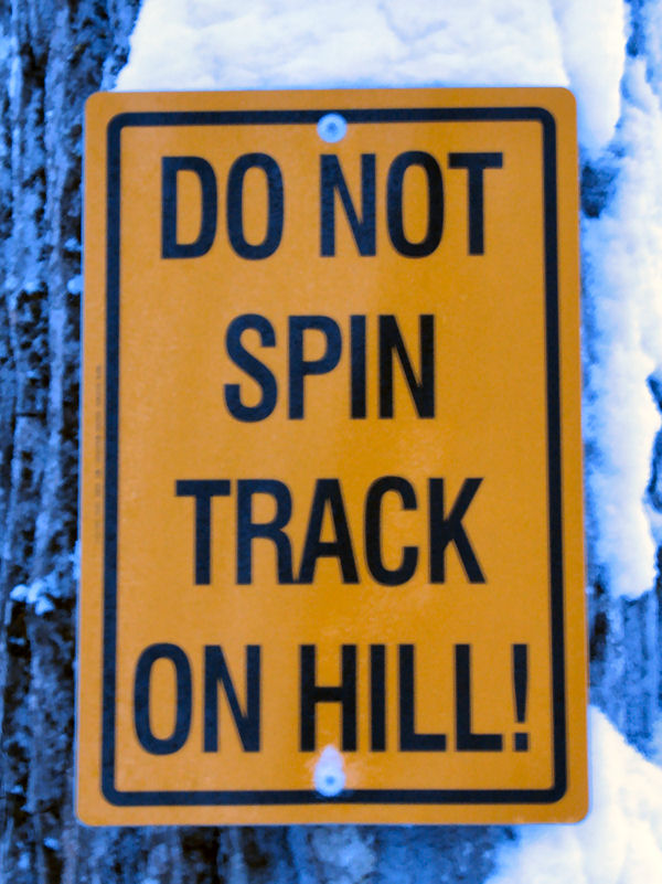
No spinners!
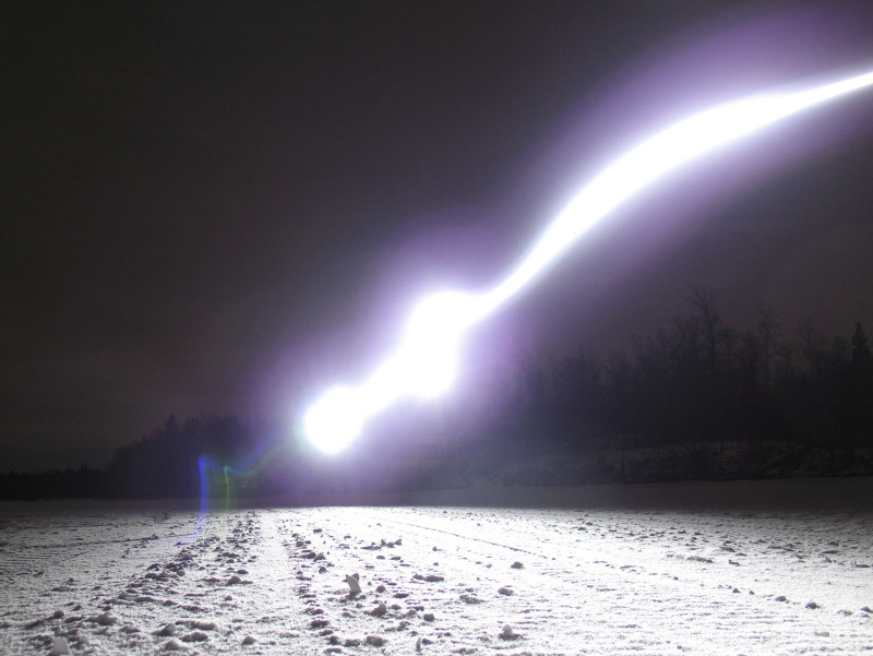
On
the way back this strange light kept showing up in front of me.
Weird. I'm pretty sure it was an invisible alien space
craft hovering above me and checking me out. This seems to
happen a lot when I'm skiing at night with a headlamp. I
think the headlamp must attract them. ;-)
The highlight of the
trip was seeing Iditarod musher Ramey Smyth's beautiful, strong
and fun-filled dog team. I talked to Ramey for a bit.
I had never met him before. But now I'm a Ramey fan.
Go Ramey ... I hope you and your dogs have a great winter!
Here is a link to Ramey Smyth and Becca Moore's
Homestretch Kennel
web page.
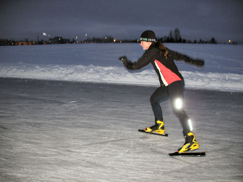
You Know You Are
Speed Skating in Anchorage ...
... when you have to halt your early
morning workout at the Cuddy Park speed skating oval to let a moose
cross!
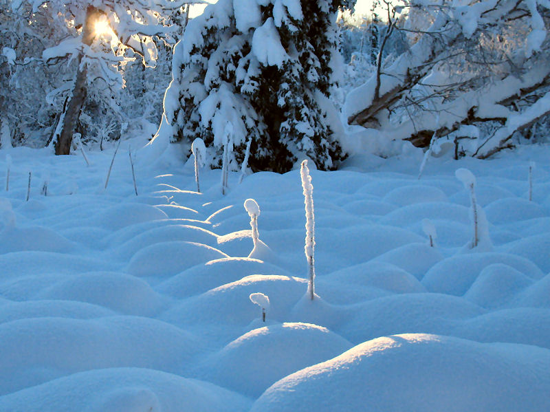
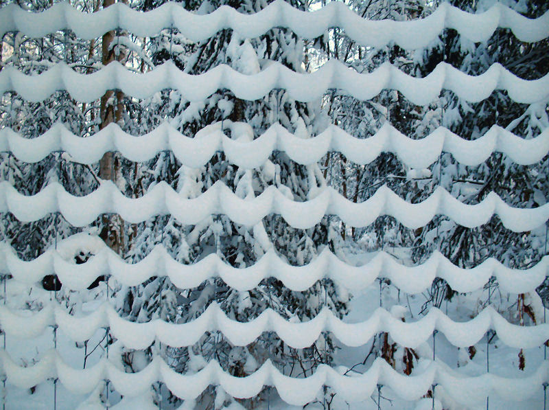
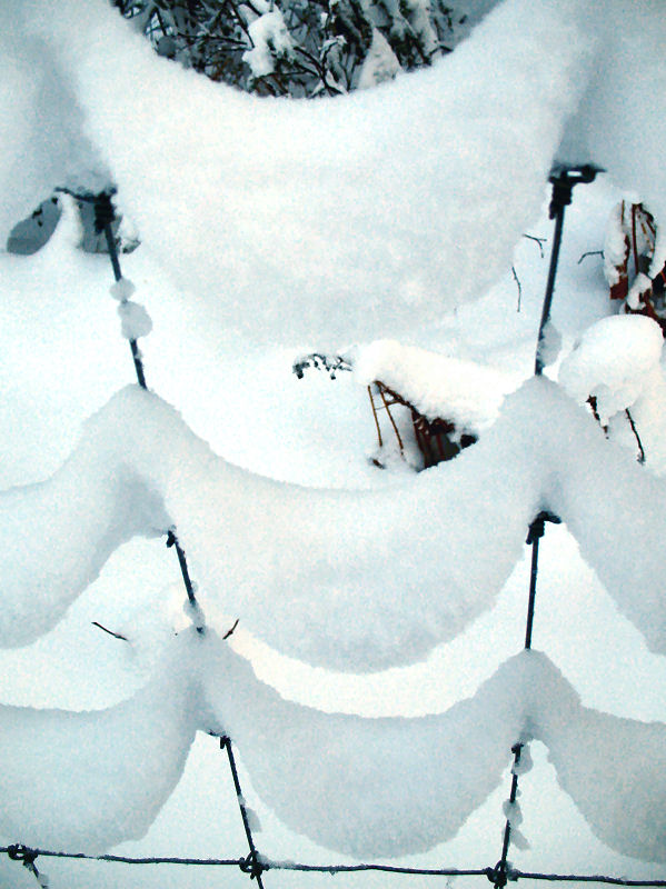
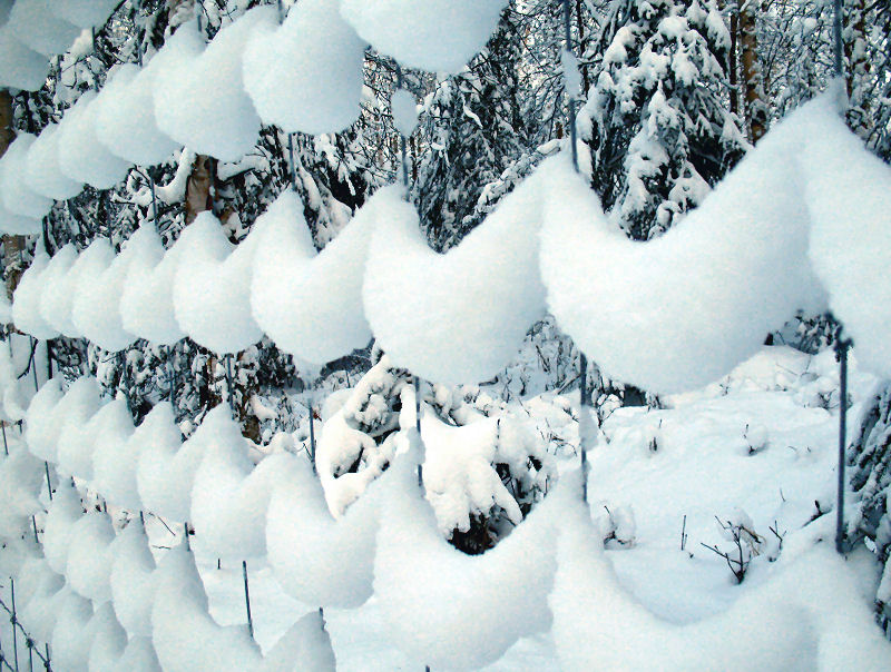
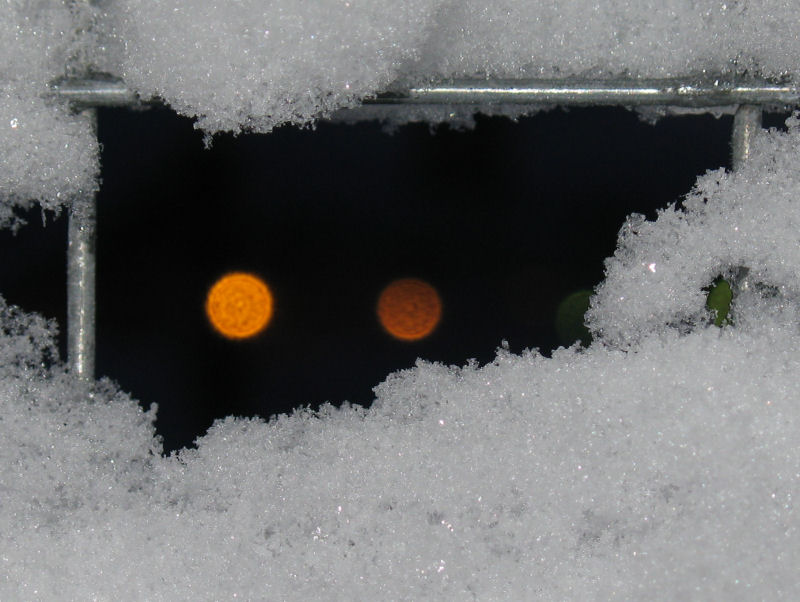
"Snow Fences" in
Far North Bicentennial Park
Anchorage - Early
December 2008: I happened to
have my camera with me while doing a workout at Far North Bicentennial
Park. I stopped a couple of times when my "art alert" went off ...
Snow clinging to a wire
fence next to the Botanical Gardens.
Lights of the BLM complex
through a wire fence.
Skiing the River of
Sand
Bell Island,
Alexander, Chedatna Lakes - Early December 2008: The
Susitna River gets its name from the Dena'ina Athabascan name
Susitnu, which translates to Sand River ('susi' = sand, 'tnu' =
river). One can often appreciate this name when skiing on
the river while the wind is blowing and scouring the snow away
down to the sand bars beneath you.
Update prompted by a recent
email - Note to Su 100
competitors: Most of the wind-swept-down-to-sand-bar areas
are downstream of where the Su 100 course crosses the Big Su.
And the dangerous ice that is pictured below is also downstream
several miles from where you cross the Big Su. So ... you
are not going to be near the sand or bad ice pictured
below. Follow the Su 100 stakes when you are on the Big Su
and Yentna Rivers and everything will be fine.
A common Lower Susitna snow
pattern ...
Day 1:
Clear and lots of snow.
Day 2:
Wind (from an Interior high pressure system rushing south to a
Pacific low) begins to erode snow down to sand bars.
Day 2:
More wind, more snow loss. Snow remains where it was
compressed by snowmobile skis.
Day 2:
Snow drifts into wooded back sloughs which are good skiing (if
you know where to find these sloughs).
Day 3:
More snow. This picture was taken from the same spot as
the Day 1 picture. See Mt. Susitna in the distance !?!?
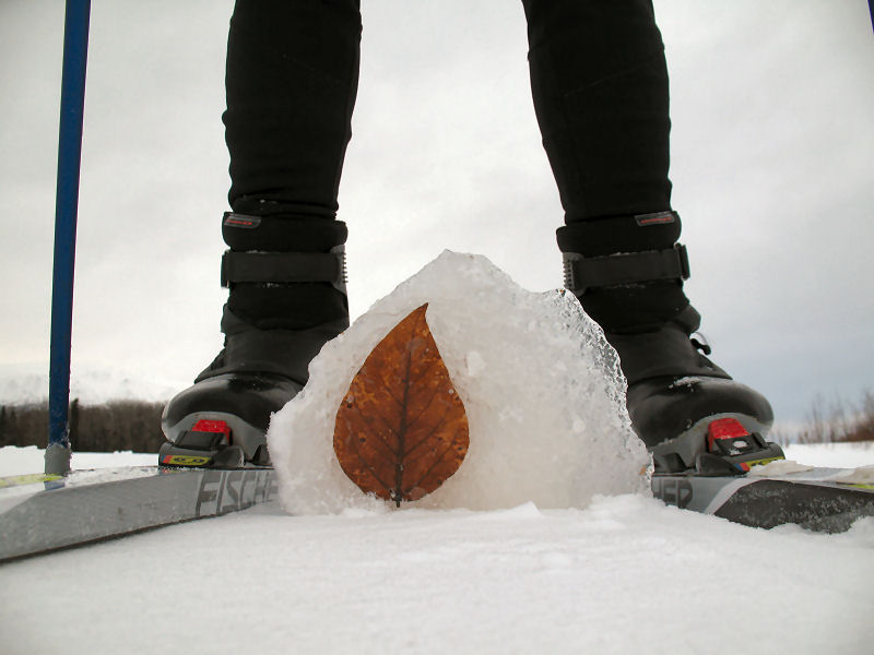
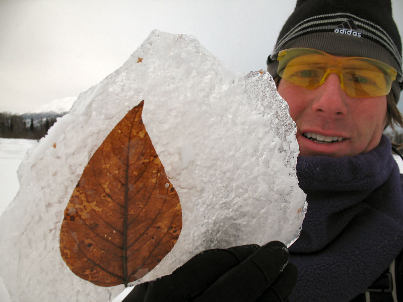
A prehistoric birch
leave frozen in glacial ice that drifted down from the Yentna
Glacier!? Nope. It's ice that fell from the tunnel
of a local freight hauler's Ski-Doo Scandic. Yep, that's
those sensitive snowmobilers for you ... leaving "art" wherever
they travel ! ;-)
Sometimes when
skiing in bush Alaska you find trails with corduroyed surfaces
that look like the ones "them city-folk skiers" make. This
"bush corduroy" is courtesy of culvert sleds, like the one
above. The base of the sled is made from corrugated road
culvert metal that is bent up on each end.
Not all dark spots
on the Su are sand bars. This is an open hole in the ice
that has been slow to freeze over this year. If you
stumbled into this hole, you would be seriously screwed.
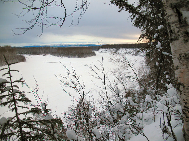
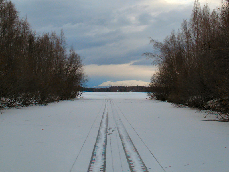
The Mat-Su Valley:
Beauty with a Rough Edge
Northern Edge
of Wasilla - Mid November 2008: Here
are a few "beauty" and "rough edge" pictures from a recent ski
trip exploring new trails in the Valley.
Beauty.
Beauty.
Rough Edge.
Beauty.
Beauty.
Rough Edge.
Early Season Trip
To The West of the Big Su
Western
Susitna Valley Drainage - Mid November 2008: This
was about the earliest winter trip I'd ever taken to the west of
the Big Susitna River. No complaints, except I wish the
Big Su ice was a little safer for crossing. The crossing
was a bit sketchy. Not that much snow out there but skate
skiing on the rivers was fine. But then again, everything
is fine when I'm at my favorite place in Alaska. Sure was
a quiet time in the Bush ... never saw another person. As
people move out, due to increasing living costs, Bush Alaska
gets quieter every year.
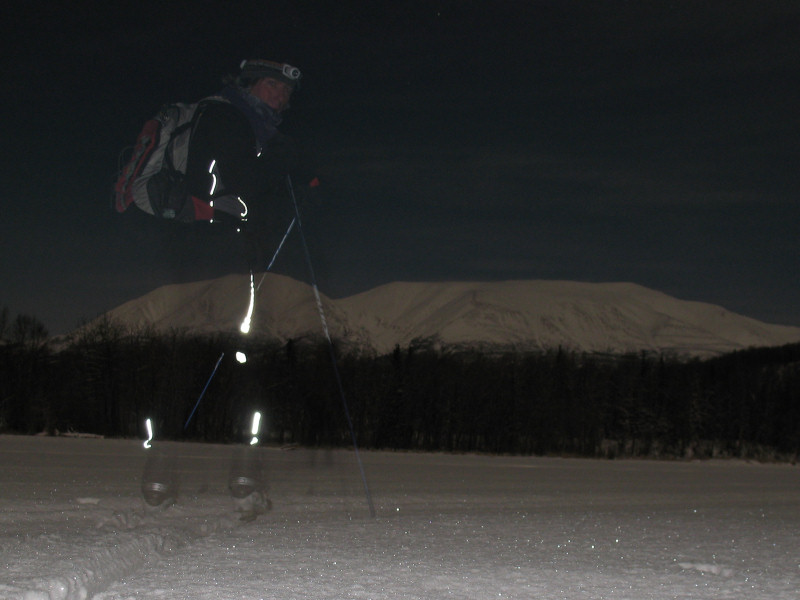
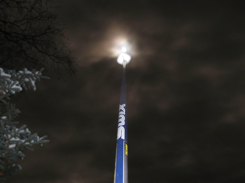
Shots from night
skiing under a moody moon. The shot to the left is the
beam of my headlamp as I'm skiing towards the camera.
It's
"Tracks in the Snow" Time Again ...
Hop and belly-slide river otter tracks.
Beaver tracks ... you can see how their tails drag and cover
their foot prints.
Beaten trail to the beavers' front door.
A
well worn path leads a short way to the beavers' restaurant.
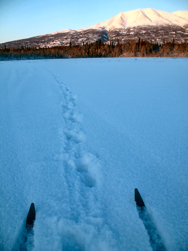
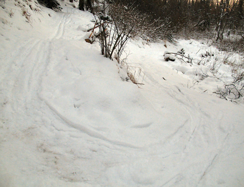
Wolf tracks.
Wolf pack tracks. 8-10 animals heading up-wind and taking
the inside line of the river to surprise any prey around the
corner.
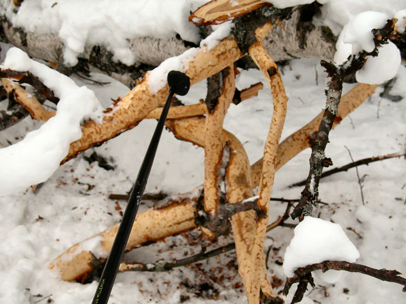
Porcupine tracks.
A downed birch tree
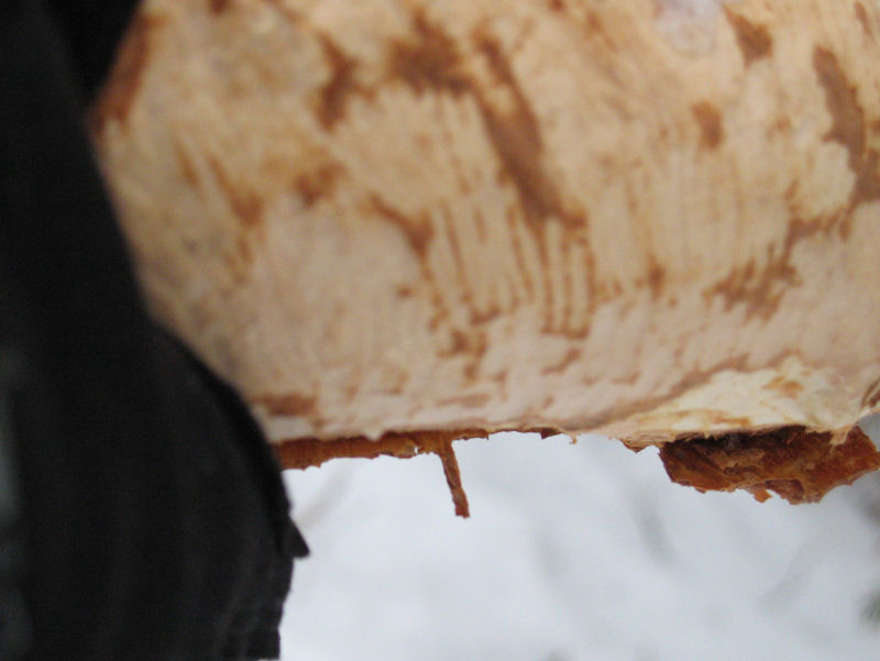
a porcupine has been munching on.
Porcupine teeth
marks.
Nearby - a porcupine
has been working on a birch tree - 25 feet up.
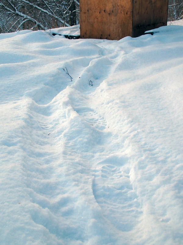
Wolf track on snowmobile track.
Coyote tracks.
Fox tracks.
Lynx tracks.
Ski tracks, moose tracks.
Human tracks. You can see from the tracks how the human
dashed in panic to this outhouse, and then casually strolled
back a short time later.
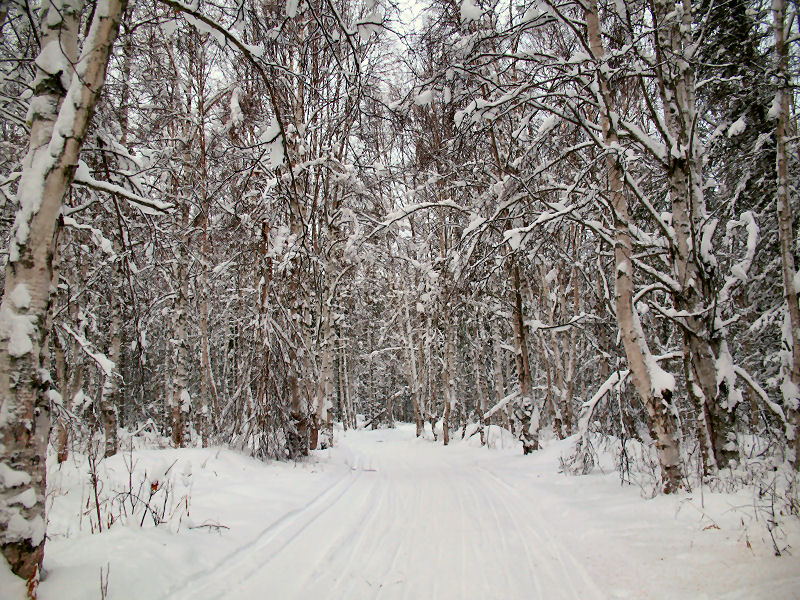
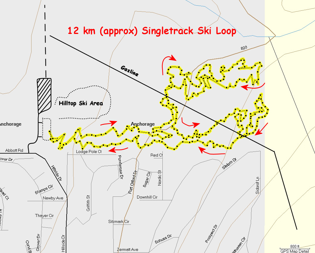
Old School Cool ...
Right In The Big City
Anchorage - November 12th, 2008: With
the first significant (well, sort of) snowfall to hit
lower Anchorage elevations this year, I wanted to be the
first to make ski tracks on the newest and coolest trail
system in Anchorage - the Hillside Singletrack Project.
This trail system is extremely fun to run or bike.
It's equally fun to ski, but the tight corners can be
challenging on skis if the snow is fast. Skiing on
this trail system is likely the best when there is a
layer of powder to keep your speed tempered.
Thanks to the Single Track Advocates for bringing these
great natural, old-school bike, foot and ski trails to
Anchorage. It's more fun and challenging to
ski trails like these than trails that are as wide as
soccer fields.
Note: The access to these trails is at the southeast
corner of the large gated parking lot to the south of
the ski jumps at the Hilltop Ski Area. A climb
with two switchbacks will take you up to the lower west
end of this singletrack trail system.
I like the
north and south loops. But for skiing I think I
like the flow of the north loop best.
Lots of
banked 180's. Hold on and "take it to the bank"!!
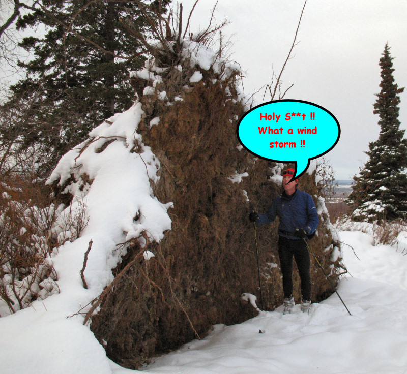
The
rootstock of an uprooted spruce from this year's very
brutal late October windstorm. Hundreds of newly
uprooted trees like this are now lying all over the
Hillside.
Best light
of the year.
A few
passes of winter bikes with Large Marge rims and
Endomorph tires make for some good classic skiing
trails. XC skiers and winter bikers can co-exist
well together.
Here is a
GPS track from the 2nd time I skied this loop.
Distance is approximately 12 km if you take my route.
The Hilltop Ski Area, ski area parking lots and the
gasline were not on the Garmin MapSource maps ... so I
guessed at where these features were and drew them in.
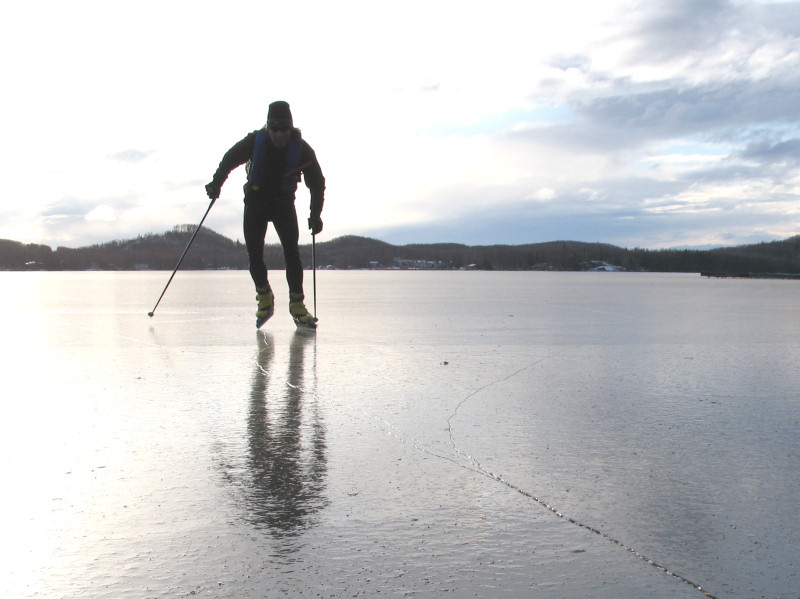
Big Lake Blading
GPS track of
27 mile loop along lake perimeters.
Low snow in
the Su Valley is okay - if you have ice like this.
There
already were some REALLY BIG trucks on the lake !!
First plow
of the season on "Ice 5".
A party
barge ready to head out ice fishing.
Big
Lake - November 10th, 2008: After
skiing with Cory and Ian at Nancy Lakes, I figured Big
Lake would be good skating. It was. Ice
thickness was 6 to 12 inches. Vehicles were
already driving on the ice of Flat Lake and on the
western parts of Big Lake. I was able to take
Nordic blades for a cruise around the perimeter of Big
Lake and Flat Lake - a 27 mile loop. The ice
was the best on the windswept eastern part of the lake.
There was a dusting of snow on western sections of these
lakes, but it did not hinder fast Nordic blading with
poles.
You can
really rip on blades!
Snowmobile
tracks heading to Flat Lake.
Tracks from
dog teams pulling 4 wheelers.
The north
shore shows signs of the 1996 Big Lake Fire.
For safety I
carried ice rescue picks and wore an inflatable PFD.
If you are a nice person this type of PFD won't work for
you, because you have to be a "jerk to inflate" it!!
A Cool Ski-Blade
Loop
Nancy
Lakes - November 8th, 2008: Cory,
Ian and I headed to Nancy Lakes hoping to push a bigger
Nordic blade loop than we had done before. By
using skis for the traverses and blades for about 22
lake and pond crossings we linked up a neat 26+ mile
loop. As Nancy Lake State Park is still closed to
snowmobiles due to low snow depths, we were "first snow
travelers (of the human kind) of the season" on much of
this loop. This was a fun early season ski and
blade trek. Of course, you can also see a great
photo-doc of this outing on
Cory's web site.
Nordic
blades
Not quite
den time yet !
Cory on
Frazer Lake
Lynx Lake
Our route
Seismic line
to Cow Lake
Redshirt
Lake
Ian on
Redshirt Lake
Map check
time
Snow was a
bit slim on the Redshirt Lake Winter Trail
November 4th ...
Busting a Trail to
the Mint Hut
Gold Mint
Trail, Talkeetna Mountains - Late October & Early November 2008: My
goal was to ski to the Mint Hut by way of the Gold Mint Trail
that heads up the Little Susitna Drainage starting just north of
the Mother Lode Lodge near Hatcher Pass. It took multiple
attempts to get to the hut because of the trail breaking I had
to do up the 2nd half of the valley, and then up the big climb
at the end of the valley to the hut. On my final attempt I
"cheated" a bit. I brought snowshoes and used them to
finish the route up to the hut. This is about a 19 mile
ski trek. It's a cool ski trip, but it takes a long time
to complete if you have to break trail.
Breaking
trail, 1st try
2nd try,
following my previous tracks
Alaska's
state bird, the Albino Moose Vulture
The climb to
the hut was a grunt
Thar she be
(in the shadows)
Mountaineering Club of Alaska's Mint Hut
Panoramic
shot from above and to the SW of the Mint Hut
1960's Head
Standard skis are mounted on the front of the cabin.
Early Season Trail
Exploring
Bald Mountain
Ridge, Talkeetna Mountains - 18 October 2008: To
pull off new trail skiing loops it often takes prior field
research. That's what today was, checking out a trail that
goes up Bald Mountain Ridge from the south that I had never been
on. I had to run / hike 3 to 4 miles to get to ski-able
snow. Skiing on the higher parts of Bald Mountain Ridge
was good ... and private! This is a super-popular
snowmobiling area. But due to too little snow for
snowmobiles on the access trails to this area - I was the only
one up there.
On top of the ridge, Mt.
McKinley in the distance
The red circle shows where
good xc ski-cruising is often found on Bald Mountain Ridge
Panoramic shot from
Bald Mountain Ridge, Western Chugach Mountains and Knik Arm in
the distance
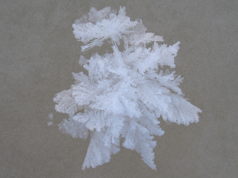
Lots of large-flaked
hoar frost was on the top of the ridge. This is also
called surface hoar. It is caused when clear and cold
weather moves in quickly and there is radiation loss. That
is - the snow becomes warmer than the air for a short while and
these large ice crystals form from the water vapor that is
quickly freezing just above the surface of the snow.
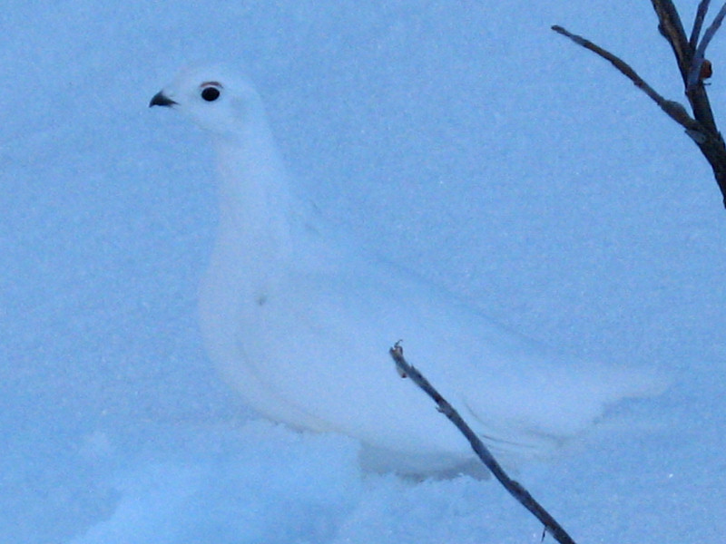
The locals haven't
gone to sleep for the winter yet!
The sun! A
bright orb in the sky that was rarely seen in South Central AK
this summer.
Runaway Crust Pucks
??
Anchorage - Late September 2008: I
was hiking above Anchorage in late September and noticed this
interesting snow phenomenon. I don't know its official name, so I
made up a name for it: Runaway Crust Pucks. Pieces of crust snow
about the size of hockey pucks were being kicked up by my footsteps, and
then they would take off and smoothly slide down the mountainside.
I made a short, artsy-ish video of this ...
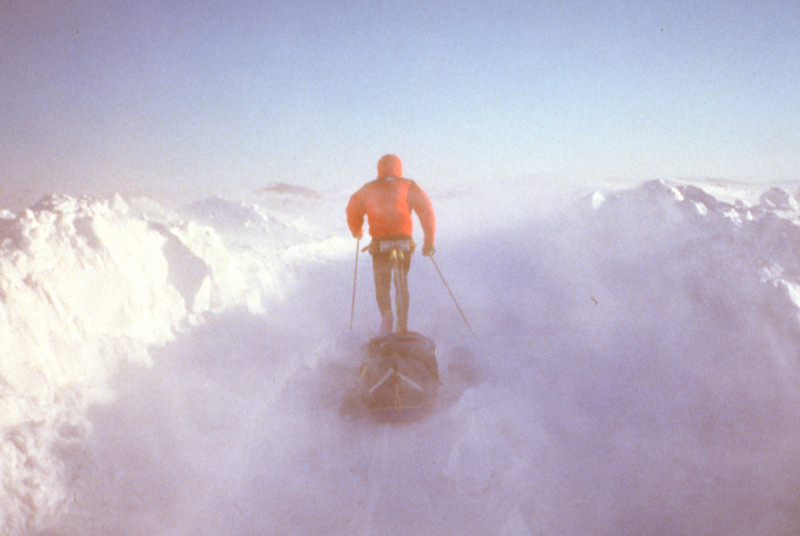
Blast From The Past
...
On the Iditarod Trail in
Unalakleet, Alaska - 1990 (Photo by Bad Bob Baker)